Well, here we are, 2025. We’re going to start the year off with a bit of a strange week. Only one site forecast (Congratulations, Gulfport!) but two very long road trips.
Road Trip from Peoria, Illinois to Anchorage, Alaska
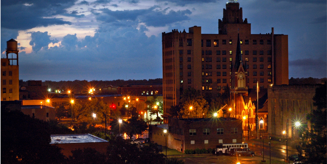
Road Trip from Atlantic City, New Jersey to Santa Rosa, California
It was another warm year, with another warm winter already started. We’ve just stepped into 2025, but already, this year feels different. Specifically, it feels cold.
As the year begins, the Northern Plains are experiencing the first tastes of below normal temperatures, but the cold is only going to intensify this week. A few ripples along the jet stream are going to drive the mean jet southward, which will allow for low temperatures to look like this by next Tuesday.
That is below freezing as far south as the Mexican border. There may be frost at Disney World. Areas that typically don’t see air this cold are the ones most impacted by these kinds of readings. The cold is less remarkable because of the magnitude of the temperatures, but rather where they are found.
The broad trough hosting this cold air is going to have a stubborn streak, and will remain in place for a while. I’ve just included the day 6-10 outlook, but every outlook from the Climate Prediction Center paints a similar picture through 1 month!
Welcome to 2025, and more to the point, welcome to January.
It’s the grand finale of 2024, which means our forecast will provide a first look at 2025. What do we have in store for northern Utah?
At 951AM, MT, Logan was reporting overcast skies with a temperature of 25 degrees. Snow was falling in the higher terrain, and near the northern part of the Great Salt Lake. The persistent, wind driven snow has lead to an increased threat for avalanches in the higher, steeper terrain, and could make for treacherous travel, particularly east of Logan. A sharp jet trough will shift out of Utah today and help tamp down some of the winds, but this disturbance is being chased out by a strong jet, albeit laminar. This will lead to more moisture, if less gusty wind. The threat for snow in the northernmost reaches of the Beehive State will return around midday on New Years Day. Not much is expected at the lower terrain of Logan, but more accumulation will be coming for the peaks of the Wasatch. The strong jet will ultimately be translating perpendicular to the flow within the jet, which means an upper ridge is coming for Thursday evening, finally ending the snow for the moment. Tomorrow – Starting calm, with snow possible in the afternoon, High 31, Low 14 Thursday – Snow early, clearing late, High 37, Low 25
TWC: Tomorrow – Variable clouds with snow showers. High 33, Low 18 Thursday – Cloudy with snow showers mainly during the morning. High 39, Low 29
AW: Tomorrow – Considerable cloudiness with a bit of snow in the afternoon with little or no accumulation High 32, Low 19 Thursday – Times of clouds and sun with a rain or snow shower in spots High 39, Low 27
NWS: Tomorrow – Snow likely, mainly after 8am. Cloudy, High 32, Low 15 Thursday – A chance of snow before 2pm, then a chance of rain and snow. Cloudy, High 38, Low 23
WB: Tomorrow – A chance of snow in the in the morning then snow in the afternoon. Mostly cloudy, High 24, Low 15 Thursday – Mostly cloudy with snow likely, High 32, Low 25
WN: Tomorrow – Mostly cloudy with light snow, High 32, Low 16 Thursday – Mostly cloudy with chance of a light wintry mix, High 37, Low 25
CLI: Tomorrow – Heavy snow showers. High 33, Low 13 Thursday – Light sleet High 39, Low 25
The last forecast of the year calls for light sleet?! I’ll be. There is a splash of precipitation on radar as of this morning.
10:51AM We’ve almost made it through 2024. The first day of 2025 promises to be an interesting one, particularly in the northeastern US. The real show, however, looks like it will be in Canada on New Years Day, avoiding the major commuter hubs on the Eastern Seaboard. Godspeed if you need to travel through Montreal, Toronto or Ottawa, though.
A product of having a state shaped like a boot, or, given the season, a stocking, is that if you are traveling from one part of the state to another, you are liable to end up spending a chunk of that drive in another state. This 4 hour drive that begins and ends in Louisiana will be spent mostly in Mississippi. It’s a 282 mile drive, likely fairly smooth sailing on Christmas Day, but plan for a pace of 66.9mph.
New Orleans, Louisiana
There may be some lingering showers as we get out of town to head over the (Mississippi) River and through the woods for grandmother’s house on Christmas Day. Momentum for the storm presently raging in east Texas will be gone by the time we drive in the morning, so heavy rain isn’t anticipated, and we may see clear skies for bits and pieces in southwestern Mississippi. It won’t last the whole time, though. We will reach Jackson with the looming specter of more, and potentially stronger rain showers redeveloping, and impeding us the rest of the way back to the Louisiana border. Rain will begin lightening up again as we cross back into our original state, but light rain will still be possible in Monroe.
Merry Christmas, one and all! The kids are in bed and I’m up waiting for St. Nick, so might as well forecast.
At 853PM, CT, Monroe was reporting a temperature of 64 degrees, with overcast skies. A line of strong storms was sweeping through east Texas, with severe weather even ongoing around Bryan and College Station, but further to the north, a shield of regular old Christmas rain was approaching. This severe weather is burning bright, but will do so briefly. This area of wet weather is part of a short waved trough butting against a large ridge in the east. Organized strong storms won’t last into Christmas, however the region will still be disturbed. and on the back side of a ridge, keeping a return flow and the threat of showers in the forecast for Christmas Day. An even shorter wave on Boxing Day will draw moisture away from Monroe, leading to a clear afternoon on Thursday, ahead of the next batch of wet weather. Tomorrow – Mostly cloudy, with scattered showers, especially early. High 66, Low 55 Thursday – Isolated showers in the morning, then clearing, followed by a late chance for rain, High 68, Low 56
TWC: Tomorrow – Cloudy with occasional rain showers High 64, Low 55 Thursday – Cloudy in the morning with scattered thunderstorms developing later in the day. High 69, Low 57
AW: Tomorrow – Mostly cloudy with a couple of showers and a thunderstorm; wet roads and lower visibility may lead to travel disruptions High 66, Low 54 Thursday – Low clouds, then perhaps some sun and mild High 67, Low 59
NWS: Tomorrow – A chance of showers before noon, then a chance of showers and thunderstorms between noon and 3pm, then showers likely after 3pm. Mostly cloudy High 66, Low 56 Thursday – A 40 percent chance of showers, mainly after noon. High 70, Low 57
WB: Tomorrow – Mostly cloudy. A chance of showers in the morning and a chance of showers with a thunderstorm in the afternoon. High 65, Low 58 Thursday – Cloudy. A slight chance of showers in the morning, a chance of showers in the afternoon, High 68, Low 60
WN: Tomorrow – Mostly cloudy with light showers and isolated thunderstorms, High 66, Low 54 Thursday – Mostly cloudy with showers and Isolated thunderstorms, High 69, Low 58
CLI: Tomorrow – Rain showers, High 66, Low 55 Thursday – Thunderstorm, High 69, Low 57
Hey, Clime’s back! And the radar from the ArkLaTex is full of festive greens and reds.
The Eastern Carolinas are just as deep into December as the rest of us, but in places like Jacksonville, December is just nicer. On the 17th and 18th, during our forecast period, it was foggy and damp, yes, but also in the 70s. And sure, there was rain, but only .01″ was recorded late on the 18th. That’s not that bad! Also not bad was the forecast put forth by the Weather Service and WeatherNation, who had top billing in this one. Actuals: Tuesday – High 74, Low 55 Wednesday – .01 in of rain in a thunderstorm, High 70, Low 54
New Orleans is a lot further south from Virginia Beach than I thought when this forecast first came up. It will be a tour of the southeast on this two day drive, which will bring us to New Orleans on Christmas Day. Our sleigh will be moving at 67.8mph for 1076 miles on this holiday road trip.
DAY ONE (Tuesday)
Virginia Beach, Virginia
A little bit of a perturbation in the Bight of Georgia is going to pull northward through the day today, and brush the Carolinas with a little bit of wet weather. We will skirt the periphery of this rain, which again, should be light, for our Christmas Eve journey, and it will erode both in the face of advancing colder air from the northeast, and simple distance from the sea. We will be in the clear as we turn west from Florence, South Carolina, and should then have quieter times through the remainder of the Palmetto State, and pull in for the night in Greensboro, Georgia, near Lake Oconee.
DAY TWO (Wednesday) Merry Christmas, travelers. We will get started from Lake Oconee and head into Alabama, relatively unscathed, save for Atlanta traffic. The Gulf will be opening up as high pressure moves into the east Coast, which will mean some afternoon rain and thunderstorms in the Mississippi Valley. The threat for rain will begin near Evergreen, Alabama, and continue to New Orleans. Stormy conditions are probably going to be more pervasive inland, so hopefully, the Mississippi Gulf Coast and New Orleans aren’t too rainy to spend Christmas afternoon.
7:38PM: Well, it’s here; Christmas week. Initial indications are for a stormy pattern out in the Northwest, and more wintry weather in New England. The good news is, if you live in those areas, you have surely taken that news into account as a part of your travel planning. If not, though, just remember that weather in either of those areas can trip up travel nationwide. And we are getting it in both regions. On Christmas. Be patient.
1107pm: A look at the Eastern Carolinas precip forecast outlines moisture rising from the southeast bearing toward New England
Rain was inundating the mid Atlantic when we forecast for Lancaster on the 10th. Over an inch fell on the 11th, which belied the 60 degree high temperature. Those 60s also didn’t stick around. The 12th got quite a bit chillier, about 25 degrees so, but at least it stayed dry! The forecast was handled pretty well all around, but Accuweather stood out a bit on the competition. Actuals: December 11th, 1.14″ of rain, high 61, Low 37 December 12th, High 38, Low 24