Pittsfield, Massachusetts to Huntsville, Alabama

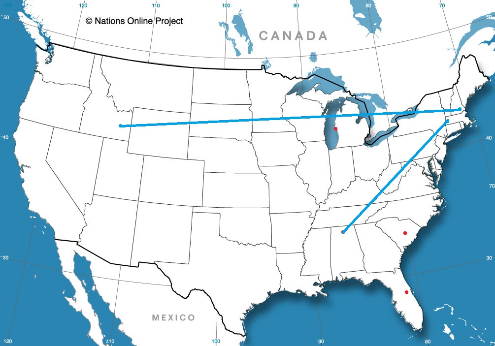
This drive will straddle the Appalachians, and despite the nexus generally in the Eastern US, we will duck a lot of the traffic trouble. We’re going to take 2 days with a total distance of 1,066 miles. We’ll average 66mph, and will travel 528 miles, a little less than half, on our first day of travel.

Pittsfield, Massachusetts

DAY ONE (Friday)
It’s been a bit active in the eastern United States, but we are looking at a break in the action, at least in the Northeast and Mid-Atlantic tomorrow. A perturbation rolling through the Great Lakes tomorrow will bring some rain to interior New England initially, and reaching the coast by late afternoon. By that time, though, we’ll be well into the Potomac Valley, on our way to Mint Spring, Virginia, which is near Staunton.

DAY TWO (Saturday)
The sunshine will continue while we are to the east of the Appalachians, but as we crest them, we will also begin to intersect the moisture flow from the Gulf. Our drive through Tennessee will be dotted with rain and thunderstorms triggered by flow sneaking up the hillsides, and we will have to navigate this threat for the remainder of our drive. There will be more widespread gaps in precipitation the nearer we are to to Hunstville, thanks to the slightly flatter terrain, but the storms will be based nearer to the surface, which suggests a bit more intensity when we are in them. And gosh dang, will it be hot.

Huntsville, Alabama

My favorite weather related fun fact about Huntsville is that it is the Weather Service office with the smallest geographic footprint. This is because of the preponderance of severe weather, but also because of the historic technical aptitude and home of the space program.

At 853AM, CT, Huntsville was reporting cloudy skies and a temperature of 75 degrees. More importantly, they were also reporting a dew point of 72, ensuring that the morning would have a fairly damp feel, thanks to lingering fog and morning dew and condensation. There was a weak pressure trough in central Tennessee that was kicking up clouds across the region, but they are expected to shift swiftly out of the area, rendering the Huntsville area, along with most of the southeast, extremely warm for the rest of the day.
Low pressure is camped out in eastern Canada and the north Atlantic, without any real plans to leave. This will force a steady southwesterly flow, drawing Gulf moisture through the already sultry air, leaving a persistent threat of afternoon showers and thunderstorms in the region. These are likely to be a blessing, as they should relive some of the heat.
Tomorrow – Scattered thunderstorms, High 91, Low 72
Saturday – Scattered thunderstorms, High 89, Low 72

TWC: Tomorrow – Partly cloudy early. Scattered thunderstorms developing in the afternoon.High 91, Low 73
Saturday – Scattered thunderstorms High 87, Low 73

AW: Tomorrow – Partly sunny (PM storms) High 91, low 73
Saturday – Intervals of clouds and sun, a couple of thunderstorms around High 87, low 73

NWS: Tomorrow – A 30 percent chance of showers and thunderstorms, mainly after 2pm. Partly sunny high 94, Low 74
Saturday – A 50 percent chance of showers and thunderstorms, mainly after 2pm. Partly sunny High 93, low 75

WB: Tomorrow – Partly cloudy, scattered showers and isolated thunderstorms in the afternoon High 90, Low 77
Saturday – Partly cloudy, scattered showers and thunderstorms in the morning and numerous showers and thunderstorms in the afternoon, high 88, low 77

WN: Tomorrow – Partly cloudy with isolated thunderstorms, high 94, low 74
Saturday – Partly cloudy with scattered thunderstorms, High 93, Low 74

FIO: Tomorrow – Possible light rain tomorrow evening.High 90, Low 74
Saturday – Possible light rain in the evening. High 87, Low 73

the GFS and NAM are fairly different in temperature forecasting, and there is a similar discrepancy in forecasts. The NAM is warmer, suggesting fewer storms, but the GFS anticipates more cloud cover. Which will play out? I split the difference, like a coward. Here is that satellite, showing the current clouds in Tennessee and north Alabama.

Pocatello, Idaho to Manchester, New Hampshire

It is a hot and active time in the northern US right now. Where there are no storms, there is blistering heat, but where there are storms, the heat abates. What will we contend with? The heat? The storms? Certainly the humidity? The only way to know is to look into the future, as we forecast for this 4 1/2 day trip, which will cover 2,463 miles. We will collect 532 miles a day. at a modest 66.5mph

DAY ONE (Tuesday)

Pocatello, Idaho

DAY ONE (Thursday)
While things have been a bit tumultuous this week, the biggest, baddest area of low pressure in the Plains is lifting towards Hudson Bay, as though it were a regular winter feature. This will provide a modicum of relieve for waterlogged farmers in the northern Plains, and a great deal of relief for anyone navigating the wilds of Idaho and Wyoming, as we will. There won’t be much to get in our way as we trek eastward, stopping in Egbert, Wyoming by night’s end.

DAY TWO (Friday)
Flow over the mountains will continue to be westerly, and as it ever does, it will fill in the gap behind the previous system with another lee trough. It will be tapped of moisture, though, and will function only to accelerate the warm air from the Gulf to the Plains. Hot and stick in Nebraska, and western Iowa, where we will alight upon Wiota, west of Des Moines, for the night.

DAY THREE (Saturday)
That advancing area of low pressure will start causing problems on our Saturday drive. The GFS, generally agreed to be more reliable in the longer term is indicating widespread precipitation from Iowa to Illinois and Indiana, though I suspect that is a resolution issue. Instead, it’s going to be hot and humid all day, with only a stray thunderstorm here or there. Granted, those storms will likely dump a lot of rain where ever they do show up, which will severely cramp our style. The drive will end in Howe, Indiana, off of the Indiana Toll Road. when we get there depends on how bound up a stray thunderstorm makes Chicago.

DAY FOUR (Sunday)
That area of low pressure from earlier in the trip, the one that we noted would be headed towards Hudson Bay? Well, he’s still going to be there, just hanging out. This will lead to much of the eastern third of the country being active, though not in a terribly organized way. Scattered thunderstorms cropping up in the heat of the day, without any semblance of a plan. This will require us to be vigilant with the wipers from Howe to Syracuse, though there is a chance those showers start tapering off as we role into Syracuse for the night.

DAY FIVE (Monday)
The mishmash of showery humid air will organize a bit to start next week. In New England and New York, this can be a bit more dangerous because of all the tree coverage. A bit of wind can block roadways for hours with the debris. don’t be surprised to see extra traffic through Albany and on to Massachusetts and southern New Hampshire.

Manchester, New Hampshire

Tyler stays clear

There had been some concern that the general instability of the season left Tyler, Texas prone to an isolated thunderstorm on Monday, as flow started to get drawn towards what would ultimately become Barry. It never came to pass, however, with a hot, sunny Texas day to start the week. Tuesday was also hot, sunny and Texan. WeatherNation eked out a solo victory, nipping a handful of other outlets for the victory.
Actuals: Monday – High 94, Low 76
Tuesday – High 93, Low 76

Grade: A-C

Barry looms over Louisiana

Barry formed sloppily over the northern Gulf of Mexico late in the week before he made landfall near Intracoastal City, in the south central part of the state. The forecast was for a weak hurricane, at some point, and it was, but Barry made his landfall as a tropical storm.

The traditional concerns with a hurricane – wind and storm surge, looked to be mitigated by the general disarray of the storm even as he approached the coast. Note that the center of the storm is actually on the far north side of this batch of clouds, taken on Friday.

NOAA/NESDIS/STAR GOES ABI BAND 02 OR_ABI-L1b-RadC-M6C02_G16_s20191932011330_e20191932014103_c20191932014148.nc

There was no rain ahead of the storm either, but that has since changed. There is now a sizeable plume of heavy rain over eastern Louisiana, with more intense bands in central Mississippi.

Barry isn’t sluggish, like Harvey a couple years ago, nor does it possess an otherworldly amount of rainfall, and isn’t very blustery. In most years, Barry would pass through inconvenient but forgotten

This year, however, the Plains have been beset by a whole lot of rain after an active late spring snow season. The Mississippi River was already up as a result of the upstream backlog, and now, Barry’s downpours will overwork the lower River and Delta. Fortunatley, the storm surge was mild, and in better news, the city of New Orleans sounds confident of the changes they have made post-Katrina. Nevertherless, Barry will continue to provide a threat for flash flooding in low lying areas in tbe far southern part of the state. Of course, the entire area is a low lying area, so be vigilant if you are riding this out in the bayous.

Coming soon…

It’s the hottest time of the summer, so let’s stay in the air conditioning and read about what’s going on outside. How does that sound?

Road Trip from Pocatello, Idaho to Manchester, New Hampshire

Huntsville, Alabama
Road Trip from Pittsfield, Massachusetts to Huntsville

Deltona, Florida

Muskegon, Michigan

Sumter, South Carolina

A reminder: Thunderstorms are strong!

While strong synoptic scale systems, from Nor’Easters to Hurricanes are recognized for the sheer kinetic energy they possess over broad swaths of earth, it’s important to recognize that individual thunderstorms have an unbelievable amount of energy as well, and it’s all expressed faster and over a smaller area.

This video captures the flash flooding produced on Monday morning by a slow moving “every day” thunderstorm across the DC area. Even non-severe storms are capable of producing brisk winds, deadly lightning and as you can see, dangerous flash flooding, even if there aren’t any severe warnings (though this storm was waned for flash floods) and aen’t ultimately any severe reports.

Just another day in Southern Mississippi

First the good news: there were no thunderstorms last Wednesday or on the 4th of July for the city of Gulfport. Now the bad news: it was really stinkin’ hot. Low to mid 90s in the afternoon, and a low of 75 each morning. I hope the air worked for locals, or at least they have grown accustomed to sweating through the night. Accuweather had a dry forecast and the second best temperature forecast, which meant they started July off on a good note.
Actuals: Wednesday – High 92, low 75
Thursday – High 94, low 75

Grade: A-B

Tyler, Texas

Hi friends! I hope the holiday weekend left you recharged to attack the workweek. I think mine just made me want another week off!

At 953AM, CT, Tyler was reporting a temperature of 85 degrees with sunny skies. Dew points were sultry, sitting in the mid to upper 70s across the region, feuling a surprisingly robust cluster of thunderstorms in southwest Arkansas, with some storms developing southwest into Texas, where a couple of cells were popping up just to the north of Tyler, and Gilmer was reporting thunder.
A very weak perturbation at the mid levels is sweeping through the region, beneath a similarly low powered ridge over the lower Mississippi Valley. This is enough to give some semblance of organization to the thunderstorm activity across the area, however widespread convection is likely across the southeast this afternoon as broadscale northwesterly flow trails some weak rotation centered over the Carolinas. Tyler will be at the western edge of this convective activity through mid afternoon tomorrow, and a stray thunderstorm cannot be ruled out. As low pressure organizes a bit over north Florida, and gets entrained with a trough over the Gulf Stream, The northwesterly flow will subside in Texas, but so too will the stream of moisture towards Tyler. Expect a hot and humid day on Tuesday, but without the threat for rain.
Tomorrow – Hot and partly cloudy with an isolated thunderstorm, High 94, Low 76
Tuesday – Mostly sunny, hot High 95, Low 75

TWC: Tomorrow – Partly cloudy. A stray shower or thunderstorm is possible High 95, Low 76
Tuesday – Mainly sunny. High 95, Low 76

AW: Tomorrow – Partly sunny; humid High 93, Low 75
Tuesday – Partial sunshine; humid High 94, Low 76

NWS: Tomorrow – Mostly sunny High 93, Low 76
Tuesday – Sunny, High 94, Low 75

WB: Tomorrow – Partly cloudy High 93, Low 76
Tuesday – Mostly sunny, High 94, Low 75

WN: Tomorrow – Partly cloudy, High 94, Low 76
Tuesday – Mostly sunny,, High 94, Low 75

FIO: Tomorrow – Humid and partly cloudy throughout the day.High 91, Low 73
Tuesday – Humid and partly cloudy throughout the day. High 91, Low 72

Guidance has already proven to be a bit too cool today, so I’m anticipating that to continue for the next couple of days. It looks like The Weather Channel and I are the only two on that bandwagon, as well as the threat for storms tomorrow. They ARE tops in the standings so far this year, so I think I picked a good partner. Here is radar, with a couple of storms popping up to the north.

June forecaster of the Month

For the first time as I can remember this year, an outlet thoroughly dominated the competition for a forecast period. The Weather Channel easily attained the top score this month, and they did it by winning or tying at the top spot on 4 of the month’s 6 rated forecasts. No stopping The Weather Channel, who now also takes the lead on forecasts wins for the year.

OutletMonth wins
The Weather Channel2.7
Weatherbug1.5
Forecast.io1
Victoria-Weather0.2
National Weather Service0.2
Accuweather0.2
WeatherNation0.2
OutletMonth winsyear wins
The Weather Channel2.79.95
Victoria-Weather0.27.7
Weatherbug1.57.58
Forecast.io16
National Weather Service0.25.45
Accuweather0.25.03
WeatherNation0.24.28