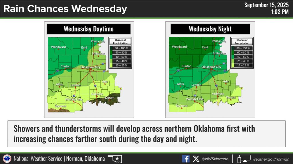
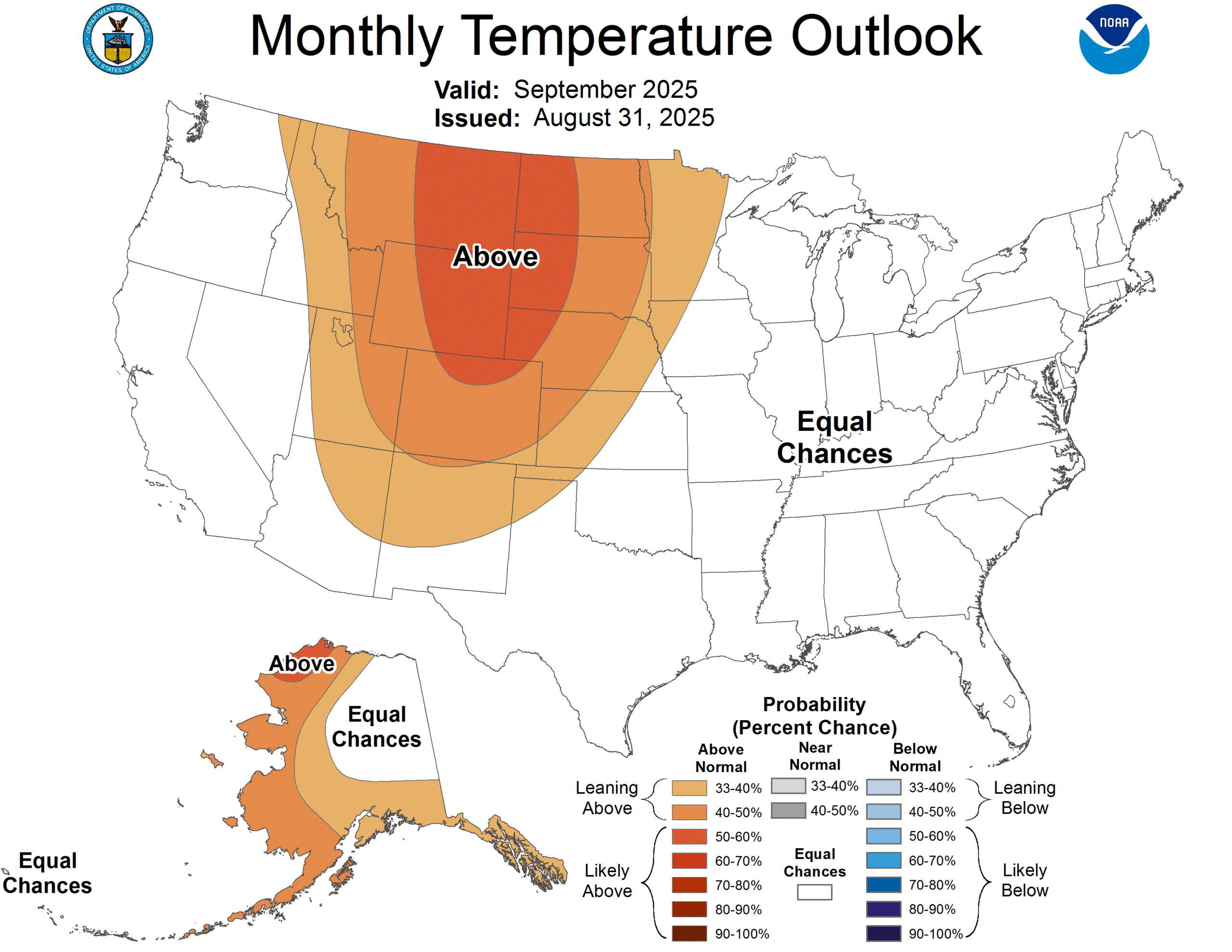
Autumn is working its way into town tomorrow, according to astronomers (it’s been here since the 1st, according to meteorologists) and this time of year I’m either talking mostly about the tropics or about transitional systems bringing big storms or big changes to the Plains. This year, I’ve not had the need for either. For one thing, it’s been colder than normal to begin the month, so a fall like transition isn’t as notable. For another, the Atlantic is serving all of the tropical features (for now) to the north Atlantic.
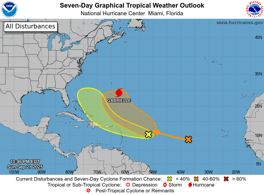
With all of the various debates over the state of the climate and sea surface temperatures, the fact that the storms are churning in the Atlantic instead of the Caribbean shouldn’t quiet any of them. Another explanation is that storms are forming further east because of the warmth, and able to veer north early on in the life cycle because of the environment for storms to do so, caused by a warmer climate/sea surface.
Don’t misunderstand this as a good thing. The Caribbean and Gulf are still plenty warm, and conducive spots most of the late summer for tropical storms. It hasn’t happened yet because of prevailing flows and upper level factors. Really, the only debate we are avoiding with the dynamics of this tropical season is the one that forces on air meteorologists to decide on the namesake of the Gulf.
We are in the second half of the tropical season, and with only one storm in the month of September, things have gone our way, whatever the cause is. After many bad seasons in a row in the tropics, we were owed an easy one.