The verification for Anniston was interesting. There was no rain to be seen anywhere, but an area of clouds last Wednesday parked itself over town just before noon. Not only did it stop diurnal heating, but a batch of cold air rushed in underneath it and made sure highs never reached the 50s. There was a cold front that showed up to the north of Anniston, but the rain never filtered down to Alabama, thanks to the effects of a cold front over the central Gulf preventing much moisture from reaching the Southeast. So it was a strong cold front, stronger than we anticipated, but with nothing to show for it. The combined forces of Accuweather and Weatherbug tied for the top forecast. Actuals: April 20th, High 76, Low 46 April 21st, High 55, Low 40
Today is the 10th anniversary of a major tornado outbreak, which caused death and destruction across the southeast, most notably when a tornado hit Tuscaloosa, including the campus of the University of Alabama. This time of year has no shortage of such anniversaries.
This year, fortunately, there aren’t any major severe weather outbreaks on the immediate horizon. Model guidance is in lockstep over the next few days, so that can be taken with some degree of certainty that there isn’t a major event before the end of April.
That’s not to say it won’t be stormy. Every increment of the forecast features a little wave, producing showers and thunderstorms rolling through the country, particularly from the Central Plains to the Ohio Valley southward. It’s not always the same wave, and no area is going to be relentlessly active for the next several days, but there will certainly be many active radars in the south central and southeastern US through the end of the work week.
Beyond nationally calm Saturday, divergence begins to settle in. Timing and placement are askew for the various computer guidance that meteorologists have available. Going beyond 5 days for a forecast is never generally as accurate as one might hope, but for a lot of the country, Sunday and the early part of next week are all over the map.
One thing that is in concert, is that none of the model maps are quiet. There is always something going on. A broad trend like that can be relied upon, moreso than a forecast for a particular location. That means the country can expect to see a lot going on in early May, even if we can’t confidently say what we should expect quite yet. With the anniversaries of Tuscaloosa, Moore and so many other coming up this time of year, “action” is not something everyone should look forward to.
Last weekend, Elizabethtown‘s forecast was up in the air. After a clear morning on Saturday, many outlets disagreed as to what twists and turns the northern Kentucky town would take. It did start on the cool side, which was the initial bone of contention, but then, clouds laden with some very light rain dictated the afternoon temperatures as well. Those that foresaw the precipitation also tended to call for cooler temperatures, but it certainly wasn’t a consensus. While they didn’t have the best overall temperature outlook, their call for rain gave Weatherbug the prize for the day. Actuals: April 17th – .05 inches of rain, High 55, Low 41 April 18th – Rain reported, not measured, High 62, Low 34
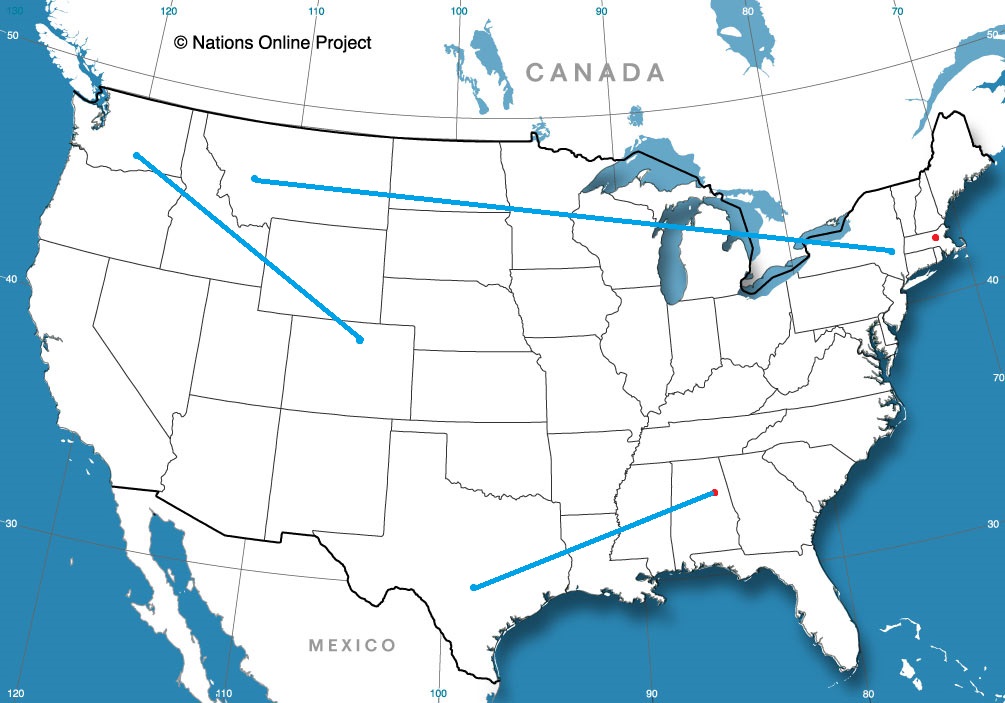
All right, everyone, we’ve got a road trip coming. The drive from Anniston to San Antonio will cover a day and a half and 923 miles. We’ll net around 542 miles on our full day at a pace of about 67.8mph, and having a big day of Texas driving to finish things off.
DAY ONE (Wednesday)
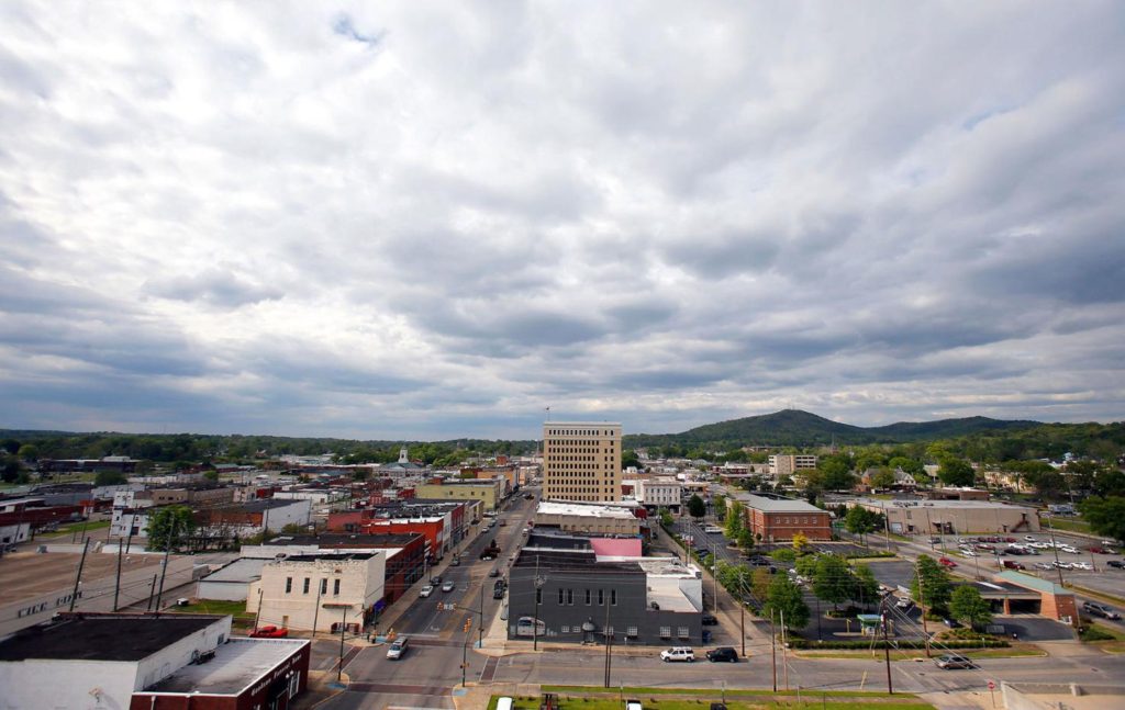
Anniston, Alabama
Things are looking pretty good for the southeast, thanks to a boundary implanted in the southern Gulf. Precipitation won’t be able to filter south as far as Anniston, or really any part of our route. It will be uncharacteristically cool in Alabama or Mississippi, and you will probably find people in Egan, Louisiana, the destination for Wednesday night, in layers when we arrive.
DAY TWO (Thursday) Surface high pressure is going to drift further to the east on Thursday, and for the first time this season, as far as I remember, a moisture rich return flow will follow the west end of the ridge. Some showers and low clouds will drift into central Texas fairly early in the day. Most noticeably when we step out in San Antonio, the humidity will have arrived.
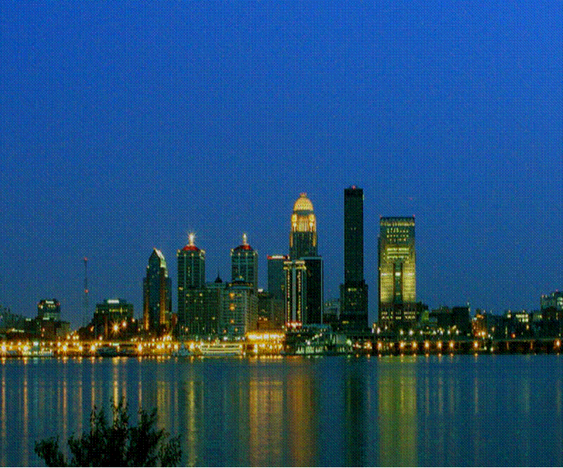
One of the consistent complaints about spring is that it is all too short. It seems, in the minds of many people, that we often jump right from winter to summer with little transition. Late last week in Louisville, spring had come. Temperatures reached the low 60s under a pleasant sunny sky — the perfect spring time weather. Forecasts were all very similar (there was a 4 way tie in 3rd place) but two outlets had morning lows forecast to be a little bit warmer, and they were in the top two spots. Victoria-Weather came in second, but Weatherbug had a nearly perfect forecast to attain victory. Actuals: Thursday – High 60, Low 43 Friday – High 65, Low 42
Alabama has certainly seen it’s share of terrible weather this spring. I suspect our forecast through the middle of this week will be a bit less intimidating.
At 1153AM, CT, Anniston was reporting clear skies and a temperature of 67 degrees. While temperatures were warm, dew points sat merely in the low to mid 40s, so it wasn’t exactly summerlike northeast of Birmingham. A strong jet lay south of the Gulf Coast, keeping any frontal activity well offshore, and providing for a pleasant, subsident air mass, which is also working to stave off other inclement weather from the north. A trough in the northern High Plains will drive southeastward, carrying with it a less active cold front than would be expected, given it’s strength. The front will pass without incident on Wednesday in the early evening, save for a switch in the wind direction. Tomorrow – Sunny, High 77, Low 46 Wednesday – Increasing clouds, High 64, Low 43
TWC: Tomorrow – Sun and a few passing clouds. High 75, Low 48 Wednesday – Partly cloudy skies. High 60, Low 47
AW: Tomorrow – Partly sunny High 76, Low 47 Wednesday – Sunny to partly cloudy and cooler High 60, Low 45
NWS: Tomorrow – Mostly cloudy, then gradually becoming sunny, High 76, Low 49 Wednesday – Sunny High 63, Low 44
WB: Tomorrow – Partly cloudy, High 75, Low 46 Wednesday – Cooler, Partly cloudy in the morning then clearing. High 60, Low 45
WN: Tomorrow – Partly cloudy, High 79, Low 47 Wednesday – Mostly sunny, High 63, Low 46
FIO: Tomorrow – Mostly cloudy throughout the day. High 76, Low 50 Wednesday – Partly cloudy throughout the day. High 61, Low 44
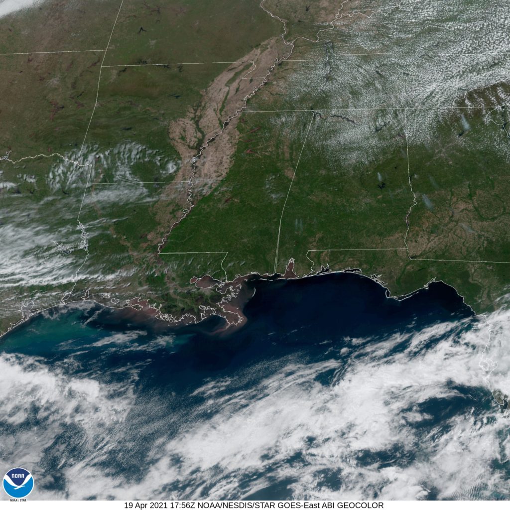
That change in wind will, I guess, bring cooler temperatures. Don’t be surprised if Wednesday highs are higher than forecast here. It won’t be colder, though. Check out this beautifully clear satellite image of Alabama.
It takes less than an hour to get from Louisville to Elizabethtown. The real intrigue is whether or not you want to take a more westerly tact through Fort Knox, but really, it’s just a 44.6 mile drive at a pace of, as I’m sure you guessed, just over 60mph. Let’s knock out this commute.
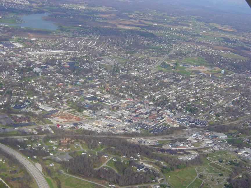
Louisville Kentucky
By tomorrow morning, a lost batch of moisture in the Ohio Valley may or may not touch off some showers in western Kentucky. That’s only if the GFS gets it right, because other outlets are pretty dry. We’ll respect the venerable GFS though, and suggest clouds will be possible on the drive down to Elizabethtown.
We were just in Kentucky for our last forecast, and today, we are going just down the road, staying in the Bluegrass State.
At 155AM, ET, Elizabethtown was reporting a temperature of 45 degrees with mostly cloudy skies. There is a remnant disturbance over the the center of the country that is providing clouds and some light rain to parts of the Lower Mississippi Valley. A seasonably strong jet streak lay just north of the Gulf of Mexico, and was reflected by the tail of a cold front along the Gulf Coast which was working to prevent much moisture from filtering into the middle of the country. As a result, the already weak feature was even less potent than it’s dynamics suggested. This aimless bit of moisture and energy has a very modest low level trough running from the eastern Great Lakes towards the Ozarks, and won’t be compelled to move. Instead, it will be lost between a resurgent area of low pressure developing along the Gulf front and a trough descending from Canada. Without a fresh infusion of moisture, or a terribly volatile trigger mechanism, expect little, if any precipitation in the area, with partly to mostly cloudy skies. Tomorrow – Mostly cloudy, High 61, Low 40 Sunday – Mostly cloudy, High 63, Low 37
TWC: Tomorrow – Overcast. High 60, Low 42 Sunday – Sunshine in the morning followed by mostly cloudy skies during the afternoon. High 63, Low 38
AW: Tomorrow – Mostly cloudy with a shower in places High 60, Low 44 Sunday – Mainly cloudy with a shower in places High 63, Low 42
NWS: Tomorrow -Mostly cloudy (10%chance of early showers), High 59, Low 44 Sunday – A 20 percent chance of showers after 2pm. Partly sunny, High 62, Low 40
WB: Tomorrow – Mostly cloudy with a 20% chance of showers, High 58, Low 44 Sunday – Partly cloudy with a 20% chance of showers, High 61, Low 39
WN: Tomorrow – Mostly cloudy, High 60, Low 46 Sunday – Partly cloudy, High 62, Low 40
FIO: Tomorrow – Overcast throughout the day., High 56 Low 44 Sunday – Partly cloudy throughout the day. High 64, Low 36
It’s always an interesting day when the forecast even features different precipitation forecasts. With some clear sky peaking through, I think the temperature has room to drop over night. That is the first question for this forecast!
Southwest Utah isn’t a terribly rainy spot, and when low pressure developed in the middle part of the state, the response in St. George certainly wasn’t rainfall. Instead, on Tuesday St. George reported gusts of over 40mph, which is certainly swift, and almost certainly laden with dust on the outskirts of town. Temperatures generally cooperated with forecasts, with warmer overnight lows on Tuesday really the only day over day change. We had a trio of outlets combine for the top forecast, with Weatherbug splitting the difference with the Weather Service and Weathernation, each of whom had their first victory of the year. Actuals: Monday, High 80, Low 52 Tuesday – High 82, Low 55