There has been a persistent drought across the west. It’s been tough this year, but it’s been ongoing for years now. The northern end of the San Joaquin Valley is no exception. Our forecast for Sacramento came before the blistering heat that is coming to the Northwest, and temperatures were relatively comfortable, only reaching the upper 80s for the weekend of our forecast, but as has been typical: no rain. Weatherbug claimed the top forecast, continuing a trend of success for that outlet. Actuals: June 12th, High 88, Low 59 June 13th, High 87, Low 61
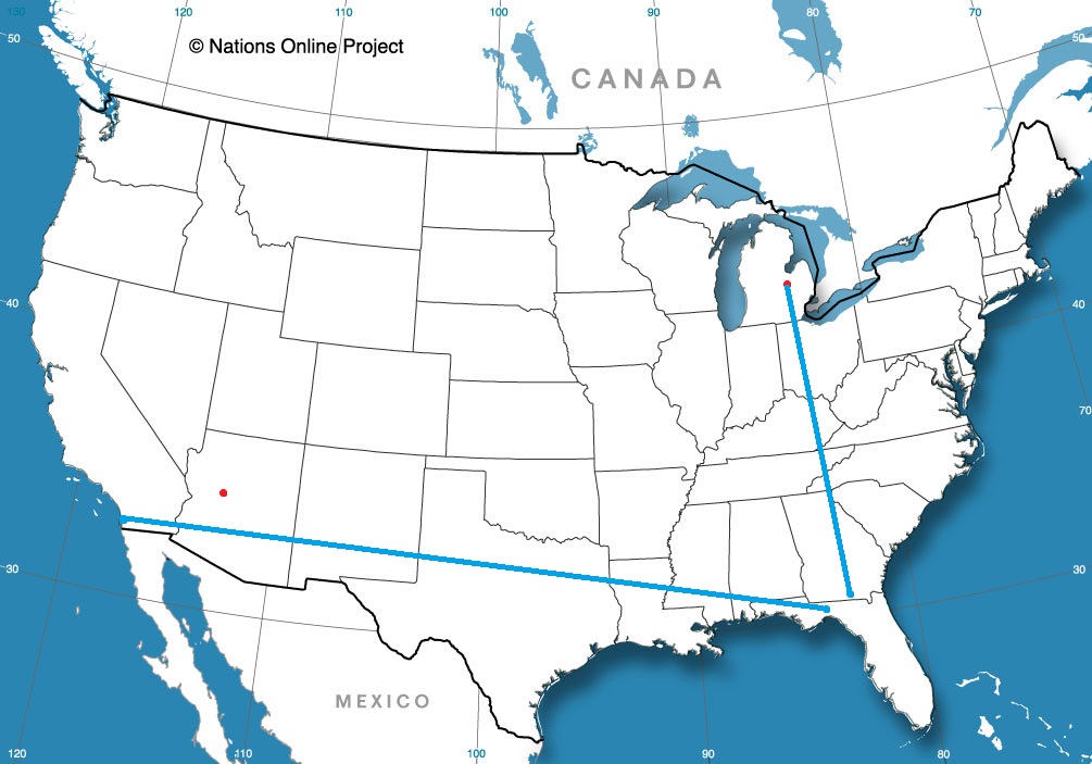
The heat is on in the southwestern United States, but there will be a seasonable reprieve in the southeast. We’ll cover most of it on our 2 day trek, covering 1,325 miles. The second day will be pretty long, so travel with a second driver. The pace will be 68.8mph, which we will use to take a 550 mile chunk out of on the first day, hopefully getting us out of Texas. Let’s find out and get going.
DAY ONE (Wednesday)
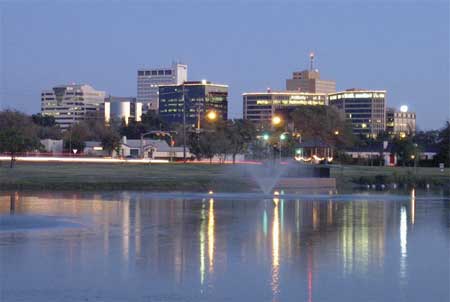
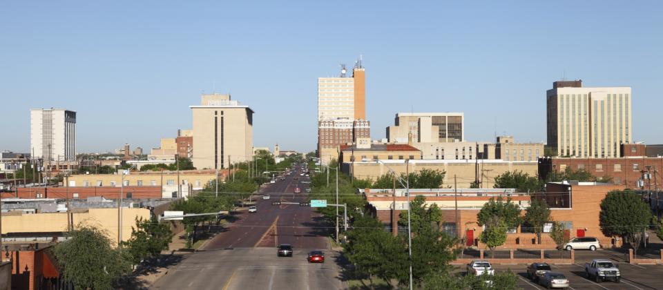
Midland, Texas By Hellorawr at English Wikipedia – Own work by the original uploader, Public Domain, https://commons.wikimedia.org/w/index.php?curid=29124005
Often in the summer, cold fronts expire along the coast, and just leave a convergence zone , amplified by the daily sea breezes. That’s what to expect in the coming days, but only as far west as about Lafayette, and not too terribly far inland. This will keep the hottest and most humid air penned to the south, relatively cool, definitely drier air will populate our route to Texas. We will make it just east of Shreveport and the town of Dubberly for our initial day of driving.
DAY TWO (Thursday) Another feature of summer in the southeast when moisture feeds systems in the Midwest and Great Lakes by streaming across the region. Guidance is pretty consistent with a potential band of light rain over western Mississippi as we drive through. From there through Georgia, expect more isolated showers and storms becoming more active as the area warms up in the afternoon. the Carolinas look a little bit drier, thanks to a weak little spot of development in the Gulf Stream, which will cycle in some subsiding air. Warm — but not too hot — weather awaits in Columbia.
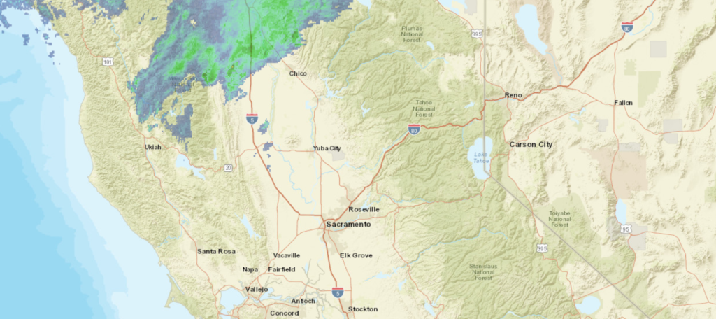
We are taking a forecast trip to the capital of California.
At 753PM, PT, Sacramento was reporting a temperature of 78 degrees with partly cloudy skies. Showers were seen in the mountains north of Chico, as a north Pacific gyre continues to spin some moisture to the Pacific Northwest. It hasn’t brought any rain to the Sacramento area, but temperatures are moderated by the cool Pacific air. Expect the temperature tends to change with a subtle update to the wind direction. Instead of cool Pacific air funneling towards Sacramento, downsloping will be enhanced and the heat will return to Sacramento tomorrow and continue through the weekend. Tomorrow – Partly cloudy, High 90, Low 58 Sunday – Partly cloudy, High 89, Low 64
TWC: Tomorrow – Sunny skies. High 91, Low 59 Sunday – Sunny skies. High 89, Low 62
AW: Tomorrow – Very warm with plenty of sunshine High 89, Low 58 Sunday – Mostly sunny High 89, Low 61
NWS: Tomorrow – Sunny High 90, Low 59 Sunday – Sunny, High 90, Low 62
WB: Tomorrow – Sunny warmer, High 90, Low 59 Sunday – Sunny, High 87, Low 62
WN: Tomorrow – Sunny, High 90, Low 59 Sunday – Sunny, High 90, Low 62
FIO: Tomorrow – Clear throughout the day. High 91, Low 57 Sunday – Clear throughout the day. High 90, Low 60
Hot and dry, just what Californians aren’t looking to hear.
Green Bay is known as the frozen tundra to NFL fans the world over, but this was not the case in June 2021. Temperatures hovered near 90 on Tuesday and Wednesday, as storms avoided the area. Fortunately for homes without air conditioners, the temperatures cooled off a bit more than had been in the forecast, which hopefully meant a decent nights sleep for residents worrying about Aaron Rodgers’ future with the Packers. Weatherbug was able to parlay the cooler temperatures into a forecast victory. Actuals: Tuesday, High 91, Low 69 Wednesday – High 89, Low 69
I am presently enjoying a vacation with my extended family in the Black Hills of western South Dakota, and we’ve had a bit of active weather in the last couple of nights. Tonight, we were in a severe thunderstorm watch, as a line of thunderstorms swept in from Wyoming and brought rain and marble sized hail to our cabin before getting a boost from the eastern slope of the Black Hills, and accelerated through Rapid City and is now preparing for a voyage through the Plains.
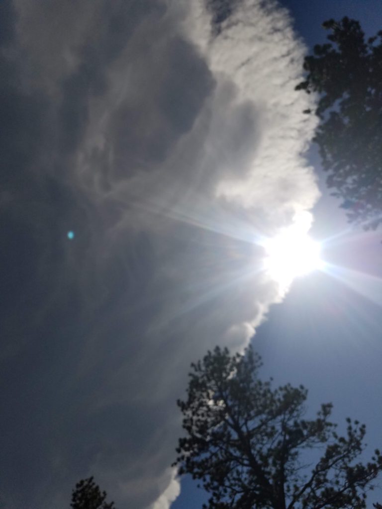
Last night, however, was different. An isolated thunderstorm, aided in part by the very mountain we are staying on, cropped up and stayed in the same spot for well over an hour. Here is the view from just to the north of the storm.
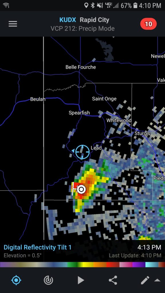
We were almost directly under this storm, and the radar confirmed our suspicions.
The storm did eventually expand and bring some drops of rain, but not as much as points on other faces of the mountain!
It was an interesting thing to see in action, the force of the terrain, and the structure of the storm that produced all of the wet weather to other parts of the mountain was pretty incredible.
As summer has arrived, a lot of people have started thinking about going to the lake and dipping their toes in refreshing waters, though for some reason, I’m not sure Green Bay has often stood out as a desired vacation destination, at least not when it isn’t football season.
At 1053PM, CT, Green Bay was reporting a temperature of 76 with clear skies. That temperature, warm for the middle of the night, was augmented by a dew point of 70. A clammy fog will likely roll into the near shore areas in the morning, and air conditioners will be stressed over night. Low pressure in the northern Rockies was helping draw more warm humid air north, while a surface trough in the Dakotas was feeding off of the potential energy and triggering thunderstorms across the northern Plains. Though they look impressive, they won’t reach eastern Wisconsin, withering as they get away from actual forcing. There is a weak trough northeast of the Ozarks, and surface low pressure over the Rockies, the Great Lakes are predominantly under a broad, nearly continent wide ridge. Still, given the soupy conditions across Wisconsin, an area thunderstorm will be possible for the next couple of days, particularly in the afternoon. Tomorrow – Hot and humid, with isolated evening storms, High 90, Low 70 Wednesday, more of the same, including storms, High 87, Low 68
TWC: Tomorrow – Intervals of clouds and sunshine. A stray shower or thunderstorm is possible.High 89, Low 69 Wednesday – Sunshine along with some cloudy intervals. High 84, Low 63
AW: Tomorrow – Periods of sun with a thunderstorm in a couple of spots; very warm High 92, Low 74 Wednesday – Very warm with intervals of clouds and sun High 87, Low 67
NWS: Tomorrow – A slight chance of showers between 9am and 1pm, then a slight chance of showers and thunderstorms after 1pm. Patchy fog before 9am. Otherwise, partly sunny, High 88, Low 70 Wednesday – Mostly sunny, High 85, Low 67
WB: Tomorrow – Humid, Partly sunny. A slight chance of showers in the morning then a slight chance of showers and thunderstorms in the afternoon, High 91, Low 74 Wednesday – Mostly sunny, High 89, Low 70
WN: Tomorrow – Partly cloudy with isolated storms, High 88, Low 72 Wednesday – Mostly sunny, High 85, Low 67
FIO: Tomorrow – Humid and partly cloudy throughout the day. High 88. Low 70 Wednesday – Partly cloudy throughout the day. High 84, Low 63
Really hit or miss with those thunderstorm chances. The activity east of Fargo sure isn’t missing tonight.
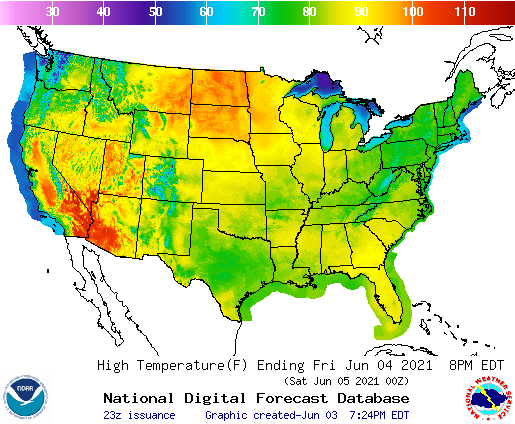
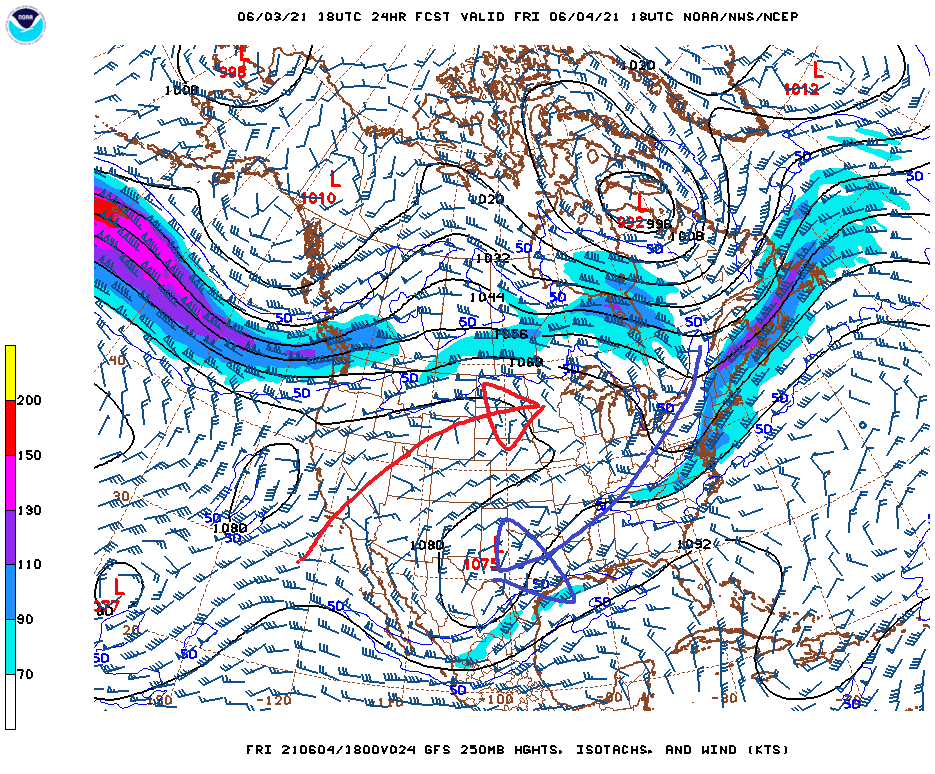
It was 90 degrees in Minneapolis today, which is certainly a pretty warm start to June, and tomorrow and the weekend will only get hotter. Heat waves are certainly newsmakers, and in particular, they are big news when they arrive in the northern US. All this is true, and really, it’s not the most interesting part of this particular heat wave. Take a look at the forecast highs for Friday.
There is the typical hot spot in the Mojave, but otherwise, the warmest part of the country will be…. North Dakota? The interesting part of this heat wave, to me, is that it completely bypasses places to the south. The forecast high in Bismarck tomorrow is 101! Unintuitively, the forecast high in Austin tomorrow is 80, a full 20 degrees cooler. I don’t have to tell you this, but that’s not how it usually works!
Why is this going on? The answer is told in the upper air forecast. Take a look at the flow pattern forecast during the day tomorrow. I have added some arrows for your benefit.
The pattern over the US is tilted. The upper level trough over the eastern part of the US takes a westward turn and heads through the southern Plains. Forgive me, because the axis of the trough in the south is a little further north than I drew it, but the result is the same. Moisture is being drawn to the Red River Valley, and then it streams into the eastern Great Lakes, keeping the entire tract covered in clouds and rain.
Meanwhile, a ridge axis runs from the southwest towards the Upper Mississippi Valley. Remember how I noted how hot it was in the southwest? Well, that is where the air moving into the Dakotas is coming from. Combined with the scouring effect of the Rockies, the dry air can warm even more during full daylight.
When this pattern sorts itself out, the hot air won’t go anywhere, but instead of shipping off to the northeast, the moisture entering through Texas will find a route north. Until a cold front comes late next week, the heat of this weekend will become hot and humid.
It’s only June 3rd. and the summer is off to a hot, hot start in the Northern Plains.
We’re coming up on the time of year for vacations. I am included in that group, getting ready to leave for a week next week, but there is a chance some of these forecasts sneak online before then.
Green Bay, Wisconsin
Sacramento, California
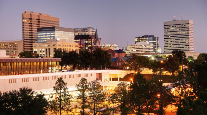
Fayetteville, Arkansas Road Trip from Columbia, South Carolina to Fayetteville
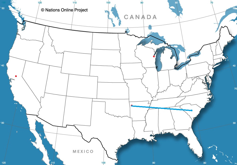
We’re ready for another road trip, as it, I think, a lot of the world, of late. We’ll take a 2 1/2 day trip from western New York to west Texas, covering 1,448 miles. That means a pace of 67.2mph, which is laudable, and a daily goal of about 538 miles. Summer time is here, and it’s road trip season!
DAY ONE (Wednesday)
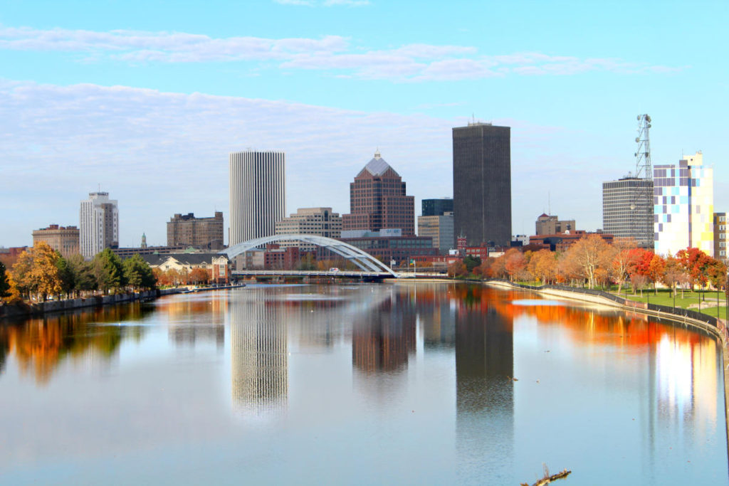
Rochester, New York
The nasty weather that has been afflicting the southern Rockies for the last couple of days is finally getting ready to climb to the north. It won’t do it with a lot of upper level support, or added precipitation, but it will still have plenty of resources to give us problems on Wednesday. Light rain will be a factor early in the day on Monday, and with heating of the day, the showers might get heavier and thunder could be possible. Don’t be surprised to hear some rumbles of thunder, particularly between Erie to Mansfield. After that, the light rain will return, but patchier, and with spots of sun. The clear skies will be likelier the further we head to the west, improving from Columbus to Knox, Indiana, which is east of Indianapolis, and will be our night one destination.
DAY TWO (Thursday) Southwesterly flow off the Gulf will draw along the back end of the cold front on the Eastern Seaboard, leading to some clouds and isolated spots of wet weather. Not the clear, blue skies we would normally expect behind a front, but we’ve been groomed by winter. Instead, mostly cloudy skies will dominate the stretch between Indy and St. Louis. I would label it “partly to mostly cloudy” in Missouri, but not a lot better. Less breezy though, I suppose, for what it’s worth. The day will end in Sarcoxie, between Springfield and Joplin.
DAY THREE (Friday) With low pressure shifting to the northeast, the Gulf will be reopened, and the south central US will get hotter and more humid. Air mass thunderstorms will be possible in the afternoon in eastern Oklahoma, but we should be through and on to Wichita Falls by the time any real thunderstorm activity fires up.