Happy November, officially, at least on the Victoria-Weather forecast front. Without digging too deeply into it, I’ll just say that I expect some headlines from Houston today. Are we thinking rain or shine?
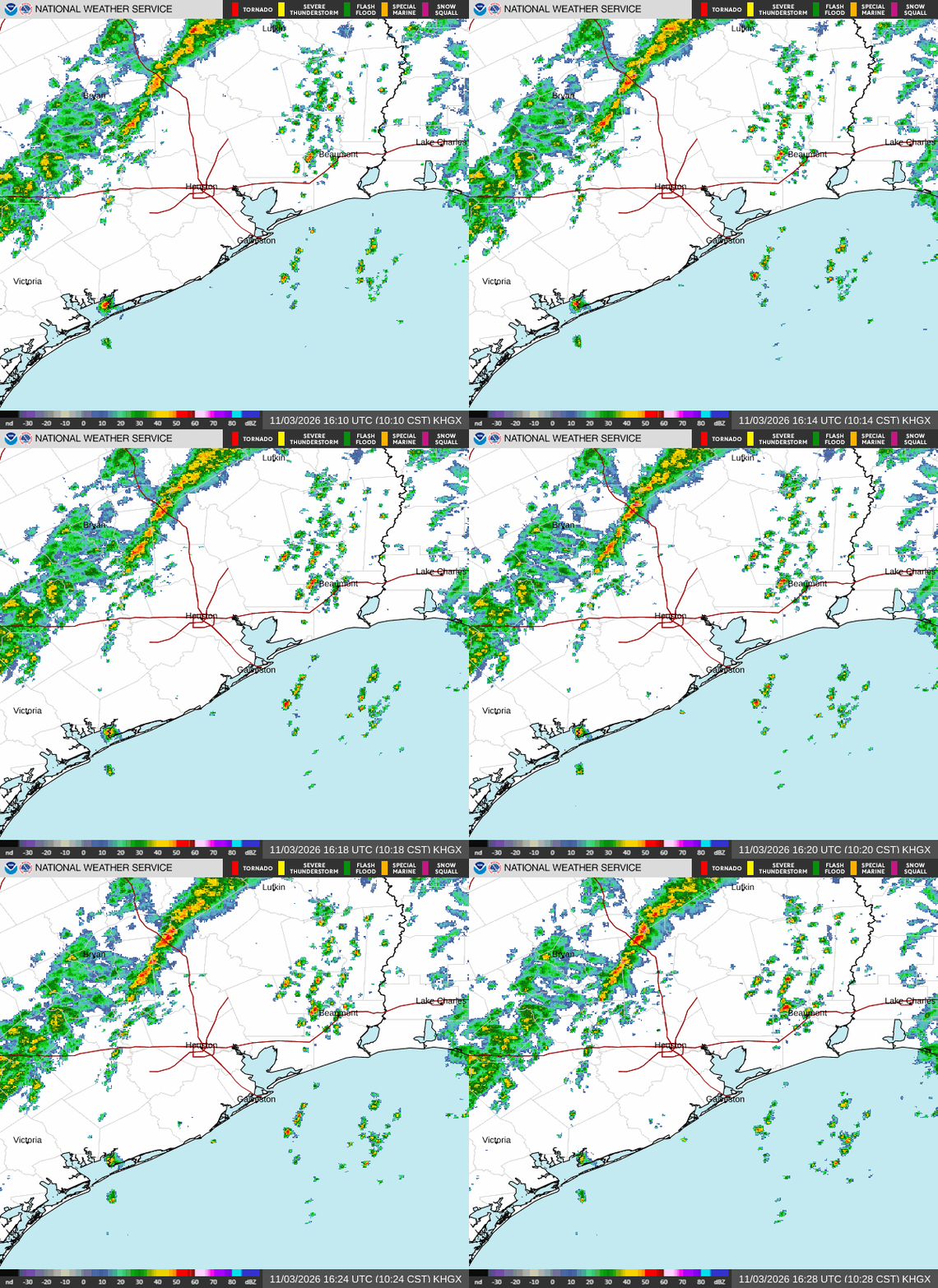
At 953AM, CT, Houston was reporting a temperature of 83 degrees with partly cloudy skies. There was a line of showers and embedded thunderstorms running Huntsville to Columbus, generally running to the north-northeast. If it holds together through the day, it will take some time to reach Houston, so expect a warm day.
Guidance right now suggests shower activity will be out of the area by midnight tomorrow. Expect a cooler, clearer day tomorrow behind the front, and with high pressure settling in. The surface high pressure will drift north through the period, with relatively low pressure developing in Texas. This will allow for weak onshore flow by Thursday evening, with some isolated showers and low clouds, primarily downtown towards Galveston, with drier conditions towards Katy and Houston – Bush airport.
Tomorrow – Mostly sunny, High 80, Low 62
Thursday – Mostly sunny, coastal drizzle late, High 82, Low 63
TWC: Tomorrow – A mainly sunny sky High 80, Low 60
Thursday – Except for a few afternoon clouds, mainly sunny. High 81, Low 60
AW: Tomorrow – Mostly sunny and less humid High 80, Low 60
Thursday – Sunshine and a few clouds High 78, Low 58
NWS: Tomorrow – Sunny, High 76, low 60
Thursday – A 30 percent chance of showers and thunderstorms after noon. Partly sunny, High 78, Low 60
WB: Tomorrow – Sunny. High 76, Low 61
Thursday – Partly sunny. A chance of showers in the afternoon. High 79, Low 58
WN: Tomorrow – Sunny, High 77, Low 60
Thursday – Partly cloudy with showers and isolated storms, High 78, Low 61
CLI: Tomorrow – Sunny, High 78, Low 61
Thursday – Sunny, High 79, Low 62
There are a few outlets going cooler, but I just don’t think this boundary is that strong. Here is the radar, and a live cam from Houston, which will allow you to watch rain role in.