Sometimes, we all need a little bit of reality to bring us back to earth. After a strong forecast to start the year in New York, it didn’t go quite that well in Logan. The various topographies of the northwestern US and the proclivity for cyclonic development in the Gulf of Alaska made for a rough day of forecasting. The primary cause of the misguided forecast were the low temperatures that arose on Monday the 8th. Well, that and how warm it got on Tuesday. Oh, and for many, the snow that lasted into Monday morning when many thought there would be a longer break. I guess there were a few issues. On a more positive note, there was a tie at the top between The Weather Channel, Accuweather and the National Weather Service. Actuals: Monday, January 8th -.03″ of precipitation in snow, High 25, Low 2 Tuesday – .04″ of precipitation in snow, High 36, Low 11
We’re off to Michigan’s capital to put together a forecast in the wake of yet another round of significant wintry weather. Are we in for a pause?
At 453PM, ET, Lansing was reporting a temperature of 5 degrees and a brisk northwest wind. The slow start to winter has led to a Lake Michigan much more capable of producing lake effect snow, and it is compounding the accumulations in the wake of yesterday’s event. All told, Lansing has received only a couple of inches, but over a foot has fallen along the lakeshore. A strong area of low pressure was retrograding to the west over Hudson Bay, sending brisk northwest winds to ensure that visibilities, even in the light snow, would be challenged. Low pressure in Canada will continue to spin thanks to the support of a strong jet trough. At the surface over the center of the country, high pressure will build in. This will dry out most of the country, the part that relies on the Gulf of Mexico for it’s moisture, however the combination of features will only bring about gustier west winds in Michigan. Expect persistent west winds and some intermittent snow showers throughout the forecast period. Tomorrow – Overcast with light snow, High 8, Low 0 Tuesday – Continued wind and clouds with light snow, High 9, Low 3
TWC: Tomorrow – Cloudy High 11, Low -4 Tuesday – Cloudy skies. Continued very cold. High 7, Low 4
AW: Tomorrow – Variable clouds with flurries, frigid; breezy in the morning; bitter cold; be sure to wear layers High 10, Low -1 Tuesday – Low clouds and bitterly cold; bitter cold; be sure to wear layers High 8, Low 6
NWS: Tomorrow – A 20 percent chance of snow showers after 1pm. Mostly cloudy and cold, High 10, Low -1 Tuesday – A 20 percent chance of snow showers after 1pm. Mostly cloudy and cold, High 9, Low 5
WB: Tomorrow – Partly sunny. Areas of blowing snow, High 9, Low 0 Tuesday – Partly sunny, High 9, Low 6
WN: Tomorrow – Mostly cloudy with slight chance of light snow showers, High 10, Low -1 Tuesday – Mostly cloudy with slight chance of light snow showers, High 9, Low 5
CLI: Tomorrow – Overcast, High 13, Low -3 Tuesday – Light snow showers, High 12, Low 3
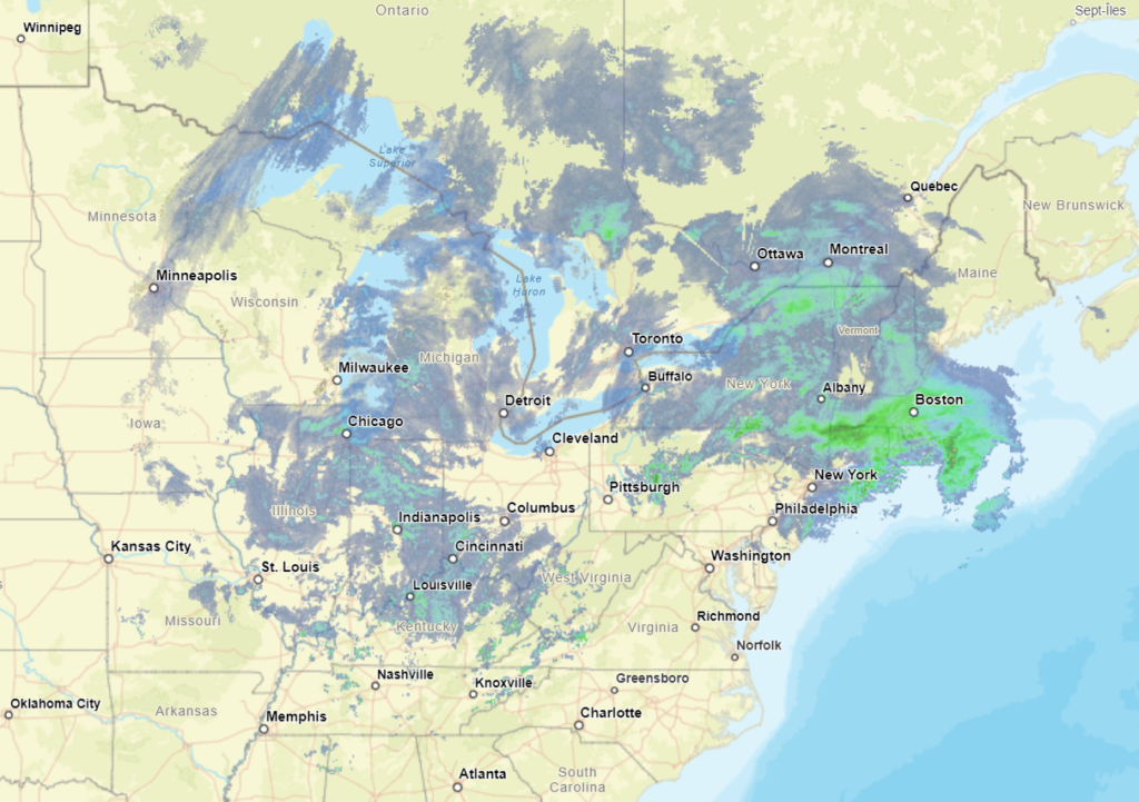
Here is a look at the radar, which is going to look pretty familiar for lower Michigan radar watchers for the next couple of days.
We’re going to sneak down to the Carolinas on the heels of a very active weather day for the southeastern US.
At 906PM, ET, Florence was reporting a temperature of 54 degrees with scattered clouds. A line of thunderstorms swept through earlier, with 63kt gusts reported at Florence. Winds have died down, but with a few post frontal sprinkles over South Carolina, Florence stands to get a little bit more rain before all is said and done. The jet structure is still very active, which will only encourage the area of low pressure to drift to the northeast, bringing the threat for rain to an end overnight tonight. The next round of low pressure is going to get organized in the south central US by Friday evening, which will also indicate the point at which warmer air will start returning to Florence. Dry conditions are expected in Florence from sunrise tomorrow through the day on Thursday. Tomorrow – Some clouds early, then sunny, High 53, Low 38 Thursday – Mostly sunny, High 58, Low 34
TWC: Tomorrow – Sunny, along with a few afternoon clouds. High 53, Low 38 Thursday – Partly cloudy. High 59, Low 35
AW: Tomorrow – Partly sunny, windy and cooler High 53, Low 39 Thursday – Milder with plenty of sun High 61, Low 35
NWS: Tomorrow – Sunny, High 52, Low 40 Thursday – Mostly sunny, High 58, Low 34
WB: Tomorrow – Sunny, High 51, Low 41 Thursday – Mostly sunny, High 59, Low 35
WN: Tomorrow – Mostly sunny, High 52, Low 48 Thursday – Partly cloudy, High 57, Low 34
CLI: Tomorrow – Mostly cloudy, High 54, Low 39 Thursday – Mostly cloudy, High 61, Low 36
There was quite a bit of severe weather in the southern and southeastern US over the last 48 hours. The strongest and most intense storms were overnight in the Florida Panhandle, but now we are near a break.
New York is obviously the center of the universe, so it was nice that round one of our winter weather week was more problematic for points outside of the Big Apple. Close, but not in the city itself, especially during out forecast. There was a wintry mix in the afternoon on Saturday, but the winter portion of the mix only lasted for a couple of hours in Manhattan. Several inches, fell north of town, and more than a foot came to some of the mountains of Pennsylvania. It was a strong start to the year for the Weather Channel, who netted the forecast victory. Actuals: Friday – High 41, Low 28 Saturday – Rain and snow, not measured, High 39, Low 32
We’re going to head to northern Utah, away from the real weather of the week, because that simply how we operate here at Victoria-Weather. Constantly missing the point.
At 851 PM, MT, Logan was reporting light snow and a temperature of 22 degrees. As the well advertised storm system begins to emerge in the southern High Plains, some of the same energy is bringing snow to the Wasatch Range. The sharp, strong trough that is the culprit behind the weather this week will transition out of the inter-mountain west by midday tomorrow, leaving the potential for some more flurries to continue into tomorrow morning in Logan. The rest of the day and early Monday look as though they will continue to be tranquil thorough the early part of the day on Tuesday as well. The next upper level wave in the jet structure is rippling through the Gulf of Alaska, preparing to bring more wet weather to the Pacific Northwest. The storm system will press moisture beyond the Cascades and as far as northern Utah by Tuesday evening. It’s going to remain chilly in Logan, so precipitation is going to fall as snow, and will predominantly fall in higher terrain. Tomorrow – A lingering flurry early, then increasingly sunny, High 25, Low 13 Tuesday – Sunny early, clouds and snow return late, High 27, Low 16
TWC: Tomorrow – Intervals of clouds and sunshine. High 25, Low 10 Tuesday – Cloudy with snow showers becoming a steady accumulating snow later on. High 30, Low 14
AW: Tomorrow – Mostly cloudy High 22, Low 9 Tuesday – Cloudy with a little snow High 30, Low 12
NWS: Tomorrow – Mostly sunny, High 24, Low 9 Tuesday – Snow, mainly after 11am. High 29, Low 11
WB: Tomorrow – Partly cloudy in the morning, then becoming sunny (Early snow) High 17, Low 13 Tuesday – Breezy. Snow likely in the morning then snow in the afternoon. High 23, Low 13
WN: Tomorrow – Partly cloudy, High 24, Low 13 Tuesday – Mostly cloudy with light snow, High 30, Low 11
CLI: Tomorrow – Mostly cloudy, High 24, Low 12 Tuesday – Blowing snow, High 32, Low 15
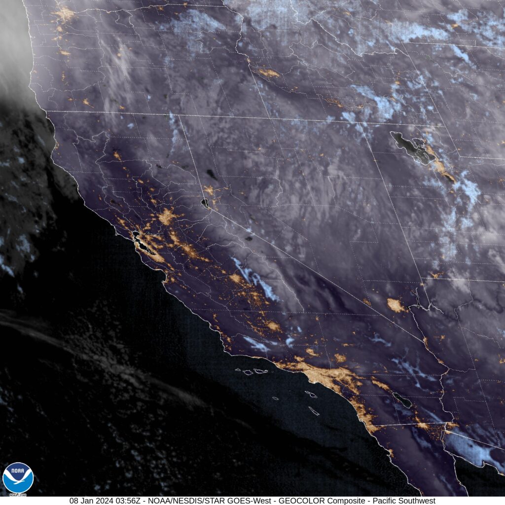
I’ll tell you what, these mountain forecasts sure get a lot of different forecasts. It doesn’t help that Utah doesn’t ever have an over head satellite image. You can see most of the snow is over the mountains.
If there is any good news for this weekend storm, it is that along the coast, things are pretty quickly moving on. Sure, there is quickly falling snow in Springfield, Massachusetts, but that is hardly the snowy mess that we feared early in the week.
The storm is also carrying more momentum that it had, even as recently as Thursday when we were issuing the forecast for New York City. Dry air is already moving into the Big Apple, and even the updated forecast, calling for light snow around Gotham, now seems a bit too aggressive.
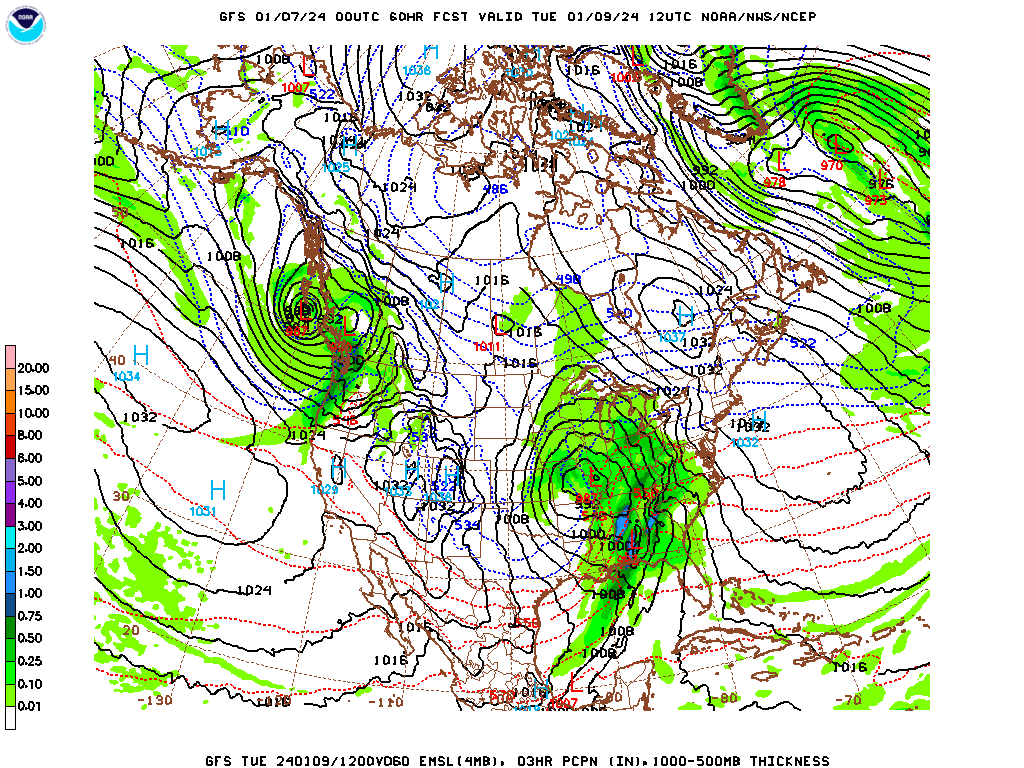
The break tomorrow will last through Monday, but even as we speak, a stronger, more organized feature is reconstituting in the southern Plains. By Tuesday afternoon, this is the GFS output.
That storm will be warmer, and won’t bring the same snow to the mid – Atlantic, but it has bad intentions for the center of the country.
This next round, with the warm air, and the inherent energy tied to it, will pose a severe weather threat for the southeastern US as well. It’s a busy week after a relatively quiet holiday season, so be careful out there as we get our first real wintry smack in the eastern US.
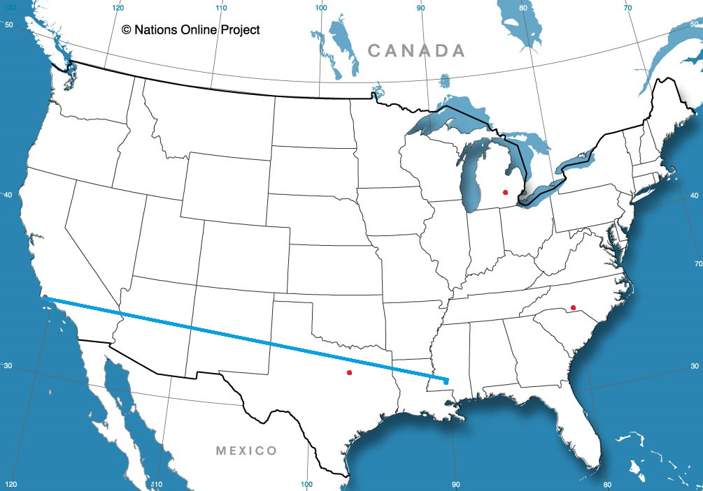
There is nothing more exciting than a January road trip, cross country through the northern US. What could go wrong? We’re going to travel for 5 days, covering 2,877 miles. Day 5 will be our longest day, after the first 4 days will be through after consuming 548 miles at a pace of 68.5mph. Don’t forget the scraper!
DAY ONE (Saturday)
Olympia, Washington
The rain will be falling in in western Washington as we get our drive started, and we can enjoy the Seattle area traffic in that same rain. Of course, we will be getting on I-94 near Snoqualmie, which means we will be forced to contend with some mountain snow through the Cascades. The system will be strong enough that we will still see some rain, albeit lighter, in the space between the Cascades and the northern Rockies. Visibility will be limited if we have designs on seeing Spokane as we pass by. The snow will return again in the western faces of the Rockies along the Idaho-Montana border, but the precipitation will finally be squeezed out of the feature, and when e get into the eastern facing valleys, ultimately stopping in Bearmouth, Montana, which is between Butte and Missoula.
DAY TWO (Sunday) The system in question is headed southward through the weekend, which will rob Montana of much by way of potential snowfall. Upsloping flow will make it a little bit warmer from Bozeman to Big Timber. There will still be clouds throughout eastern Montana, but the precipitation will dry up as we hit flatter ground. We will reach the northeast corner of Wyoming and the small town of Colony to stop for the night.
DAY THREE (Monday) While we sleep, the low pressure center is going to sink further south and east, tapping into some serious Gulf moisture as it intensifies. The bulk of the moisture is going to be spent in the central Plains, but an inverted trough will set up in the Upper Midwest. There will be a little bit of snow in western South Dakota overnight, but as we get moving, the first chance for falling snow will be around Chamberlain, as we cross the Missouri River. I say falling snow, because in South Dakota, there are no trees and there is a bunch of wind. Don’t be surprised if blowing snow is a major issue, even with just a couple of inches, maybe less. Steadier snow will continue in eastern South Dakota and into southern Minnesota. It’s been a quiet start to the winter in Minnesota, and the snow falling will be the first they’ve seen along I-90 this winter. It should be well managed, but it will be slow driving until we reach Blue Earth for our stop.
DAY FOUR (Tuesday) Our drive Tuesday is going to be complicated, but at the same time, not so much. The system is well advertised as a big winter weather make headed for New England and the Mid Atlantic, but don’t sleep on the potential for big snow in the Great Lakes either. We will be fine, probably, through southeastern Minnesota and western Wisconsin, but it will take a sudden and fairly swift turn for the worse around Madison, and will be pretty nasty right on through Granger, Indiana, where we hope to make it for the night. Wind will be howling, making for ugly commutes throughout Chicago, as it will drive snow and make things very slow, and reduce visibility significantly. It’s a little ways out, but right now, the target maximum for snow is right through the heart of Chicago, and it could stack up 6-12″ in some spots. It will be a relief to reach Granger.
DAY FIVE (Wednesday) The significant weather will be behind us by the time we head out on Wednesday, but much of the eastern Great Lakes will be cleaning up after this major winter storm. There will still be some howling west winds and some mountain snow through the Appalachians of Pennsylvania, but that threat will be winding down as the day continues. The wind, too, will start to wrap up as we head through the Poconos, ultimately arriving in New York, which will start getting itself back to normal as we arrive. Or whatever normal is for New York City.
New York City, New York By Dllu – This file has been extracted from another file, CC BY-SA 4.0, https://commons.wikimedia.org/w/index.php?curid=126278106
Heading for the Big Apple for our first forecast of 2024. Absolutely no pressure, right?
At 151PM, ET, Central Park was reporting cloudy skies with a brisk northwest wind and a temperature of 44 degrees. Temperatures across the region were in the mid-40s with the northwest wind, as the area found itself between a large north Atlantic storm and a weaker system in New England. A line of showers extending from Concord, New Hampshire to White Plains was going to pass through the City in the next couple of hours, but given the presence of the offshore feature, not much rain is anticipated. High pressure will follow the messy system into town, giving the New York area a day to prepare for the first strong winter storm seen in a couple of years. Strong low pressure is going to start organizing in west Texas overnight tonight, and begin sweeping through the Gulf Coast by morning. Saturday morning, the feature will be a formidable system centered over Mobile Bay, getting ready to press north. Meanwhile, a Clipper in the Upper Midwest will be moving eastward, supplying cold air for the pending storm. Precipitation will move in around nightfall. While snow will be persistent in New Jersey, Downstate New York and Connecticut, it will struggle to accumulate initially on Long Island, Staten Island and Manhattan. There could be an inch or two in some parts of the Bronx before Sunday rolls around. Warm air will intrude on Sunday and wash away any snow that does accumulate, but in the evening, things will get more interesting, and accumulating snow is possible even in Manhattan. Tomorrow – Mostly sunny, High 37, Low 26 Saturday – Clouds increase, with rain and some flakes mixed in late, High 38, Low 30
TWC: Tomorrow – A mainly sunny sky. High 40, Low 28 Saturday – Cloudy skies with periods of rain later in the day. High 39, Low 31
AW: Tomorrow – Sunny to partly cloudy High 39, Low 27 Saturday – Rather cloudy; snow and deteriorating travel conditions at night High 40, Low 30
NWS: Tomorrow – Sunny, High 38, Low 28 Saturday – A chance of snow after 2pm, mixing with rain after 5pm. Cloudy, High 40, Low 32
WB: Tomorrow – Sunny, High 35, Low 26 Saturday – Cloudy. Rain and snow likely in the afternoon. Little or no snow accumulation, High 36, Low 29
WN: Tomorrow – Sunny, High 37, Low 29 Saturday – Partly cloudy with a wintry mix likely, High 41, Low 32
CLI: tomorrow – Sunny, High 39, Low 27 Saturday – Rain Showers, High 37, Low 30
Well, that was a lot. I think the real chance for accumulation will be just outside of the city, and after our forecast period expires, but I can’t well leave it out, right? Here is the rain headed for NYC right now.
Only rarely are we able to post a forecast with no bearing on our annual and monthly verification competitions, so when I posted the forecast for Kansas City just a couple of days before the new year, I wanted to do something a little differently. I openly posted the forecast for Kansas City International Airport, while the other outlets had forecasts for the city of Kansas City, Missouri, which is verified downtown. As expected, it was cooler out away from the city, at the airport. The 6 outlets that forecast for downtown were almost all exactly the same in their verification, while my forecast at the airport was a hair removed from the downtown forecasters. Temperature forcing aside, it was still high pressure, and not much existed to sway anyone in any particular direction. Actuals: (Downtown) Sunday – High 36, Low 30 Monday – High 39, Low 27
Actuals (Airport) Sunday – High 33, Low 28 Monday – High 36, Low 22