When you are working with clear skies in the Plains, you might expect to have a pretty easy forecast. Even with low pressure moving towards Topeka late in the forecast period last week, it was the first day of our forecast period that proved toughest. Those clear skies brought temperatures all the way down to 29 degrees by Wednesday morning, which was a solid 5 degrees colder than anyone prognosticated. The Weather Channel was the best aside from that blip that was on everyone’s ledger, as they accurately had the warmest high temperature forecast. Actuals: Wednesday – High 72, Low 29 Thursday – High 72, Low 30gradec
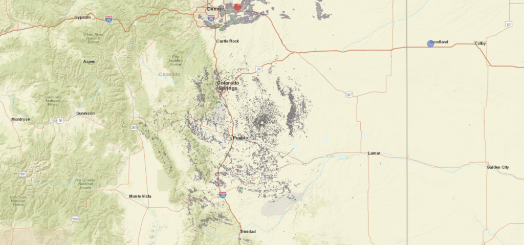
The Palmer Divide separates Denver from Colorado Springs, and though the topographies of the individual cities may appear similar, they often have very different weather fortunes. Let’s see what happens in Colorado Springs to round out the week.
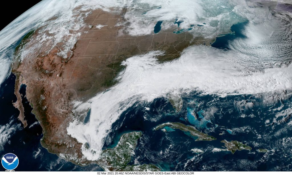
At 854AM, MT, Colorado Springs was reporting a temperature of 45 degrees with a brisk west wind, gusting to 35mph with scattered clouds. An area of low pressure over the central Plains was leading to a wet day across the Northern Plains, with some light snow wrapping in from the north for Denver. South of the Palmer Divide, things were looking significantly drier, and the winds across the region were leading to red flag warnings for the Colorado High Plains. Jet flow should remain fairly consistent across the region for the remainder of the week, southwest to northeast, though flow through the jet will continue to strengthen. A trough will begin to propagate along the jet stream in the western United States overnight Thursday to Friday, which will invigorate a warm front in the Plains, and will eventually lead to cyclogenesis in the southern High Plains. Skies will be fairly cloudy throughout the period, thanks to the flow aloft, but they will darken further late Friday, with a chance for a stray drizzle or flurry before midnight and a stormy weekend. Tomorrow – Mostly cloudy, High 45, Low 23 Friday – Increasing clouds, wintry mix late, High 40, Low 25
TWC: Tomorrow – Partly cloudy. High 45, Low 26 Friday – Partly cloudy skies during the morning hours will give way to cloudy skies with light rain and snow developing in the afternoon High 40, Low 26
AW: Tomorrow – A bit of morning snow with little or no accumulation followed by a little rain in the afternoon High 47, Low 24 Friday – Cloudy with a little snow with little or no accumulation, mixing with, then changing to rain High 44, Low 28
NWS: Tomorrow – Mostly sunny (Late snow) High 47, Low 24 Friday – A chance of snow before 3pm, then rain likely, possibly mixed with snow. Mostly cloudy, High 41, Low 26
WB: Tomorrow – Mostly cloudy in the morning then becoming mostly sunny, High 46, Low 28 Friday – Mostly cloudy. Slight chance of snow in the morning then chance of snow possibly mixed with rain in the afternoon, High 40, Low 29
WN: Tomorrow – Partly cloudy, High 47, Low 24 Friday – Motly cloudy with light wintry mix likely, High 42, Low 26
FIO: Tomorrow – Partly cloudy throughout the day. High 50, Low 28 Friday – Foggy overnight and in the evening. High 47, Low 30
Guidance is pretty reluctant to put much precipitation in Colorado Springs Friday night, but many outlets are going hard for a miserable end to the work week. Look at the radar below, with snow, deceptively heavy, up in Denver and nothing in Colorado Springs. That Palmer Divide sure lives up to it’s billing!
Victoria Weather finally got our forecasting groove back, giving you more regular weather updates, and we sure picked the right month to do that. Victoria-Weather cruised to victory, and have a stranglehold on the overall lead for the year. Thanks, February! (Note, Forecast wins posted now only reflect the total wins for the year)
I wrote recently about the flooding in eastern Kentucky and across West Virginia. Western Maryland, and specifically the city of Cumberland, for which we had a forecast last week, didn’t avoid the persistent soaking rains either. On the last day of February, Cumberland endured daylong rain that accumulated to over an inch. Fortunately, reports of flooding in Maryland weren’t as prolific, but this was enough rain to cause concern. Weatherbug was the top forecast for the end of the month. Actuals: Saturday – .03 inches of rain, High 47, Low 25 Sunday – 1.21 inches of rain, High 47, Low 40
They are only two states away, but at opposite ends of those big Prairie states. What I am trying to say, is that the distance between Rapid City and Topeka is a little bit longer than I expected. Most of it is on an interstate, so the 686 miles will pass at a pace of 67.3mph. I will spare you the math, that’s a 10 hour drive.
Rapid City, South Dakota
I don’t want to sound too overdramatic, but this drive will be a race against time. An area of low pressure moving out of the southern Rockies is headed right toward Topeka. Our route will go north of the northern most fringe of the rain and then east of the easternmost fringe of rain on Thursday. The rain will finally reach Topeka after midnight on Thursday, which means our drive will be dry, but our day in Topeka will not be.
I really enjoy forecasting in Kansas. It’s right there, smack dab in the middle of the country, and it gets a little bit of influence from the Rockies, a little from the Gulf. It’s a lot of fun, I think.
At 253, PM, CT, Topeka was reporting a temperature of 62 degrees with clear skies and a brisk southwest wind. High pressure was dominating the picture in the middle of the country, leaving the entirety of Kansas in a pleasant warm air regime. Some brisk southerly winds were being drawn towards low pressure in the Canadian Prairies, but a feature along the Gulf Coast was intercepting moisture across the country, leading to the warm, dry situation in the Plains. The clear skies and increasing warm weather will continue unabated through the middle of the week, however a fast moving wave presently over the Pacific, off the California coast will move swiftly on a line for Kansas. Rain should wait until after midnight, coming on Friday morning, but some warm south winds will take hold on Thursday afternoon. Tomorrow – Sunny, High 69, Low 37 Thursday – Increasing clouds late, High 70, Low 34
TWC: Tomorrow – Sunny, High 71, Low 34 Thursday – Generally sunny despite a few afternoon clouds. High 70, Low 34
AW: Tomorrow – Mild with plenty of sun High 67, Low 35 Thursday – Mild with plenty of sun High 69, Low 34
NWS: Tomorrow – Sunny, High 66, Low 34 Thursday – Sunny, High 67, Low 34
WB: Tomorrow -Sunny, High 70, Low 35 Thursday – Sunny, High 69, Low 35
WN: Tomorrow – Sunny, High 66, Low 34 Thursday – Mostly sunny, High 67, Low 34
FIO: Tomorrow – Clear throughout the day. High 69 Low 35 Thursday – Clear throughout the day. High 69, Low 36
The series of systems moving through the Tennessee Valley, towards the Mid-Atlantic, have generally been rainy, but not particularly threatening. Not individually, at least.
The problem is that the stream of moisture took a path through the hills of eastern Kentucky and West Virginia. While steady rain anywhere will end up being problematic, it’s a much shorter trip to disaster in the terrain of the central Appalachians. Take a look at the video from WTHR showing the fast water flowing through the streets of Hurricane, West Virginia, west of Charleston
The end of February saw another, somewhat repetitive pattern, with perturbations emerging from the southern Plains and heading for the eastern Great Lakes. It happened more than once, including early last week when we were forecasting in Ocean City, New Jersey. It was about to rain on Sunday night when we looked at the forecast, and to the surprise of a few, that rain mixed with snow on Monday morning. It was more rain than snow, however, and nothing accumulated as the day wore on. Ultimately, it was a tied forecast win for Forecast.io and Victoria-Weather. I had a typo in my forecast, so I am ok letting FIO have the plaudits on this go-around. Actuals: Monday – .46″ of rain, High 45, Low 31 Tuesday – High 51, Low 35