My parents live part of the year in south Florida, due east of Fort Myers Beach, which was among the hardest hit areas by Hurricane Ian this September, along with Sanibel Island. Inland, in places like Estero, Bonita Springs and the south side of Fort Myers, the lack of coastline prevented the storm surge and flooding that proved so catastrophic to Fort Myers Beach, wiping the beloved Time Square shopping area off the map.
Southwest Florida had a very good run, avoiding hurricanes for a very long time. That was true until 2017, actually, when, after battering the Caribbean and the Florida Keys, Hurricane Irma made landfall at Marco Island, and moved through the Peninsula from south to north. Ian made landfall further to the north, and was more specifically aimed at the Fort Myers area.
There was a grove of palm trees that I particularly admired the first time I was down there, about 10 years ago. 3 royal palms stood near the pin of one of the short holes of the course, and were a photogenic and stately landmark at the facility. I took a picture and had it as my phone background for a while.
Trust me, they were stately. This is a screen shot of a years old picture, and don’t do them justice. 5 years after this picture was taken, Irma came to pass. Irma decimated the foliage of Estero. The tree cover was significantly less around the facility, and what trees weren’t taken down were defoliated. Cypresses were laid bare, and stood out the most. The palms that weren’t felled stood proud. Of that trio, that was the case.
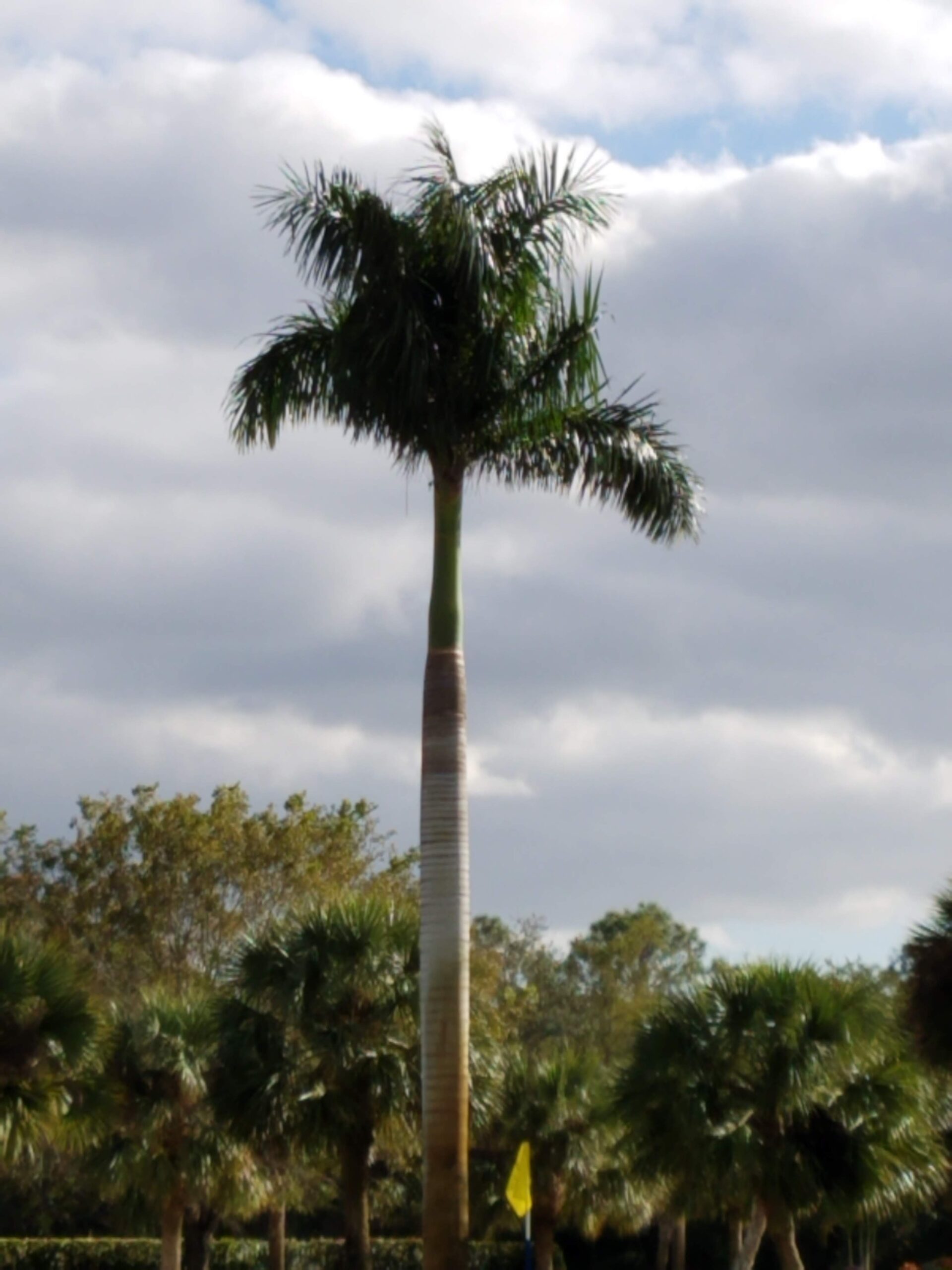
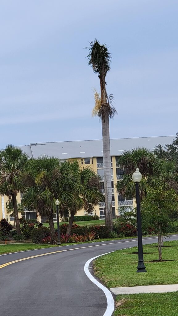
Only one of the palms survived Irma, and the tall palm in the trees behind the stand, for example, was also lost. But this pine stood as a stately welcome and a great object to aim at from the tee box.
Ian was a different beast. The damage with Ian produced more structural damage. My parents’ building was ok, though the carport was destroyed. Throughout the town, there are still tarps on roofs. Even buildings adjacent to their facility had unrepaired roof damage. The most noticeable damage to a visitor was in the signs for various venues. There was a Waffle Us and a Chi i around town, with letters gone and yet unrepaired. Still more signs were completely decimated, living only a ring where a corporate brand had once been.
That remaining palm though, stood tall. He definitely looks worse for wear, and is a stoic reminder of what Irma and Ian have wrought on the region.