
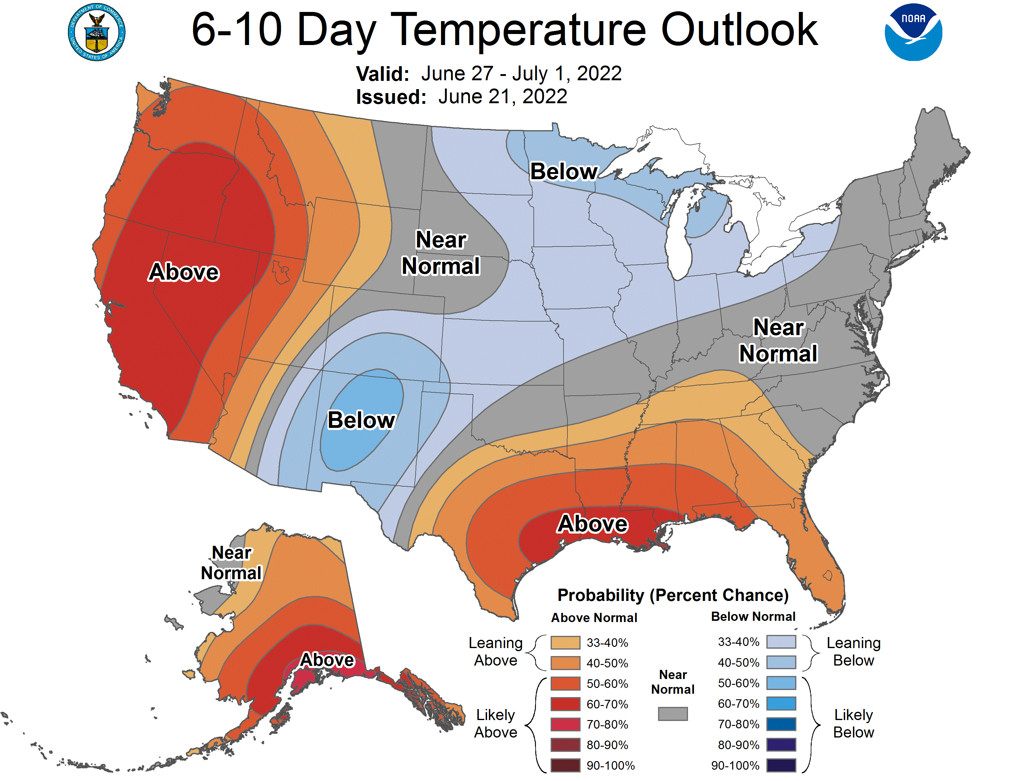
Everything being relative, of course, there was a rare sight on the CPC page. The Desert Southwest, particularly Arizona and fire ravaged New Mexico are expected to see below normal temperatures and above normal precipitation next week. This qualifies as good news, if it dents the drought and doesn’t fully inundate the region.
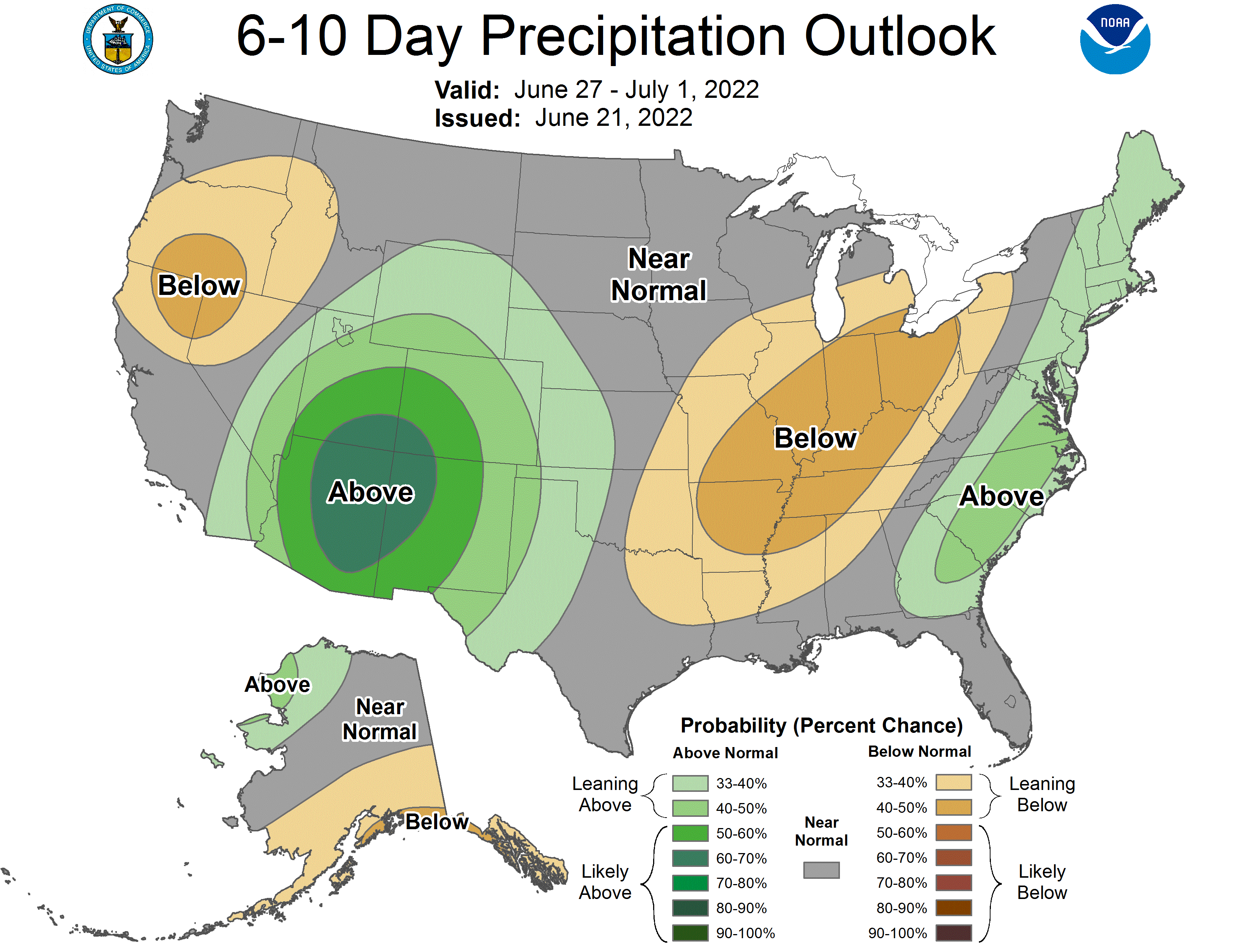
A combination of factors will lead to this tandem of potential results. First, the monsoon is expected to get a bit more active this week, producing thunderstorms across the southern Rockies between Arizona and New Mexico. Tropical Storm Celia is spinning off the coast of Mexico. It poses no threat to land, but will generate mid level moisture accessible by the air mass over the Land of Enchantment.
Second, an area of low pressure moving through the Northern US is going to leave a stationary front across the Plains, which is going to connect with the dry line and monsoonal flow in New Mexico and Arizona. Robust shower and thunderstorm activity is anticipated throughout much of the week.
Lightning is a threat to fire prone parts of the landscape, and dust will be a concern. Any heavy rain, especially in the undulating terrain could lead to flash floods. Despite these individual perils, it seems like the rain and the cooler temperatures are good things.