
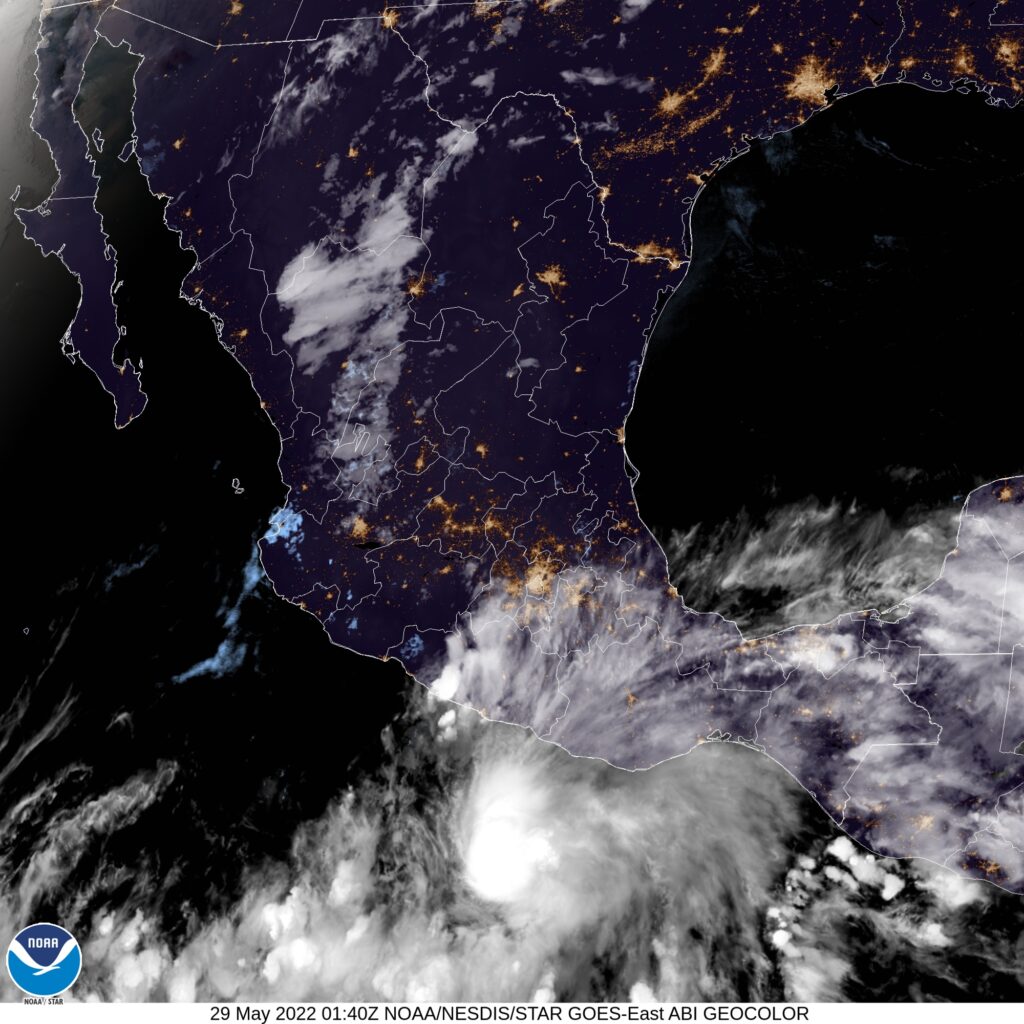
The Pacific hurricane season gets an earlier start than the Atlantic, historically, thanks to abeing a vast body of water that doesn’t see the same changes in temperatures the Atlantic can undergo. It’s not terribly surprising to see Tropical Storm Agatha lurking off the coast of Mexico, but what is surprising is that this feature is expected to back up into the Mexican coast.
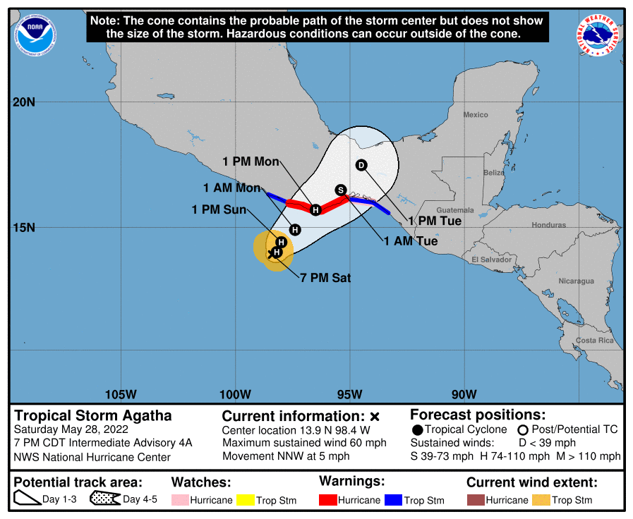
Pacific storms tend to start in this area, but the tropical wave they gear up from tend to maintain some momentum, allowing them to shift off to sea. Agatha is nearly stationary, and looks as though she will begin to move poleward earlier than is typical in the Pacific, and back up into Oaxaca.
If there is any good news, it is that Agatha isn’t a large storm. She is expected to become a hurricane before making land fall, which means the wind will be stronger along the beaches of southern Mexico, but the breadth of territory affected by the associated heavy rain should be mitigated. Additionally, that Agatha has backed up and moved northeast fairly recently suggests that storm surge will not be a primary concern either.
Even so, it looks like the storm won’t landfall until Monday, and changes are always possible. Notably, a storm over warm waters always possess the ability to get stronger, though of course, we hope that doesn’t happen.