
Everyone loves to talk about the weather, as I’m sure you do (you’re here at this site, after all) but depending on where you are this April, you might have a decidedly different conversation. If you are in the southern US, you are probably talking about how stormy this year has been. In the north, you probably can’t get over how chilly things have remained all spring.
For an explanation, we need to look even bigger than we usually do, beyond the confines of the Contiguous US. The answer lies in the jet structure across the United States. As you may already be aware, bigger features are more challenging to move in the atmosphere, and there is an enormous trough that keeps recycling and sustaining itself, and the base of that trough has run across the northern United States.
Take a look at the big picture, the jet forecast for this afternoon.
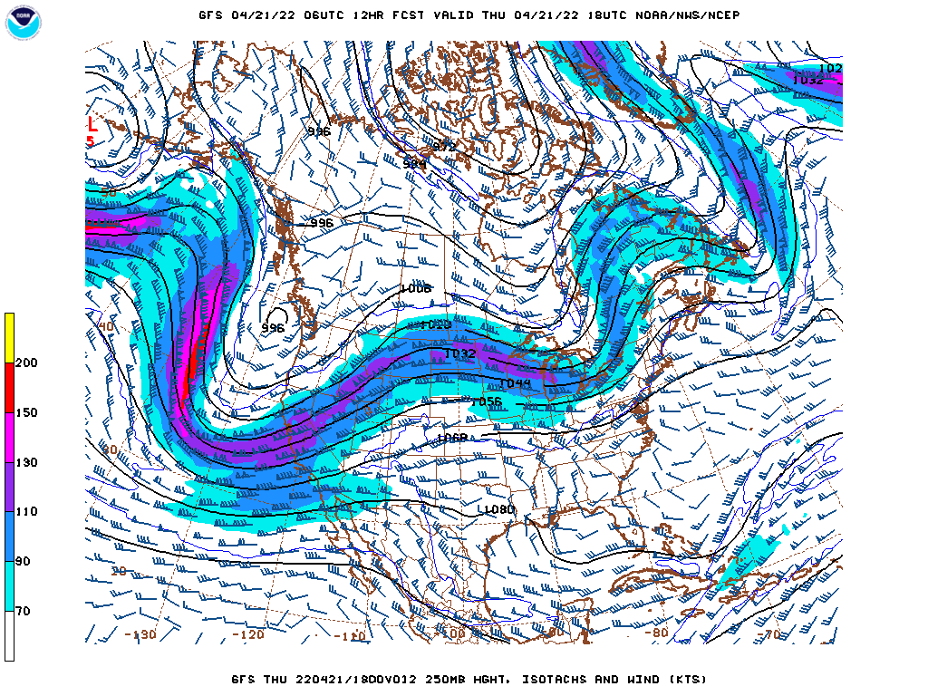
Typically, if I am looking at the US forecast, I would note the deep trough coming to the west coast was, or even noting the ripple in the northern Great Lakes, but when taking into account the spring writ large thus far, and unfortunately for the coming weeks, the immediate notice is that the larger waves are the ridges bracketing the United States.
There are semi-permanent features in the ocean, certainly, including the Bermuda High, and the existence of the ridges are not unusual. Some things that are factoring into making this spring unusual is the amplitude of the trough over North America. It should be starting to retreat into Canada, bringing some calm to the south, and allowing warmth to filter back north, but the mean trough is instead littered with localized troughs like the one set to upset this weekend.
Another peculiarity is how weak the trough in the Gulf of Alaska is. The Aleutian Low is as permanent s the Bermuda High, but right now, and for a while, this feature has been replaced by transient features moving into the Pacific Northwest. This gives this larger continental wave more breadth, and makes it more difficult to move.
With the mean trough over the US running through the northern tier of states, it is penning cold air that same swath of the country. On the same note, the sun is getting stronger, so warmth is building south of the jet. This clash of air masses at the surface, when coupled with the relatively shorter waves moving across the nation, is making for an active storm season, and a chilly spring, depending on what side of the divide you are on. Eventually, the pattern will break, but there isn’t an immediate sign of that happening quite yet.