San Antonio, Texas

Let’s take a look at the southern part of Texas, where it’s going to be extra hot and extra sticky.

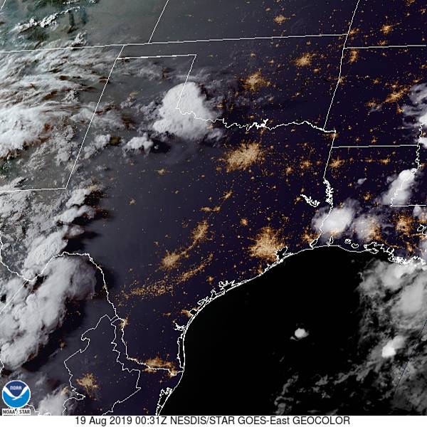
At 751PM, San Antonio was reporting a temperature of 94 with a dew point of 70. Clear skies covered eastern and downstate Texas, though the dry line was active on satellite in the western part of the state. Excessive heat advisories continue through the southern Plains, as high pressure has settled into the area.
The anticyclonic flow is going to dissipate over the next 48 hours, with a return flow setting up along the Sabine River but not any further to the west. San Antonio looks to remain dry if uncomfortably warm to begin the workweek.
Tomorrow – Mostly sunny, High 99, Low 78
Tuesday – Still hot, High 99, Low 79

TWC: Tomorrow – Partly cloudy skies High 99, Low 78
Tuesday – A few clouds from time to time. Continued very hot. High 99, Low 78

AW: Tomorrow – Mostly sunny; very warm High 100, Low 79
Tuesday – Mostly sunny; very warm High 101, Low 78

NWS: Tomorrow – Mostly sunny and hot, High 100, Low 79
Tuesday – Mostly sunny and hot, High 100, Low 78

WB: Tomorrow – Mostly cloudy in the morning, then clearing. High 98, Low 79
Tuesday – Partly cloudy. High 97, Low 78

WN: Tomorrow – Partly cloudy, High 100, Low 79
Tuesday – Partly cloudy, High 100, Low 78

FIO: Tomorrow – Humid and partly cloudy throughout the day. High 98, Low 79
Tuesday – Humid and partly cloudy throughout the day. High 99, Low 78

Here is the satellite, with some puffs developing in west Texas.

Birmingham, Alabama

As we look forward to the weekend, let’s head to the Deep South and see how the historic city of Birmingham will fare!

At 953pm CDT, the temperature at Birmingham, AL was 80 degrees under fair skies. It’s been nothing short of ridiculously hot over the Southeast this past week as I mentioned a few days ago, and it doesn’t look like it’s gonna go anywhere soon. A strong ridge of high pressure is continuing to sit over the Deep South and will park itself there for another couple of days yet. It will break down a bit on Sunday and a chance of thunderstorms will re-enter the forecast. But until then, it’ll be dry but scorching hot!

Friday: Sunny and hot. High 95, Low 71.
Saturday: Sunny and even hotter. High 96, Low 69.

TWC: Friday: Sunny. High 96, Low 70.
Saturday: Sunny. High 98, Low 70.

AW: Friday: Mostly sunny. High 96, Low 70.
Saturday: Mostly sunny; hot. High 98, Low 68.

NWS: Friday: Sunny. High 98, Low 70.
Saturday: Hot. High 100, Low 71.

WB: Friday: Sunny. High 95, Low 71.
Saturday: Sunny. High 97, Low 70.

WN: Friday: Sunny. High 98, Low 70.
Saturday: Mostly sunny. High 100, Low 71.

FIO: Friday: Clear throughout the day. High 95, Low 70.
Saturday: Clear throughout the day. High 97, Low 69.

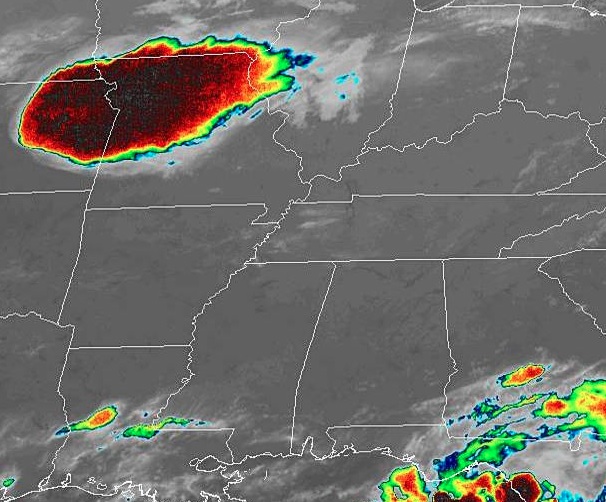
The Deep South is extremely quiet tonight, and looks to remain that way as we head into the weekend. Just don’t look at that cluster of severe thunderstorms in MO/NE. Nothing to see here folks!

Morgantown, West Virginia

As we head into the latter part of the workweek, lets head off to Appalachia and see what Morgantown is up to the next couple of days!

At 1153pm EDT, the temperature at Morgantown, WV was 70 degrees under fair skies. A weak area of low pressure is traversing the OH Valley region and looks to be the instigator of some afternoon thunderstorm activity. Nothing particularly severe is anticipated, just some good ol’ fashioned summertime thunderstorms. Activity should dwindle down late evening as the system pushes off to the east. Friday looks to be on the dry side with perhaps some isolated shower activity staying up in the mountains to the east.

Thursday: Increasing clouds in afternoon, scattered thunderstorms possible. High 84, Low 64.
Friday: Decreasing clouds in afternoon. High 84, Low 66.

TWC: Thursday: Afternoon thunderstorms. High 85, Low 64.
Friday: Partly cloudy. High 84, Low 64.

AW: Thursday: A strong afternoon thunderstorm. High 85, Low 66.
Friday: Periods of sun. High 86, Low 67.

NWS: Thursday: Scattered afternoon showers and thunderstorms. High 86, Low 65.
Friday: Isolated early morning shower, otherwise mostly sunny. High 87, Low 65.

WB: Thursday: Chance of thunderstorms. High 83, Low 64.
Friday: Partly cloudy. High 84, Low 65.

WN: Thursday: Partly cloudy with scattered showers. High 86, Low 65.
Friday: Partly cloudy. High 87, Low 65.

FIO: Thursday: Partly cloudy, few showers. High 86, Low 62.
Friday: Partly cloudy throughout the day. High 87, Low 66.

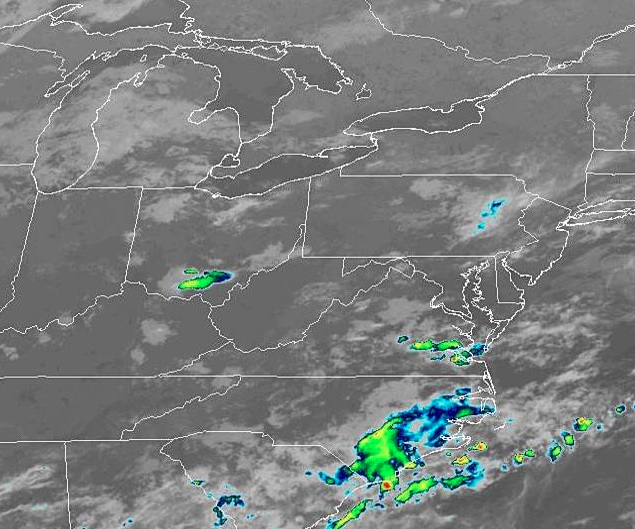
Quiet conditions are found around Morgantown this evening, with some shower activity found over southern OH. We can expected some more activity tomorrow but then taper down for the weekend.

Sweltering in the South

We’re deep into the dog days of Summer now, as families are enjoying the last couple of weeks of Summer Vacation before they have to worry about kids going back to school. As expected, conditions are hot and humid across the South, but lately it’s been kicked up a notch above even where locals are accustomed too.

Houston has hit 101 degrees for a third day in a row now, the first time they’ve done that since 2015 when they went 102 102 106 (yikes!). Combined with that has been dew points approaching 80, cranking up the heat index around the metro to 115-120 degrees. Doesn’t look like much relief is on the way either in the coming days.

Pensacola hit 97 yesterday, breaking a high temperature record for the 2nd day in a row. On top of that, potent afternoon thunderstorms then parked overhead dumping over 3.5 inches of rain on the city, also a record for the day. Like Houston, these sweltering conditions are expected to persist for the next couple of days with heat index readings around 110.

Luckily, the residents along the Gulf Coast don’t have to worry about any tropical systems developing over the next several days as the Atlantic Basin is in a pretty quiet pattern right now. However, the intense heat and almost unbearable humidity doesn’t look to relent anytime soon. Stay indoors and cool if you can!

Rochester, Minnesota

We are going to sneak close to home tonight, going down to Rochester, the home of the Mayo Clinic.

At 1254AM, CT, Rochester was reporting a temperature of 67 degrees with fair skies. Low pressure moving through northern Manitoba is inducing a lot of low level moisture northward, and dewpoints across the region were high. Fog is likely to settle in in low lying areas overnight, particularly given the clear skies.
Between the low in Manitoba and the remnants of a system in northern Quebec, there has been a rise in instability in the Upper Midwest, with scattered showers through Wisconsin on Saturday. The Manitoban low will bring some drier air into northern Minnesota on Sunday, and continue through the southern part of the state on Monday. As a result, shower and storm activity will become more voluminous, and depending on the available energy, there is a chance for some severe weather in the Rochester area on Monday.
Tomorrow – Isolated showers and thunderstorms, High 85, Low 64
Monday – Scattered showers and thunderstorms, High 82, Low 66

TWC: Tomorrow – Sunny, along with a few afternoon clouds. High 85, Low 65
Monday – Mixed clouds and sun with scattered thunderstorms. Storms may contain strong gusty winds. High 81, Low 68

AW: Tomorrow – Partial sunshine; humid High 84, Low 65
Monday – A strong afternoon thunderstorm; storms can bring flooding downpours, large hail and damaging winds High 82, Low 67

NWS: Tomorrow – Patchy fog before 8am. Otherwise, mostly sunny High 85, Low 63
Monday – Showers and thunderstorms likely, mainly before 1pm. Partly sunny, High 85, Low 66

WB: Tomorrow – Mostly sunny, patchy fog in the morning, High 84, Low 65
Monday – Numerous showers and thunderstorms, high 82, Low 68

WN: Tomorrow – Partly cloudy High 85, Low 63
Monday – Partly cloudy with numerous thunderstorms, High 85, Low 66

FIO: Tomorrow – Partly cloudy throughout the day. High 85, Low 65
Monday -Rain in the afternoon and evening. High 83, Low 69

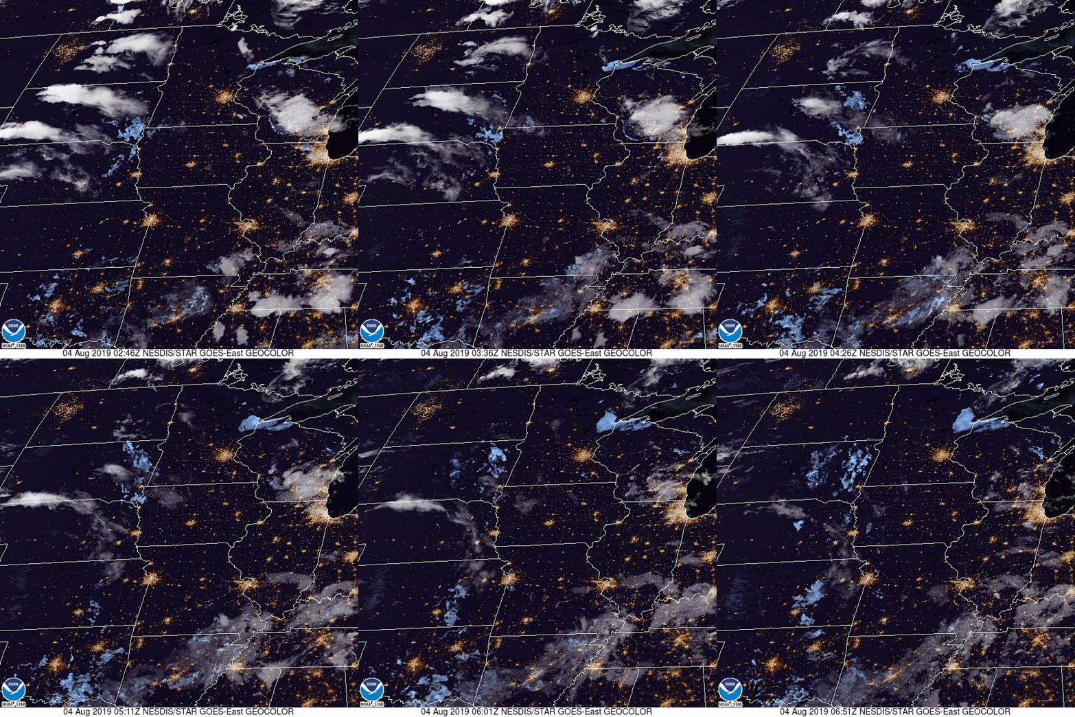
The timing everyone has for precipitation is all different. Several outlets have rain starting shortly after midnight on Monday, while others don’t have it until the evening. Meanwhile, we have a chance on Sunday. Here is a loop of the day’s satellite imagery, showing the thunderstorms moving through Wisconsin, and fog developing up by Duluth.

Pocatello, Idaho

Something about Pocatello always seemed interesting to me. If I’m being honest, I think I just like the way the name sounds.

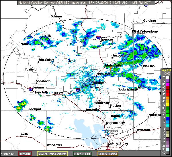
At 127PM, MT, Pocatello was reporting a temperature of 83 degrees with a brisk wind from the northeast, right down the Snake River Valley. There is a general area of showers in the higher terrain east of Idaho Falls contributing to the brisk winds, and any lightning that results from these showers will be particularly dangerous, as the region is tinder dry.
A weak ridge over the Rockies is no match for the monsoon, which will continue to bring showers and storms to the Tetons, particularly in the afternoon for the next two days. Showers and storms aren’t likely to settle down into Pocatello, but similar to today, wind is likely to rush in and the fire threat probably won’t abate.
Tomorrow – Partly cloudy and hot, High 95, Low 53
Wednesday – Mostly cloudy, High 96, Low 57

TWC: Tomorrow – Sunshine along with some cloudy intervals. High 94, low 57
Wednesday – A mix of clouds and sun early, then becoming cloudy later in the day. High 91, Low 61

AW: Tomorrow – Partly sunny; hot High 95, Low 58
Wednesday – Rather cloudy High 92, Low 59

NWS: Tomorrow – Sunny, High 93, low 61
Wednesday – Partly sunny, High 91, Low 61

WB: Tomorrow – Sunny, High 89, Low 57
Wednesday – Mostly sunny, High 88, Low 57

WN: Tomorrow – Mostly sunny, High 93, Low 60
Wednesday – Partly cloudy, High 91, Low 63

FIO: Tomorrow – Partly cloudy throughout the day. High 94, low 59
Wednesday – Mostly cloudy throughout the day. High 93, Low 62

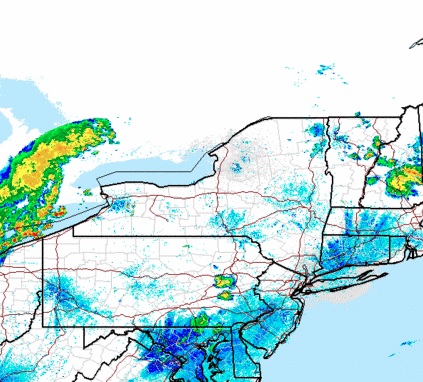
Look at that range in high temperature forecasts! For a forecast with no rain involved, we can brand this as E for exciting. Here is a look at the radar, with those storms over the Tetons.


Sumter, South Carolina

Sumter is sort of an in between town. It’s not a coastal town, but it’s not very far inland either. What is the leading factor in the weather in Sumter? I reckon’ we’re about to find out.

At 1055AM, ET, Sumter was reporting a temperature of 81 degrees with sunny skies. After a muggy weekend, an unseasonably strong cold front has swept unpleasantness off the coast, and high pressure has built into the Carolinas.
The remnant boundary will lay astride of the coast, and within the convective remainder, a tropical wave will become involved and briefly intensify before pulling the dry continental air further into South Carolina, and the showers and storms at sea further into the Sargasso. All the while, Sumter looks to enjoy a whole lot of sunshine.
Tomorrow – Mostly sunny, High 89, Low 65
Saturday – Hot but clear, High 90, low 64

TWC: Tomorrow – Sunshine and clouds mixed. High 88, low 66
Saturday – Plentiful sunshine High 89, Low 65

AW: Tomorrow – Intervals of clouds and sunshine High 87, Low 66
Saturday – Mostly sunny High 89, Low 65

NWS: Tomorrow – Partly sunny High 88, Low 67
Saturday – Mostly sunny, High 89, low 65

WB: Tomorrow – Partly sunny High 87, Low 68
Saturday – Mostly sunny, High 87, low 67

WN: Tomorrow – Partly cloudy High 88, Low 67
Saturday – Mostly sunny, High 89, low 65

FIO: Tomorrow – Mostly cloudy throughout the day. High 88, Low 69
Saturday – Partly cloudy throughout the day. High 89, Low 67

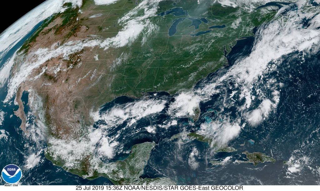
All told, especially after this past week, that’s not really a bad outlook for South Carolina. Here is a look at the western Atlantic satellite, showing the instability off shore.

Muskegon, Michigan

Today seems to be an interesting day in the weather department, particularly in western Michigan. How interesting? Why don’t we find out?

At 1155AM, ET, despite a stiff breeze off of Lake Michigan, Muskegon was reporting 87 degrees, clear skies and a dew point of 70. While the heat was oppressive nearly everywhere, the instability was mounting. A area of low pressure in the lee of the Rockies extended a weak stationary boundary towards Hudson Bay, and it appears that this is the perfect vehicle for a severe outbreak tonight.
Tomorrow, the stationary front will begin to sink southward as a slow moving cold front, which will bring in more comfortable and more stable air, but before that on Saturday, another similar looking squall line will role through Michigan with a little more intensity than the one that will arrive late tonight. Heavy rain and thunderstorms will be possible, particularly tomorrow afternoon, with lighter rain in the evening. Clouds will linger through the morning on Sunday, however they will clear to the south, and much more moderate air will take over western Michigan to conclude the weekend.
Tomorrow – Clouds, with rain and thunderstorms especially in the afternoon and evening, High 86, Low 72
Sunday – Early clouds then clearing and pleasant, High 80, low 65

TWC: Tomorrow – Partly cloudy in the morning followed by scattered thunderstorms in the afternoon. Storms may contain strong gusty winds. High 86, Low 73
Sunday – Overcast with rain showers at times. High 82, Low 68

AW: Tomorrow – Variable cloudiness, warm, very humid; an afternoon shower or thunderstorm around High 86, Low 75
Sunday – A passing morning shower; otherwise, mostly cloudy High 82, Low 70

NWS: Tomorrow – A slight chance of showers and thunderstorms before 8am, then a chance of showers and thunderstorms after 2pm. Partly sunny, High 87, Low 76
Sunday – Showers and thunderstorms likely, mainly before 8am. Partly sunny, High 82, Low 69

WB: Tomorrow – Partly sunny with a 40% chance of showers and thunderstorms. High 84, low 73
Sunday – Partly sunny until midday, then becoming mostly sunny. A 40 percent chance on showers and thunderstorms, High 82, Low 69

WN: Tomorrow – Partly cloudy with scattered storms, High 87, Low 77
Sunday – Partly cloudy with thunderstorms likely, High 82, Low 69

FIO: Tomorrow – Possible light rain tomorrow evening. High 88, Low 73
Sunday – Mostly cloudy throughout the day. High 84, Low 69

This is the rare non-standard day in the heat of summer. Tonight, the temperature will only get down to about 80 degrees, which is uncomfortable.

Deltona, Florida

With all the focus on the 50th anniversary of the Moon Landing, I think that a trip to the Space Coast and a rapidly developing town near Cape Canaveral is very appropriate.

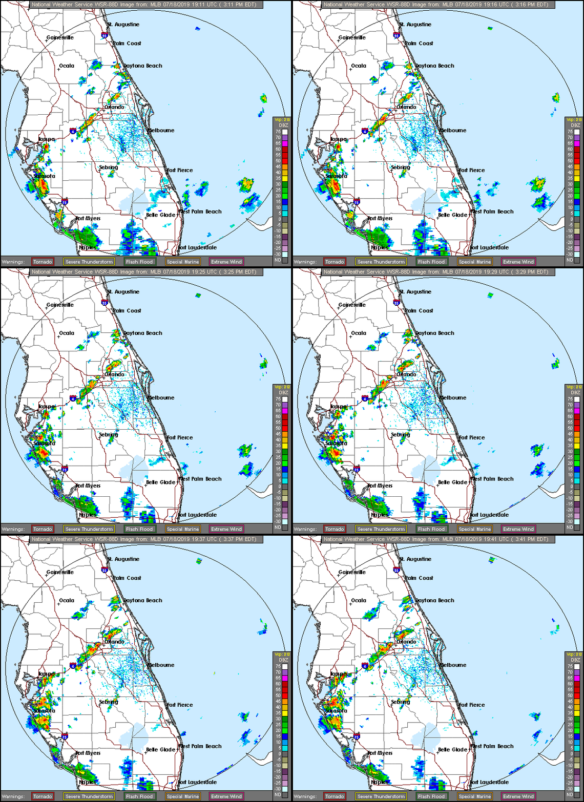
At 336PM, ET, Deltona was reporting a temperature of 88 degrees, and thunderstorms in the vicinity. In fact, they were reporting lightning from all quadrants. It paints a more aggressive picture than what radar indicates. but there is a band of storms south and east of town that is the most robust.
It’s that time of year for Florida, in which the dynamics are very small scale, reliant on the temperature profiles of see and land as opposed to any broad scale waves. Indeed, Deltona is going to be answerable only to the day time seabreezes as opposed to any broad scale flow pattern. Expect carbon copies of the next two days, with thunderstorms fairly likely, thanks to Deltona’s position set inland.
Tomorrow – Scattered PM thunderstorms, High 95, low 77
Saturday – Scattered PM Thunderstorms, High 95, Low 77

TWC: Tomorrow – Partly cloudy in the morning followed by scattered thunderstorms in the afternoon high 92, Low 75
Saturday – Partly cloudy with afternoon showers or thunderstorms. High 93, Low 75

AW: Tomorrow – Sunshine and some clouds High 92, Low 75
Saturday – Partly sunny, a shower or thunderstorm around in the afternoon High 93, Low 75

NWS: Tomorrow – Mostly sunny and hot, High 95, Low 77
Saturday – A 30 percent chance of showers and thunderstorms after 2pm. Sunny and hot, High 96, Low 77

WB: Tomorrow – Partly cloudy. A chance of showers and thunderstorms in the late morning and afternoon, High 91, Low 78
Saturday – Partly cloudy. A chance of showers and thunderstorms in the late morning and afternoon, High 90, low 78

WN: Tomorrow – Partly cloudy with scattered storms, High 93, Low 76
Saturday – Partly cloudy with scattered storms, High 95, Low 75

FIO: Tomorrow – Humid and partly cloudy throughout the day. High 93, Low 76
Saturday – Humid and partly cloudy throughout the day. High 94, Low 75

Hot and humid. Exactly what we want from Florida in July. Here is a look at the radar in central Florida.

Huntsville, Alabama

My favorite weather related fun fact about Huntsville is that it is the Weather Service office with the smallest geographic footprint. This is because of the preponderance of severe weather, but also because of the historic technical aptitude and home of the space program.

At 853AM, CT, Huntsville was reporting cloudy skies and a temperature of 75 degrees. More importantly, they were also reporting a dew point of 72, ensuring that the morning would have a fairly damp feel, thanks to lingering fog and morning dew and condensation. There was a weak pressure trough in central Tennessee that was kicking up clouds across the region, but they are expected to shift swiftly out of the area, rendering the Huntsville area, along with most of the southeast, extremely warm for the rest of the day.
Low pressure is camped out in eastern Canada and the north Atlantic, without any real plans to leave. This will force a steady southwesterly flow, drawing Gulf moisture through the already sultry air, leaving a persistent threat of afternoon showers and thunderstorms in the region. These are likely to be a blessing, as they should relive some of the heat.
Tomorrow – Scattered thunderstorms, High 91, Low 72
Saturday – Scattered thunderstorms, High 89, Low 72

TWC: Tomorrow – Partly cloudy early. Scattered thunderstorms developing in the afternoon.High 91, Low 73
Saturday – Scattered thunderstorms High 87, Low 73

AW: Tomorrow – Partly sunny (PM storms) High 91, low 73
Saturday – Intervals of clouds and sun, a couple of thunderstorms around High 87, low 73

NWS: Tomorrow – A 30 percent chance of showers and thunderstorms, mainly after 2pm. Partly sunny high 94, Low 74
Saturday – A 50 percent chance of showers and thunderstorms, mainly after 2pm. Partly sunny High 93, low 75

WB: Tomorrow – Partly cloudy, scattered showers and isolated thunderstorms in the afternoon High 90, Low 77
Saturday – Partly cloudy, scattered showers and thunderstorms in the morning and numerous showers and thunderstorms in the afternoon, high 88, low 77

WN: Tomorrow – Partly cloudy with isolated thunderstorms, high 94, low 74
Saturday – Partly cloudy with scattered thunderstorms, High 93, Low 74

FIO: Tomorrow – Possible light rain tomorrow evening.High 90, Low 74
Saturday – Possible light rain in the evening. High 87, Low 73

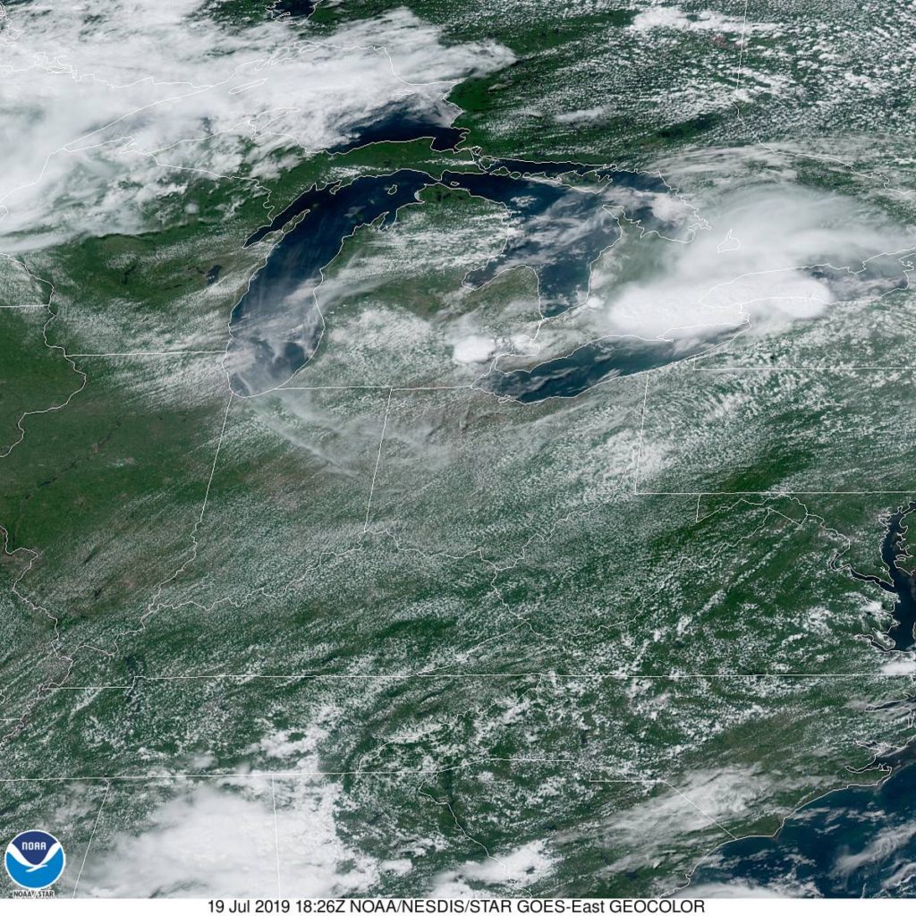
the GFS and NAM are fairly different in temperature forecasting, and there is a similar discrepancy in forecasts. The NAM is warmer, suggesting fewer storms, but the GFS anticipates more cloud cover. Which will play out? I split the difference, like a coward. Here is that satellite, showing the current clouds in Tennessee and north Alabama.