
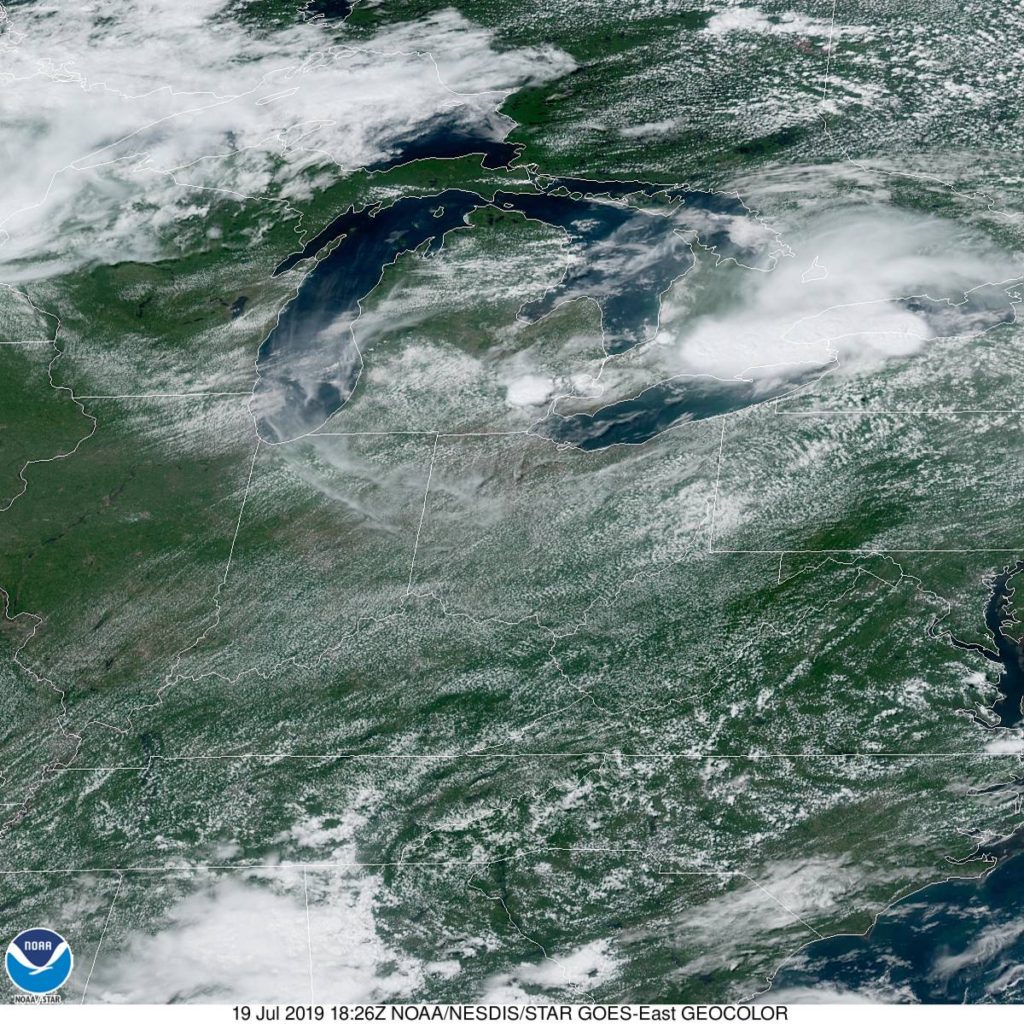
Today seems to be an interesting day in the weather department, particularly in western Michigan. How interesting? Why don’t we find out?
At 1155AM, ET, despite a stiff breeze off of Lake Michigan, Muskegon was reporting 87 degrees, clear skies and a dew point of 70. While the heat was oppressive nearly everywhere, the instability was mounting. A area of low pressure in the lee of the Rockies extended a weak stationary boundary towards Hudson Bay, and it appears that this is the perfect vehicle for a severe outbreak tonight.
Tomorrow, the stationary front will begin to sink southward as a slow moving cold front, which will bring in more comfortable and more stable air, but before that on Saturday, another similar looking squall line will role through Michigan with a little more intensity than the one that will arrive late tonight. Heavy rain and thunderstorms will be possible, particularly tomorrow afternoon, with lighter rain in the evening. Clouds will linger through the morning on Sunday, however they will clear to the south, and much more moderate air will take over western Michigan to conclude the weekend.
Tomorrow – Clouds, with rain and thunderstorms especially in the afternoon and evening, High 86, Low 72
Sunday – Early clouds then clearing and pleasant, High 80, low 65
TWC: Tomorrow – Partly cloudy in the morning followed by scattered thunderstorms in the afternoon. Storms may contain strong gusty winds. High 86, Low 73
Sunday – Overcast with rain showers at times. High 82, Low 68
AW: Tomorrow – Variable cloudiness, warm, very humid; an afternoon shower or thunderstorm around High 86, Low 75
Sunday – A passing morning shower; otherwise, mostly cloudy High 82, Low 70
NWS: Tomorrow – A slight chance of showers and thunderstorms before 8am, then a chance of showers and thunderstorms after 2pm. Partly sunny, High 87, Low 76
Sunday – Showers and thunderstorms likely, mainly before 8am. Partly sunny, High 82, Low 69
WB: Tomorrow – Partly sunny with a 40% chance of showers and thunderstorms. High 84, low 73
Sunday – Partly sunny until midday, then becoming mostly sunny. A 40 percent chance on showers and thunderstorms, High 82, Low 69
WN: Tomorrow – Partly cloudy with scattered storms, High 87, Low 77
Sunday – Partly cloudy with thunderstorms likely, High 82, Low 69
FIO: Tomorrow – Possible light rain tomorrow evening. High 88, Low 73
Sunday – Mostly cloudy throughout the day. High 84, Low 69
This is the rare non-standard day in the heat of summer. Tonight, the temperature will only get down to about 80 degrees, which is uncomfortable.
Comment (1)