We are going to sneak close to home tonight, going down to Rochester, the home of the Mayo Clinic.
At 1254AM, CT, Rochester was reporting a temperature of 67 degrees with fair skies. Low pressure moving through northern Manitoba is inducing a lot of low level moisture northward, and
Between the low in Manitoba and the remnants of a system in northern Quebec, there has been a rise in instability in the Upper Midwest, with scattered showers through Wisconsin on Saturday. The Manitoban low will bring some drier air into northern Minnesota on Sunday, and continue through the southern part of the state on Monday. As a result, shower and storm activity will become more voluminous, and depending on the available energy, there is a chance for some severe weather in the Rochester area on Monday.
Tomorrow – Isolated showers and thunderstorms, High 85, Low 64
Monday – Scattered showers and thunderstorms, High 82, Low 66
TWC: Tomorrow – Sunny, along with a few afternoon clouds. High 85,
Monday – Mixed clouds and sun with scattered thunderstorms. Storms may contain strong gusty winds. High 81, Low 68
AW: Tomorrow – Partial sunshine; humid High 84, Low 65
Monday – A strong afternoon thunderstorm; storms can bring flooding downpours, large hail and damaging winds High 82, Low 67
NWS: Tomorrow – Patchy fog before 8am. Otherwise, mostly sunny High 85, Low 63
Monday – Showers and thunderstorms likely, mainly before 1pm. Partly sunny, High 85, Low 66
WB: Tomorrow – Mostly sunny, patchy fog in the morning, High 84, Low 65
Monday – Numerous showers and thunderstorms, high 82, Low 68
WN: Tomorrow – Partly cloudy High 85, Low 63
Monday – Partly cloudy with numerous thunderstorms, High 85, Low 66
FIO: Tomorrow – Partly cloudy throughout the day. High 85,
Monday -Rain in the afternoon and evening. High 83,
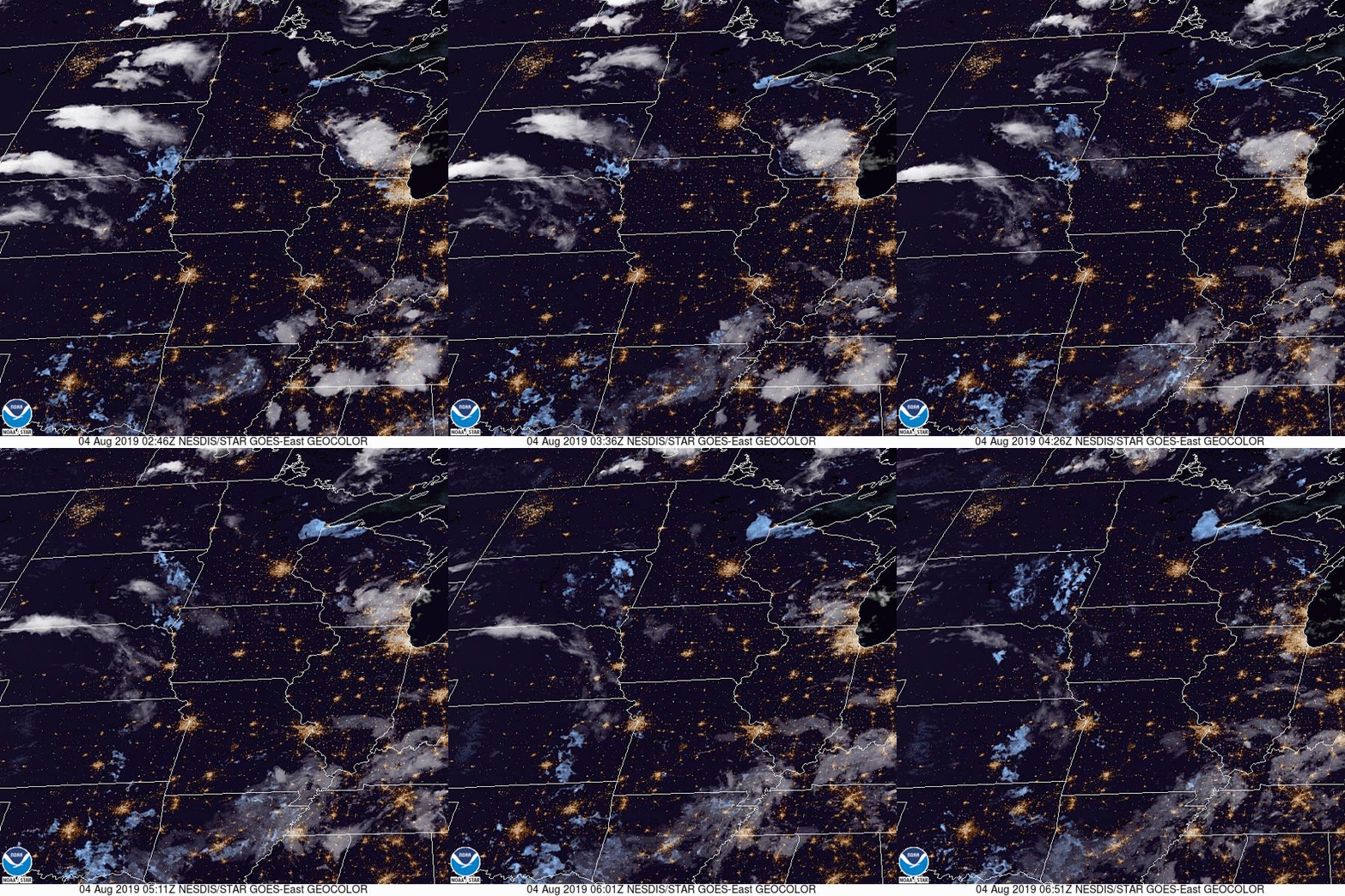
The timing everyone has for precipitation is all different. Several outlets have rain starting shortly after midnight on Monday, while others don’t have it until the evening. Meanwhile, we have a chance on Sunday. Here is a loop of the day’s satellite imagery, showing the thunderstorms moving through Wisconsin, and fog developing up by Duluth.


Comment (1)