Rochester, New York to Wichita Falls, Texas

We’re ready for another road trip, as it, I think, a lot of the world, of late. We’ll take a 2 1/2 day trip from western New York to west Texas, covering 1,448 miles. That means a pace of 67.2mph, which is laudable, and a daily goal of about 538 miles. Summer time is here, and it’s road trip season!

DAY ONE (Wednesday)

Rochester, New York

The nasty weather that has been afflicting the southern Rockies for the last couple of days is finally getting ready to climb to the north. It won’t do it with a lot of upper level support, or added precipitation, but it will still have plenty of resources to give us problems on Wednesday. Light rain will be a factor early in the day on Monday, and with heating of the day, the showers might get heavier and thunder could be possible. Don’t be surprised to hear some rumbles of thunder, particularly between Erie to Mansfield. After that, the light rain will return, but patchier, and with spots of sun. The clear skies will be likelier the further we head to the west, improving from Columbus to Knox, Indiana, which is east of Indianapolis, and will be our night one destination.

DAY TWO (Thursday)
Southwesterly flow off the Gulf will draw along the back end of the cold front on the Eastern Seaboard, leading to some clouds and isolated spots of wet weather. Not the clear, blue skies we would normally expect behind a front, but we’ve been groomed by winter. Instead, mostly cloudy skies will dominate the stretch between Indy and St. Louis. I would label it “partly to mostly cloudy” in Missouri, but not a lot better. Less breezy though, I suppose, for what it’s worth. The day will end in Sarcoxie, between Springfield and Joplin.

DAY THREE (Friday)
With low pressure shifting to the northeast, the Gulf will be reopened, and the south central US will get hotter and more humid. Air mass thunderstorms will be possible in the afternoon in eastern Oklahoma, but we should be through and on to Wichita Falls by the time any real thunderstorm activity fires up.
Wichita Falls, Texas

The snow hose (or whatever)

Over the weekend, there was a report from CBS that labeled lake effect snow as a “snow firehose” and claimed it was very rare. Anyone who lives east or south of the Great Lakes know that this is decidedly untrue. If it WAS true and it happened over the weekend then Rochester would have been in the “overspray” area, collecting only a trace on Friday and 1-2″ on Saturday. Now the wind, that was something, especially on Friday, where they got 30mph gusts. Maybe that was the firehose? Victoria-Weather and the Weather Service collected the top forecast.
Actuals: Friday – Trace of snow, High 26, low 22
Saturday – 1-2″ of snow, High 23, low 12

Grade: B-C

Rochester, New York

Things are pretty dicey in western New York. Yesterday’s Lake flooding alerts have turned to winter storm and blizzard warnings. My oh my, this should be an interesting forecast.

At 1007AM, ET, Rochester was reporting temperature of 25 degrees, but the thing everyone was surely noticing was the west wind at 33kt and light, wind driven snow. A strong area of low pressure lay over Ontario and Quebec, and on the south end of the system, the brisk west wind is leading to blizzard conditions east of Lakes Ontario and Erie, while Rochester, for the time being, is spared of the worst of this storm.
The upper level structure parenting this blizzard is asymmetrical, and that will be it’s undoing. With all the strength off shore, the central low pressure will weaken significantly and the brisk west winds and potential for snowfall will subside this afternoon and through tomorrow. The strong off shore jet will become associated with a laminar jet in the southern US, which will mean cold air will remain in western New York for the next few days. The orientation of the trough will subsequently foster northerly flow, which, while light, will create a fetch off of Lake Ontario that presents the possibility for Lake Effect accumulation in Rochester starting late Friday and lasting through Saturday.
Tomorrow – Mostly cloudy with snow returning in the evening, High 28, low 20
Saturday – Persistent, wet snow, High 23, low 15

TWC: Tomorrow – Windy with snow showers in the afternoon High 27, low 21
Saturday – Overcast. A few flurries or snow showers possible High 23, Low 18

AW: Tomorrow – Windy, cold with blowing snow; cloudy with snow at times, accumulating a coating to an inch High 28, low 21
Saturday – Low clouds and cold with a flurry or two High 25, Low 17

NWS: Tomorrow – Snow showers likely, mainly between noon and 5pm, then snow after 5pm. Areas of blowing snow. High 26, Low 20
Saturday – Snow. High 23, Low 17

WB: Tomorrow – Snow showers in the morning, then lake effect snow in the afternoon. Areas of blowing snow. Accumulations of 1-2″ in the most persistent snows. Very windy and cold. High 26, low 21
Saturday – Lake effect snow, High 22, Low 19

WN: tomorrow – Windy with snow showers likely, High 26, Low 21
Saturday – Cloudy with light snow, High 23, Low 21

FIO: Tomorrow – Windy tonight and tomorrow morning. High 27, Low 19
Saturday – Foggy tomorrow night and in the morning. High 25, Low 17

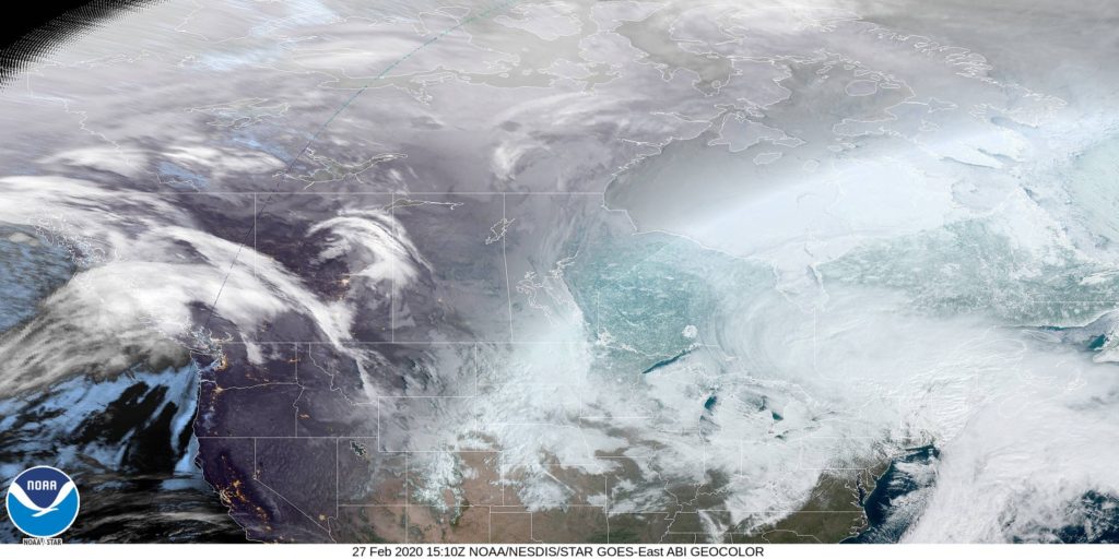
Instead of the radar, like I would normally add when there is precipitation, I have included the satellite imagery from Canada. This is a big area of low pressure stretched across eastern Canada, but it’s not going to last much longer. It’s getting stretched to oblivion as we speak.

Rochester, Minnesota

We are going to sneak close to home tonight, going down to Rochester, the home of the Mayo Clinic.

At 1254AM, CT, Rochester was reporting a temperature of 67 degrees with fair skies. Low pressure moving through northern Manitoba is inducing a lot of low level moisture northward, and dewpoints across the region were high. Fog is likely to settle in in low lying areas overnight, particularly given the clear skies.
Between the low in Manitoba and the remnants of a system in northern Quebec, there has been a rise in instability in the Upper Midwest, with scattered showers through Wisconsin on Saturday. The Manitoban low will bring some drier air into northern Minnesota on Sunday, and continue through the southern part of the state on Monday. As a result, shower and storm activity will become more voluminous, and depending on the available energy, there is a chance for some severe weather in the Rochester area on Monday.
Tomorrow – Isolated showers and thunderstorms, High 85, Low 64
Monday – Scattered showers and thunderstorms, High 82, Low 66

TWC: Tomorrow – Sunny, along with a few afternoon clouds. High 85, Low 65
Monday – Mixed clouds and sun with scattered thunderstorms. Storms may contain strong gusty winds. High 81, Low 68

AW: Tomorrow – Partial sunshine; humid High 84, Low 65
Monday – A strong afternoon thunderstorm; storms can bring flooding downpours, large hail and damaging winds High 82, Low 67

NWS: Tomorrow – Patchy fog before 8am. Otherwise, mostly sunny High 85, Low 63
Monday – Showers and thunderstorms likely, mainly before 1pm. Partly sunny, High 85, Low 66

WB: Tomorrow – Mostly sunny, patchy fog in the morning, High 84, Low 65
Monday – Numerous showers and thunderstorms, high 82, Low 68

WN: Tomorrow – Partly cloudy High 85, Low 63
Monday – Partly cloudy with numerous thunderstorms, High 85, Low 66

FIO: Tomorrow – Partly cloudy throughout the day. High 85, Low 65
Monday -Rain in the afternoon and evening. High 83, Low 69

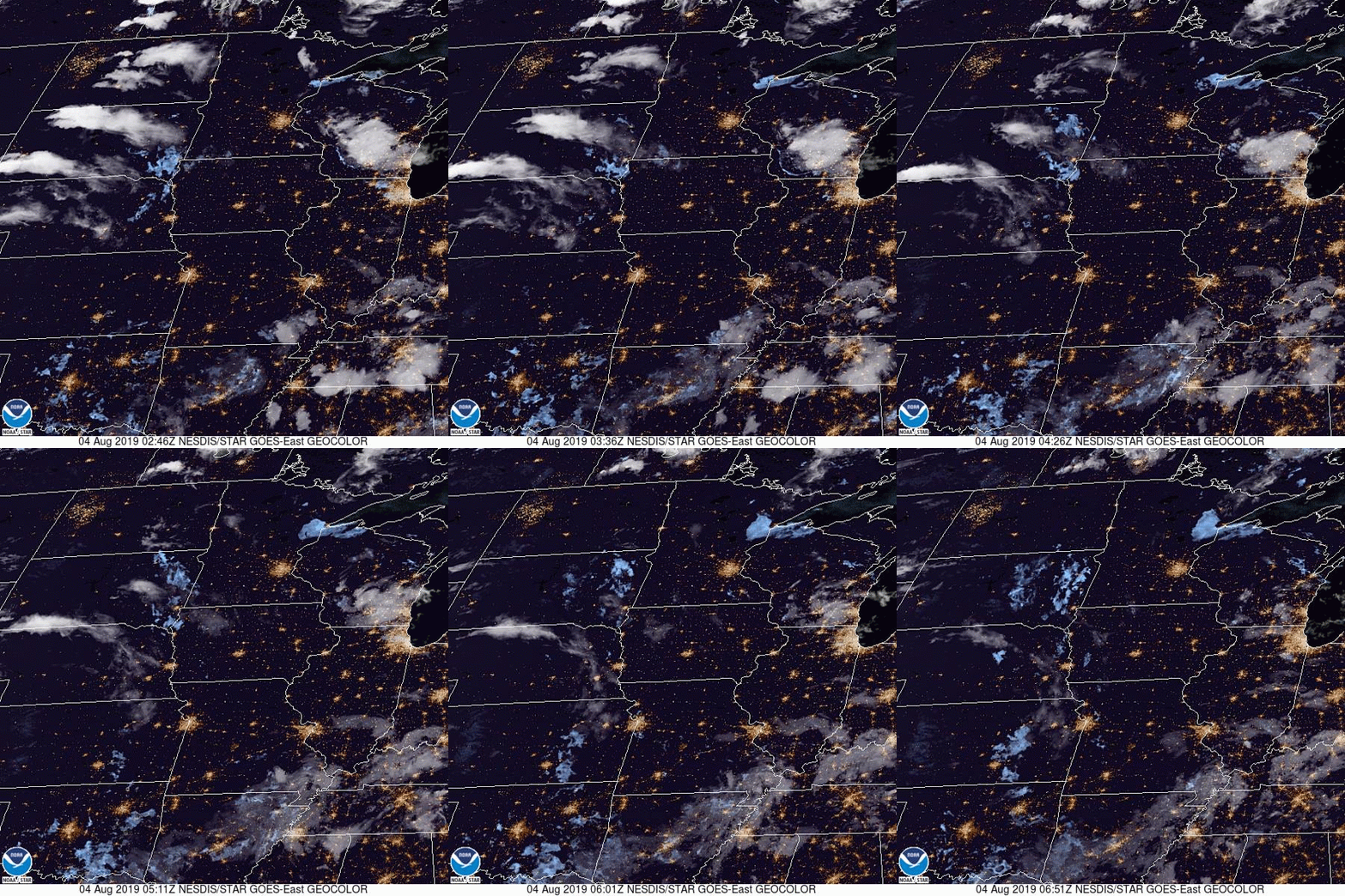
The timing everyone has for precipitation is all different. Several outlets have rain starting shortly after midnight on Monday, while others don’t have it until the evening. Meanwhile, we have a chance on Sunday. Here is a loop of the day’s satellite imagery, showing the thunderstorms moving through Wisconsin, and fog developing up by Duluth.