Prepandemic, my wife and I went to Sonoma for a friend’s wedding. Not only did I end up underdressed for the wedding (it was very fancy, and I was not), but I was also underdressed for the weather. It was significantly colder than expected, and I simply didn’t have enough warm weather gear for the blustery winds and chilly air. Beautiful country though. At the end of September, we put together a forecast for Santa Rosa, not far from Sonoma, and I had some serious flashbacks. After a gorgeous day on September 30th, onshore flow brought more clouds and chilly north Pacific air into Santa Rosa. Temperature forecasts were warm by a matter of double digits. Not great! The Weather Channel picked up a victory, but not one to be proud. Actuals: September 30th – High 88, Low 50 October 1st, High 65, Low 51
There are two options for Fayettevilles in the United States. I’ve only been to the one in Arkansas, and it is definitely not what you expect in “Arkansas” given the haven of Fortune 500 companies, University and tourism. What kind of weather is coming their way?
At 853PM, CT, Fayetteville was reporting a temperature of 59 degrees with clear skies. It was a continuation of dry weather, and there were burn bans across most of the region. The Ozarks were seeing cooler temperatures than surrounding regions, owing to the terrain of northwest Arkansas. Surface high pressure is dropping southward within a complicated jet trough. The nature of the troughing pattern is such that precipitation is being inhibited and moisture is being staunched at the Gulf. This will lead to more quiet weather tomorrow, however as the surface ridge sinks south, baroclinicity will arrive across the region, importing some moisture from the monsoon. This isn’t going to lead to a lot of wet weather, but some rain and clouds are possible overnight Monday into Tuesday. Expect a breezier day on Tuesday. Tomorrow – Increasing clouds with some late rain, High 79, Low 52 Tuesday – Mostly cloudy, with some early showers, High 79, Low 58
TWC: Tomorrow – Some sun in the morning with increasing clouds during the afternoon. (PM storms), High 78, Low 53 Tuesday – Cloudy. Slight chance of a rain shower. High 81, Low 61
AW: Tomorrow – Some sun, then turning cloudy High 77, Low 54 Tuesday – Beautiful with periods of clouds and sun High 79, Low 61
NWS: Tomorrow – Partly sunny, High 80, Low 54 Tuesday – A 20 percent chance of showers and thunderstorms before 1pm. Mostly cloudy High 80, Low 60
WB: Tomorrow – Partly sunny, High 77, Low 56 Tuesday – Mostly cloudy. A slight chance of showers and thunderstorms in the morning. High 80, Low 63
WN: Tomorrow – Partly cloudy, High 80, Low 53 Tuesday – Mostly cloudy with isolated storms, High 80, Low 60
FIO: Tomorrow – Partly cloudy throughout the day. High 78, Low 56 Tuesday – Possible light rain in the morning. High 79, Low 60
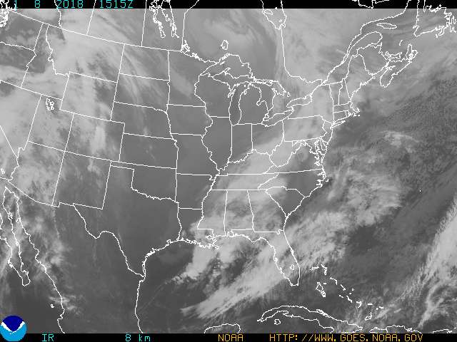
It’s fun when there is a variety to the precipitation forecasts. We’ll see how it plays out! Not much on satellite right now, but it will likely change in the next 48 hours.
The weather in the Big Easy was hot and humid towards the end of September. The humidity was a real issue, with temperatures failing to dip below the 78 degree mark in either the 24th or the 25th. At least it didn’t rain though! Victoria-Weather saw our personal hot September fritter away with a cooler forecast and a forecast for rain, but Accuweather nabbed the victory in New Orleans. Actuals: Saturday Sep 24th, High 92, Low 78 Sunday Sep 25th, High 91, Low 81
I spent quite a bit of time tweeting @Vic_WX as Hurricane Ian made landfall near Punta Gorda and Fort Myers, Florida. I suggest a follow for discussion on live and breaking news stories like Ian.
Our forecast today will be in the North Bay. Perhaps even further north than just the North Bay, deeper into Wine Country. It’s a gorgeous part of the weather when the temperatures are cooperative. It could go either way in September!
At 153PM, PT, Santa Rosa was reporting clear skies and a temperature of 81 degrees. A trough was dipping into the northern Rockies, riding on the eastern flank of a coastal ridge. Pleasant conditions were found throughout the coast, with an onshore flow keeping temperatures manageable. Through the forecast period, the low in the northern Rockies will become orphaned from a north riding jet, while the weak ridge at the coast will continue to provide a northwesterly flow. Sunshine will continue, and so to will fairly pleasant, even cooler temperatures. Tomorrow – Sunny, High 85, Low 51 Saturday – Remaining sunny, but with scattered clouds, High 82, Low 52
TWC: Tomorrow – Sunny, High 86, Low 52 Saturday – Mostly sunny, High 78, Low 52
AW: Tomorrow – Mostly sunny, High 84, Low 52 Saturday – Mostly sunny and pleasant High 79, Low 52
NWS: Tomorrow – Sunny, High 86, Low 55 Saturday – Sunny, High 82, Low 53
WB: Tomorrow – Sunny, High 83, Low 55 Saturday – Partly Cloudy in the morning then becoming sunny. Patchy fog in the morning, High 75, Low 55
WN: Tomorrow – Sunny, High 87, Low 55 Saturday – Mostly sunny, High 81, Low 53
FIO: Tomorrow – Clear throughout the day. High 82, Low 55 Saturday – Clear throughout the day. High 76, Low 52
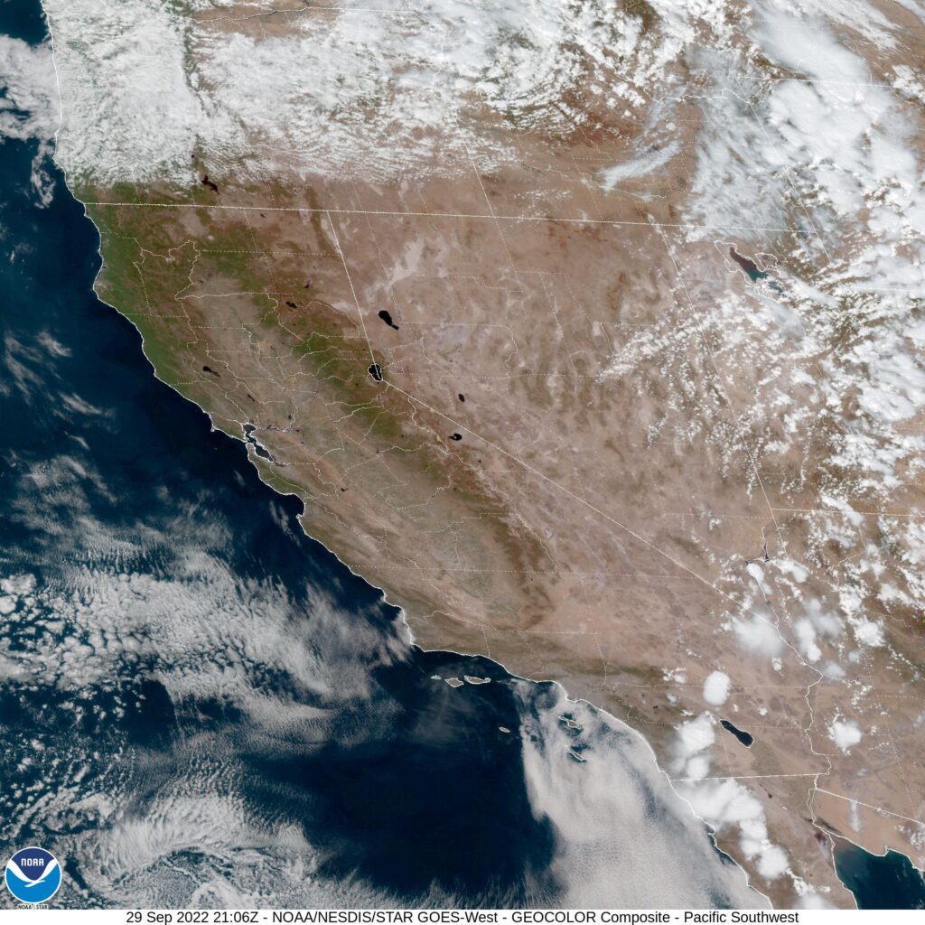
The satellite shows an almost entirely clear California, save for a little cumulus over the far southern part of the state. Not bad!
I spent quite a bit of time tweeting @Vic_WX as Hurricane Ian made landfall near Punta Gorda and Fort Myers, Florida. I suggest a follow for discussion on live and breaking news stories like Ian.
Last week, Idaho Falls was in the midst of a warm up that brought it close to record warmth for this time of year. With a trough off to the northwest, it seemed like these figures were about to change. How fast and how much was up for debate, though. Victoria-Weather and The Weather Channel were on the right side of the debate, insisting that it would be “not very quickly” and “by about 5 degrees”. Actually, the issue for those that struggled with this forecast was a belief in more cloud cover for the area, and missed cold on the highs and warm on the lows. this warmth thanks to early sunshine and clear skies meanth much rainier storms when the clouds finally did fill in. Actuals: 9/20 – High 84, low 42 9/21 – .68 inches of rain and thunderstorms, High 79, Low 45
I would venture that more ink gets spilled on the weather in the national press this time of year than any other. We are in the midst of hurricane season (and will have Ian landfall soon), enduring California Fire season, all while getting ready for fall and winter to show up and really turn things on their heads. Check out this college town-heavy schedule for the week.
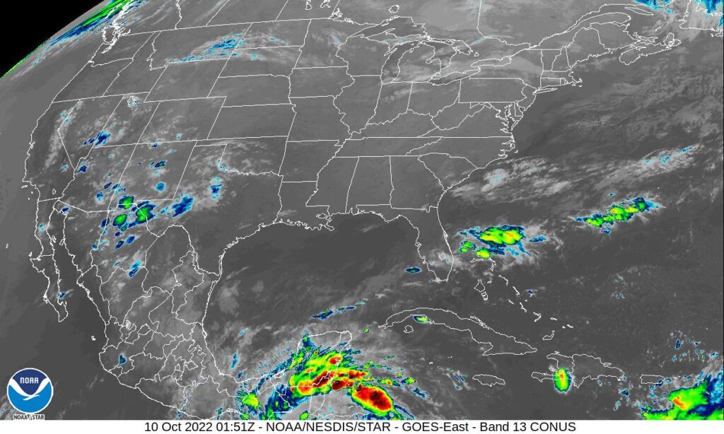
We’ve had quiet tropics, and the southern US is looking at more quiet weather this week, but even now, more than a week out and with nothing fully developed, the eyes of Louisiana are on the Venezuelan coast, where a tropical feature may develop and threaten the Gulf Coast. What before then? That’s where we come in.
At 856PM, CT, New Orleans was reporting fair skies with a temperature of 86 degrees. The satellite image of the Gulf of Mexico was a little bit murkier than the model analysis, which indicated the tail of a cold front over the northern Gulf, extending from Hurricane Fiona, bearing down on Nova Scotia. As Fiona presses into the Canadian Maritimes, the attendant boundary will diminish. Low pressure in the Great Lakes will produce a cool front through the Ozarks, advancing southward. Though not expected to be terribly robust, it will be enough to induce an onshore flow, and a return of some clouds and spotty rain showers around New Orleans by Sunday evening. Tomorrow – Mostly sunny, High 90, Low 75 Sunday – Mostly sunny, late showers and storms in the area, High 91, Low 74
TWC: Tomorrow – Sunny, High 93, Low 77 Sunday – Sunshine and clouds mixed. A stray shower or thunderstorm is possible. High 94, Low 77
AW: Tomorrow – Sunny to partly cloudy High 92, Low 76 Sunday – Humid with clouds and breaks of sun High 91, Low 75
NWS: Tomorrow – Sunny, High 90, Low 76 Sunday – Sunny, High 91, Low 75
WB: Tomorrow – Sunny, High 90, Low 76 Sunday – Sunny, High 91, Low 76
WB: Tomorrow – Mostly sunny, High 90, Low 76 Sunday – Mostly sunny, High 91, Low 75
FIO: Tomorrow – Humid throughout the day. High 89, Low 76 Sunday – Humid and partly cloudy throughout the day. High 90, Low 75
Pretty consistent numbers across the board, thanks toa fairly quiet pattern, for the time being. The storm near Venezuela was named Ian while I was writing this post. For the moment, he looks like he will curl into the Gulf Coast of Florida, but the most recent GFS has a bit more northerly track than the consensus. It’s all still pretty variable for now. Here is the currently tranquil satellite imagery..
Overnight lows in the 50s are like gifts, no matter where you are, but especially in a place like Gadsden, Alabama, where the persistent summertime humidity makes the nights cloying and hard to sleep through. This past weekend likely led to a lot of well rested residents, especially since manageable highs in the mid 80s should have meant a lot was accomplished during the day as well. Victoria-Weather can be proud of our accomplishment, earning the forecast victory. Actuals: Saturday, High 85, Low 55 Sunday, High 86, Low 59
We’ve been dabbling out in the Great Lakes or southeast for so long, it seems about time to hone our skills out west.
At 953PM, MT, Idaho Falls was seeing clear skies and a temperature of 59 degrees. The western US was within a strong upper level trough, which was tiered and producing two separate surface features. A weak low and cold front lay over Canada, and at the base of the deeper trough, a low spun off the California coast. Idaho Falls sat between the two features, and was a position of calm. The trough was squashing monsoonal moisture to the osuth. The low off the California coast will be the one to follow, as it will track along the existing jet structure. It will take until the afternoon on Wednesday, but it will arrive in eastern Idaho, pulling monsoonal moisture back northward. Rain and some isolated thunderstorms are expected in the evening in Idaho Falls, along with a few blustery gusts. Tomorrow – Mostly sunny, High 84, Low 46 Wednesday – Showers in the afternoon with isolated thunderstorms. High 78, Low 47
TWC: Tomorrow – A few clouds from time to time. High 84, Low 45 Wednesday – Partly cloudy in the morning. Thunderstorms developing later in the day High 79, Low 49
AW: Tomorrow – Mostly sunny and warm with the temperature breaking the record of 83 set in 1966 High 84, Low 45 Wednesday – Partly sunny with a thundershower in spots in the afternoon High 77, Low 48
NWS: Tomorrow – Sunny High 82, Low 47 Wednesday – A 40 percent chance of showers and thunderstorms after noon. Mostly sunny, High 78, Low 50
WB: Tomorrow – Sunny, High 83, Low 49 Wednesday – Mostly sunny with a chance of rain showers and a slight chance of thunderstorms, High 76, Low 53
WN: Tomorrow – Mostly sunny, High 82, Low 47 Wednesday – Partly cloudy with showers and chance of storms, High 78, Low 50
FIO: Tomorrow – Clear throughout the day. High 81, Low 50 Wednesday – Rain in the evening. High 72, Low 54
There is a big difference between the west and east of the Rockies. When amid a trough out west you can still get record highs. Let’s get the local perspective from KIFI in Idaho Falls
A fairly miserable little wave moved through the Great Lakes last week, bringing rain — too much in some instances — clouds and cooler weather throughout the region. It was a rather unpleasant weekend. By midweek, summer was ready to make a comeback, and nowhere appreciated that like Battle Creek. After a weekend of drear, temperatures were back up to 80 by Wednesday. Nice! Forecast.io had the forecast victory, thanks to that nice weater. Actuals: Tuesday, High 73, Low 47 Wednesday – High 80, Low 55