
After a relatively docile November, the end of the month is going to provide quite a bit of climactic intrigue. Low pressure is already spiraling through the Rust Belt on it’s way to New England. It will make for a wet trek home from Thanksgiving for a lot of people, and even includes some rumbles of thunder in western Pennsylvania, and will likely bring snow to interior New England this evening.
This storm is a hassle, definitely, but a real show is massing in the northern Plains. The next trough is going to dip to the south and give rise to a strong area of low pressure developing in the middle of the country. Things will really come together on Tuesday evening, seemingly from nothing.
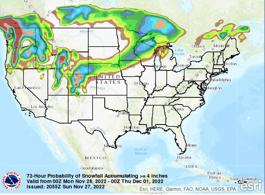
The center of low pressure will slide north of the Canadian Border on Tuesday, with a slow moving cold front extending from southern Minnesota to the Denver area, with snow showers expected along the boundary on Tuesday. As the feature shifts into Manitoba, things will really take off. Moisture will start flowing northward as the low taps into the Gulf, while an undercutting area of low pressure emerges in the mid Mississippi Valley. This will lead to some higher output snow bands on the northeastern stretch of the low. Some spots from southeastern Minnesota to the Upper Peninsula of Michigan will see 6+ inches of accumulation.
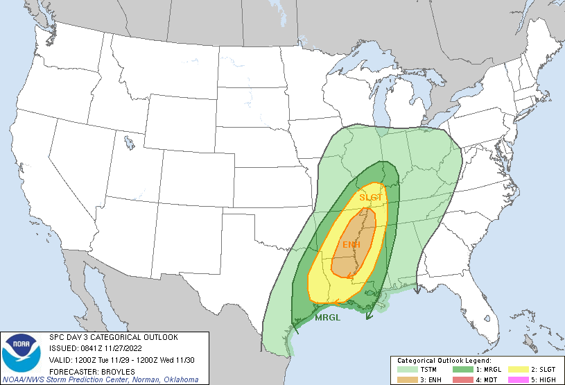
Also, with the atmospheric machinations and additional moisture, there is a looming threat for severe weather in the Lower Mississippi Valley. The undercutting low will produce a cold front of it’s own, and this will be the focal point for severe weather. Strong straight line winds are going to be a wide ranging problem, but the twisting and turning of flow in the region will also induce an seasonably high tornado threat.
The highest threat will be around sunset, just before and after, stretching from the Bootheel of Missouri to about Natchez, Mississippi. I would expect some supercellular storms in eastern Arkansas and northeast Louisiana, putting places like Monroe, Louisiana at risk for tornadoes. Things will aggregate into a line, bringing a more widespread straightline wind threat to western Tennessee and Mississippi, though embedded tornadoes are still going to be possible through the evening. The severe threat won’t last into the night, but rain and storms will be an issue in Alabama, Georgia and most of the eastern Seaboard on Wednesday.
The target area for severe weather is pictured below by the SPC.
It’s definitely going to be a nasty day for a lot of people on Tuesday, whether it be the snow in the north, the severe weather to the south, or the cold rain in between.