On this, the first day of the round of 64 in the NCAA tournament, we go to Utica, a town that sure sounds like a college town. Alas, they are not home to any Division 1 universities, but they are situated in the scenic Adirondacks.
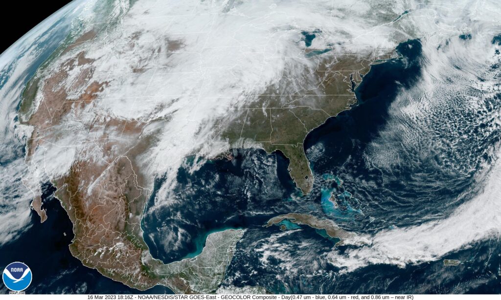
At 153PM, ET, Utica/Rome was reporting a temperature of 43 degrees with overcast skies. The temperatures have bounced back nicely in the wake of the first real nor’easter of the season, however the climb in temperatures is aided by another system developing in the Mississippi Valley. Southerly winds will continue through the mid Atlantic today, bringing even more warm air to Utica, continuing what has been a very toasty winter season, though at this point in the year, and this system in particular are quite spring like.
The storm is responsible for severe weather in the Red River Valley that will become more widespread this afternoon. Of more pertinence to the Utica region is the sloppy mix in the Northern Plains. As most systems do, this feature is starting its poleward motion, and at this time even the northern flank of this feature is mixing with rain. This suggests that warmer air will pull further north, and as the system moves through, Utica can expect an all rain event tomorrow. The rain will be fairly light with a dry slot nosing into the Adirondacks, and temperatures will fall off on Saturday as the cold air arrives. By that point, most of the moisture will have pressed into Canada, and a chilly breeze will be more noticeable than the few flakes in the evening.
Tomorrow – Scattered showers, High 44, Low 32
Saturday – Chilly and breezy with a little bit of flurry activity late, High 35, Low 24
TWC: Tomorrow – Rain, High 45, Low 30
Saturday- Mostly cloudy. Snow showers around in the afternoon. High 37, Low 30
AW: Tomorrow – Periods of rain, High 47, Low 32
Saturday – Mostly cloudy with a couple of snow showers; any heavy snow shower could cover the ground quickly and reduce visibility High 40, Low 26
NWS: Tomorrow – Showers, mainly after 9am High 45, Low 31
Saturday – A chance of snow showers after 3pm High 37, Low 25
WB: Tomorrow – Rain showers with freezing rain likely in the morning with rain showers in the afternoon, High 42, Low 32
Saturday – Partly sunny in the morning then becoming mostly cloudy. A 40% chance of snow showers, High 36, Low 24
WN: Tomorrow – Mostly cloudy with showers, High 45, Low 31
Saturday – Windy with snow showers possible, High 35, Low 29
CLI: Tomorrow – Drizzle, High 45, Low 32
Saturday – Light snow, High 39, Low 23
More wet weather is on the way for Utica. It seems pretty ok for now, but the next feature looms.