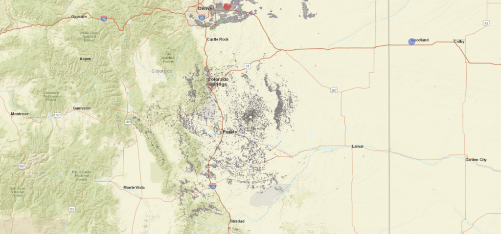
The Palmer Divide separates Denver from Colorado Springs, and though the topographies of the individual cities may appear similar, they often have very different weather fortunes. Let’s see what happens in Colorado Springs to round out the week.
At 854AM, MT, Colorado Springs was reporting a temperature of 45 degrees with a brisk west wind, gusting to 35mph with scattered clouds. An area of low pressure over the central Plains was leading to a wet day across the Northern Plains, with some light snow wrapping in from the north for Denver. South of the Palmer Divide, things were looking significantly drier, and the winds across the region were leading to red flag warnings for the Colorado High Plains.
Jet flow should remain fairly consistent across the region for the remainder of the week, southwest to northeast, though flow through the jet will continue to strengthen. A trough will begin to propagate along the jet stream in the western United States overnight Thursday to Friday, which will invigorate a warm front in the Plains, and will eventually lead to cyclogenesis in the southern High Plains. Skies will be fairly cloudy throughout the period, thanks to the flow aloft, but they will darken further late Friday, with a chance for a stray drizzle or flurry before midnight and a stormy weekend.
Tomorrow – Mostly cloudy, High 45, Low 23
Friday – Increasing clouds, wintry mix late, High 40, Low 25
TWC: Tomorrow – Partly cloudy. High 45, Low 26
Friday – Partly cloudy skies during the morning hours will give way to cloudy skies with light rain and snow developing in the afternoon High 40, Low 26
AW: Tomorrow – A bit of morning snow with little or no accumulation followed by a little rain in the afternoon High 47, Low 24
Friday – Cloudy with a little snow with little or no accumulation, mixing with, then changing to rain High 44, Low 28
NWS: Tomorrow – Mostly sunny (Late snow) High 47, Low 24
Friday – A chance of snow before 3pm, then rain likely, possibly mixed with snow. Mostly cloudy, High 41, Low 26
WB: Tomorrow – Mostly cloudy in the morning then becoming mostly sunny, High 46, Low 28
Friday – Mostly cloudy. Slight chance of snow in the morning then chance of snow possibly mixed with rain in the afternoon, High 40, Low 29
WN: Tomorrow – Partly cloudy, High 47, Low 24
Friday – Motly cloudy with light wintry mix likely, High 42, Low 26
FIO: Tomorrow – Partly cloudy throughout the day. High 50, Low 28
Friday – Foggy overnight and in the evening. High 47, Low 30
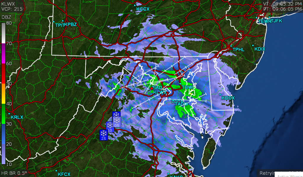
Guidance is pretty reluctant to put much precipitation in Colorado Springs Friday night, but many outlets are going hard for a miserable end to the work week. Look at the radar below, with snow, deceptively heavy, up in Denver and nothing in Colorado Springs. That Palmer Divide sure lives up to it’s billing!