After setting some high marks for forecasts in the past couple of months, November looks a bit slower. Good thing Fox Weather is around.
Terre Haute, Indiana
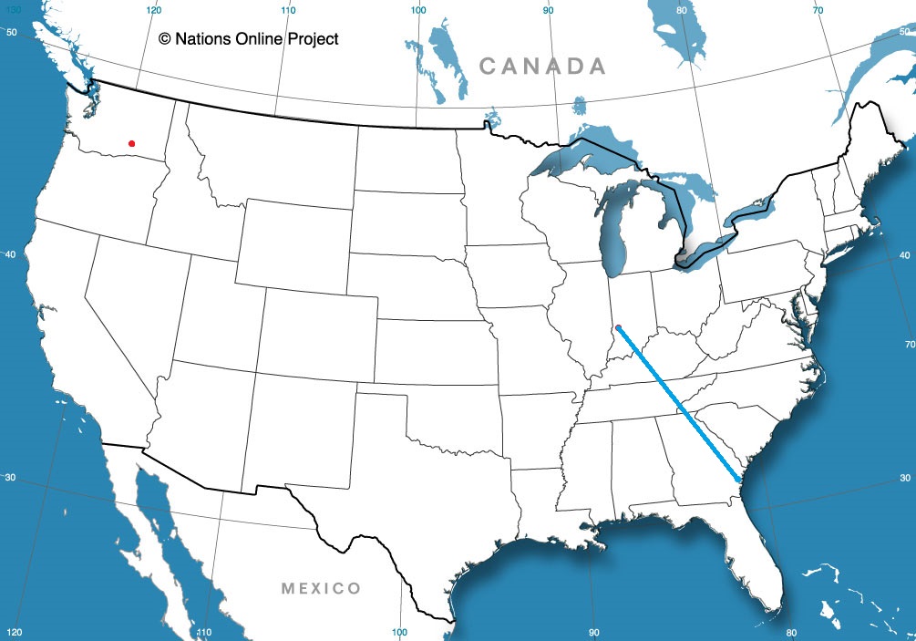
Road Trip from Brunswick, Georgia to Terre Haute
Kennewick, Washington
from Victoria-Weather

After setting some high marks for forecasts in the past couple of months, November looks a bit slower. Good thing Fox Weather is around.
Terre Haute, Indiana
Road Trip from Brunswick, Georgia to Terre Haute
Kennewick, Washington
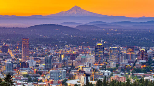
We are forecasting for Portland, Maine mere days after verifying a forecast for Portland, Oregon. I have nothing to add to that, but felt as though I needed to acknowledge it.
At 751PM, ET, Portland was reporting a temperature of 42 degrees with clear skies. In what can only be described as an upset victory, New England was entirely under clear skies on this early November evening. The most recent Gulf Stream storm was well off the coast, and actually helping to inhibit moisture for the next system working its way across Hudson Bay.
That feature over Hudson Bay, while limited in potential precipitation, is still backed by good upper level support and substantial surface reflection in terms of temperature and lack of moisture. Tonight will ultimately be a foggy one for Portland and most of coastal Maine, however the cold front will bring first a spot of light rain overnight Tuesday to Wednesday, with a chance for cooler crisper air after the morning low clouds clear out on Wednesday.
Tomorrow – AM fog, then mostly sunny, Light rain possible rain before midnight High 58, Low 37
Wednesday – Light rain through the morning, becoming sunny, High 57, Low 38
TWC: Tomorrow – Plentiful sunshine. High 60, Low 37
Wednesday – Showers in the morning, then partly cloudy in the afternoon. High 55, Low 42
AW: Tomorrow – Mostly sunny; great day to be outside High 57, Low 35
Wednesday – Clouds breaking, a shower possible High 55, Low 41
NWS: Tomorrow – Sunny High 60, Low 40
Wednesday – Cloudy through mid morning, then gradual clearing, High 55, Low 40
WB: Tomorrow – Mostly cloudy, High 59, Low 32
Wednesday – Mostly cloudy in the morning, then clearing (rain early) High 53, Low 39
WN: Tomorrow – Mostly sunny, High 60, Low 41
Wednesday – Partly cloudy with isolated showers, High 55, Low 45
FIO: Tomorrow – Clear throughout the day. High 60, Low 39
Wednesday – Light rain overnight and in the morning. High 57, Low 46
It’s going to be a nice couple of days in Portland, and the rain will even have the decency to come overnight. Look how beautiful New England is tonight.
Tonight, we take a trip through what should be some nice weather. It’s a two day trek from Sherman to Roanoke, and will cover 1080 miles. That means a pace of 67.8 mph, and that will ultimately mean about 543 miles on the first day, which is a nice even split of the trip into two days.
DAY ONE (Sunday)
High pressure is in charge east of the Mississippi, and an emerging low in the Plains is helping direct some southerly flow to the region. Our drive will be in the sun, in warmer air than the region has seen for a couple of days. We’re going to make it through Arkansas and into Tennessee. Parkers Crossing, Tennessee will be the destination. The town is just northeast of Jackson.
DAY TWO (Monday)
That high pressure is just going to hang on in the eastern US. Even the drive through the Smokey Mountains and astride of the Appalachians will be devoid of the fog and haze that can be persistent in that area. Roanoke will be nice for the autumn.
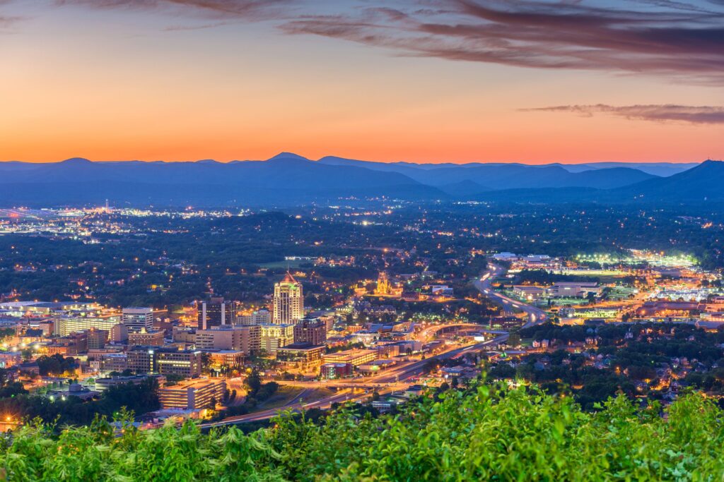
Good evening! Let’s get this weekend forecast off the ground, shall we?
At 1254AM, ET, Roanoke was reporting clear skies and a temperature of 36 degrees. With clear skies and dew points sub freezing, frost is a foregone conclusion tomorrow morning. A sharp trough moving into the area is bringing cold air to he region, but more significantly outside of Roanoke, will aid in the development of a low in the Bight of Georgia, which will prove impactful later this weekend.
As the system develops this weekend, it will reinforce the chilly air invading the Roanoke area. There may be a few scattered clouds thanks to the flow over the Appalachians, but there is no threat of the feature moving onshore far enough to bring rain or snow to Roanoke. Expect cool temperatures but generally sunny skies through the weekend, but rain, potentially flooding rain and high surf in Georgia and South Carolina, not that far away. The trough will flatten a bit on Sunday, allowing some warmer temperatures to conclude the weekend.
Tomorrow – Partly cloudy, High 53, Low 30
Sunday – Partly cloudy, cool and crisp, High 61, Low 34
TWC: Tomorrow – A mix of clouds and sun early, then becoming cloudy later in the day. High 55, Low 30
Sunday – Mostly cloudy skies early, then partly cloudy in the afternoon. High 62, Low 36
AW: Tomorrow – Times of sun and clouds High 54, Low 34
Sunday – Partly sunny High 62, Low 38
NWS: Tomorrow – Mostly sunny High 54, Low 29
Sunday – Mostly cloudy, then gradually becoming sunny, High 62, Low 38
WB: Tomorrow – Mostly sunny, High 54, Low 33
Sunday – Mostly sunny, High 62, Low 35
WN: Tomorrow – Partly cloudy, High 54, Low 29
Sunday – Partly cloudy, High 62, Low 38
FIO: Tomorrow – Mostly cloudy throughout the day. High 55, Low 30
Sunday – Mostly cloudy throughout the day. High 62, Low 34
The pattern is unkind specifically to Charleston lately. Persistent troughing and development of low pressure over the Bight of Georgia will continue through the early part of the week. Sheesh.
Portland certainly did not miss the rainfall last week, which makes it fairly impressive, in a way, that our forecast fell between the blasts of bomb cyclone and atmospheric river. In fact, on the days of October 27th and 28th, there was only a combined .03 inches of rain. The cloud cover kept temperatures from ranging a whole lot on the 27th, but then, with significantly less activity on the 28th,they really blossomed, hitting 69 degrees. Accuweather did a good job figuring all of this out ahead of time, successfully winning this forecast, notably with the warmest high temperatures on the 28th.
Actuals: October 27th – .03 inches of rain, High 58, Low 52
October 28th, Trace of rain, High 69, Low 53
Grade: A-C
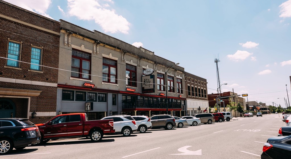
Happy Election Day, and Happy November everyone. We’re going to mosey just south of the Red River and check out Sherman.
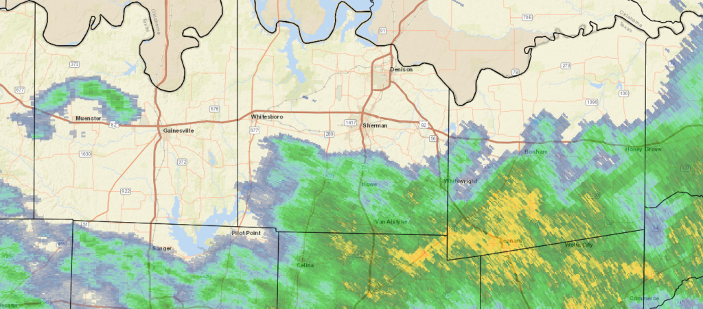
At 815PM, CT, Sherman was reporting a temperature of 49 degrees with overcast conditions. A swath of rain was falling just to the south, between Sherman-Denison and I-30, and generally drifting eastward. Scattered showers extended as far to the west as Wichita Falls, so even though the heaviest rain is probably over for the night, more rain is likely on the way tonight. An upper level trough is represented by a notch within a surface ridge, with the ridging expected to overtake the disturbance through the day tomorrow. The rain tonight will continue through late morning, perhaps, but a clear, cool afternoon is anticipated.
With high pressure reestablished under an early winter trough, Sherman should see some tastes of normal to slightly below normal temperatures for the season.
Tomorrow – Light showers early, then clearing and cool, High 50, Low 45
Thursday – Partly cloudy and chilly in the morning, high 56, Low 40
TWC: Tomorrow – Showers in the morning, then cloudy in the afternoon High 48, Low 45
Thursday – Mostly cloudy skies early will become partly cloudy later in the day. High 57, Low 42
AW: Tomorrow – Cool with occasional rain and drizzle High 51, Low 47
Thursday – Clouds giving way to some sun and cool High 57, Low 42
NWS: Tomorrow – Showers and possibly a thunderstorm before 1pm, then a slight chance of showers between 1pm and 3pm. High 49, Low 47
Thursday – Partly sunny, High 55, Low 43
WB: Tomorrow – Showers and perhaps a thunderstorm in the morning, then a slight chance of showers in the afternoon, High 49, Low 47
Thursday – Mostly cloudy in the morning, then becoming partly sunny, High 56, Low 42
WN: Tomorrow – Cloudy with light showers and isolated thunderstorms, High 49, Low 47
Thursday – Partly cloudy, High 55, Low 43
FIO: Tomorrow – Rain until afternoon. High 52, Low 47
Thursday – Partly cloudy throughout the day. High 57, Low 41
I’m drier and clearer than the rest, and it shows in my temperature forecasts. It looks a little damp tonight.
I’m not sure it was planned this way, but Fox Weather sure had a good chance to show off the skills it’s bullpen of meteorologists have, with a pair of severe weather days, first in Missouri on Sunday (Fox covered the aftermath on their launch day) and again in the Sabine Valley from east Texas to western Louisiana, where Lake Charles had a tornado sweep through town only a year after being devastated by the 2020 hurricane season, notably by Hurricane Laura.
That first round of storms reemerged off shore and drove into southern New England and the mid-Atlantic as a nor’easter, bringing flooding rains around the New York area. There was also more mountain snow and the long awaited conclusion of rain on the west coast, and steady rain at times for nearly everyone in the country as some point, wrought by one of these storms.
The low that was so problematic in the south central United States has become bloated and slow moving. It is now slogging through the eastern Great Lakes bringing intermittent rain to a lot of the northeastern US. Through the weekend, the low will sink off shore, become reinvigorated and blast back north into New England. Behind the feature, cooler than normal temperatures in place, and will be there for the beginning of November.
So how did Fox Weather handle the busy week? Fairly well, I would say. If nothing else, Fox Weather hired people who were comfortable in front of a camera, or were capable of highly produced television. The station is slick, and looks nice. The presenting meteorologists are clear and conversive, and it is a good over the air package.
Unfortunately, all the money was spent on making the streamed product. There is no way for you to get the forecast on their website, and the app is a challenge to use. Fox Weather is essentially a news website with a focus on the weather. You can’t get any forecasts online from Fox. Can you imagine a weather website in which you can’t get your local forecast?
Preposterous.
Two cities that are slightly inland, but have been pummeled by extremely heavy rain in the last week. They seem similar, but are separated by 2884 miles. We will take 5 days to cover all this ground, including a really long day at the end, moving at a pace of 67mph, and we will cover about 536.5 miles a day for the first 4 days of the week. If there is anything nasty coming this week, we will sure see it on this trip.
DAY ONE (Thursday)
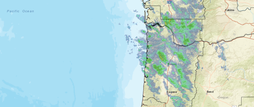
The next wave of wet weather moving into the Pacific Northwest will really arrive on shore overnight tonight, though rain and some mountain snow has continued to fall from Portland to the Cascades. The wind and precipitation will be heavier through the morning as far east as Biggs Junction than it has been today, but then, it will cut off. The system will be angled towards the north, and should leave the rest of our route on Thursday unmolested. We’ll stop in Wendell, Idaho which is northwest of Twin Falls, for the night.
DAY TWO (Friday)
A ridge is setting up over the Rockies for late in the week, and that coincides pretty sweetly with our trek through the region. Idaho, Utah and Wyoming will be dry on Friday, with seasonable warmth and sunshine. We’ll make it to Arlington, Wyoming, northwest of Laramie on Friday.
DAY THREE (Saturday)
The low pressure feature that was arriving on shore as we attempted to leave Portland is going to ride over the ridge as we head east. It will feature a mostly inactive cold front diving into the northern High Plains on Saturday as we cross the Nebraska prairies. We will make it to Lincoln, where we will stop for the night, amid increasing breezes and temperatures ready to cool down. Now, my alma mater, the Purdue Boilermakers are playing in Lincoln on Saturday, but I swear this is just a coincidence.
DAY FOUR (Sunday)
A cold front is going to be moving at about our pace through Iowa and northern Illinois, but this is probably a good thing. It looks like it will be dry throughout the drive, but will instead just give us a nice little tailwind. Sure, it will feel chilly when we stop for gas, but that gas will come with better mileage! Of course, the stop and go of the Chicago area will slow us down, and we will make it to Hobart, Indiana, just across the border, leaving one final, albeit lengthy day to wrap this bad boy up.
DAY FIVE (Monday)
That crisp breeze will be our companion, only helped, surely, but the Great Lakes to our north. The Appalachians in Pennsylvania will bring respite from the wind, and ultimately the cold, as the East Coast looks to mostly avoid the worst of the cold air brought by the area of low pressure quickly marching towards Hudson Bay. Trenton will be experiencing some partly cloudy skies with southerly breezes when we arrive, a far cry from what they saw last weekend

Our first forecast of the workweek, and perhaps the last of October (I don’t know that, just how slowly I operate) takes us to the teeth of a bomb cyclone/atmospheric river, and a whole lot of climate buzzwords.
At 553AM, PT, Portland was reporting a temperature of 52 degrees with light rain. The Portland metropolitan area was still getting soaked, The rainfall in the Pacific Northwest is ongoing west of the Cascades, but at a lessened rate than it has over the last few days. The strong system in the Gulf of Alaska has moved towards the Panhandle near Sitka and Juneau, which has decreased the westerly flow, but the low level moisture is still available, and the flow is enough that the Cascades will still see steady precipitation with more intermittent rain in Portland.
While all this is good news, it will take until the middle of the day on Wednesday to really wind down, so occasional breezes and rain will be a fixture today and through the beginning of tomorrow. Wednesday afternoon will be the nicest stretch of the forecast, as a secondary, but weaker reinforcing wave is expected to emerge off the Oregon Coast, arriving overnight Wednesday to Thursday. This feature will take a direct shot at the Olympic Peninsula, but Portland will see more rain and wind, especially in the evening on Thursday as the next round slides ashore. This second round will bring a warmer ridge northward, and some warming should be anticipated late.
Tomorrow – Rain in the morning, a bit of clearing late, High 60, Low 50
Thursday – Rain, maybe a rumble of thunder in the evening, High 65,Low 52
TWC: Tomorrow – Cloudy with occasional light rain in the afternoon. High 57, Low 51
Thursday – Rain showers in the morning will evolve into a more steady rain in the afternoon High 65, Low 53
AW: Tomorrow – A thick cloud cover with a little rain High 58, Low 51
Thursday – Mostly cloudy with a couple of showers HIgh 67, Low 54
NWS: Tomorrow – Showers likely before 2pm, then rain likely after 2pm. Cloudy, High 58, Low 50
Thursday – Rain. High 64, Low 50
WB: Tomorrow – Showers likely until afternoon, then rain likely late in the afternoon, High 55, Low 50
Thursday – Rain, High 64, Low 52
WN: Tomorrow – Mostly cloudy with light showers likely, High 58, Low 50
Thursday – Mostly cloudy with rain, High 64, Low 53
FIO: Tomorrow – Light rain throughout the day. High 60, Low 48
Thursday – Light rain throughout the day. High 62, Low 57
We are all over the place in what we expect will happen in Portland over the next couple of days. I’m very interested in seeing how it all plays out.
When we forecast for Ogden last weekend, I noted specifically that I thought something broke at Forecast.io. Little did I know, it was the rest of us that had the issues. While many of us expected the large system moving into town to bring rain, potentially mountain snow and colder temperatures, Forecast.io didn’t go nearly as cold. Neither did Ogden, as it turned out, and FIO nailed the first three verifying times. Eventually, temperatures fell off quicker than Forecast.io expected, but by that point, they had a commanding lead in the forecast chase.
Actuals: Sunday, High 74, Low 43
Monday – .38 inches of rain, High 63, Low 43
Grade: B-D