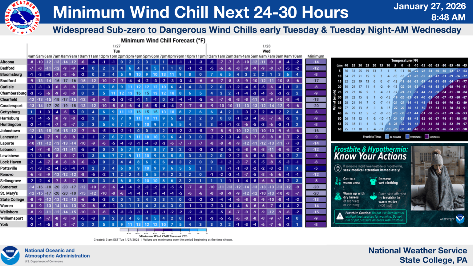
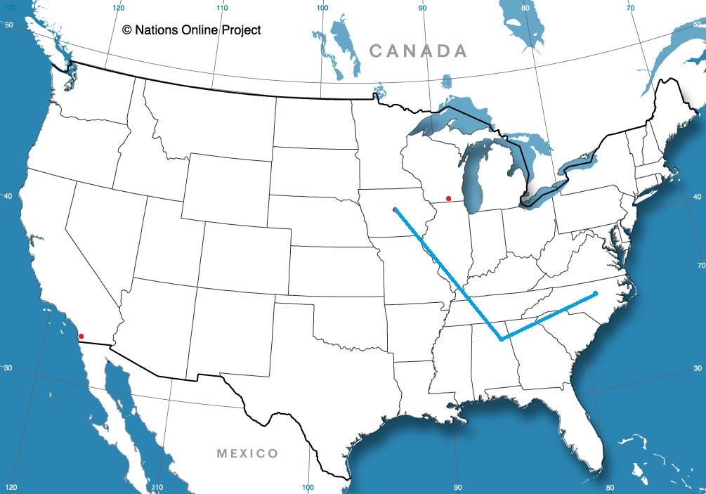
My friends, I regret to inform you that, once again, in the Carolina Plains, it will be snowing again. That is the bad news. The good news is, there is a reason that I specifically called out this particular area.
The polar vortex is still parked over eastern Canada, which means a persistently active, and most importantly, a continually cold stretch of time for America east of the Rockies. Later this week, the upper level structure is going to rotate further to the south and a bit to the east, which is going to do two important things. One, it is going to get even colder for an unfortunate chunk of the country. Additionally, it is going to push the storm track south and a bit to the east.
The trough, in its motion, is going to have improved vorticity, and an increased capacity for cyclogenesis. What does that mean? It means low pressure is going to develop towards the southern base of the trough. As I said, this feature is going to be shifting further south and a bit to the east, which means the surface area of low pressure is going to develop south and a bit east of where the weekend storm went. Offshore.
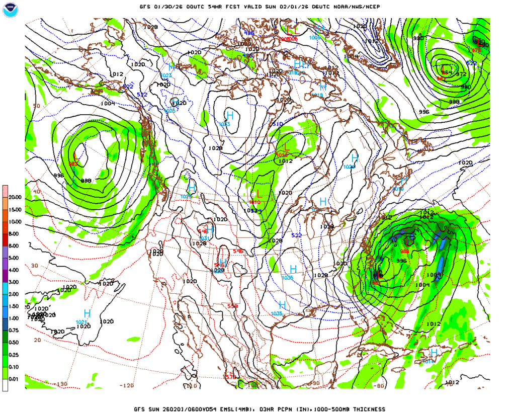
This does mean the storm going to be stronger, with a deeper central pressure. This means that despite less moisture, and a narrower focus for the precipitation,, the wind will drive most of the issues. There are blizzard watches out for the Piedmont, but there aren’t any snow accumulation forecasts for even double digits that I have seen. And absolutely no forecasts for ice.
So even with the limited precipitation relative to last week, the nature of this storm is that it will be stronger at it’s heart, colder and windier. Snow that falls will be heaviest in the Carolinas and Virginia, but there may be a few flakes along the immediate coast from New Jersey through Massachusetts, but there too, the big threat is blustery wind.
The winter weather will pick up overnight tomorrow in the Carolinas and Virginia. The wind will peak Saturday night, and will be worst in the Outer Banks. The cold will move back in and continue to linger. The good news is, this storm i narrower geographically, and won’t have ice. But it will be windy. Stay safe, and tie down the lawn chairs.