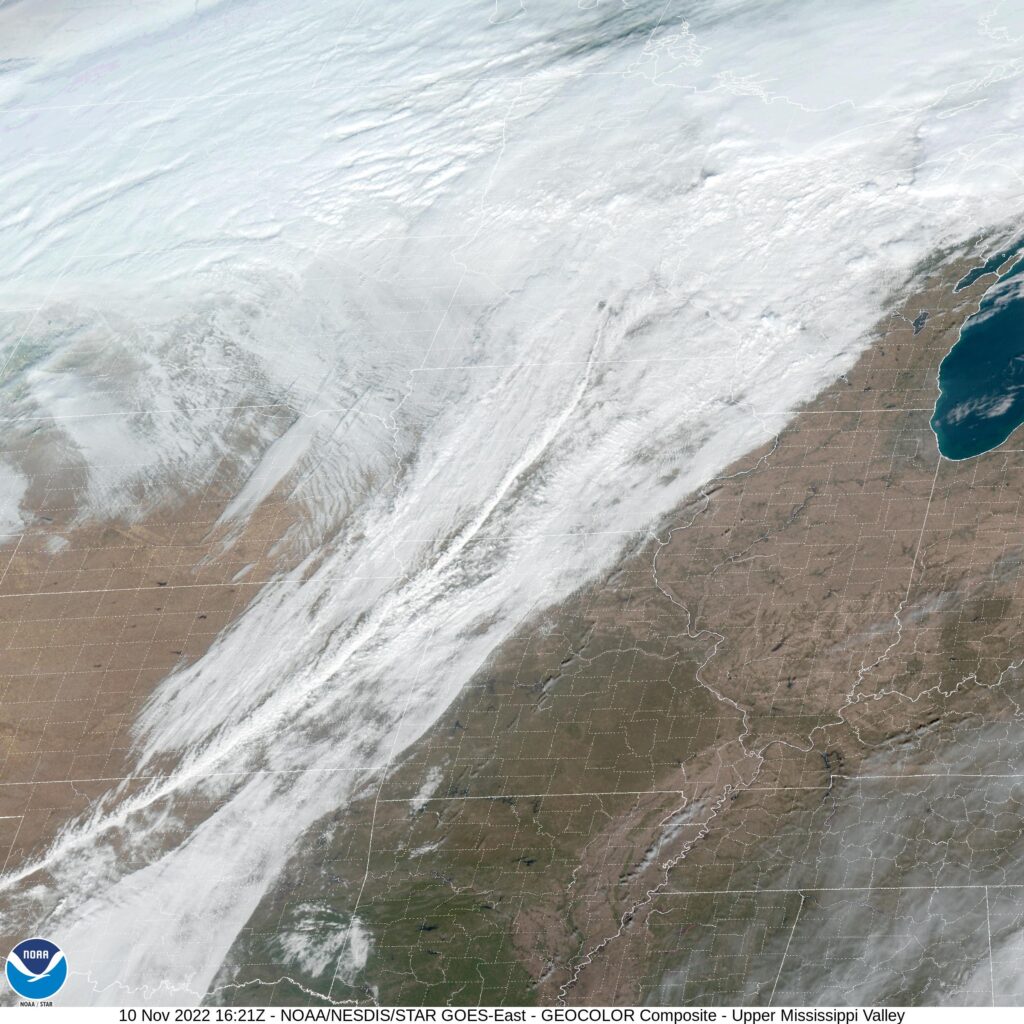
A strong cold front moving into the middle of the country started us on a weeklong cold snap that afflicted a sizeable tract of the country. It brought heavy rain to the High Plains, but it dwindled as it progressed eastward. There was only about a tenth of an inch of rain in Jefferson City on the 11th, but it diminished from the heavy rain seen west of there thanks to Hurricane Nicole. Nicole was moving inland at the same time the cold front was passing through Missouri, and at the same time, intercepting a lot of the moisture that would have fallen on the Show Me State. It didn’t slow down the cool down, though, because it sure got chilly on the 12th! Not as chilly as the forecast said, though, which gave the shared victory to The Weather Service and Weathernation. Actuals: November 11th, .11 inches of rain, High 49, Low 32 November 12th, High 32, Low 29
I love absolutely nothing more than mostly rural road trips through the middle of nowhere. Imagine how big Casper is going to seem after this 2 day voyage! It’s a 921 mile journey between these two towns, which we will pace at 64.5mph, ending the first day at the 516 mile mark. Let’s go on this windswept journey!
DAY ONE (Wednesday)
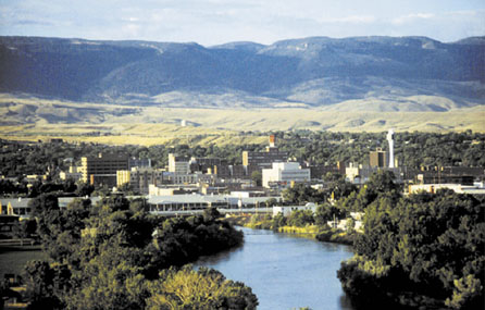
Jefferson City, Missouri
A broad, disorganized area of low pressure has been bringing fairly steady light snow to much of the Northern Plains for the last couple of days. It’s a nuisance, but it hasn’t yet drifted so far south to impact Missouri, and the drive through the Show Me State and Kansas City will be fine. We will pop north and cut through Lincoln (the last sizeable town for the rest of the drive) and head west, where a lobe of that mass of light snow will start digging to the south. The feature won’t reach Nebraska until the overnight, and we should reach Lexington, in south central Nebraska without much fuss. Don’t let that lull you into a false sense of security.
DAY TWO (Thursday) Windy conditions with light snow can make for some terrible visibility, and that is what we can expect west of North Platte. The precipitation, but not the wind, will taper by noon, with the snow becoming more likely in the mountains off Wyoming by the end of the day. Snow or no snow, conditions will be challenging in Nebraska, and only a little bit better in Wyoming. If the roads are clear, that will be good news. Casper certainly sounds like a friendly destination, doesn’t it? It will have a faint dusting of snow when we arrive.
We are heading back to Missouri for our forecast today, and this time, we are taking it to the manager, visiting the state capital.
At 553AM, CT, Jefferson City was reporting clear skies and a temperature of 65 degrees with clear skies. Low pressure centered over the Upper Midwest is producing a warm front that ranged through the northern Great Lakes, and was drawing forth a significant warm surge through the Mississippi Valley, bringing forth the unusual warmth in early November. As with most autumnal systems, there is a strong cold front dangling off the back end of the low pressure center, This active pattern is also punctuated by the remnants of Hurricane Nicole over Florida, and drifting north into southern Appalachia. The cold front will be active with showers and storms over northwestern Missouri this afternoon and evening, with the chance of a shower arriving near sunrise tomorrow. Nicole, however, will sap most of the moisture moving towards Jefferson City, which will tone down the rain chances through the day Friday. That said, mid layer clouds and a rush of cooler air will still trail the boundary, making for a chilly start to the weekend. Tomorrow – Early showers lead to clouds and cold, High 52, Low 30 Saturday – Partly cloudy but colder, High 37, Low 22
TWC: Tomorrow – Cloudy skies early will become partly cloudy later in the day. Slight chance of a rain shower. High 51, Low 33 Saturday – Sunshine and clouds mixed High 40, Low 24
AW: Tomorrow – A passing shower in the morning; otherwise, partly to mostly sunny and cooler; the colder weather will linger into next week High 53, Low 32 Saturday – Mostly sunny and cold High 40, Low 24
NWS: Tomorrow – Cloudy through mid morning, then gradual clearing, (early storms) High 50, Low 30 Saturday – Sunny High 38, Low 24
WB: Tomorrow – Sunny (early rain), High 53, Low 32 Saturday – Sunny, High 40, Low 26
WN: Tomorrow – Mostly sunny, High 50, Low 34 Saturday – Mostly sunny, High 38, Low 24
FIO: Tomorrow – Rain overnight and in the morning. High 51, Low 31 Saturday – Clear throughout the day. High 40, Low 25
The cold front over northern Missouri is looming. Enjoy the heat today, because winter is around the corner.