It wasn’t well modeled in Champaign over the weekend, but perhaps it should have been more closely monitored. Temperatures after a weak cold front moved through overnight Saturday into Sunday fell off fairly quickly Sunday night. I think most of us anticipated more clouds, or simply weren’t in on guidance’s plans, so Sunday lows were too warm, across the board. Also off were the precipitation forecasts for a couple of outlets. It did continue to rain on Sunday morning, nearly a quarter inch, which Accuweather and Clime didn’t have in their forecast. This hurt Accuweather the most, as it cost them victory for the day, instead handing it to us, Victoria-Weather. Actuals: Saturday, .43 inches of rain, High 56, Low 44 Sunday .2 inches of rain, High 67, Low 43
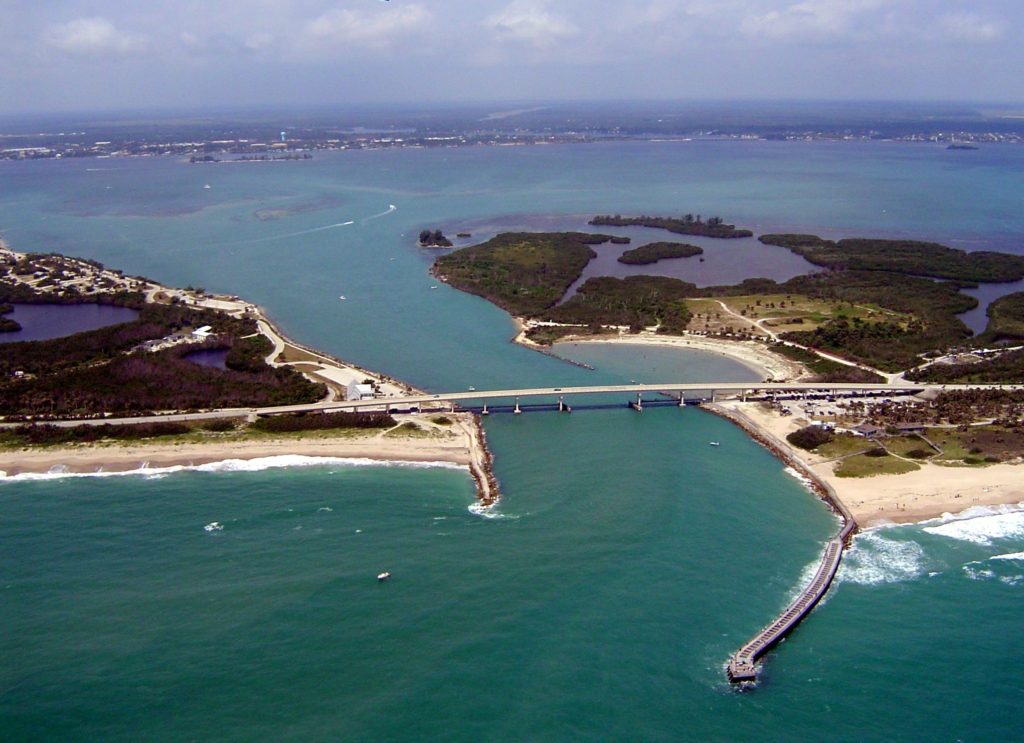
We’re headed southeastward to start the work week. Getting into the middle of November, a trek to the beach might be a good idea. It will take two days to get from Illinois to the Treasure Coast, covering 1162 miles. That will cover nearly 70 miles an hour, and we will over 554 miles on our first day, leaving a longer day for Tuesday. Beach day!
DAY ONE (Monday)
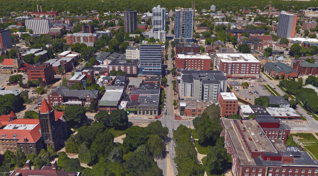
Champaign, Illinois
Low pressure in the Great Lakes has hooked up with the remnants of Rafael at this point, which is slowing the eastward traffic down a bit. By the time we get going on Monday morning, it will have dried out in east Central Illinois, and will be dry, if with some patchy clouds, for our route. The tail of the cold front, fused to the remnants of Rafael, will stall through Georgia, bringing about some mid to lower level overcast through the Smokey Mountains as we pass through Chattanooga. The day will conclude in Calhoun, just north of Atlanta.
DAY TWO (Tuesday) That low in the Gulf will refuse to go away, but will get forced apart by a burgeoning ridge of high pressure in the eastern two thirds of the country. The low moving out of the Great Lakes will be safely off in the Canadian Maritimes, and our drive on Tuesday to Sebastian will be done with very good conditions, save for all those Florida drivers to worry about.
We’ll head to America’s Heartland for our weekend forecast. Champaign is the home of the University of Illinois, school with a good meteorology program, and rivals of my Purdue Boilermakers.
At 1053AM, ET, Champaign was reporting a temperature of 55 degrees with clear skies. High pressure was seated over the Great Lakes, thanks to a shortwaved ridge riding the greater jet structure. This means that while it is sunny in east central Illinois, it is also fairly cool. A perturbation moving out of the base of the mean trough is starting to send some high clouds into the area. While it is cool and calm right now, a couple of features, the remnants of Rafael in the Gulf and the perturbation in the trough poise to make the weekend a bit less pleasant. Rising moisture out of the Gulf will carry with it some additional warmth tomorrow. The well wound system in the center of the country is rapidly occluding, but is generally well organized enough to transfer airmasses, and send some worthwhile cold air into Champaign behind the cold front tomorrow evening. This will allow the murky shower and perhaps isolated thundershower activity not to overstay its welcome. Clearing will come by the end of the day on Sunday. Tomorrow – Mostly cloudy, with rain in the afternoon and evening. An isolated thunderstorm can’t be ruled out. High 58, Low 40 Sunday – Rain early, then clearing and warmer with sunlight, High 63, Low 49
TWC Tomorrow – Cloudy skies (Late rain), High 59, Low 40 Sunday – Sun and a few passing clouds (Early rain) High 64, Low 52
AW: Tomorrow – Increasing cloudiness (Late rain)High 60, Low 41 Sunday – Breezy and pleasant with periods of clouds and sun High 62, Low 46
NWS: A 20 percent chance of showers after 3pm. Mostly cloudy, High 60, Low 40 Sunday – A 40 percent chance of showers before noon. Mostly sunny, High 64, Low 49
WB: Tomorrow – Partly sunny in the morning, then a slight chance of showers in the afternoon, High 60, Low 42 Sunday – Mostly sunny, a chance of showers in the morning, High 62, Low 49
WN: Tomorrow – Partly cloudy with showers and isolated storms, High 58, Low 39 Sunday – Partly cloudy with isolated showers, High 62, Low 52
CLI: Tomorrow – Light rain showers, High 58, low 40 Sunday – Sunny, High 63, low 52
It’s going to be active and wet this weekend, though not a complete drencher. Still, if it is going to be this cool, it’s pretty gross. Clouds are already filtering in across the region.
Let’s do an Election Day forecast, shall we? In the parlance of politics, we’ll head from one blue state to another, but we’ll travel through some red states along the way. It will take 4 days, or about as long as it will take to count all the votes, to cover 2107 miles. The fourth day will be slightly shorter than the first three, with those first three days concluding after 544 miles of driving at around 68mph. Most cars can stream audio now, so maybe avoid the AM radio and just enjoy the open road for this trip.
DAY ONE (Wednesday)
Champaign, Illinois
As the jet has drifted back a bit to the north, things have started to warm up for the middle of the country, and our drive on Wednesday can likely be done with the windows down if the car gets too stuffy. There won’t be much weather to remark on, save for breezes that could gust to 15mph at times. Noting treacherous. We’ll arrive in suburban Tulsa for the night.
DAY TWO (Thursday) Thursday will be similar to Wednesday, though with a diminished chance of a prevailing wind. We will drive through central and western Oklahoma, still cleaning up after a calamitous ice storm, and pass through the Texas Panhandle into New Mexico under sunny skies. We will stop at the San Ignacio exit west of Santa Rosa and completely be out of touch with the rest of civilization.
DAY THREE (Friday) As we approach California, we will do it through the desertified parts of the Southwest. New Mexico and Arizona will remain clear and dry, but a system moving into the West Coast will stir some winds inland. Watch for tumbleweeds in this part of the world. The drive will end at Silver Spring Road between Kingman and Seligman in Arizona.
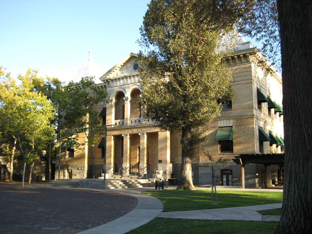
DAY FOUR (Saturday) As is often the cast, the feature moving into the West Coast will lose a lot of structure as it gets into the mountains, but that doesn’t mean it will be completely obliterated. In fact, well defined fronts will still exist, including a cold front we will drive though in southern California. That’s not to say it will be particularly rainy, if at all, as the frontal passage will be between Barstow and Mojave, right in the heart of the desert. When we descend into the central Valley at Bakersfield, we’ll probably get into some soupy overcast with drizzle. Expect that right on down to Hanford. Strange, right? The only part of the trip with rain will be the part in California.
Hanford, California
By Armona at en.wikipedia, CC BY-SA 3.0, https://commons.wikimedia.org/w/index.php?curid=17978087