Our forecast in Albany proved to be even less exciting than expected. I though there might have been a smattering of light rain or some fog thanks to the pool of moisture still lingering in the southeast, but no, that would have been a little bit too much adventure. Instead, we saw no rain, highs what were the same on both the 25th and 26th and low temperatures that merely wobbled a couple of degrees. In fact, there was so much sameness, WeatherNation and Clime had the same score, and tied for the win. Actuals: April 25th, High 87, Low 63 April 26th, High 87, Low 65
We’re headed through the southern part of the country today. Well, for the next three days. It’s nearly a straight eastward shot covering 1758 miles. The pace will be 67.6mph, which means a pace of about 541 miles a day for the first two days, with a longer drive coming on the third day. We’re leaving from the desert, so that 10 hour drive will also happen to coincide with the most interesting weather as well.
DAY ONE (Sunday)
Tucson, Arizona
It’s time to hit the road on day one of our southern road trip, and as one might expect, the drive through the Desert Southwest is going to be pretty dry. Arizona and New Mexico, all the way to El Paso are going to be pretty dormant, however as the evening approaches, the dry line in west Texas is going to start looking a little more active. Maybe storms won’t fire as far south as I-20, but I wouldn’t rule it out. The real question is, will they fire far enough west for us to reach them on Friday night? Also not likely, but I wouldn’t rule it out. Let’s stop in Barstow, just past Pecos, for the night.
DAY TWO (Monday) Saturday will be spent entirely within the state of Texas. All eyes will be on an area of low pressure in the northern Plains that will be making for very spicy weather way up there. In Texas, the return flow will be churning through Texas as things continue to bubble up in the Dakotas. For our purposes, that means scattered clouds throughout the day, and an increasingly unpleasant humidity as we make stops for gas. The threat for rain will be fairly low, however. We will make it to Kilgore, Texas, which is just to the southwest of Longview, for the night.
DAY THREE (Tuesday) It’s going to be a long day of driving just north of the Gulf shore. The system will be continuing in the northern US and will have a more typical cold front draped through the Tennessee Valley. This indicates a decent return flow across the Gulf, meaning heat and humidity will return, but beneath high pressure. This may allow some more low clouds and fog along the parts of the route that are a little closer to the water. Albany will be hot and muggy, just like you expect it to be in South Georgia.
Guess who’s back! After a long Easter hiatus, I’m back to bring some weather updates, and we will start with a look in the deep south.
At 753AM, ET, Albany was reporting clear skies and a temperature of 68 degrees. Lingering shower activity over the last couple of days has led to clouds and fog, particularly north and east of Albany. It wasn’t likely to advect out of the region, instead holding on for the heating of the day to scour moisture out. This will also destabilize the region, and more showers and storms are possible throughout north Georgia again tomorrow. The moisture in the area is a result both of the beginning of the summer season, but also a remnant trough, orphaned by a weak area of low pressure that transitioned out of the Canadian Maritimes in the last couple of days. A weak ripple in the Upper Midwest will provide enough of a draw over the next day or so to pull instability out of the south. It will get warmer and more humid in Albany, but the threat of rain will lessen tomorrow. Because the wave is shortwaved, it will be inclined to move, and will do so into a more cyclogenic region. A weak cold front will arrive in south Georgia by Saturday evening, brining about the threat for a few isolated thunderstorms. Tomorrow – Mostly cloudy with isolated drizzle overnight, High 88, Low 67 Saturday Isolated showers early and late, otherwise hot and humid, High 90, low 68
TWC: Tomorrow – Sunshine and clouds mixed. High 88, Low 65 Saturday – Sunshine along with some cloudy intervals High 90, Low 65
AW: Tomorrow – Becoming cloudy High 88, Low 64 Saturday – Mostly sunny and warm High 89, Low 62
NWS: Tomorrow – Patchy fog before 9am. Otherwise, mostly sunny, High 89, Low 64 Saturday – Patchy fog before 9am. Otherwise, sunny, High 90, Low 65
WB: Tomorrow – Mostly sunny. High 85, Low 65 Saturday – Mostly sunny. Patchy fog in the morning. A slight chance of showers and thunderstorms in the afternoon. High 87, Low 67
WN: Tomorrow – Partly cloudy, High 88, Low 64 Saturday – Partly cloudy with isolated storms, High 89, Low 65
CLI: Tomorrow – Sunny, High 88, Low 63 Saturday – Sunny, High 88, Low 63
I suspect models are picking up on the moisture which will lead to fog across south Georgia for the next two overnights, however I’ve also seen the radar there, with smatterings of light rain everywhere. I’m too skittish to take it out. Look how cloudy it was this morning!
The snowbirds are returning to the north, and while I don’t think Albany is a bit vacation destination, I would imagine there are several people travelling through or near Albany. This particular drive will last two days and cover 992 miles. The drive snakes through some larger towns, and not as much open country as would be conducive to a fast trip, so our pace will be about 65mph, with a day 1 journey of 523 miles, with a little bit shorter day to end it. Go home, Snowbirds!
DAY ONE (Friday)
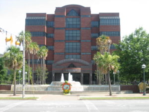
Albany, Georgia
What do I always say about spring and fall? The systems are bigger and badder, thanks to the clash of air masses, and the system that brought tornadoes to Austin and New Orleans, and continues to bring rain to the east coast, will linger on the Eastern Seaboard as we depart tomorrow, thanks to a deep occlusion and the whole beast just spinning itself over the Great Lakes. Our drive through Georgia and Tennessee will be just fine, but don’t be surprised to see clouds ahead of us when we reach Horse Cave, Kentucky. Lingering light precipitation isn’t moving too quickly thanks to the bogged down system. Horse Cave is near Mammoth Cave, so get away from all the weather worries and just go underground!
DAY TWO (Saturday) Guidance suggests a lot more movement as the weekend approaches, but I’m not as optimistic. I don’t think it is going to be fully cleared out, say north from Indianapolis, as the models project. It will be chilly and cloudy, with lingering moisture. I would, therefore, anticipate a wet snowflake to fall at any moment as we trudge through Chicago and on north into Milwaukee. Everything slows traffic in Chi-town, but this should be a mild dose of it. Even if it takes a while for this precipitation to shove off, Sunday in Milwaukee should start to look like spring.
Spring break! Georgia has some great vacation destinations, though I’m not entirely sure that Albany is a site many are thinking of. Our drive for this trek will take three days, with the final day a bit shorter. We’ll cover 543 miles at a day at a pace just shy of 68mph, ultimately traveling 1553 miles on our journey. It’s been active in the southeastern US. Will that continue?
DAY ONE (Sunday)
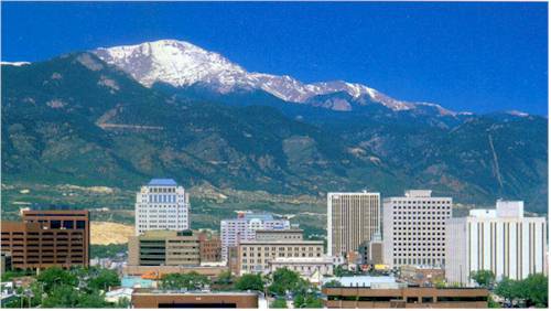
Colorado Springs, Colorado
As I noted, there have been a parade of strong systems moving through the Eastern US of late, and the most recent has just brought snow to the eastern Great Lakes and interior New England, with severe storms along the coastal Carolinas. Behind those features, high pressure has been returning to the Plains and Mississippi Valley. It’s been a chilly start to March, but warm air will start building north on Sunday in western Kansas. It won’t be warm, but it will be warmer as we end the day in Lawrence, Kansas.
DAY TWO (Monday) The next ripple will arrive in the Plains by the beginning of the week, but will initialize with a bit less vitriol than our most recent system. It will get there, but it won’t bother us too much on Monday. Guidance hints at some very scattered showers in Missouri, but they won’t be heavy enough to be a problem in the unfortunate event we pass through one. That threat should abate as soon as we cross into Illinois. Expect mostly cloudy skies with temperatures approaching seasonable in western Kentucky. We will finish the day just across the border in Clarksville, Tennessee.
DAY THREE (Tuesday) A much more focused wave will develop over the lower Mississippi Valley on Tuesday, and will quickly start moving towards our route. Light precipitation will start on the north end of the Atlanta metro. I feel like we should be dry in the high country, so we can save the fun for the chaos of Atlanta traffic. The real show comes around Macon, when thunderstorm activity will become more widespread and intense. Severe weather, including hail and tornadoes, isn’t out of the question. That will probably be the scene in around Albany when we arrive. Get indoors quickly!