Country blasted by winter weather

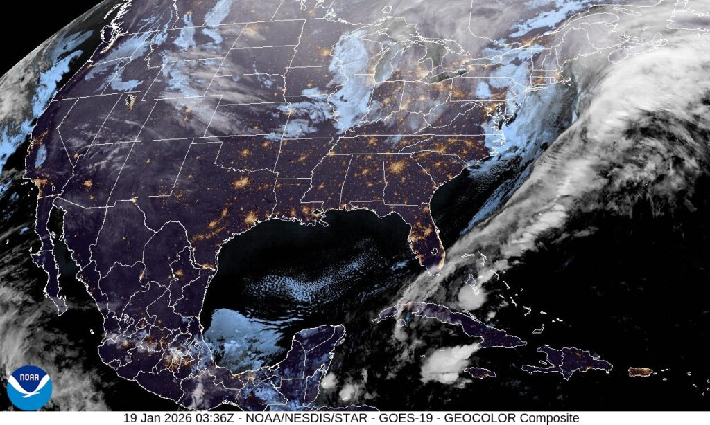
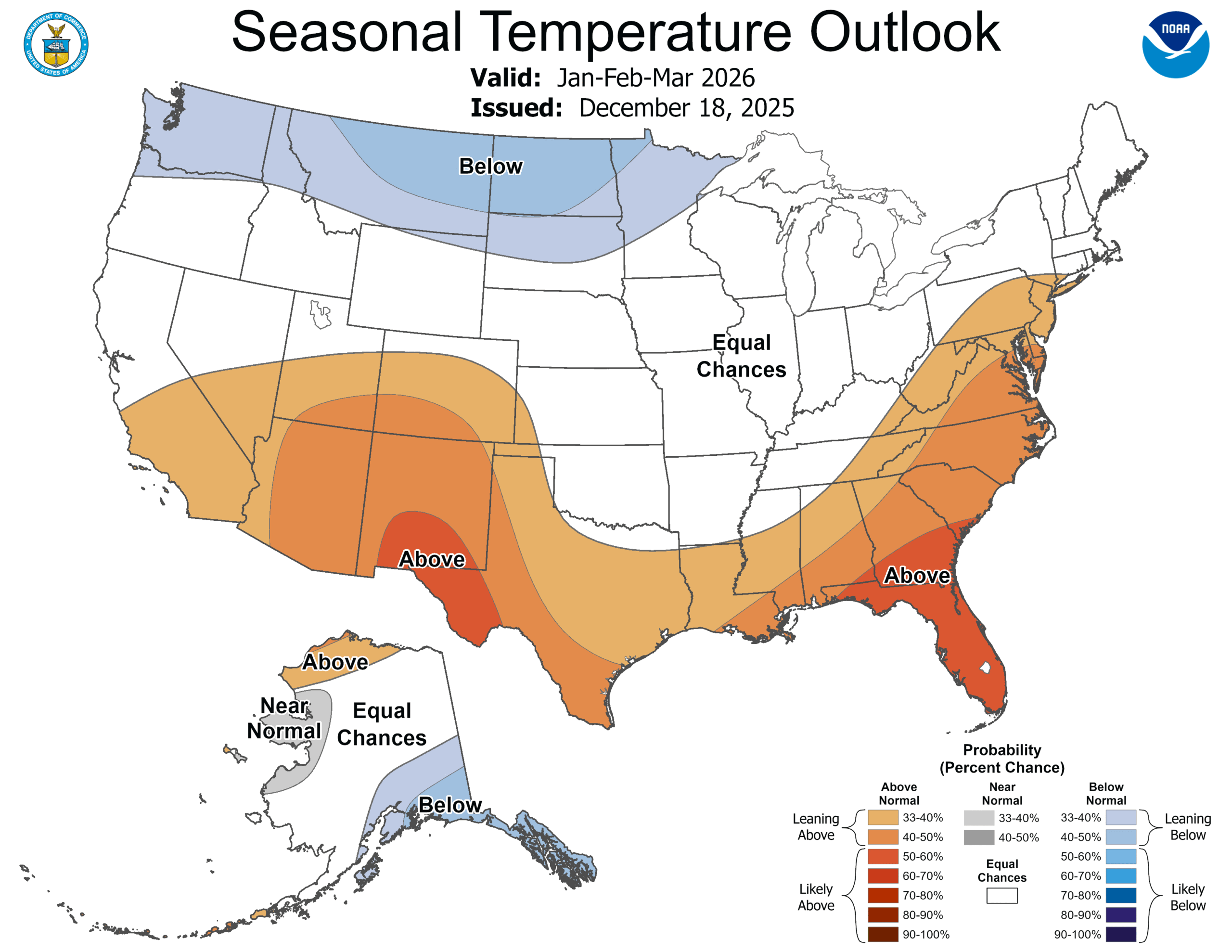
This weekend saw much of the country paralyzed, with millions losing power, thousands of flights canceled, and recovery an ongoing battle. The snow is still actively falling in parts of New England, but the thaw is not ready to move in yet. Everything that was frozen this weekend remains so.

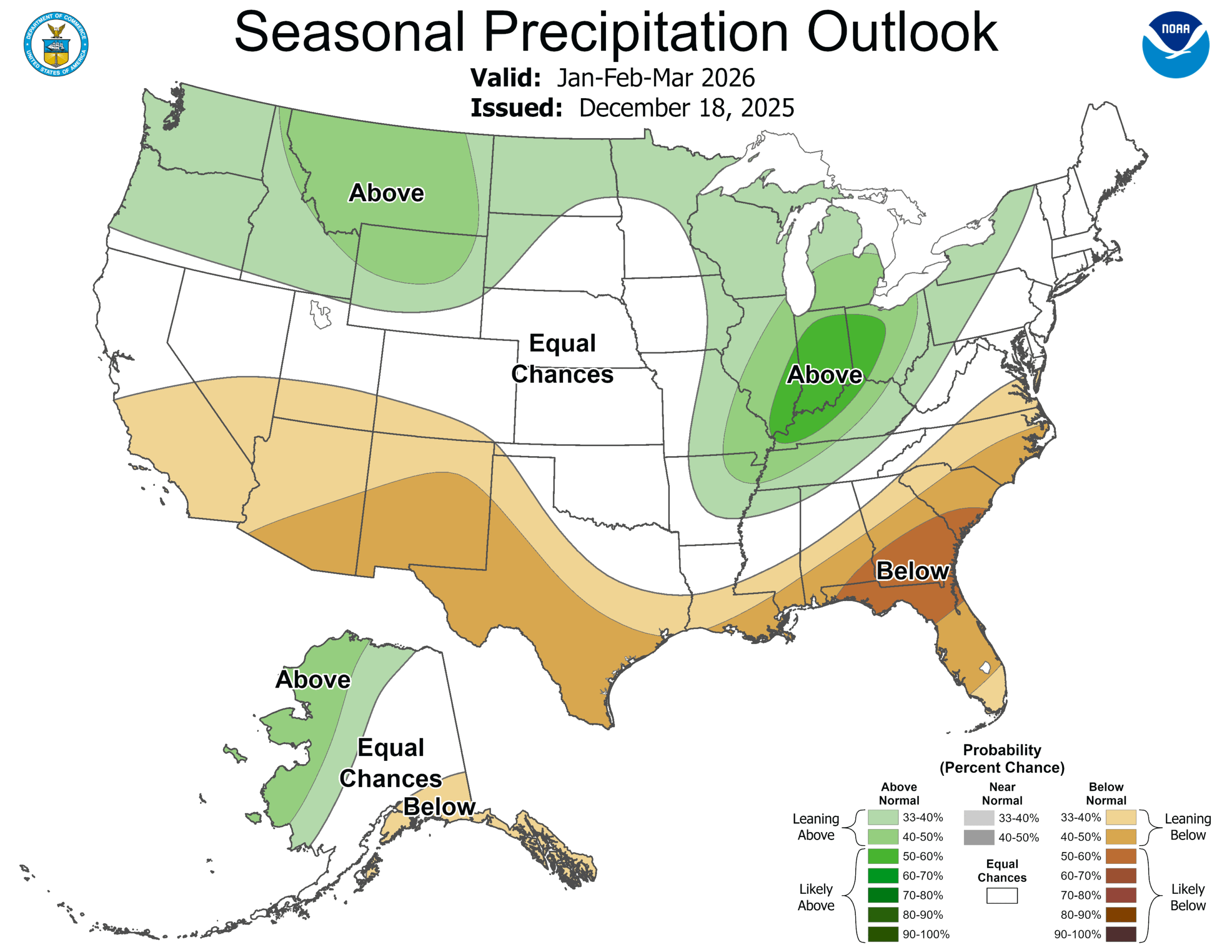
A deep and strong trough has been ebbing and flowing across the eastern two thirds of the country for a couple of weeks now, and at long last, the surae organization matched with what was going on aloft. Low pressure developed in the Southern Plains and was able to tap into Gulf moisture, while at the same time drawing very cold air from the Canadian Prairies.

As we saw with our forecasts in Florence and Rome, several days before the storm set in, there was already cold air in place. The storm, therefore, wasn’t necessarily marked by the great conflict of air masses, but rather the incredible amount of moisture that was able to blanket the country.

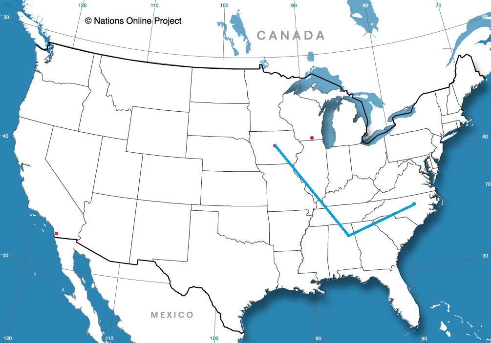
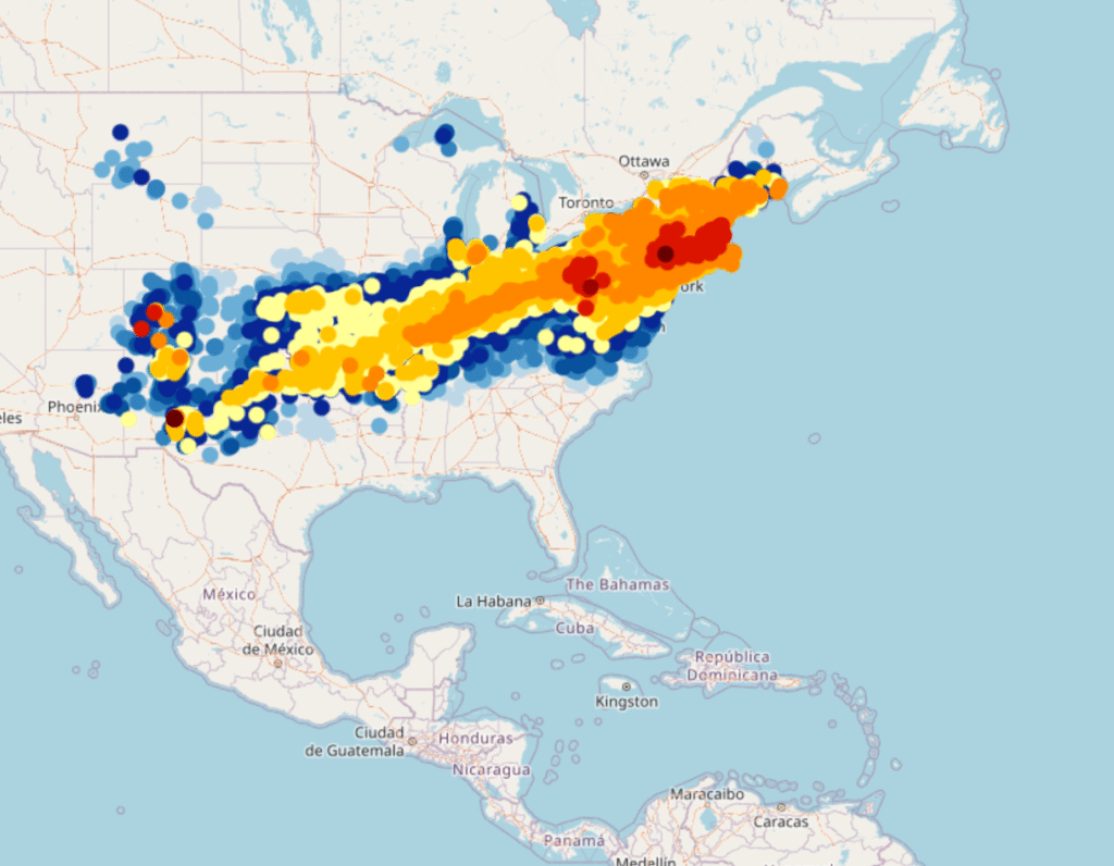
The area covered by freshly fallen snow, mapped below with the heaviest totals coming from western Pennsylvania to Massachusetts, is an elongated southwest to northeast line, starting in southern New Mexico and running to New England. It tells the story of the track of the storm, starting in the southern Plains and ending up in the Canadian Maritimes. A “Texas Hooker” to be sure. Snow was measured over two feet in some of the terrain in Pennsylvania, and well over a foot throughout Massachusetts.

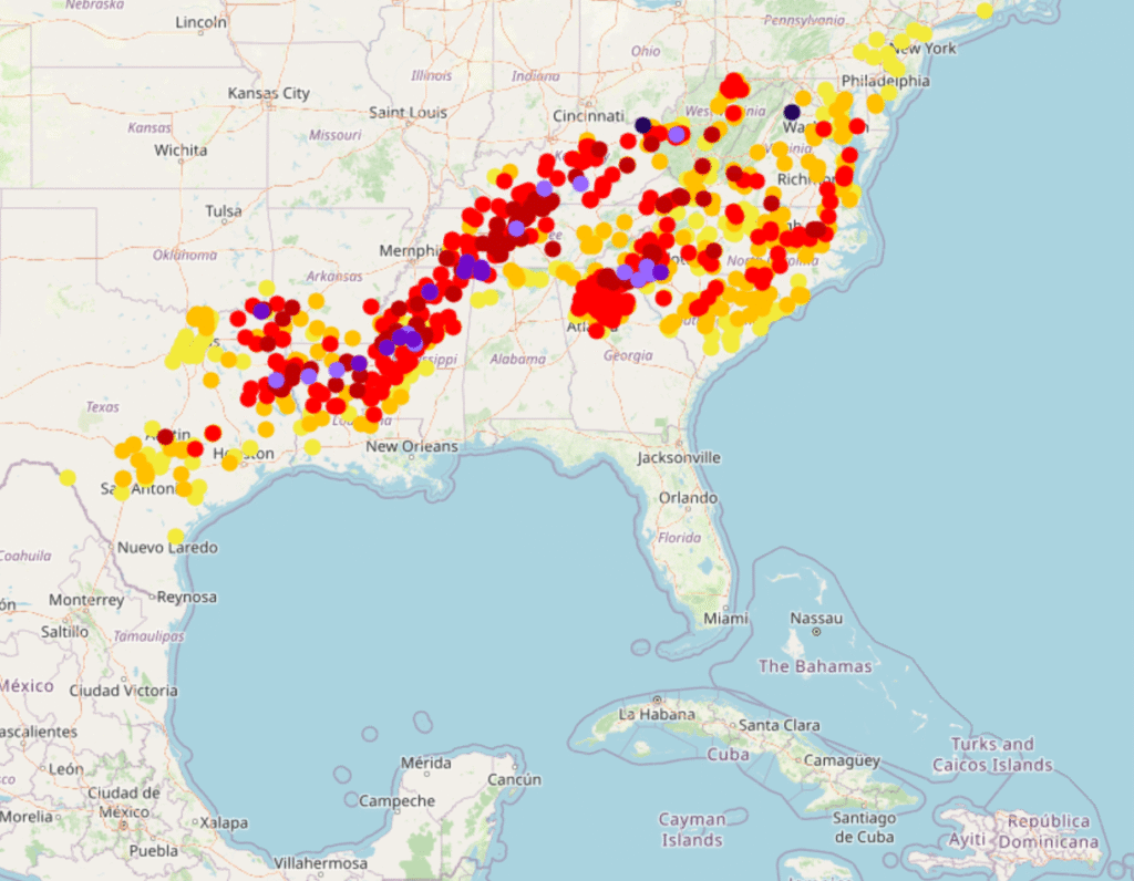
A broad area of accumulated ice, pictured below, is found on the southern fringes of this vast area of snow. This is where the most significant damage you have head about is showing up, from northern Mississippi, to Nashville and on to the Carolina Plains. I saw reports of up to 3″ of accumulated ice, which is devastating. Many places saw an inch, which is debilitating in itself.

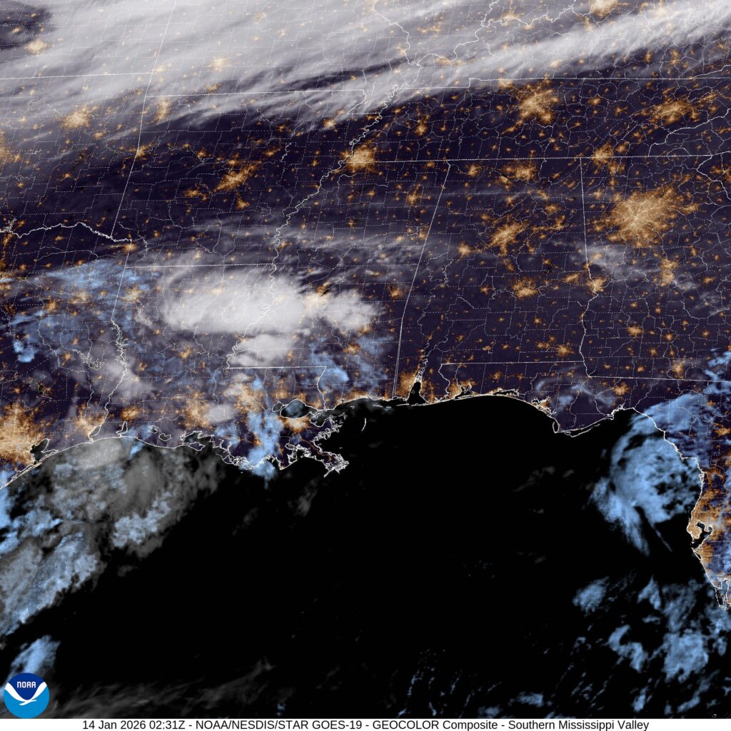
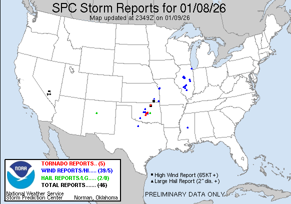
The map of this storm tells us that much of the destruction was done by a stationary front, which became a weak, meandering warm front. The cold front associated with this rotating area of low pressure had little to do with what the storm wrought. There were several severe thunderstorm reports around the Florida Panhandle, but for all intents and purposes, this was purely a winter storm.

The cold air has of course eventually found it’s way in, and is keeping all these people buried under snow and ice in a deep freeze. For this particular occasion, the cold front has worked to exasperate an existing problem, rather than being the progenitor of the problems. Cold fronts generally have it easier when they want to raise a ruckus, and are pretty expert at it in the summer and spring, when they have warm air to work with. It takes a special blend of cool temperatures, and the right oscillating warm front to cause the havoc that this weekend’s storm did.

The first wintry of blasts

The weather has been so bad that even in this of all weeks, it has broken through as a major headline in many markets. A week and a half ago, we looked at Florence, Alabama, which was preparing for a cold front that would ultimately be a pittance to what was received this weekend. There was a quick shot of rain on the 14th, after which temperatures started dropping, though not nearly as quickly as some believed. It only got down to 35 before the 15th rolled around The sun was out for Florence, but it wasn’t working, and the high never cleared 40. It was a good forecast over all, with The Weather Channel earning the top spot.
Actuals: January 14th, .08″ of rain, High 50, Low 35
January 15th, High 39, Low 23

Grade: B

Coming Soon…

We are looking ahead to a week that could bring the storm of the winter. The hallmark of a “storm of the year” is that it brings conditions that are extreme for the given area that those conditions arrive, and that means we are looking at snow, ice and cold in the south, stretching from Texas to the Carolinas. We will talk about it this week, as well as these specific forecasts.

Road Trip from Raleigh, North Carolina to Gadsden, Alabama

Ames, Iowa
Road Trip from Gadsden to Ames

Janesville, Wisconsin

San Diego, California

Rome, Georgia to Pittsburgh, Pennsylvania

It’s a January road trip through Appalachia. Perhaps not as beautiful as the summer or fall, and maybe even a bit more treacherous, but… .well, I guess I’m not doing a good job of selling this trip. It will take us one long day to cover the 664 miles at a pace of 64.7mph.

Rome, Georgia
By Thomson200 – Own work, CC0, https://commons.wikimedia.org/w/index.php?curid=63993488

There is a weak little wave moving into the Great Lakes, dangling a fairly inefficient cold front through the Mississippi Valley tonight, which is going to be arriving in the Appalachians tomorrow. The precipitation will be more likely on the western faces of the terrain, and for our drive from Rome to about Beckley, West Virginia, when the chance for snow will filter back in. The snow will persist through the Mountaineer State, and as we arrive in Pittsburgh – yep, snow there too. It won’t be Lake enhanced, and it is going to be very cold, so just expect some fluff.

Pittsburgh, Pennsylvania

Rome, Georgia

We are sadly only going to be spending our time in Rome, Georgia, and not Rome, Italy. It would be a bit warmer in Italy.

At 1053PM, ET, Rome was reporting an unusually brisk 28 degrees with clear skies. Throughout the region, skies were clear and temperatures were below freezing as a jet trough dove deep into the Southeast. An occluded area of low pressure sat over the Great Lakes, with a cold front emanating from a secondary (but as is usually the case, stronger) area of low pressure off the southeast coast of Nova Scotia dangled a surface cold front that had already cleared the Florida Peninsula. There were frost and freeze warnings as far south as Orlando.
The upper level structure that is bringing the cold air to the southeast looks to be pretty entrenched, and a surface area of high pressure is unlikely to move. Calm winds and clear nights suggest that frost is something that residents of Rome should get accustomed to for the next couple of days, at least.
Tomorrow – Sunny, High 47, Low 25
Tuesday – Sunny, High 45, Low 21

TWC: Tomorrow – Sunny. High 50, Low 26
Tuesday – Sunny.  High 47, Low 22

AW: Tomorrow – Sunny High 50, Low 26
Tuesday – Plenty of sunshine High 46, Low 22

NWS: Tomorrow – Sunny, High 46, Low 25
Tuesday – Sunny, High 43, Low 20

WB: Tomorrow – Sunny, High 43, Low 28
Tuesday – Sunny, High 42, Low 25

WN: Tomorrow – Sunny, High 46, Low 25
Tuesday – Mostly sunny, High 43, Low 20

CLI: Tomorrow – Clear, High 47, Low 25
Tuesday – Sunny, High 46, Low 21

This is dangerously cold for this part of the world, where heating systems aren’t as robust as they are further to the north. Brr! At least the sun will be out in the day time, right?

Florence, Alabama

We are going to northern Alabama on this fine Tuesday evening. It’s pretty quiet out there at this moment, but this time of year, if anywhere is going to see interesting weather, Florence would be a good bet.

At 753PM, CT, Florence was reporting a temperature of 49 degrees with clear skies. Despite the clear skies, the region was active. A cold front was digging into central Missouri, and ahead of the boundary, there was a bit of convection showing on satellite in the Lower Mississippi Valley. The boundary was associated with a deep digging trough, and is going to move quickly. Moisture from the Gulf and the boundary itself will arrive in Florence by lunch time tomorrow.
Tomorrow afternoon will be rainy, with a bit of thunder at the outset. Cold air will follow close behind, but not near enough to allow for any flurries in Florence. The cold air will settle in through Thursday, however, leading to some uncharacteristically brisk conditions.
Tomorrow – A little bit of thunder in the late morning, then showers through the afternoon, Getting colder, High 48, Low 28
Thursday – Partly cloudy, chilly, High 39, Low 23

TWC: Tomorrow – Rain early…then remaining cloudy with showers in the afternoon. High 49, Low 34
Thursday – A mainly sunny sky. Colder. High 39, Low 23

AW: Tomorrow – Cloudy and cooler with a touch of rain High 48, Low 32
Thursday – Mostly sunny and cold High 39, Low 22

NWS: Tomorrow – Showers, mainly between 9am and 1pm. High near 49. West southwest wind 5 to 10 mph becoming north northwest in the afternoon. High 49, Low 31
Thursday – Sunny, High 38, Low 22

WB: Tomorrow – Showers, High 49, Low 30
Thursday – Cooler sunny. High 36, Low 22

WN: Tomorrow – Mostly cloudy with light showers, High 49, Low 30
Thursday – Sunny, High 38, Low 22

CLI: Tomorrow – Rain Showers, High 50, Low 30
Thursday – Sunny, High 38, Low 23

This is a day that isn’t particularly chilly for the part of the country I’m in, but in Alabama, this is a winter parka scenario. Take a look at the satellite, with the cold front to the north, and moisture arising from the south.

Snowy times ahead?

For the first time in years, California is not beset by a drought. The primary areas in which drought is ongoing this year are further inland. It’s pretty dry nearly everywhere EXCEPT California, which makes for an interesting change of pace.

In the winter, that means that snow is in a deficit. The way to build that snow pack back up is A) through precipitation, and B) through temperatures remaining cold enough for the snow to generate. For one part of the country, at least, there appear to be the correct ingredients, and it may slake the thirst, at least for a corner of the country. Lets look at the CPC outlooks for both temperature and precipitation.

It looks to me like nearly everyone that expects snow this time of year is going to be in for a healthy dose through March. In particular, the northern Rockies will get to combine below normal temperatures and above normal moisture. Montana ski season is on, baby!

Also of note is the bullseye of above normal precipitation for Indiana. This region is one of the driest in the country right now, and a good drink through spring will do wonders. This part of the world is also cold enough to see snow in the winter, and with the forecast for near normal temperatures, they could certainly see some of this precipitation as a healthy dump of snow.

If you are one of the people that likes snow, then you probably do live in this snow zone, which means the forecast is good news. The snow is coming, just hold on.

We do have severe weather in 2026

We made it a full week before we had a severe weather day here in the US, but our luck has run out. An area of low pressure moving through the Plains started generating severe weather, with a smattering of severe thunderstorm reports and a couple tornados in Oklahoma, including one that hit a farm in Purcell.

You’ll also note several severe storm reports in Illinois on Thursday. These were associated with the tail of a cold front tied to a deep area of low pressure moving earlier today through Labrador. The tail of that front also led to several wind storm reports today south of Rochester, New York.

The real show is in the Lower Mississippi Valley. Low pressure dissipated after yesterday’s storms, but reconstituted over southern Arkansas late in the day. This redeveloped area is tapping into quite a bit of moisture, but also quite a bit of instability, and even now, there are tornado warnings and a tornado watch for northern Louisiana and southern Mississippi. These storms are rolling through overnight, which makes it a particularly treacherous scenario.

Fortunately, the system is moving quickly, which will allow it to occlude very quickly, and sap energy from the system. There is going to be a little bit of a carry over into tomorrow, particularly in the morning in areas like central Alabama, but the threat, fortunately, is going to be short lived. With a pattern as active and fast moving as it is, don’t be surprised for more quick hitter storms like this over the next couple of weeks.

A crisp start to the new year

Our first forecast of the year took us to Atlantic City, which was bracketed by waves to the north and south. They pushed each other away, which kept Atlantic City dry. That’s great news for New Jerseyans, but also the people who enjoy accurate forecasts. Temperatures were pretty reliable, including the bump in temperature on Sunday as low pressure scooted through western Atlantic. The first forecast of the year was a shared victory for The Weather Channel and National Weather Service.
Actuals: Saturday – High 33, Low 19
Sunday – High 38, Low 26

Grade – B – Just a reminder, this year our grade now represents the consensus score for all forecasters. A b for the group is pretty good!