This month is undoubtedly one that is going to change the country, and probably the world. The fires in Los Angeles are deeply effecting one of the planet’s cultural anchor cities, and one has to believe that this will affect the art and artists for some time. Maybe forever. And we aren’t even half done with this month.
Chattanooga, Tennessee
Holland, Michigan
New Orleans, Louisiana
Road Trip from New Orleans to Brunswick, Georgia
Colorado Springs, Colorado Road Trip from Brunswick to Colorado Springs
The current windchill is in the 40’s all the way down to north Florida and the Texas Gulf Coast. And those figures are 80 degrees warmer than what Minot, North Dakota is seeing tonight. This chilly intrusion is illustrated by a very strong jet streak in the southeastern US and a trough angled from the Great Lakes to the southwest.
The jet underscores the cold air, and the angle of the trough is keeping the pattern in place. Persistence often leads to problems, as whatever conditions are held in place can wear down infrastructure. The precipitation associated with this storm is off shore, so flooding is not a concern. The growing cold will continue to be a concern for the next couple of days.
The real problem, of course, is that it is holding a dry, windy pattern over southern California. A lot of us in the Midwest are hoping for a warm up. Californians may not know it, but they will too. Recovery may not really start until that big trough clears out and the pattern changes. Right now, that looks like Wednesday. Hang in there.
12:39 AM – Really, the only weather show in town right now is out on southern California. Fire fighting efforts are ongoing, but also, fire prevention efforts are underway, anticipating winds to return to start the week for a spell.
Aside from the wind, the big story I guess is the cold in the north central US and I don’t know, rip currents in Guam?
8:56PM – This satellite doesn’t capture the smoke in southern California, but it shows how far off the coast any clouds are. There is no marine layer because the Santa Anas are howling so hard. No marine layer also means no local moisture.
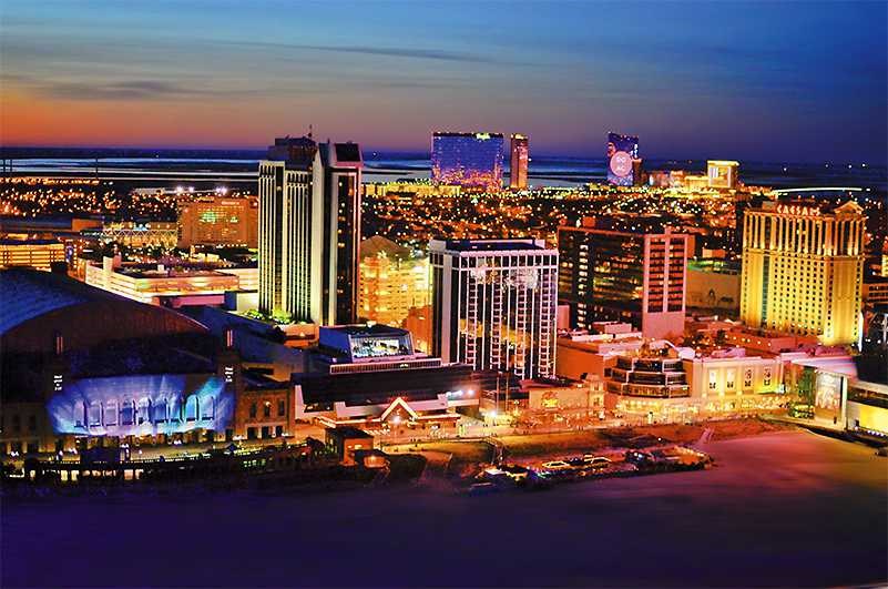
Fires in the Los Angeles area have made headlines this week, for being the most destructive in the history of the city, for afflicting so many familiar faces, and for sweeping through the area in January, when we should just be reaching the height of the wet season in California.
I don’t discuss climate change much here, because I like to distinctly separate climate from meteorology. To that end, it is important to distinguish that climate change did not cause this tragedy, but rather created an environment in which such a tragedy might occur. The long term effects of climate change are best left to discussion by climatologists, and those knowledgeable of the systems climate change will impact. While climate change did not necessarily cause the fires, as I said, the weather of the last year set the stage for the disaster, and the weather of the last couple of days may have caused the fires, and certainly made them exponentially worse. Don’t take my lack of discussion on the climate as any sort of commentary on anything other than – I am a meteorologist, and I am not an authoritative source on climatology. I can tell you all about the local, short term weather that made these fires what they are.
The first thing that you need to make a fire is the fuel for the fire. After years of drought, last winter was a wet one in California. A thirsty terrain was given a healthy drink of water at the beginning of 2024, and plant life that had been scoured through years of fire and drought came back and was replenished. And then, after the wet winter and early spring, it stopped raining, and it got dry again in southern California.
More recently, high pressure has settled into the southern Rockies behind a strong trough bringing the cold air and snow in the southeastern US. The flow around high pressure is clockwise, and positioned where it is, it will be off shore in southern California, meaning that it is dry. Additionally, because he high pressure was strong, and gravity and temperature changes between the sea and land played a bit of a role, the winds this session were absolutely howling over the Santa Ana Mountains. The wind was strong enough to cause damage on it’s own, including to power lines.
Most wildfires, especially in southern California, are of human origin, either because of the intentional setting of them, or more likely in this case, because of downed power lines, which is why power companies out west are sued so regularly. The downing of these power lines is also a problem, because power lines are near people. With a swelling population, there are more power lines and a greater exposure to a fire. Additionally, fires are now more likely to start near inhabited areas, simply because of the infrastructure covering more territory.
There isn’t any rain in the near future for southern California, however there is some hope in the form of reduced winds. High pressure does look like it will be tapering off early next week. As the fires are currently uncontrolled they will likely get worse before they get better first.
This is it, friends, the first individual forecast of the year. Off to the Gulf Coast, and hopefully some warm temperatures.
At 1253PM, CT, Gulfport was reporting a temperature of 48 degrees with clear skies. This will not last, however. Scattered showers are moving through Louisiana, the vanguard of a system developing off the Texas coast near Corpus Christi. A sharp upper level trough is going to aid the development of this feature, which will temporarily slow it down, but will ultimately give the storm a bit of a jolt. Fortunately, Gulfport looks to be far enough south to evade the snow and ice this storm will bring, but still chilly enough to avoid severe weather. Warm air will lift north at the leading edge of the system, and the onshore flow will almost certainly led to a stray shower overnight in Gulfport. The heavy rain associated with the core of the area of low pressure will arrive in Gulfport around mid-morning, and may feature a thunderstorm or two. By the time it passes southern Mississippi, the feature will have some momentum, and will make a hard charge through th region, exiting later in the evening on Friday, and leading to an even cooler Saturday. Fortunately, with a little bit of sunshine, Gulfport should bounce back to something closer to comfortable. Tomorrow – Rain, heavy at times with some thunder in the morning. Wrapping up in the evening, getting chilly late, High 60, Low 40 Saturday – Increasing sun, cooler, High 51, Low 37
TWC: Tomorrow – Windy with a steady rain in the morning. Showers continuing in the afternoon. Potential for heavy rainfall. High 57, low 41 Saturday – Intervals of clouds and sunshine. High 51, low 35
AW: Tomorrow – Turning colder in the morning; windy with rain High 58, Low 43 Saturday – Partial sunshine, High 52, Low 36
NWS: Tomorrow – Showers High 62, low 40 Saturday – Partly sunny High 48, Low 35
WB: Tomorrow – Showers, mainly in the morning. Locally heavy rainfall possible in the morning. High 55, Low 38 Saturday – Mostly cloudy in the morning, then becoming mostly sunny, High 50, Low 36
WN: Tomorrow – Mostly cloudy with showers, High 61, Low 39 Saturday – Partly cloudy, High 46, low 36
CLI: Tomorrow – Rain Showers, High 61, Low 44 Saturday – Sunny, High 51, Low 36
Believe it or not, not all of our forecasters put Tomorrow’s low at midnight headed into Friday. Temperatures should plateau there for a bit, and perhaps not necessarily any cooler than they will be tomorrow morning, ahead of the surge of warmer air before the rain. Did someone say rain? Here is some rain arriving in Louisiana.
Wow, what a short trip! We are going from New Jersey to northern California, on a journey that is 2 full days shorter than the last one. We will cover 2,946 miles over 5 1/2 days at a pace of about 67 miles an hour, or 535.6 miles a day. Really, this is going to be a piece of cake, gang.
DAY ONE (Wednesday)
Atlantic City, New Jersey
Driving from Atlantic City to Santa Rosa is a job that seems like it should be done in a convertible. Probably yellow. All to say that a winters drive along this route seems cruel. It’s going to start very chilly as we depart from the Jersey Shore and cut through Pennsylvania. The major storm now on its way out of town is bringing strong northerly winds to the eastern Great Lakes. That is typically a good recipe for Lake effect snows, and sure enough, we will probably encounter some bands of heavy snow around the west Cleveland suburbs to Lorain. It will lighten up, but not disappear as we head on into Sandusky.
DAY TWO (Thursday) Winds will taper off and so too will any lingering snow threat around Sandusky, giving us a clean start for the day. Still too chilly for that yellow convertable, though. We’ll head west through northern Indiana and Illinois, and will be between Cedar Rapids and Des Moines as our Thursday wraps in Brooklyn, Iowa. A weak clipper spiraling through the Upper Midwest will bring a threat for snow as we sleep.
DAY THREE (Friday) The clipper won’t do much for accumulation, and will essentially leave southern Nebraska alone. As we get going on Friday, there might be extra traffic in Des Moines, but not enough to ruin our day. The sky will be clear, but the clipper will have brought in another batch of cold air. Expect our stops to be chilly, but will start to be a bit warmer when we stop for the night in Brule, Nebraska, in the first reaches of the Panhandle.
DAY FOUR (Saturday) Another batch of disturbed weather will be arriving in the northern Rockies over the weekend. This feature is coming from the Gulf of Alaska, so will have spent a good deal of moisture before it arrives on the scene. Snow will probably still make an appearance throughout Wyoming, particularly on the western and northern faces of terrain, with plenty of clear air to appreciate as well. The mountain snow, valley dry pattern will continue into Utah, where we will stop at Emory, which lies in the Wasatch east of Salt Lake City.
DAY FIVE (Sunday) We will leave the snow behind in the Rockies, because the Great Basin is going to be quite dry, and quite sunny. It will still be brisk, but we should drive through Nevada with no weather related concerns, though obviously one may need to contend with gambling temptations. Especially after leaving Atlantic City. Our day will end in Fernley, which lies just outside of Reno.
DAY SIX (Monday) It can be dicey this time of year, passing Truckee, as you never know when you are going to get an 8 foot snow storm, but that won’t be a concern on Monday. We’ll be able to head closer to the Bay Area, and with the sun, we might be tempted to crack a window. It will be in the upper 50s or low 60s when we finally reach Santa Rosa.
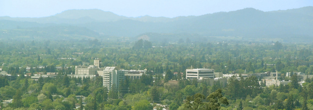
Santa Rosa, California
By JLankford – wikitravel, Public Domain, https://commons.wikimedia.org/w/index.php?curid=37654846
It’s frankly been a runaway since the summer for our top forecaster of 2024. While some outlets had very good months, and we had our wins here and there, The Weather Channel was consistent throughout the year. They had the most individual forecast wins this year, and were the top forecaster based on consistently finishing near the top of the standings, even when they weren’t the best for the day. Congratulations to The Weather Channel, and thank you all for another fun year at The Weather Blog!
Sure, you may note the extraordinary length of this trip, but I would like to note that we are driving away from a major winter storm by headed through Canada to Alaska. It will be a 3,620 mile journey, lasting 7 1/2 days. The amount of time spent rolling over 2 lane highways in Canada and Alaska will set the pace at only about 60mph, and our days will be through after about 482 miles. To the land of the Midnight Sun!
DAY ONE (Monday)
Peoria, Illinois
The toughest part of the day on Monday will be digging out of Peoria. Even that won’t be terrible, as the heaviest snow is falling south of Peoria, though that is a razor thin distance, meteorologically speaking. Peoria has about an inch at this point, and Springfield is closing in on 8. Snow or no snow on the ground now, there will be a few persistent flakes through the morning that plows will be working at scraping off the roads. The threat for fresh snow will end around Davenport, and the threat for driving through any areas that will have seen snow today will be done when we turn north at Iowa City. Unadulterated roads will be our pathway through Iowa, up to the Twin Cities. We’ll stop northwest of Minneapolis, in Albertville, Minnesota on Monday night.
DAY TWO (Tuesday) The good news, as I sort of spoiled with the intro to this post, is that we will fully be into high pressure behind the major winter storm in the middle of the country. Bad news is it will be very cold in our drive from Minnesota into North Dakota. The day will end near Minot, in the town of Burlington, where temperatures will almost certainly be subzero when we hit the road on Wednesday.
DAY THREE (Wednesday) We won’t be under high pressure on Wednesday, but I don’t think we will see any precipitation either. We’ll enter Saskatchewan, and pass Regina and Saskatoon, eventually reaching North Battleford, northwest of Saskatoon for the night. Low pressure will be skirting the southern border of the Northwest Territories on Wednesday, but it won’t be able to tap into any moisture, so all we will see is energy. It will be blustery on the Canadian prairies, but I think we will be hard pressed to find any fresh falling snow. The best chance will be a stray flurry as the night ends.
DAY FOUR (Thursday) We will travel west bound through Canada, passing Edmonton on our way to Crooked Creek, Alberta. There is a patch of civilization around Crooked Creek that will offer some places to stay and eat, surrounded by oil fields and oil workers. Low pressure is looming over the Gulf of Alaska, but the Rocky Mountains will keep us in good shape for the time being. On the lee of the Rockies, it should even be warmer than it was at our previous stops.
DAY FIVE (Friday) Don’t be surprised by a damp start to our Friday, with moisture clearing the Canadian Rockies and settling into Crooked Creek in the early hours. Snow will be a possibility for only a short while as we get moving, and head even further north into Alberta, and finally British Columbia. We’ll turn west at Fort Nelson, stopping at Summit Lake in northeastern BC. It will be clear and cold, and we still have 2 1/2 more days to go.
DAY SIX (Saturday) Low pressure and storms buffeting southwestern Alaska, sending a cold front into the Panhandle will not bother us at all on Saturday, as we trek through northern British Columbia and southern Yukon. Our route closes at night, so it is key to make this drive during the day time hours. We’ll pull into Canyon City, just before Whitehorse, and call it a night. Maybe the Northern Lights will be out.
DAY SEVEN (Sunday) Back in the USA! We’ll cross into Alaska shortly after midday, and will continue to be grateful the roadways mostly hug the valleys, because precipitation will first and foremost be on the coast, thanks to low pressure over the Alaska Peninsula, but also in the high terrain, where snow will fall on the peaks of Denali. We will stay dry, and it will be cloudy, ensuring that the already dark days will be grimmer than normal. We’ll pull in for the night near Chistochina, about an hour and a half south of Tok.
DAY EIGHT (Monday… again) A resurgent round of snow fall will slam the Alaskan shores on Monday morning, and some of that will bleed north into the valley of the Chistochina River. We will face increasing snow for the half day of driving down toward the Cook Inlet. It will be snowy and a bit blustery in Anchorage as we arrive, though that seems to be the standard this time of year. Wow, 8 days. Maybe consider flying back.
We had one last forecast in 2024 and it…. sucked. We forecast for the first two days of 2025, with a weak feature moving into town, ultimately becoming the behemoth that is going to cut a swath through middle America this weekend. It wasn’t much in days 1 and 2 of 2025 though, at least not in Logan, Utah. Flurries popped in on both Wednesday and Thursday, which weren’t nearly as much as anticipated, but the big surprise was the warm temperatures on Thursday, with highs climbing all the way up to 47. So much for the anticipated snow storm! Creating the top forecast was The Weather Channel, who wrapped up a very good year. Actuals: Wednesday – .02″ of precipitation in snow, High 33, Low 19 Thursday – .01″ of precipitation in snow, High 47, Low 30