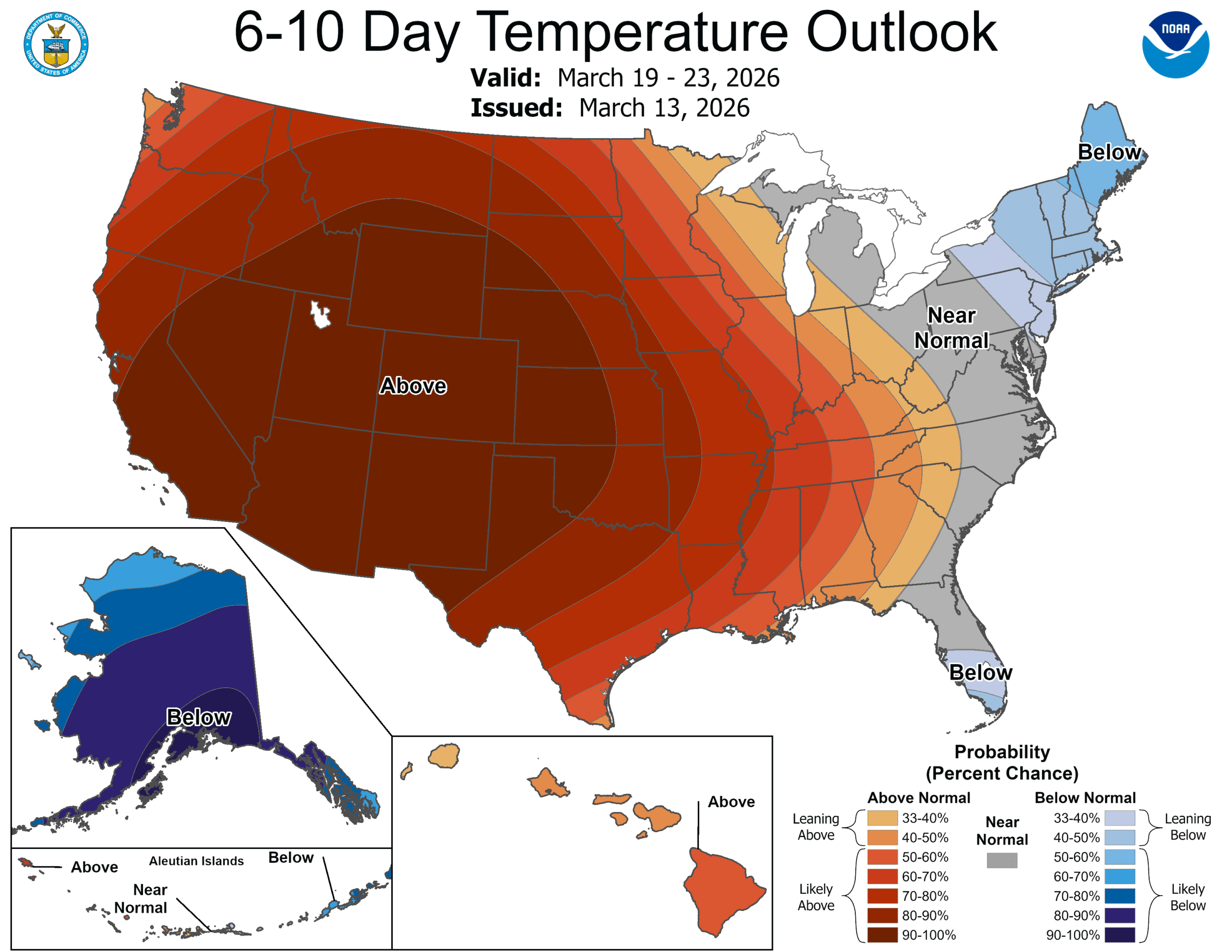
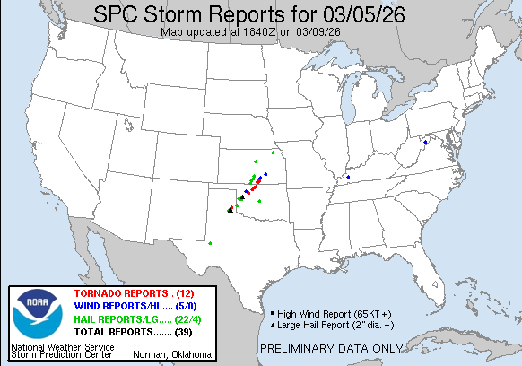
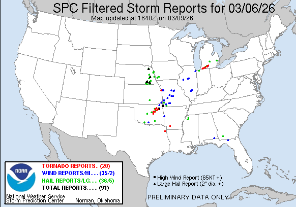
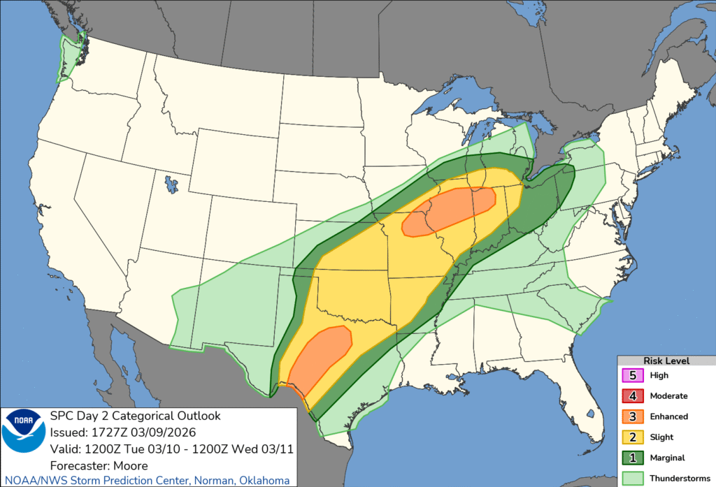
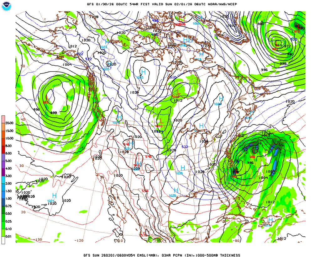
One thing that comes up every year, it seems, and one thing that I write about every single year, is the amount of variability that a single forecast can hold. If you live in the Great Lakes, it feels like there was a particularly significant tornado event, though the SPC had a Marginal Outlook that day. And it was a marginal event. There was one storm that had one track. Terribly, it tracked through three towns and caused damage and heart break and loss of life along the way.
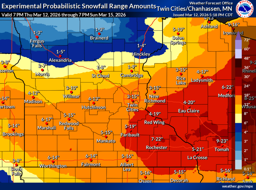
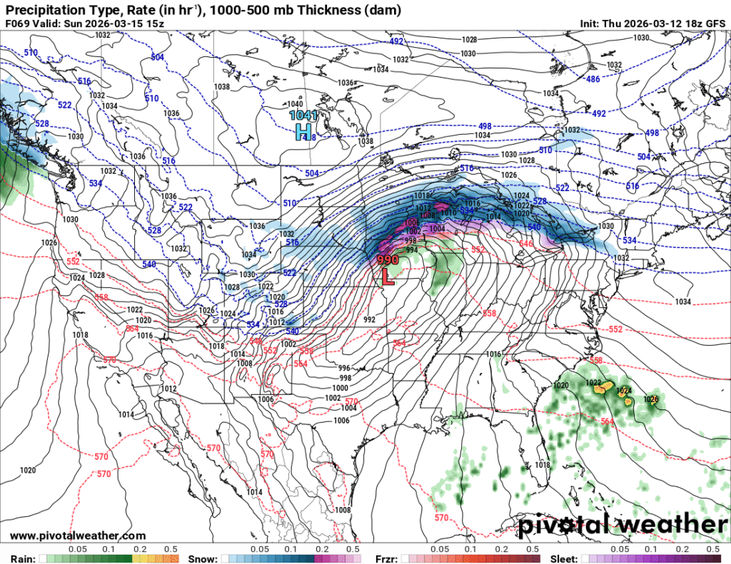
In Minneapolis, there was a significant snow storm over the weekend. There were forecasts that called for nearly two feet of snow as a possibility in the metro and throughout western Wisconsin. There were accumulations of that high degree, but they were about 30 miles southeast of Minneapolis. It was a slog, to be sure, but not the one that had been feared originally.
This time, though, I want to tie it back to a couple of other trending headlines. Artificial Intelligence and the current administration. Artificial Intelligence has been around for a while. The big change is a revolution in computational power. Meteorologists have used numerical models for decades, now, and they have been aided by computers since that time. They work by reducing the time it takes to navigate the numbers ingested into the models. Increasing compute abilities makes the models run faster, and without the same server load.
The increased ability to compute these models has allowed private enterprise, and increasingly, private citizens to develop their own models, based on smaller territories, or focused on specific metrics derived from the model guidance. There are any number of WRF models for specific locations out there now. It takes a lot less to crank one of these models out, for the same reason that AI is exploding nowadays: Faster computers.
But the problem with models is the same as it has always been. They are only as good as the data that is ingested to generate them. More or less ,this is the problem with AI and the large language models that are so popular. Real time data is collected hourly from airports and other sensor sites. Upper air data is collected in the weather balloons sent from WFO office, of which there aren’t really THAT many. And they are sent up fewer times a day. And now, actually, even fewer than before thanks to government cutbacks.
There is a larger point that could be made about AI and it’s future impact (that it’s only as good as the user and data ingested), but instead, I’ll make a point that I make annually. The forecast will always get you close to what will transpire perfectly, however there is always going to be some inaccuracy, related to the resolution of the models. It then is on us, the consumer to monitor weather that is ongoing, and to know your local geography.
Man, if I write this every year, maybe I should just ChatGPT it next year?