We made it a full week before we had a severe weather day here in the US, but our luck has run out. An area of low pressure moving through the Plains started generating severe weather, with a smattering of severe thunderstorm reports and a couple tornados in Oklahoma, including one that hit a farm in Purcell.
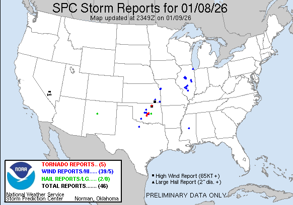
You’ll also note several severe storm reports in Illinois on Thursday. These were associated with the tail of a cold front tied to a deep area of low pressure moving earlier today through Labrador. The tail of that front also led to several wind storm reports today south of Rochester, New York.
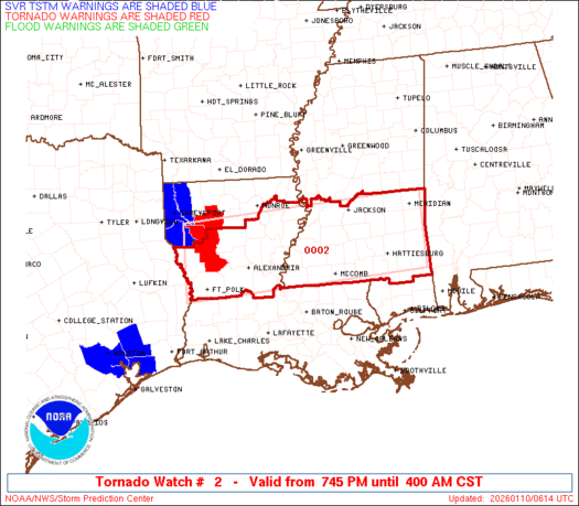
The real show is in the Lower Mississippi Valley. Low pressure dissipated after yesterday’s storms, but reconstituted over southern Arkansas late in the day. This redeveloped area is tapping into quite a bit of moisture, but also quite a bit of instability, and even now, there are tornado warnings and a tornado watch for northern Louisiana and southern Mississippi. These storms are rolling through overnight, which makes it a particularly treacherous scenario.
Fortunately, the system is moving quickly, which will allow it to occlude very quickly, and sap energy from the system. There is going to be a little bit of a carry over into tomorrow, particularly in the morning in areas like central Alabama, but the threat, fortunately, is going to be short lived. With a pattern as active and fast moving as it is, don’t be surprised for more quick hitter storms like this over the next couple of weeks.