I was more skeptical of the chances for rain in Logan earlier this week than most, because it looked like precipitation would be available for the higher terrain, and less so in the dry, urban locales of Utah. Not that I didn’t want it to rain, as this part of the world will take advantage of precipitation when they can. There was about a third of an inch on Monday, while Tuesday saw a few drips, but no actual reports of rain on Sunday. Clime had it’s second very good forecast verification in a row, earning the championship for the day. Actuals: Monday – .32″ of rain, High 51, Low 32 Tuesday – .01″ of rain reported, not measured. High 54, low 30
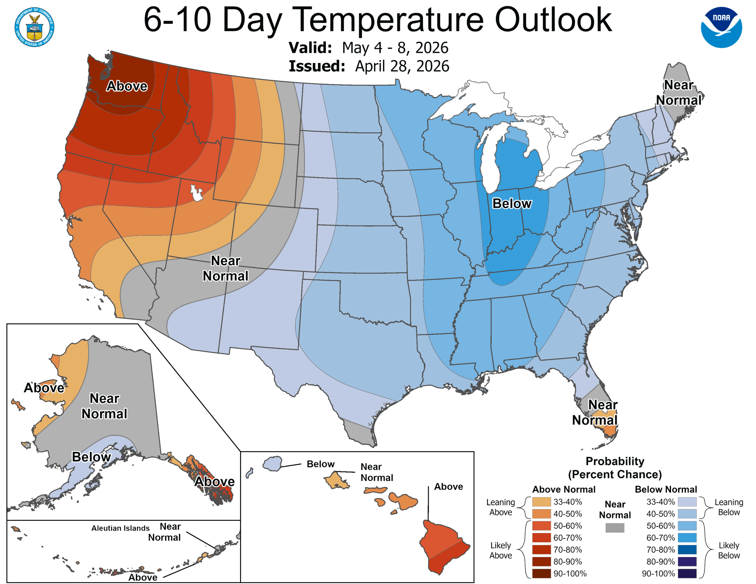
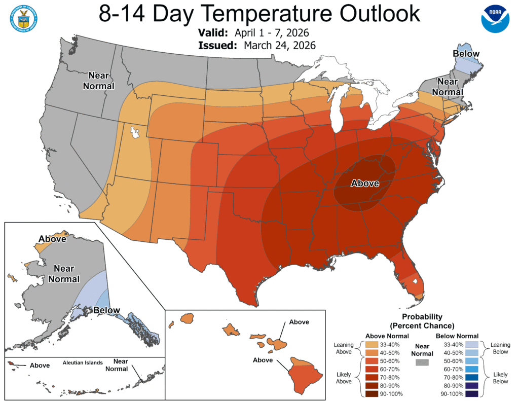
The CPC has issued their outlook, as of yesterday, for the 6-10 day, 8-14 day and 3-4 week outlooks. This is the 6-10 day outlook, but I assure you, the other two vary only slightly.
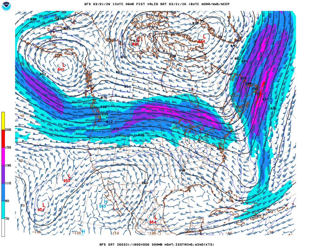
The jet flow is going to be bifurcated throughout the next couple weeks, with a strong jet running along the northern Gulf Coast. The Polar jet will be wavering along the Canadian border, often dipping into the US as a trough, ensuring some active weather, however the jet streak to the south will be an effective barrier to moisture rising into the continental US. We aren’t anticipating many soakers around the Great Lakes. This will do wonders for the drought in the southeast, though.
Even with successive waves from the northern jet, it’s really just seasonal thermal forcing that is going to break down the feature to the south and start allowing warmth and moisture back to the north. This isn’t expected to happen until around the 11th, though, which is why we have such a lengthy stretch of below normal temperatures East of the Rockies. It’s still nearly two weeks out, but the action of the northern jet by the 11th tells me that it won’t suddenly get hot in the northern tier, with ongoing showers and storms remaining likely, which will keep temperatures a little cooler if the showers are too widespread
If you are a fan of warm weather, this forecast is a bummer. If you are a storm chaser, this is also a bummer, as this should put a damper on what is historically one of the most active storm periods on the calendar. If you live on the West Coast, you can ignore everything above and enjoy the beach.
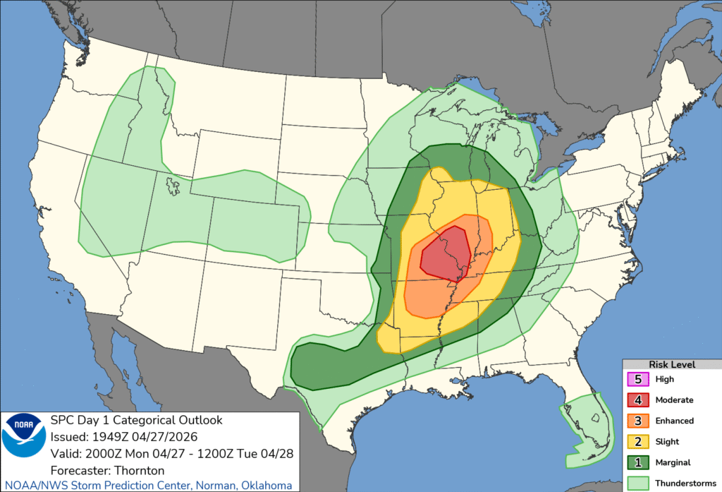
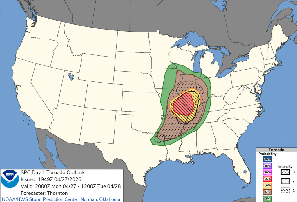
Just after sunrise on April 27th, the SPC elevated the thunderstorm forecast for southeastern Missouri to a moderate risk. A deep upper level trough was generating a strong area of low pressure in the Plains that was feasting on the chaos of colliding air masses. Cold and Canadian with tropical and maritime. The helicity in the atmosphere meant tornadoes were likely.
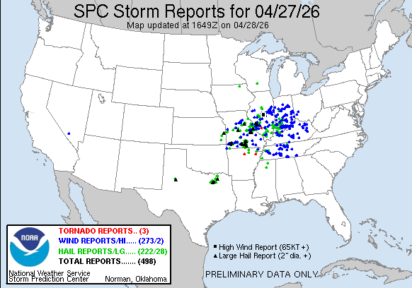
There were indeed several tornadoes from Missouri to Indiana, with a great deal of damage wrought by straight line winds. The tornadoes were embedded within a line, and at some point, it becomes a bit academic as to whether damage is caused by winds or tornadoes.
The changes to the SPC and the deeper set of information within the convective outlook are new features to the thunderstorm season. I wanted to take this specific example to look at what the SPC released, and see what factors best correlate to the outlook that is provided. First, here is the outlook, issued in the early hours on Monday.
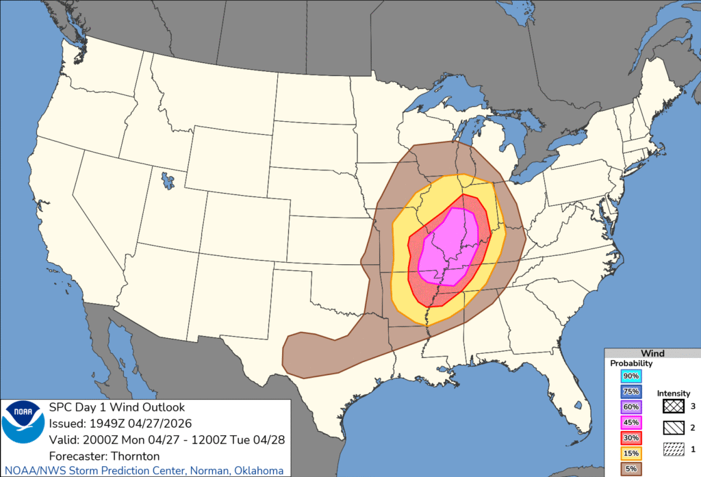
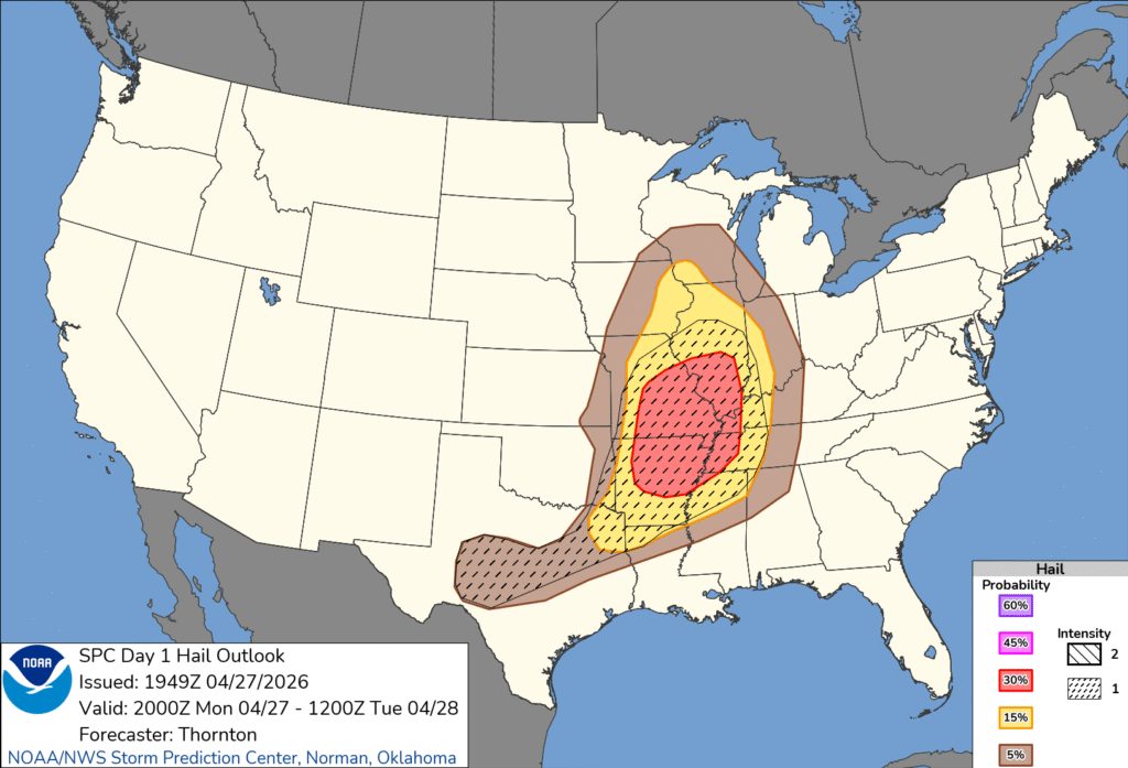
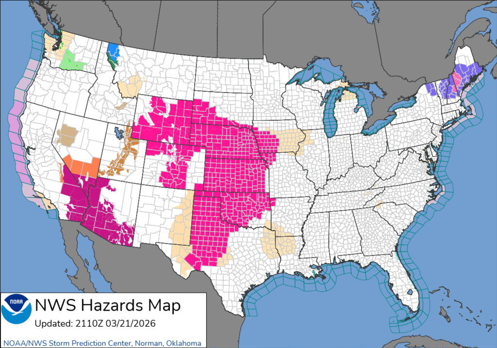
As a bit of background, the change that was recently made to the storm hazard maps added a storm intensity rubric to go along with the probability guidelines that had been a part of those maps before. Take a look at the wind and hail maps to get the idea.
So, you can see there was a high probability of strong wind, and a lower probability of hail, but the hail in the forecast was expected to be larger. We can also see that neither the high probability of severe wind, or the expectation of large hail defined the moderate outlook boundaries. That’s not particularly surprising. That the significant hail in central Texas didn’t lead to a higher outlook than a marginal risk in central Texas surprised me, though.
Moderate and high risk events generally need a threat of tornadoes, so let’s look at the tornado outlook issued at the same time as the full outlook.
The threat for strong tornadoes is only designated on the charts as 1, 2 or 3, and the probability of a tornado within 25 miles of a spot is more well defined. Perhaps it is no surprise, then, that the moderate hugs the 15% chance of a tornado risk. I’m sure it didn’t hurt the case that the forecast was a level 2 on the intensity scale, either.
For what it’s worth, here is the break down of severe reports.
March was not a busy month here at Victoria-Weather, at least on the forecast side. We had plenty of updates and weather discussions, but the forecasting was light. Therefore, it is tough to split the difference between our two top options for Forecaster of the Month: The Weather Channel and Clime.
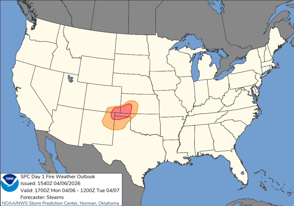
12:05AM: A full week into April now, and we are definitely in severe season. If it were a busier pattern. Instead, the concern is going to be fire in the Plains.
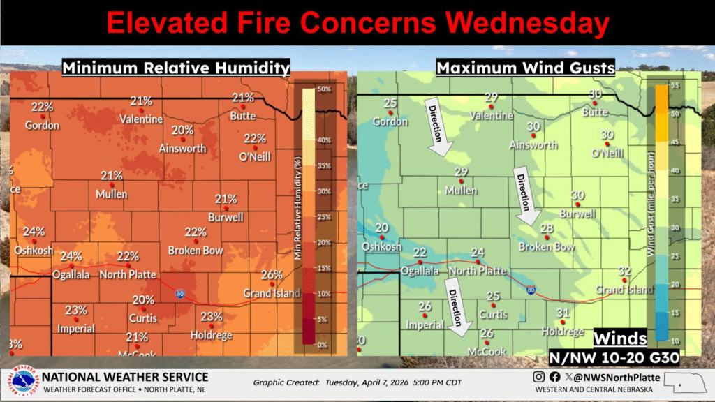
6:23PM: The concern for fire in the Plains is shifting a bit further north. Here is the outlook from NWS North Platte.
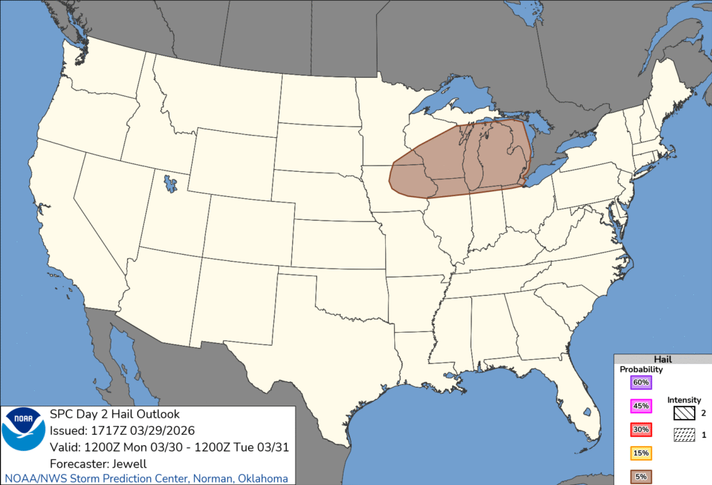
Take a look at the hail forecast from the SPC, issued for Monday. There is a swath of the Great Lakes that will see a threat for hail tomorrow.
There are two things to call out, design wise. First, perhaps most obviously, the color scale has changed to a creamier tone. The scale is distinctive, and particularly well defined on the general severe weather outlook. It’s easier on the eyes.
The other addition is in the bottom right corner. The individual hazards have always had a probability scale, but now, there is also an intensity scale for for every type of severe weather. There is no intense hail coming tomorrow, and in fact, it is just a marginal risk for severe weather overall. Better believe I’ll feature an outlook later this summer with forecasts for intense severe weather. You can look ahead though, these new maps are live already.
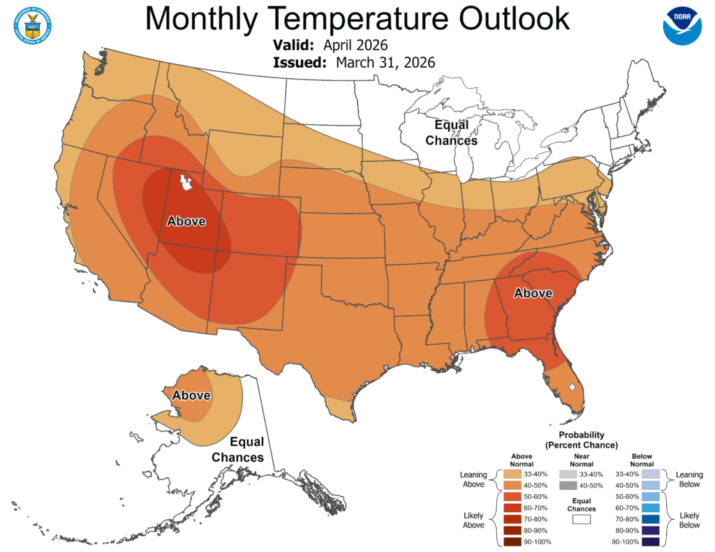
9:16AM: Good morning! We have some changes to our weather pattern. They may not be significant, but it will be for residents of the West Coast. The hot weather will continue nearly everywhere, but the Pacific Coast is going to get a reprieve, and will enjoy temperatures a little closer to normal through the beginning of April.
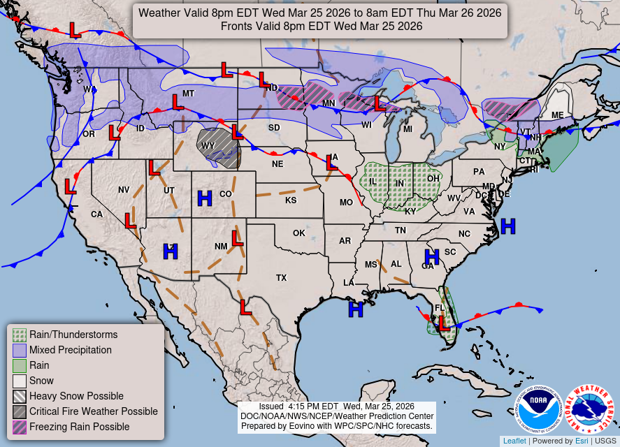
8:37PM: Just a look at the forecast map from the WPC, showing that “average” in late March can still mean “wintry”
11:28PM: I know, based on previous updates today, you might be led to believe that this is snow, but it’s rain, and it is along a cold front that will give way to chilly weather tomorrow, and eventually severe storms in the Great Lakes this week.
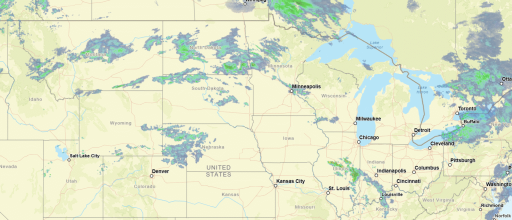
Spring officially kicked off yesterday. Spring is a season of transition, and because of that, is a season of big weather stories. Indeed, this week started with a snowstorm in the Great Lakes, and a couple of severe weather days in the Eastern US, and now the unseasonable heat is the story for everyone.
Well…. Maybe not EVERYONE. Yes, those are winter weather advisories in New England, where snow is falling, and the heat wave has not made it’s way in. That is quite the contrast. The 300mb jet seems to suggest a particular bone to pick with Maine.
While it does seem a little bit cruel to keep just one corner of the country out of the fun, it does serve as a reminder that this little breach in the jet is allowing snow making conditions into a country that is otherwise experiencing record breaking heat.
This isn’t summer time yet. Cold air is just across the border. This is why we will probably see a few more big weather days before spring gives way.
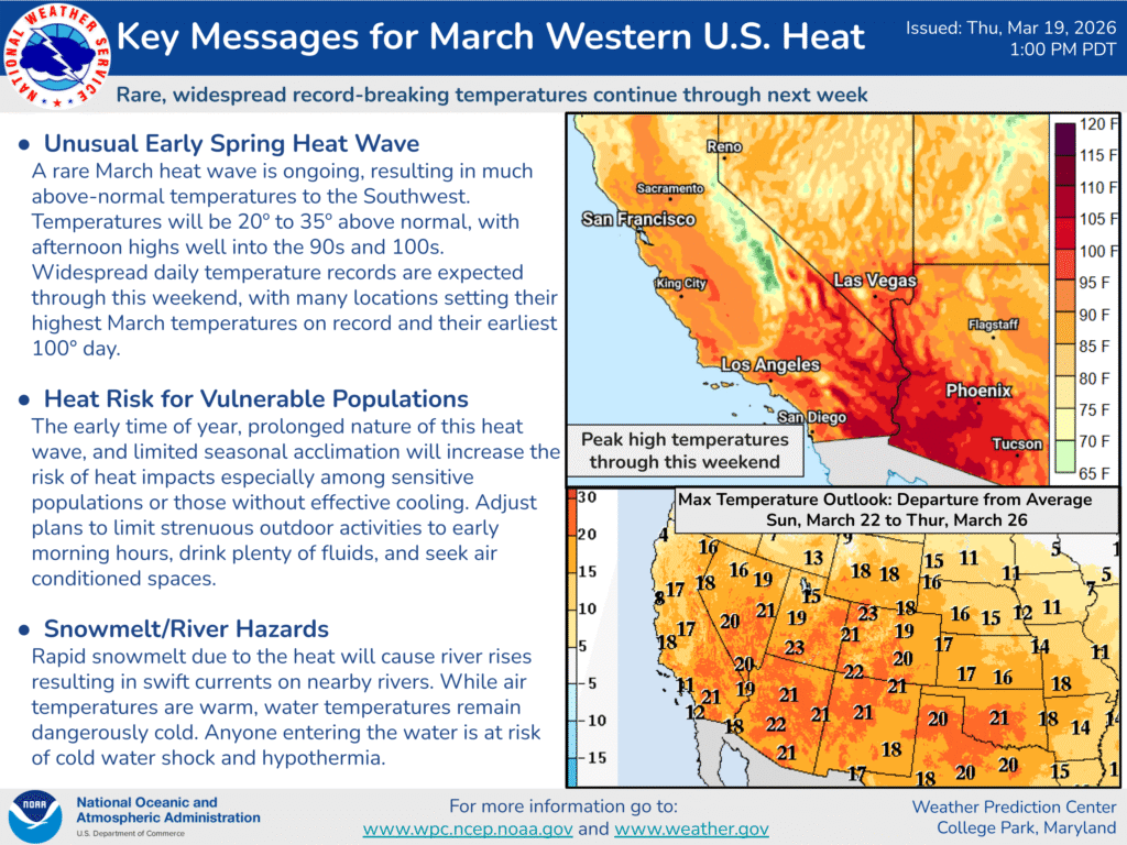
10:19PM: The heat is on, with record breaking warmth across the west. The NWS has a discussion covering this heat wave that is valid through the weekend.