There is an enhanced risk for severe weather today in Minnesota, though at present, the radar is pretty sparse, save for a few showers in northern Minnesota and the first severe storm in northwest Iowa.
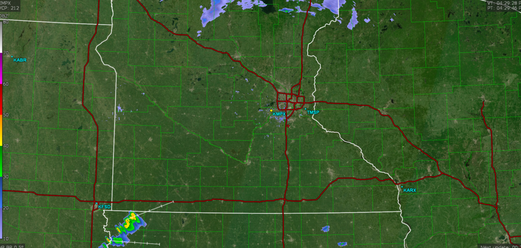
This radar imagery is from about 4:15. Here is a look at the HRRR
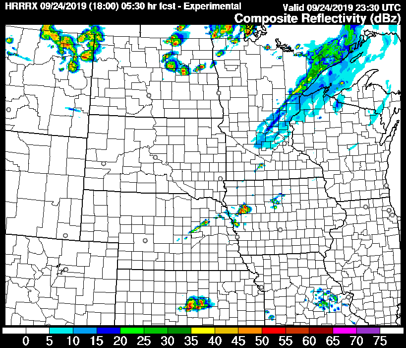
It looks as though the guidance is a little behind schedule, but the most important thing to note, will be how fast this line develops. This is the
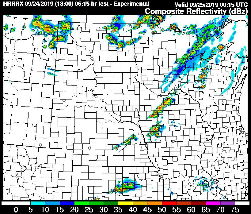
This looks like a strong line from Mankato to Storm Lake. Note the distinct blobs within the line. The threat for tornadoes and large hail is real tonight, and it is evidenced by the depiction of discrete cells within this line.
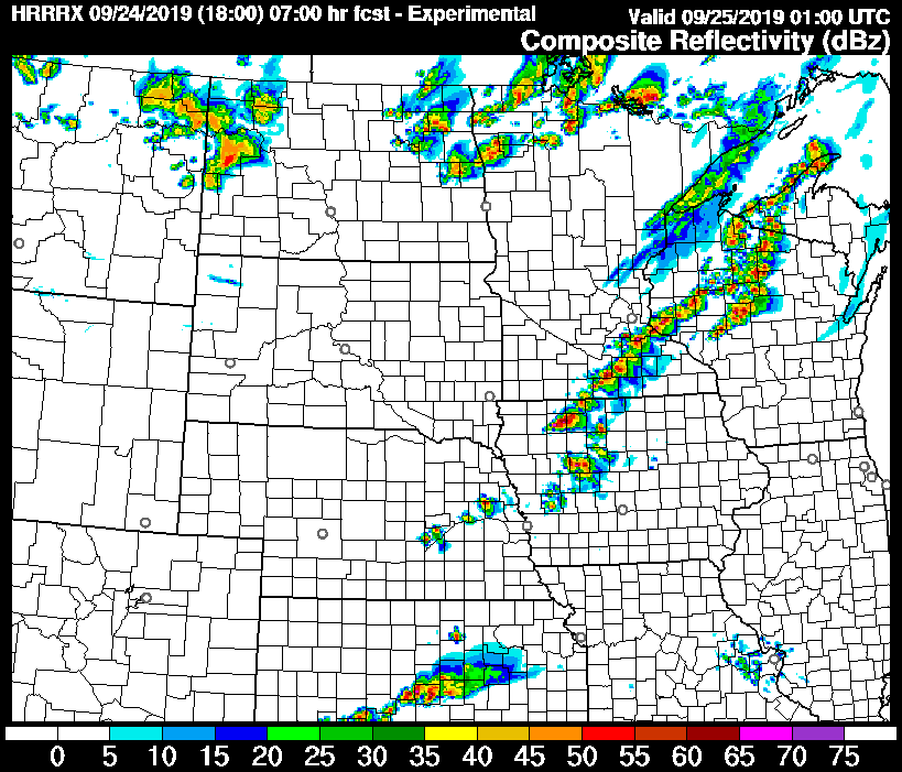
Eventually, and only within another 45 minutes, the storm will metastasize into a line. It will still be strong, and straight line winds will be added to the mix of threats.
This is the epitome of the “pay attention to the skies” days in southeast Minnesota and northern Iowa. Strong, dangerous storms are likely tonight, and they are likely to develop rapidly. It is possible that strong storms can develop and produce tornadoes even between radar scans with rapid development such as this.
Stay alert, heed local warnings, and listen to your gut. If it seems dangerous, take shelter, even if a warning has not yet been issued.
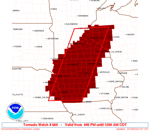
*Even as I was writing this, a tornado watch was issued for the region*