
Because of the slowed down pace, Dorian was able to deepen further than forecasts originally expected, and has become a Category 5 storm as it bears down on the northern Bahamas. It has developed a well defined eye, as a symbol of
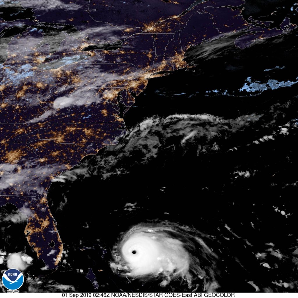
That’s a remarkable satellite image, in all of the worst ways. Dorian is going to prove very dangerous to the northernmost islands of the Bahamas, and it appeared he was on his way to becoming the strongest storm to hit the east coast of Florida since Andrew, but alas, that slow pace may have spared Florida the worst.
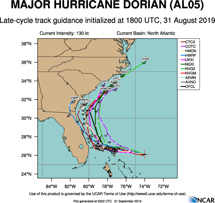
The NHC maintains warnings for the northern Bahamas, particularly Great Abaco and Grand Bahama, which look to bear Dorian’s full brunt over the weekend, but at this time, only a tropical storm warning has been issued for a small stretch of Floridian coastline.
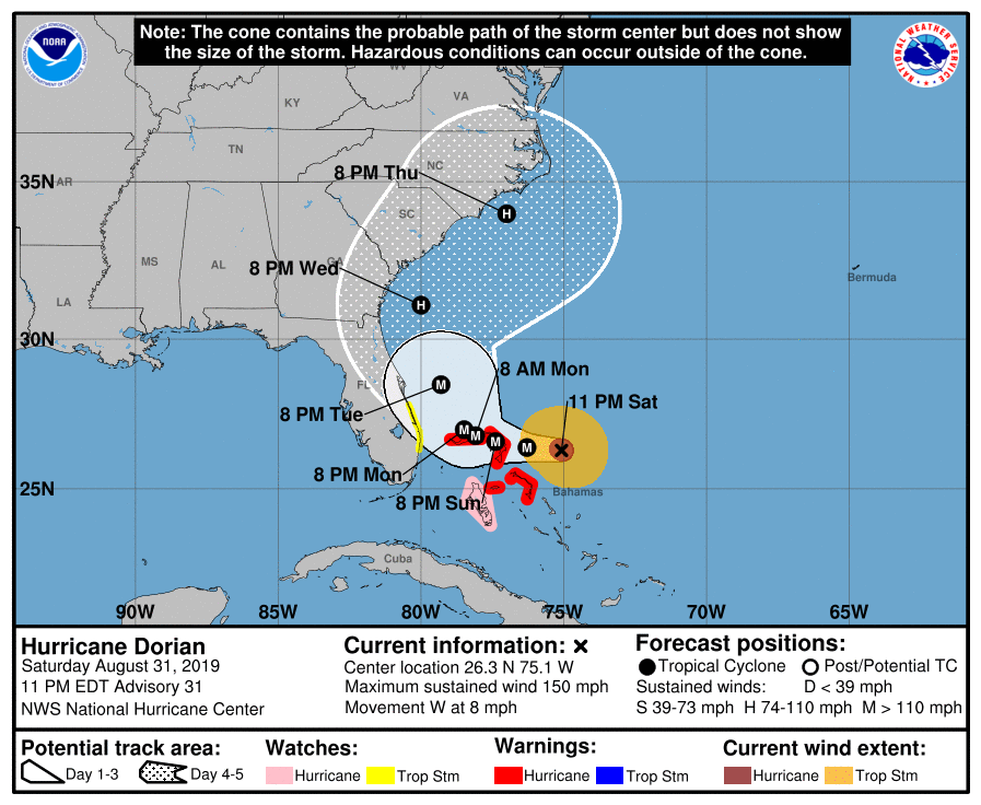
Dorian remains a danger, of course. The Bahamas in particular are in imminent danger, and even if the storm stays