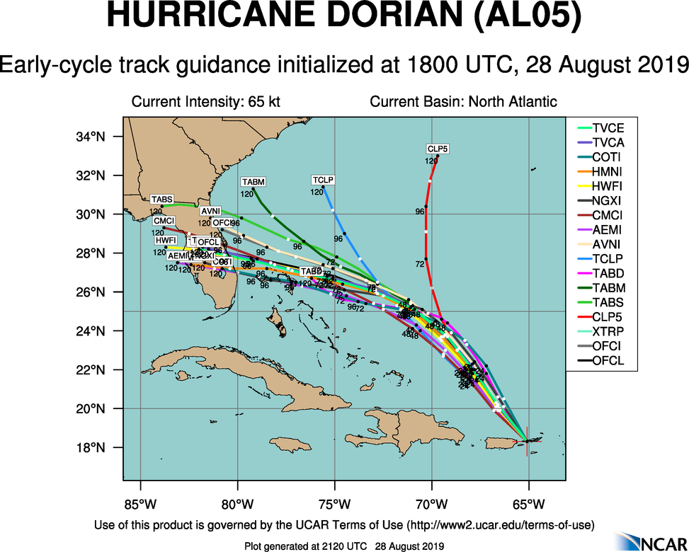
Dorian has just now been upgraded to hurricane status. He presently sits to the east of Puerto Rico, and will move across the virginiaIslands. Forecast trends have been for a slower progression, a bit removed from the Bahamas, both of which are trends that indicate a stronger storm than had been originally forecast.
Not last week, we were discussing the timid nature of Chantal, as she spun into the north Atlantic. Dorian was initially thought to be another fish storm (after he encountered the Lesser Antillies, of course) but now, the storm is getting slower, and is missing out on the steering flow that instead grabbed the short lived Erin, who is now spiraling off after Chantal.
Dorian is now expected to swing north of the Bahamas before curling back to the west towards Cape Canaveral in about 5 days time, with a landfall sometime this weekend. This is still quite a ways out, and there is certainly plenty of time for things to change, a caveat that is always in place for tropical features, but things aren’t breaking well in the last 48 hours.
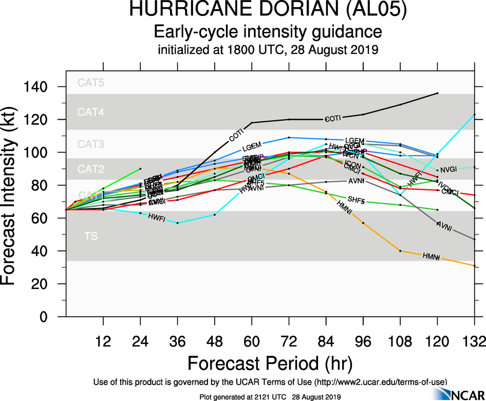
A slower course will allow it more time to ingest warm, energizing ocean water, which would have been ok, if it had continued on it’s original course over Puerto Rico and Hispaniola, and through the Bahamas. Instead, it’s jogged east and north, avoiding most of the major landmasses in his way. Now, Dorian, which looks to take an unimpeded run at the Florida coast, may arrive as a major hurricane over Labor Day weekend.
If high pressure doesn’t develop with the strength expected over Bermuda, the storm may shift north, but if it does, it will press south. If the storm tracks directly over some islands, or shear is greater than expected, then Dorian will end up weaker as he landfalls on the Florida Coast. Unfortunately, none of those things seem as though they are expected to come to fruition.
The below track and intensity projections don’t ingest the European model. If they did, they would likely be more aggressive on a land fall closer to Vero Beach and Fort Pierce, with a bit more of an intensity peak at landfall. We’ll try to keep you updated here and on Twitter.