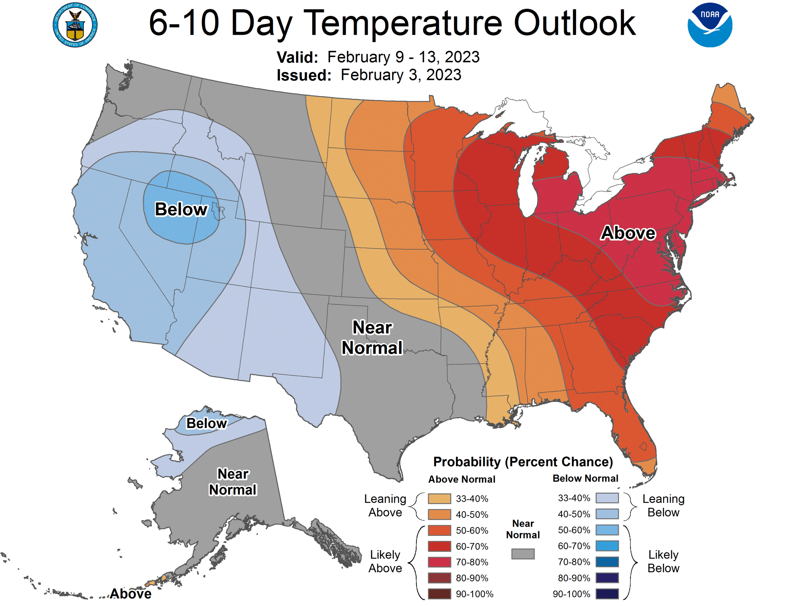
The winter track has not been kind to the low country of the Carolinas this year. It’s been quite dry and warm in the eastern Carolinas and a drought, not quite as severe as other parts of the country, has been building. Might we finally get a soaking of rain in North Carolina? Greensboro, in particular?
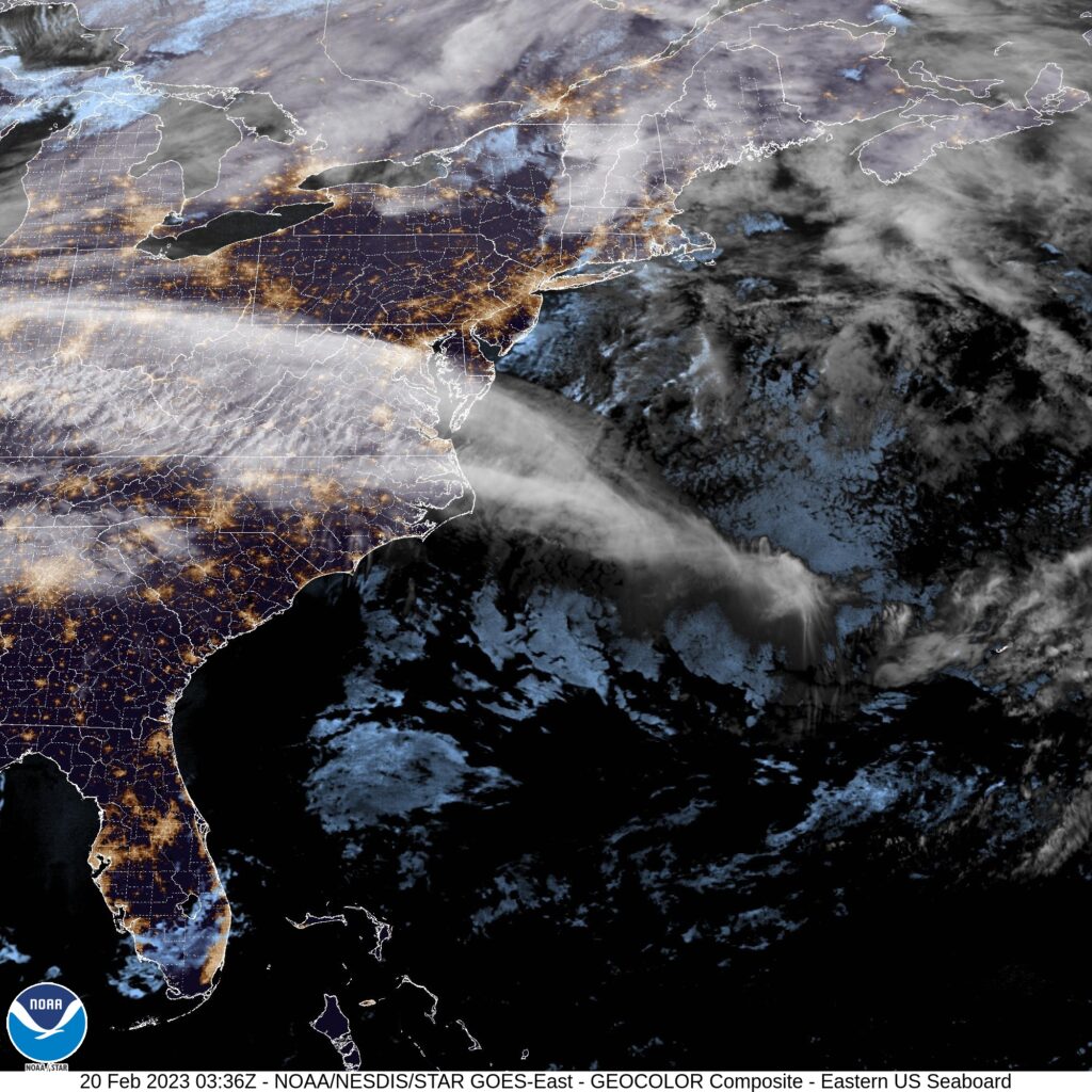
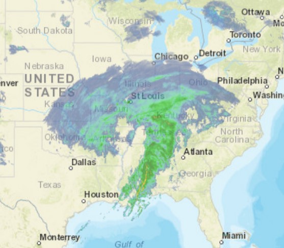
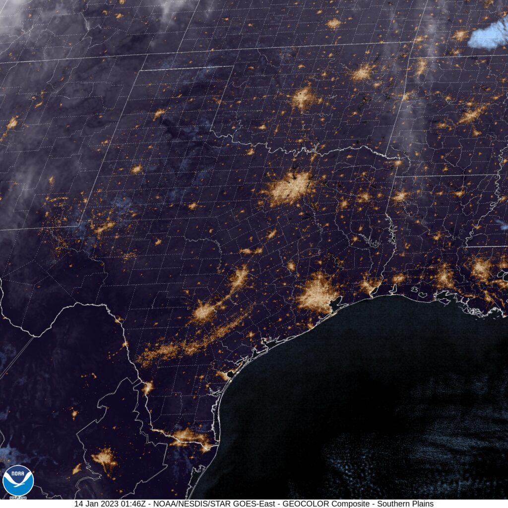
At 954PM, ET, Greensboro was reporting cloudy skies and a temperature of 48 degrees. Most of the Tar Heel State was reporting clear or fair skies, but Greensboro was under a high overcast. Greensboro’s observation reflects the satellite a bit more accurately, as a feather of clouds is seen extending from the Atlantic through Viginia and on to the Ohio Valley. This is extended from low pressure now headed for Greenland, and following a strong jet streak, running west to east through the region.
Temperatures are expected to remain on the warm side in Greensboro to start the work week. A pulse moving through the northern Great Lakes will connect a warm front through a secondary trough moving behind the offshore front, and will touch off some mountain showers in Virginia and western North Carolina. More high overcast is anticipated in Greensboro on Monday afternoon. The real show will be massing in the High Plains. Warm air is going to start rushing north on Tuesday ahead of this feature, with temperatures beginning to rise, even among the layered clouds across the region.
Tomorrow – mostly cloudy, High 65, Low 42
Tuesday – Mostly cloudy, High 71, Low 49
TWC: Tomorrow – Cloudy. Slight chance of a rain shower. High 64, Low 44
Tuesday -Partly cloudy, High 72, Low 51
AW: Tomorrow – Times of clouds and sun with a shower in places in the afternoon High 62, Low 45
Tuesday – Mostly cloudy; a shower cannot be ruled out High 70, Low 49
NWS: Tomorrow – A slight chance of rain after 1pm. Cloudy High 62, Low 44
Tuesday – A slight chance of rain. Partly sunny, High 71, Low 51
WB: Tomorrow – Cloudy, a slight chance of rain in the afternoon, High 60, Low 44
Tuesday – Partly sunny with a 20 percent chance of rain. High 71, Low 52
WN: Tomorrow – Mostly cloudy with isolated showers, High 62, Low 44
Tuesday – Partly cloudy, High 71, Low 51
CLI: Tomorrow – Light rain showers, High 61, Low 43
Tuesday – Partly cloudy, High 69, Low 48
I think with the lack of moisture in the area, the ongoing dry, and the warm temperatures, rain just doesn’t ring true to me as a worthwhile forecast. I’ll probably be wrong! Hope I am. Here is satellite, with that feather of clouds in the mid-Atlantic.