There are two options for Fayettevilles in the United States. I’ve only been to the one in Arkansas, and it is definitely not what you expect in “Arkansas” given the haven of Fortune 500 companies, University and tourism. What kind of weather is coming their way?
At 853PM, CT, Fayetteville was reporting a temperature of 59 degrees with clear skies. It was a continuation of dry weather, and there were burn bans across most of the region. The Ozarks were seeing cooler temperatures than surrounding regions, owing to the terrain of northwest Arkansas.
Surface high pressure is dropping southward within a complicated jet trough. The nature of the troughing pattern is such that precipitation is being inhibited and moisture is being staunched at the Gulf. This will lead to more quiet weather tomorrow, however as the surface ridge sinks south, baroclinicity will arrive across the region, importing some moisture from the monsoon. This isn’t going to lead to a lot of wet weather, but some rain and clouds are possible overnight Monday into Tuesday. Expect a breezier day on Tuesday.
Tomorrow – Increasing clouds with some late rain, High 79, Low 52
Tuesday – Mostly cloudy, with some early showers, High 79, Low 58
TWC: Tomorrow – Some sun in the morning with increasing clouds during the afternoon. (PM storms), High 78, Low 53
Tuesday – Cloudy. Slight chance of a rain shower. High 81, Low 61
AW: Tomorrow – Some sun, then turning cloudy High 77, Low 54
Tuesday – Beautiful with periods of clouds and sun High 79, Low 61
NWS: Tomorrow – Partly sunny, High 80, Low 54
Tuesday – A 20 percent chance of showers and thunderstorms before 1pm. Mostly cloudy High 80, Low 60
WB: Tomorrow – Partly sunny, High 77, Low 56
Tuesday – Mostly cloudy. A slight chance of showers and thunderstorms in the morning. High 80, Low 63
WN: Tomorrow – Partly cloudy, High 80, Low 53
Tuesday – Mostly cloudy with isolated storms, High 80, Low 60
FIO: Tomorrow – Partly cloudy throughout the day. High 78, Low 56
Tuesday – Possible light rain in the morning. High 79, Low 60
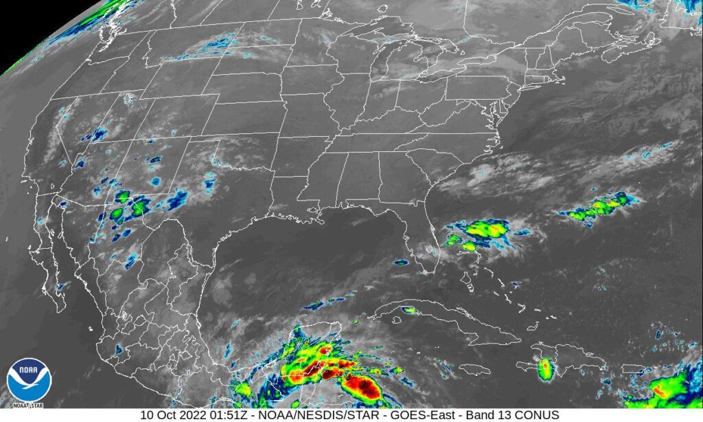
It’s fun when there is a variety to the precipitation forecasts. We’ll see how it plays out! Not much on satellite right now, but it will likely change in the next 48 hours.