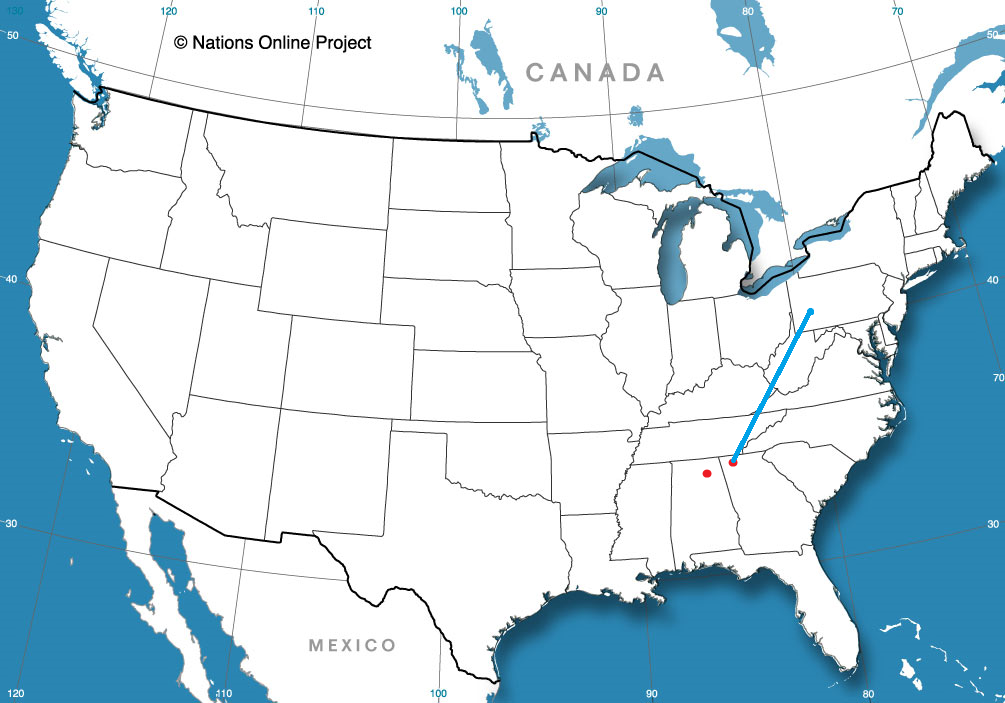
It’s a January road trip through Appalachia. Perhaps not as beautiful as the summer or fall, and maybe even a bit more treacherous, but… .well, I guess I’m not doing a good job of selling this trip. It will take us one long day to cover the 664 miles at a pace of 64.7mph.
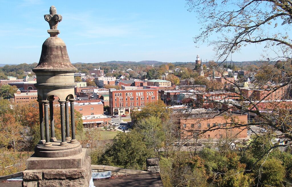
Rome, Georgia By Thomson200 – Own work, CC0, https://commons.wikimedia.org/w/index.php?curid=63993488
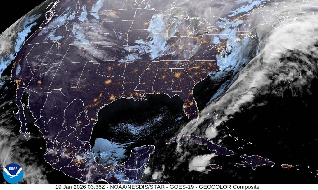
There is a weak little wave moving into the Great Lakes, dangling a fairly inefficient cold front through the Mississippi Valley tonight, which is going to be arriving in the Appalachians tomorrow. The precipitation will be more likely on the western faces of the terrain, and for our drive from Rome to about Beckley, West Virginia, when the chance for snow will filter back in. The snow will persist through the Mountaineer State, and as we arrive in Pittsburgh – yep, snow there too. It won’t be Lake enhanced, and it is going to be very cold, so just expect some fluff.
We are sadly only going to be spending our time in Rome, Georgia, and not Rome, Italy. It would be a bit warmer in Italy.
At 1053PM, ET, Rome was reporting an unusually brisk 28 degrees with clear skies. Throughout the region, skies were clear and temperatures were below freezing as a jet trough dove deep into the Southeast. An occluded area of low pressure sat over the Great Lakes, with a cold front emanating from a secondary (but as is usually the case, stronger) area of low pressure off the southeast coast of Nova Scotia dangled a surface cold front that had already cleared the Florida Peninsula. There were frost and freeze warnings as far south as Orlando. The upper level structure that is bringing the cold air to the southeast looks to be pretty entrenched, and a surface area of high pressure is unlikely to move. Calm winds and clear nights suggest that frost is something that residents of Rome should get accustomed to for the next couple of days, at least. Tomorrow – Sunny, High 47, Low 25 Tuesday – Sunny, High 45, Low 21
TWC: Tomorrow – Sunny. High 50, Low 26 Tuesday – Sunny. High 47, Low 22
AW: Tomorrow – Sunny High 50, Low 26 Tuesday – Plenty of sunshine High 46, Low 22
NWS: Tomorrow – Sunny, High 46, Low 25 Tuesday – Sunny, High 43, Low 20
WB: Tomorrow – Sunny, High 43, Low 28 Tuesday – Sunny, High 42, Low 25
WN: Tomorrow – Sunny, High 46, Low 25 Tuesday – Mostly sunny, High 43, Low 20
CLI: Tomorrow – Clear, High 47, Low 25 Tuesday – Sunny, High 46, Low 21
This is dangerously cold for this part of the world, where heating systems aren’t as robust as they are further to the north. Brr! At least the sun will be out in the day time, right?
We are going to northern Alabama on this fine Tuesday evening. It’s pretty quiet out there at this moment, but this time of year, if anywhere is going to see interesting weather, Florence would be a good bet.
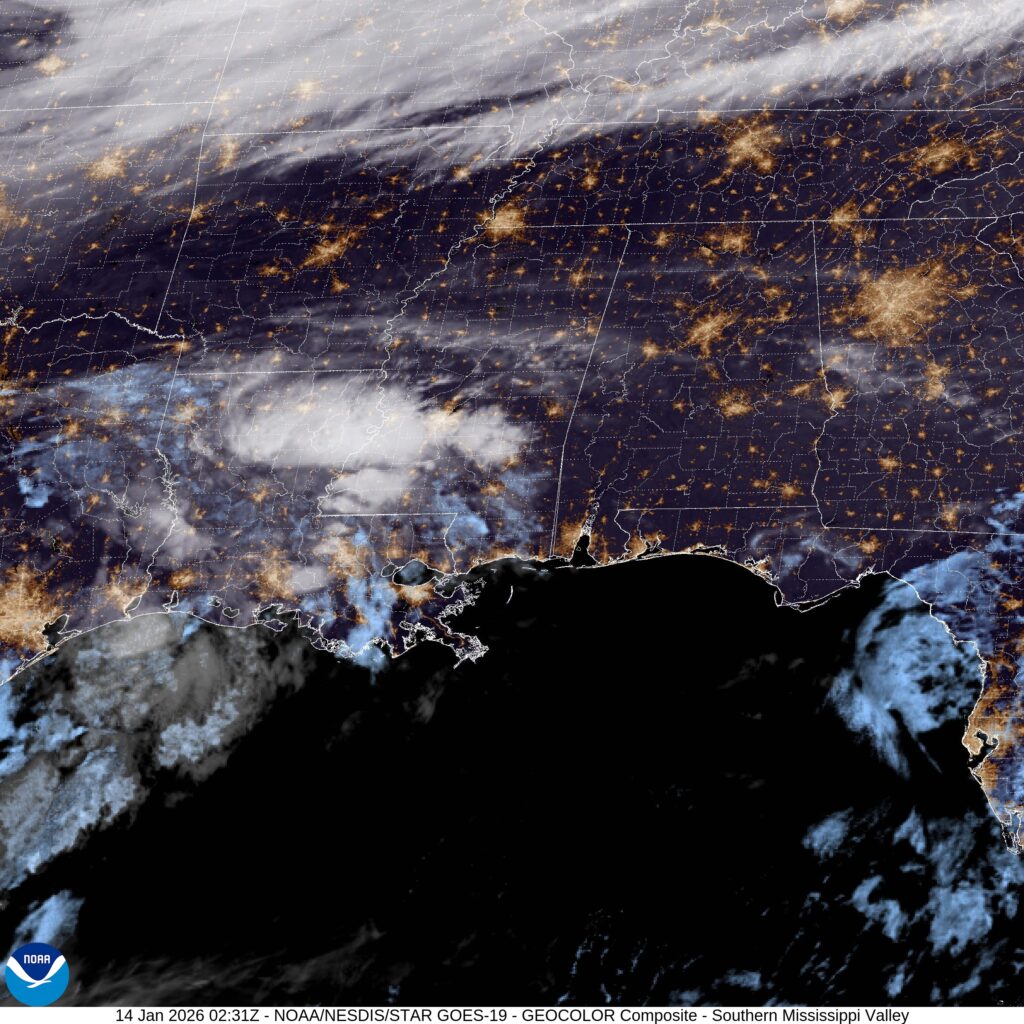
At 753PM, CT, Florence was reporting a temperature of 49 degrees with clear skies. Despite the clear skies, the region was active. A cold front was digging into central Missouri, and ahead of the boundary, there was a bit of convection showing on satellite in the Lower Mississippi Valley. The boundary was associated with a deep digging trough, and is going to move quickly. Moisture from the Gulf and the boundary itself will arrive in Florence by lunch time tomorrow. Tomorrow afternoon will be rainy, with a bit of thunder at the outset. Cold air will follow close behind, but not near enough to allow for any flurries in Florence. The cold air will settle in through Thursday, however, leading to some uncharacteristically brisk conditions. Tomorrow – A little bit of thunder in the late morning, then showers through the afternoon, Getting colder, High 48, Low 28 Thursday – Partly cloudy, chilly, High 39, Low 23
TWC: Tomorrow – Rain early…then remaining cloudy with showers in the afternoon. High 49, Low 34 Thursday – A mainly sunny sky. Colder. High 39, Low 23
AW: Tomorrow – Cloudy and cooler with a touch of rain High 48, Low 32 Thursday – Mostly sunny and cold High 39, Low 22
NWS: Tomorrow – Showers, mainly between 9am and 1pm. High near 49. West southwest wind 5 to 10 mph becoming north northwest in the afternoon. High 49, Low 31 Thursday – Sunny, High 38, Low 22
WB: Tomorrow – Showers, High 49, Low 30 Thursday – Cooler sunny. High 36, Low 22
WN: Tomorrow – Mostly cloudy with light showers, High 49, Low 30 Thursday – Sunny, High 38, Low 22
CLI: Tomorrow – Rain Showers, High 50, Low 30 Thursday – Sunny, High 38, Low 23
This is a day that isn’t particularly chilly for the part of the country I’m in, but in Alabama, this is a winter parka scenario. Take a look at the satellite, with the cold front to the north, and moisture arising from the south.
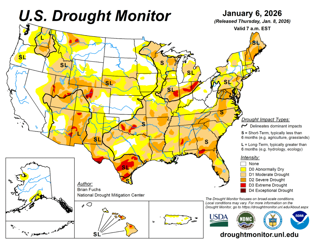
For the first time in years, California is not beset by a drought. The primary areas in which drought is ongoing this year are further inland. It’s pretty dry nearly everywhere EXCEPT California, which makes for an interesting change of pace.
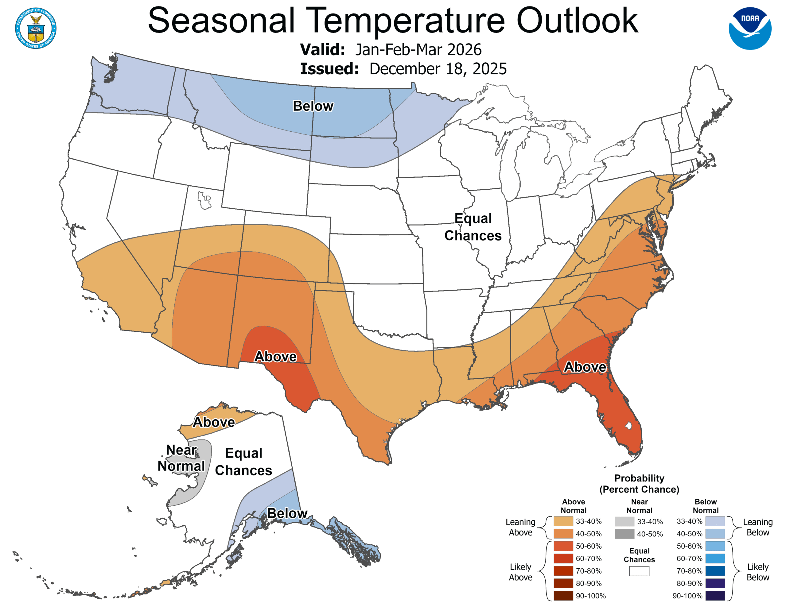
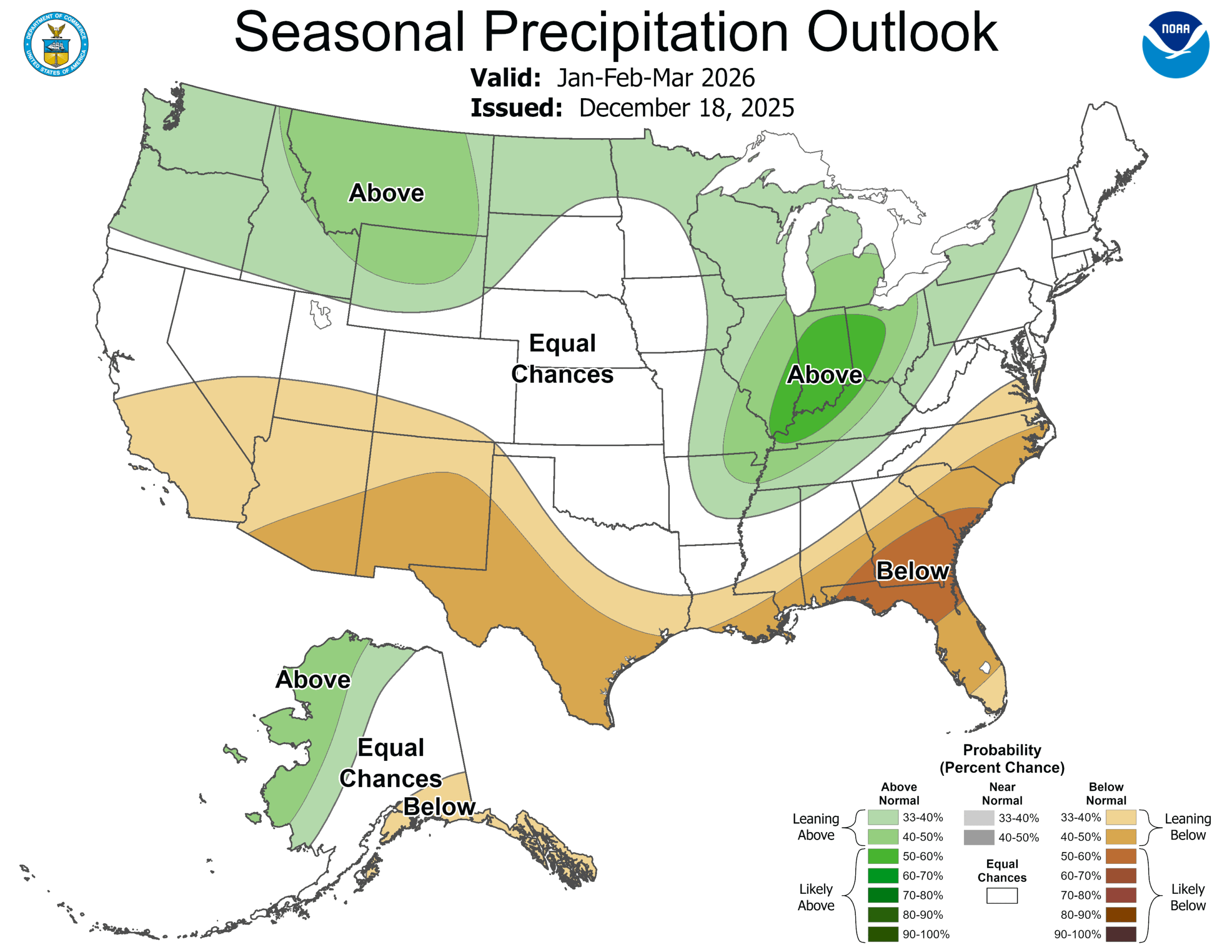
In the winter, that means that snow is in a deficit. The way to build that snow pack back up is A) through precipitation, and B) through temperatures remaining cold enough for the snow to generate. For one part of the country, at least, there appear to be the correct ingredients, and it may slake the thirst, at least for a corner of the country. Lets look at the CPC outlooks for both temperature and precipitation.
It looks to me like nearly everyone that expects snow this time of year is going to be in for a healthy dose through March. In particular, the northern Rockies will get to combine below normal temperatures and above normal moisture. Montana ski season is on, baby!
Also of note is the bullseye of above normal precipitation for Indiana. This region is one of the driest in the country right now, and a good drink through spring will do wonders. This part of the world is also cold enough to see snow in the winter, and with the forecast for near normal temperatures, they could certainly see some of this precipitation as a healthy dump of snow.
If you are one of the people that likes snow, then you probably do live in this snow zone, which means the forecast is good news. The snow is coming, just hold on.
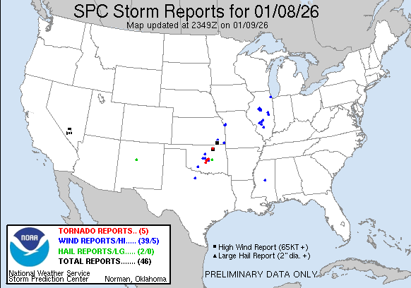
We made it a full week before we had a severe weather day here in the US, but our luck has run out. An area of low pressure moving through the Plains started generating severe weather, with a smattering of severe thunderstorm reports and a couple tornados in Oklahoma, including one that hit a farm in Purcell.
You’ll also note several severe storm reports in Illinois on Thursday. These were associated with the tail of a cold front tied to a deep area of low pressure moving earlier today through Labrador. The tail of that front also led to several wind storm reports today south of Rochester, New York.
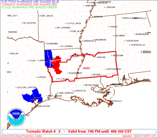
The real show is in the Lower Mississippi Valley. Low pressure dissipated after yesterday’s storms, but reconstituted over southern Arkansas late in the day. This redeveloped area is tapping into quite a bit of moisture, but also quite a bit of instability, and even now, there are tornado warnings and a tornado watch for northern Louisiana and southern Mississippi. These storms are rolling through overnight, which makes it a particularly treacherous scenario.
Fortunately, the system is moving quickly, which will allow it to occlude very quickly, and sap energy from the system. There is going to be a little bit of a carry over into tomorrow, particularly in the morning in areas like central Alabama, but the threat, fortunately, is going to be short lived. With a pattern as active and fast moving as it is, don’t be surprised for more quick hitter storms like this over the next couple of weeks.
Our first forecast of the year took us to Atlantic City, which was bracketed by waves to the north and south. They pushed each other away, which kept Atlantic City dry. That’s great news for New Jerseyans, but also the people who enjoy accurate forecasts. Temperatures were pretty reliable, including the bump in temperature on Sunday as low pressure scooted through western Atlantic. The first forecast of the year was a shared victory for The Weather Channel and National Weather Service. Actuals: Saturday – High 33, Low 19 Sunday – High 38, Low 26
Grade – B – Just a reminder, this year our grade now represents the consensus score for all forecasters. A b for the group is pretty good!
We made it, at long last, to the end of 2025, and are hopeful for a 2026 that is safe and contributes wisdom and collaboration to our lives and discourse. One thing that will be added here, is in the verifications, the grade will no longer be a range, but will be based on a consensus – basically the average – forecast, and how it compares to what verifies.
2025 was an eventful year in America, from fires in California at the beginning of the year to the first EF5 tornado in a decade, ocurring in Enderlin, North Dakota, and on to this winter, where attention returned again to the Golden State, as snow and rain before Christmas led to impassable roads and severe flooding. We checked in with a few forecasts every month, but who was the top forecaster of the month?
The Weather Channel had a tremendous year, beginning to end. Often times when writing these recaps, plugging in the verification data and reviewing things month to month, there is a bit of intrigue as to who will be the top spot. Not this year! The Weather Channel was the most frequent forecast champion, sure, but not in a runaway. They were, however, always consistently near the top, and rarely had clunkers. As a result, they are easily the 2025 Forecaster of the Year.
Our trek on this day is going to cover the nation, and will last a week. A real American road trip. The trip is going to span 2,846 miles, which covers about 66 miles an hour. This lengthy trip is going to be broken apart in about 524.5 mile daily chunks.
DAY ONE (Wednesday)
Atlantic City, New Jersey
Low pressure in the Great Lakes is doing something we can all appreciate: Moving quickly. The low will be out of the picture by the time we start heading out on Wednesday morning, and while the models aren’t capturing the Lake effect snow very well, it doesn’t much matter. We will indeed be driving just south of Lake Erie, but I don’t think the fetch will be right to bother us in northern Ohio. The drive will end in Sandusky, Ohio of conclude the first day on the road.
DAY TWO (Thursday) Thursday isn’t going to be great. We will start out fine, and make it through Chicago with little problem, but our next fast moving feature will be emerging from the Plains, and getting stronger and wetter before slamming into the Midwest. We will encounter rain starting around Joliet, and really getting going as we reach the Quad Cities. The rain will continue, heavy in spots, through Iowa City and on to our destination for the night in Williamsburg, Iowa, drenched.
DAY THREE (Friday) The back side of our little storm will transition over to a bit of light snow while we rest in Williamsburg. The core of the system is going to continue on to the Great Lakes, and while there won’t be accumulation, the flurries on top of refreezing ice could make the entire drive through the Hawkeye state. No precipitation while we travel in Nebraska, but there is going to be a weak lee trough kicking up clouds as far east as Paxton, Friday’s destination.
DAY FOUR (Saturday) After a couple of tougher days, we might be a bit trepidatious about hitting the mountains. Fortunately, a ridge will be moving into the area, and driving the Nebraska Panhandle and the bulk of Wyoming will be pretty easy. We won’t make it out of Wyoming on Saturday, stopping for the day in Piedmont.
DAY FIVE (Sunday) We have a bit to go to wrap this trip up, but by this point, we will have undergone a significant change to the pattern. Surface high pressure off shore is stifling that Pineapple Express that has been so problematic this winter, and clear skies beckon from Utah, Nevada and on to California.
Welcome to 2026. This is the twentieth year of this blog, which is incredible, for a few reasons. One, that I am old enough to be doing something for twenty years, that I’ve had the stamina to do it for twenty years, and that I still don’t know the first thing about coding or SEO.
According to Google, it would be almost 8 hours to fly from the Bay City area to Atlantic City. It’s eleven and a half hours to make that drive. Combined with the wait at the airport, getting your bags, rental cars, etc. It’s probably shorter and definitely easier to drive. We’ll do this in one big day, covering the 741 miles at a pace of 64.4 miles.
Bay City, Michigan
As has been the case for weeks now, there is another feature rippling through the Great Lakes. This one is moving in from the central Plains, which is further south than anything we’ve seen for a while. That means it hasn’t really been able to tap into much moisture yet, which is great, because there isn’t any precipitation yet. It is cloudy now in Bay City, which will keep things from cooling too much overnight. Temperatures, in fact, will start to warm up overnight, which means the light precipitation moving through lower Michigan tomorrow morning will fall as rain, with a bit of a mix just as we get started. The threat will mostly wane after we pull through Toledo. Clouds will chase us into Pittsburgh, but by the time we get to the Allegheny Mountains, the sun should pop out. The low pressure center is going to be pretty broad, and the rotation associated with it will carry off shore. The southwesterly fetch could lead to a bit of low clouds and fog late in Atlantic City upon our arrival.