Our next couple of forecasts are going to be in California. Very recently, the Golden State has seen some significant weather, but will that return any time soon?
At 1151AM, PT, San Diego was reporting a temperature of 81 degrees with clear skies. After some patches of rough weather earlier in the month, Southern California was back to living up to its reputation as a sunny, warm destination.
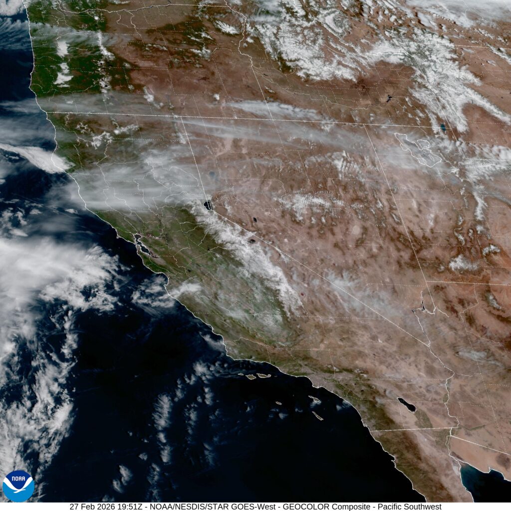
On satellite, there is an obvious area of low pressure over the eastern Pacific that is trying to fold into the upper level jet pattern. It will weaken in the famously inhospitable to synoptic features eastern Pacific, but will arrive in northern California late on Saturday, with an associated cool front stirring things up a bit in San Diego, though failing to bring anything but fresher air by late Sunday.
Tomorrow – Sunny, High 82, Low 60
Sunday – Partly cloudy, High 80, Low 57
TWC: Tomorrow – Partly to mostly cloudy. High 78, Low 56
Sunday – Some sun in the morning with increasing clouds during the afternoon. High 74. Low 55
AW: Tomorrow – Sunny to partly cloudy and warm High 77, Low 57
Sunday – Pleasant with sunshine and a few clouds High 73, Low 55
NWS: Tomorrow – Mostly sunny High 81, Low 61
Sunday – Sunny, High 78, Low 58
WB: Tomorrow – Partly cloudy. High 81, Low 63
Sunday – Mostly sunny High 81, Low 59
WN: Tomorrow – Mostly Sunny, High 81, Low 61
Sunday – Mostly Sunny, High 77, Low 58
CLI: Tomorrow – Mostly cloudy, High 74, Low 60
Sunday – Sunny, High 70, Low 57
Well, well, well. That is certainly an interesting array of forecasts, isn’t it? Wind flow and cloud cover are going to be quite impactful, but things are weird if there is a warm/cold divide and Weatherbug shows up on the warm side. Satellite looks great, with that low over the Pacific making its presence known.