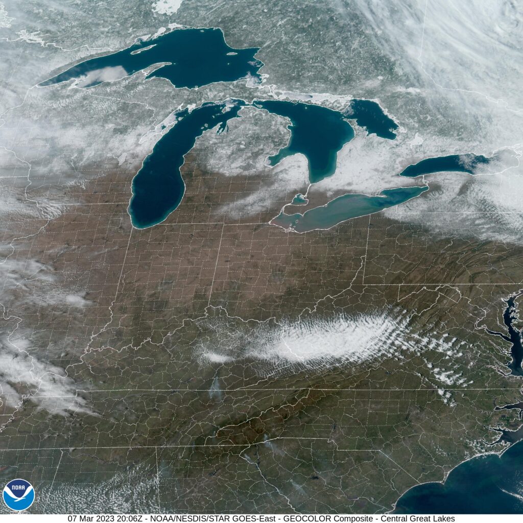
I think we can all agree that Michigan City, Indiana is a strange name for a town that is part of the greater Chicagoland region, yes?
At 255PM, ET, Michigan City was reporting a temperature of 39 degrees with clear skies. A brisk flow is coming off of Lake Michigan, a true lake breeze flowing from the colder dense air to relatively warm air of northern Indiana, absent of prevailing synoptic flow. Temperatures were about 5 or 6 degrees warmer away from the Lake. A broad ridge aloft is helping the southern Great Lakes to dry out, and it should be a fairly pleasant middle of the week in Michigan City. A broad area of low pressure in the Rockies and High Plains bears watching, however. It will be slow in transpiring, but low pressure will develop at the surface through the day on Saturday. Precipitation will arrive in Michigan City late on Thursday. It is likely to be a chilly rain, but given the uncertainty wrought by the lateness in development of this feature, snow cannot be left out of the forecast. Tomorrow – Mostly sunny, High 44, Low 30 Thursday – Increasing clouds with a late rain-snow mix, High 41, Low 32
TWC: Tomorrow – Mostly cloudy skies High 43, Low 30 Thursday – Overcast. High 42, Low 30
AW: Tomorrow – Sun and clouds, High 41, Low 29 Thursday – Cloudy, late rain and snow, High 42, Low 33
NWS: Tomorrow – Partly sunny High 42, Low 30 Thursday – Mostly cloudy, Late rain/snow, High 44, Low 30
WB: Tomorrow – Cloudy, high 42, Low 32 Thursday – Cloudy, high 42, Low 32
WN: Tomorrow – Partly cloudy, High 42, Low 30 Thursday – Partly cloudy, High 44, Low 30
CLI: Tomorrow – Overcast, High 42, Low 29 Thursday – Overcast, High 41, Low 29
I think you can see some of the uncertainty with the model guidance showing up in the forecast. The models aren’t spread over a wide range, but without any thing fully developed yet, there is a lack of precipitation commitment. Look how clear it is right now! And you’re telling me it might snow?
Back in Mid February, Greensboro was in the midst of a comfortable stretch of weather, at odds with what the calendar said. On the 20th and 21st, the weather was at the very least interesting. On the 20th, a splash of rain and a cold front meant temperatures were able only to reach 60 degrees. After that frontal passage, the high jumped to 73 on the 21st. Those highs and lows were both as low as (20th) and higher than (21st) all of the forecast highs. As it worked out, Clime was able to navigate their first forecast win, owing their victory to a dry forecast on the 21st. Actuals: February 20th, .03″ of rain, High 60, Low 44 February 21st, High 73, Low 47
There is a healthy respect for hurricanes, which is continually reinforced by some vicious storms over the past few years. National Hurricane Center forecasts lead to drastic action, and with the verification of the storms coming ashore and doing incomprehensible damage, even the most skeptical citizens are driven to take precautions when a hurricane looms.
Severe weather has garnered a fair bit of respect as well, and we are starting to see the dawning of this year’s severe season. We usually start with some storms in the lower Mississippi Valley. An outbreak in the state of Mississippi in January or February is practically a rite of passage at this point, and we’ve had a couple of those already. This week, we’ve also seen strong storms in the traditional tornado alley of Oklahoma and Kansas.
Severe weather gains the respect, and the response and preparation of people directly impacted by severe season. Of course, tornadoes are very isolated incidents, and they don’t touch every part of the area impacted by the more general thunderstorm. Even in the example of the recent stormy weather, Norman, Oklahoma was struck by a tornado. Norman is famously the home to the National Severe Storms Laboratory and the Storm Prediction Center, and the twister passed about half a mile from their shared facility, and damage was felt in local neighborhoods. Otherwise, however, the Oklahoma City metro was left unperturbed.
By tornadoes, it should be noted. The storm that swept through the region was contributed by a very strong cold front, which caused dust storms through western Oklahoma and the Texas Panhandle. Still, even with the strong storms, it’s usually the tornadoes that capture the imagination of the conscientious weather watcher.
Snow storms are something of a blend between the two features of a hurricane and severe storms. It comes from broad, well anticipated systems, but the impacts are felt differently from mile to mile. Instead of respected and anticipated, snow storm forecasting is almost always derided immediately, and sometimes amid the storm, especially in locations that see their share of severe winter weather.
Even as snow was ongoing in the Twin Cities, a lot of stalwarts complained that the snow was not as advertised. In truth, nobody was reading the fine print on the advertisements, because things were proceeding exactly as planned. There was about half a foot of snow that fell on Tuesday night, and then another 10-15 inches fell overnight Wednesday to Thursday. Originally, there were more dire forecasts, but outlets were pretty well in line on the total snow, a foot to 18″ in the metro (it was up to 20 in Apple Valley in the south suburbs), and the break in the middle was noted by every forecast people took the time to read.
Let me tell you, 18″ of snow, even just a foot of snow, is plenty of snow. It tied up the morning commute, and justifiably closed schools across the region. This storm was bruising winter weather maker, shutting down roads in South Dakota, Nebraska and Minnesota, and ushering in subzero temperatures on the back of 40mph winds, even if it wasn’t as big a storm as some people might have wanted.
This pattern has also been strong enough to bring about the first significant snowfall of the season to the I-95 corridor. Of course, the snow there was fairly light, otherwise it probably would have led local newscasts. What was more significant was that it was the first real snow, and March starts tomorrow. The warm weather will persist in the southeast, but a cooler pattern is forecast to continue as we roll into March.
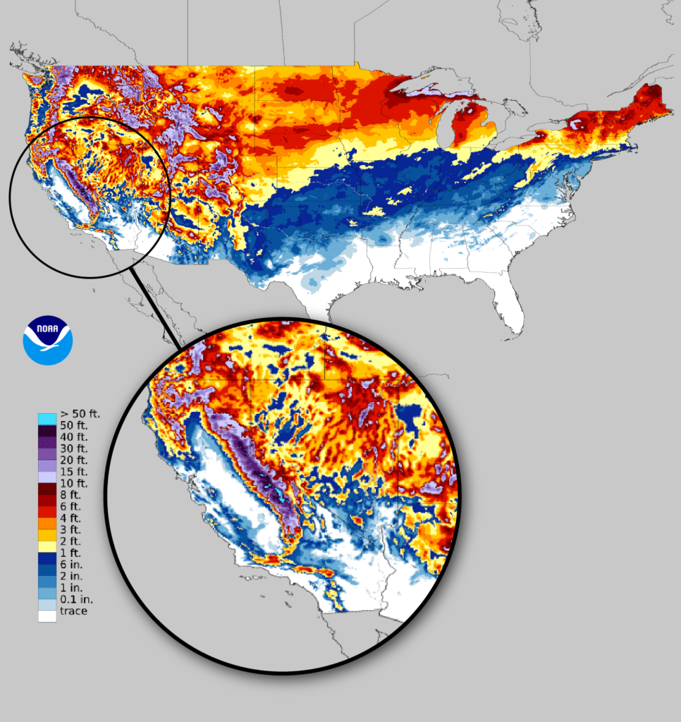
Nowhere will it be unseasnably colder than on the West Coast, where southern California, notably the highlands around Los Angeles, received substantial snowfall at the end of February, accumulating in spots to over a foot. The force of the features coming onshore, unchecked by topography allowed the system to bring full force of wind ot the region as well, with blizzard warnings blanketing much of the Golden State.
The graphic at the top of the screen shows the snowfall coverage across the country, with an emphasis on the snow that has battered the United States to end the shortest month of the year. The As we enter March, of course, the emphasis will continue to focus on severe storms. They again are traversing the southern Plains tonight, with tornado warnings in the Dallas area. With cold in the west and warmth in the southeast only becoming magnified in the spring, expect more wild weather to continue.