A cool front was sliding into Alabama as the month started, just as we were waiting for Debby to make her way to the Florida Peninsula. Montgomery, typically awash in pop up showers and storms, was able to evade that activity on Saturday, even as a cool front slid through town. “Cool”. It was still in the 90s after it’s passage. There was a lingering splash of rain on Friday morning, which some people successfully called out, but ultimately, the top forecast came to a good temperature prognostication. Because of that, there was a three way tie on top, between The Weather Channel, Weather Service and Weatherbug. Actuals: Friday – .02 inches of rain, High 95, Low 77 Saturday – High 96, Low 76
Well, we are deep into the summer, so we should probably take on a road trip, right? This journey will cover 550 miles, and will last only a day. It’s just a shot down I-65 at a pace of 67.9mph. That’s cooking! Let’s cook down to Montgomery!
Bloomington, Indiana
Low pressure is going to keep churning through the southern Great Lakes tomorrow, with rain continuing to wind around the center of low pressure, we are going to have to navigate through a few showers and embedded thunderstorms, especially in southern Indiana. More isolated storms are going to pop up in Kentucky and Tennessee, but being later in the day, they will probably be a little bit spicier. Fortunately, this should be the last of the wet weather. Unless you are talking about humidity, because it will be unbelievably sticky, all the way down to Montgomery.
Our Bloomington streak is over. We’re headed down to Alabama as we reach the dog days of summer. Get ready to sweat.
At 253PM, ET, Montgomery was reporting a temperature of 90 degrees with clear skies. There was a smattering of isolated thunderstorms in southern Alabama, thanks to the remnants of a cold front trying to move into the area. There isn’t really a cold front in the traditional sense, but really just a change in wind direction. This may lead to less haze in the morning tomorrow, but isn’t a particularly significant change to the airmass. Of future concern is an area of low pressure in the Great Lakes. It’s not particularly dynamic, as is often the case with summer time low pressure, but it is tapping into a wealth of heat and humidity. Quite a bit of rain and thunder is expected in the southern Great Lakes and Lower Ohio Valley through the day today, and will flare up again tomorrow evening when it reaches the western slope of the Appalachians. A band of showers and storms is expected to sink south overnight to southern Alabama, with some showers and storms becoming possible for Montgomery in the morning. A tropical invest moving through the Greater Antilles will arrive in the eastern Gulf in the evening on Saturday, and may inflame the boundary again, but by this point, it should be south of Montgomery Tomorrow – Very hot, High 99, Low 79 Saturday – Isolated showers in the morning, then partly cloudy late, High 95, Low 78
TWC: Tomorrow – Mostly sunny skies. Hot and humid. Late rain High 98, Low 77 Saturday – Mostly sunny skies. A stray shower or thunderstorm is possible High 95, Low 77
AW: Tomorrow – Mostly sunny and hot; a thunderstorm in spots in the afternoon; danger of dehydration and heatstroke if outside for extended periods of time High 98, Low 76 Saturday – Periods of clouds and sun with a heavy thunderstorm in the afternoon; thunderstorms can cause flash flooding High 97, Low 74
NWS: Tomorrow – A 20 percent chance of showers and thunderstorms after 4pm. Sunny and hot High 98, Low 77 Saturday – A 50 percent chance of showers and thunderstorms after 1pm. Sunny High 95, Low 77
WB: Tomorrow – Sunny. A slight chance of showers and thunderstorms in the afternoon. High 97, Low 78 Saturday – Sunny. A slight chance of showers and thunderstorms in the morning, then a chance of showers and thunderstorms in the afternoon, High 96, Low 78
WN: Tomorrow – Partly cloudy with isolated storms, High 97, Low 77 Saturday – Partly cloudy with isolated storms, High 94, Low 78
CLI: Tomorrow – Sunny, High 98, Low 77 Saturday – Light rain showers, High 95, Low 75
Well, I said you were going to sweat. We’ll see how the showers pop up tomorrow, but I feel good about some stability building in. The wild card will be how much rain falls on Saturday.
Got a long trip from northern CA to the Deep South, covering 2,536 miles, which should take 5 days to cover.
DAY ONE
A broad ridge of high pressure is found over the Great Basin/Four Corners region, which is keeping most of the thunderstorm activity over the Sierras as well as the Rockies in the Four Corners region. Much of the day should be dry and fairly quiet as we travel southward from Redding along I-5 to Sacramento, then along Hwy 99 through much of the Central Valley past Fresno and Bakersfield. Late in the afternoon and evening we’ll cut across the Antelope Valley on 58 before ending our long day in Barstow.
DAY TWO
Going to be spending all day on I-40 as we head east out of Barstow and eventually make our way into northwestern AZ by midday. Some spotty thunderstorms are expected to get going over the mountains as we make our way towards Flagstaff, so by the evening hours some of this activity looks to roll off of them, which could give us a bit of a wet welcome heading past Winslow and Holbrook before ending our night in Gallup, NM.
DAY THREE
Slightly shorter day today, but still a hike across New Mexico as we continue our tour of I-40. However, storms are expected to flare up over the mountains in the central part of the state, so if we don’t get past them in time, we’ll be needing to turn on our wipers as we pass Albuquerque and eventually Santa Rosa. If we can get out ahead of the storms, it should be smooth sailing into Amarillo, TX, where we’ll end the night. Don’t be surprised if some late evening storms roll into town however, might keep us up a bit.
DAY FOUR
Our tour of I-40 comes to an end as we head southeast on 280 out of Amarillo towards Wichita Falls. Unfortunately a boundary settling across the Central Plains eastward is interacting with moisture coming up from the Gulf, and widespread showers and thunderstorms are expected to develop during the midday hours and persist well into the evening. Some thunderstorm activity could get potent as we pass by the Dallas-Fort Worth area, hopefully we’re able to dodge it as we continue onwards and end the long day in Shreveport, LA.
DAY FIVE
Looks like it will be another day of dodging showers and storms as low pressure shifts into the Mid-MS River Valley, increasing the chances of storms from AR/LA eastward into AL/GA as the day progresses. I don’t expect a washout, but you will have to keep an eye on the sky as we push through MS on I-20 past Jackson and eventually into Alabama before finally ending our trip in Montgomery.
Tonight let’s take a trip down south and see how the rest of the weekend shapes up for the lovely folks in Montgomery, AL!
At 953pm CDT, the temperature in Montgomery, AL was 74 degrees under fair skies. The tail end of a boundary is working through the TN Valley this evening, but behind it high pressure is moving in. This area of high pressure is going to keep the Montgomery area dry over the next couple of days, with just a few passing afternoon clouds anticipated. Looks like a good start to the month!
Sunday: Sunny. High 93, Low 66.
Monday: Few afternoon clouds. High 92, Low 68.
TWC: Sunday: Mostly sunny. High 94, Low 65.
Monday: Partly cloudy. High 93, Low 68.
AW: Sunday: Mostly sunny; warm. High 90, Low 64.
Monday: Mostly sunny; warm. High 89, Low 68.
NWS: Sunday: Sunny. High 93, Low 68.
Monday: Sunny. High 91, Low 70.
WB: Sunday: Sunny. High 92, Low 66.
Monday: Mostly sunny. High 91, Low 69.
WN: Sunday: Mostly sunny. High 93, Low 68.
Monday: Mostly sunny. High 91, Low 70.
FIO: Sunday: Clear throughout the day. High 93, Low 66.
Monday: Partly cloudy until evening. High 92, Low 70.
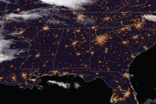
Here we see a fairly calm and clear night over the Deep South, with much of the same expected over the next couple of days.