It seemed like a little bit cooler air was going to settle in early to southwestern Oklahoma. There was a chance for a little bit of rain over the holiday weekend, but it was still plenty warm. Saturday was he winning day in Lawton, with dry skies and a cooler temperature that came on Sunday. There wsan’t much rain, just a drizzle, and it came with temperatures that were back up in the upper 80s. It’s what you should expect in Lawton, but it’s still disappointing when the forecast was for something a bit cooler. Accuweather had the warmest forecast and earned victory for the day. Actuals: Saturday – High 81, Low 70 Sunday – .02″ of rain, High 88, Low 69
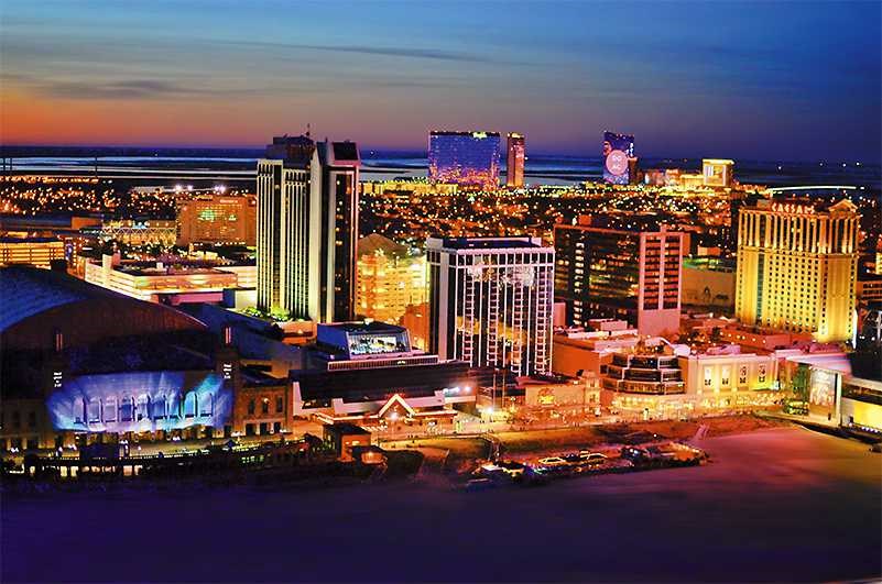
I have a NASCAR race on in the background, which makes me think that we can cover the 1,529 miles of this trip in no time. Really, though, let’s play it cool and instead make the drive in about 3 days, leaving the third day the shortest. and drive at a safe speed of 68mph, and about 547 miles a day. We will save our poor choices for Atlantic City.
DAY ONE (Monday)
Lawton, Oklahoma
There is an eroding dry line that is washing out in the central Plains. This is producing some showers from about the Oklahoma City area to Springfield, Missouri, and there is no reason to think that this instigator will move much tomorrow. It likely won’t be as widespread as it is today. I would say the best threat will be in the higher terrain around the Ozarks, but should be fully wrapped up before we reach Sullivan, MO. Definitely before we hit Fenton, on the southwest side of St. Louis and our destination for the night.
DAY TWO (Tuesday) Our weak trough is going to start to consolidate and turn around over night. It’s going to shift towards the Tennessee Valley, which should keep it juuuuuust far enough south to keep us dry for the day. There will be a few dark clouds dappling the sky as we continue east, and they will probably linger thorughout the day. Aside from maybe a sprinkle early in the morning as we pass through St. Louis, I think we are probably OK. The best bet for another shot of rain, albeit low, will come in the last couple of hours, from Columbus to Bannock, which is just outside of Wheeling, and our destination for the night.
DAY THREE (Wednesday) That same trough will waste itself on the Appalachians and spread along the range. There will be some splashes of rain, particularly on the western faces of the range for the first part of the day. We’ll have rain through about Bedford, after which point the weak system will have a tough time transcending the Appalachians. The sun will be shining in Atlantic City when we pull in.
Lawton is home to Fort Sill, which also gives us most of the population. The town is in the southwest part of the state, which leaves it in a dryer patch of land this late in the summer.
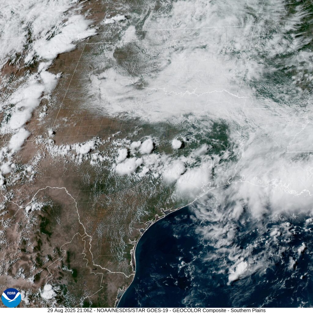
At 353PM, CT, Lawton was reporting overcast skies with a temperature of 77 degrees. Dew points were also in the upper 60s, making for a rather soupy afternoon. The tail of a cool front was triggering some thunderstorms in Texas, and westerly flow over the Rockies was contributing to a particularly vigorous dry line, leading to severe weather in the Colorado Plains. All the while, an upper level ridge is keeping Oklahoma dry, if a bit on the cloudy side. As the upper level jet streak shifts further to the east, it will weaken greatly. The dry line will press east as well, but without as much momentum. The threat of showers and storms will arrive in southern Oklahoma on Sunday morning. The associated boundary will continue to weaken, and there won’t be any organized shower activity. As the afternoon wears on, the threat will lessen as the former dry line mixes out. The extra clouds will keep temperatures moderated. Tomorrow – Mostly cloudy, High 80, Low 69 Sunday – Scattered showers, mostly cloudy, High 84, Low 68
TWC: Tomorrow – Isolated thunderstorms in the morning, then cloudy skies late High 80, Low 68 Sunday – Showers in the morning, then partly cloudy in the afternoon. High 85, Low 69
AW: Tomorrow – Humid with a shower in places; cloudy in the morning, then intervals of clouds and sunshine in the afternoon High 81, Low 69 Sunday – Humid with sun and some clouds; a thunderstorm in the afternoon High 86, Low 69
NWS: Tomorrow – A 50 percent chance of showers and thunderstorms, mainly after 7am. Mostly cloudy, High 81, Low 68 Sunday – A 50 percent chance of showers and thunderstorms. Mostly cloudy High 83, Low 69
WB: Tomorrow – Mostly cloudy in the morning then becoming partly sunny. A chance of showers with a slight chance of thunderstorms High 78, Low 69 Sunday – Mostly cloudy in the morning then becoming partly sunny. A chance of showers. A slight chance of thunderstorms in the morning then a chance of thunderstorms in the afternoon. High 79, Low 69
WN – Tomorrow – Partly cloudy with scattered showers and isolated thunderstorms, High 80, Low 64 Sunday – Mostly cloudy scattered showers and chance of storms, High 83, Low 68
CLI: Tomorrow – Thunderstorm, High 79, Low 67 Sunday – Light rain showers, High 84, Low 69
It looks like a pretty good holiday weekend is coming up for southwest Oklahoma. Spots of rain, but temperatures are manageable. Not so bad on satellite this afternoon.
After a couple of short trips, we had a very long trip. Now, we can settle somewhere in the middle, with this 2 1/2 day trip. Storm chasing is still a thing even in these strange times, and I could imagine someone having a successful chase based out of Lawton last night, then wanting to take the 1,446 mile journey home to tell stories about the storms they saw near the Red River. The drive will cover 67.5mph and those first two days will be through after about 540 miles on the highway.
DAY ONE (Sunday)
Lawton, Oklahoma
To say the pattern is turbulent in the center of the country is a bit of an understatement. Successive short waves keep spiraling through the northern Plains, which draw moisture and instability through the central and southern Plains. There isn’t so much forcing that I would suggest there might be a severe weather outbreak on Sunday, but I would be surprised if it didn’t rain somewhere along the way. Light rain will be possible around Lawton as we head out, with a break through Oklahoma City and Tulsa, but there will be increasing chances for pop up thunderstorms by the time we hit the afternoon and Missouri. The best threat will be between Springfield and Rolla, but really, they will be aimless, and the possibility will continue to St. Clair, our destination for night one.
DAY TWO (Monday) The entire Ohio Valley is going to become increasingly humid and warm. There might be a stray pop up shower or thunderstorm virtually anywhere during our drive from St. Clair, but the threat will naturally rise with the temperature as the day progresses. Still, the most active weather will be reorganizing to our west, so I don’t foresee anything more significant than a localized downpour. and the majority of the day will be warm and dry, but perhaps incredibly humid. Our day concludes in Jacksontown, Ohio, which is to the east of Columbus.
DAY THREE (Tuesday) For the final day of our trip, we have a little bit better news. The low level moisture associated with all the disorganized action in the center of the country will be unable to penetrate Appalachia, and we are right on the doorstep of Appalachia. The threat for some rain likely won’t stretch further east than Zanesville, and the rest of the drive will be beset by nothing other than scenery and mountainside Americana. Lancaster should be appropriately late-springlike.