Let’s all look back fondly at the middle of April. Warm temperatures and generally sunny skies dominated a lot of the middle of the country. That started slowly eroding, and now with the advance of a strong cold front tonight in the Mississippi Valley, is disintegrating quickly. But last week, think Wednesday and Thursday of last week in Canton was brilliant. Highs in the upper 70s to near 80 with nary a cloud in the sky. Clime and The Weather Channel each tied for the top forecast, which weren’t as good as expected, because the weather was even better than anyone ever imagined. Actuals: Wednesday. April 12th, High 77, Grade 55 Thursday, April 13th, High 80, Low 54
Canton is the home of the football hall of fame. It isn’t football season, but I don’t know a lot else about Canton.
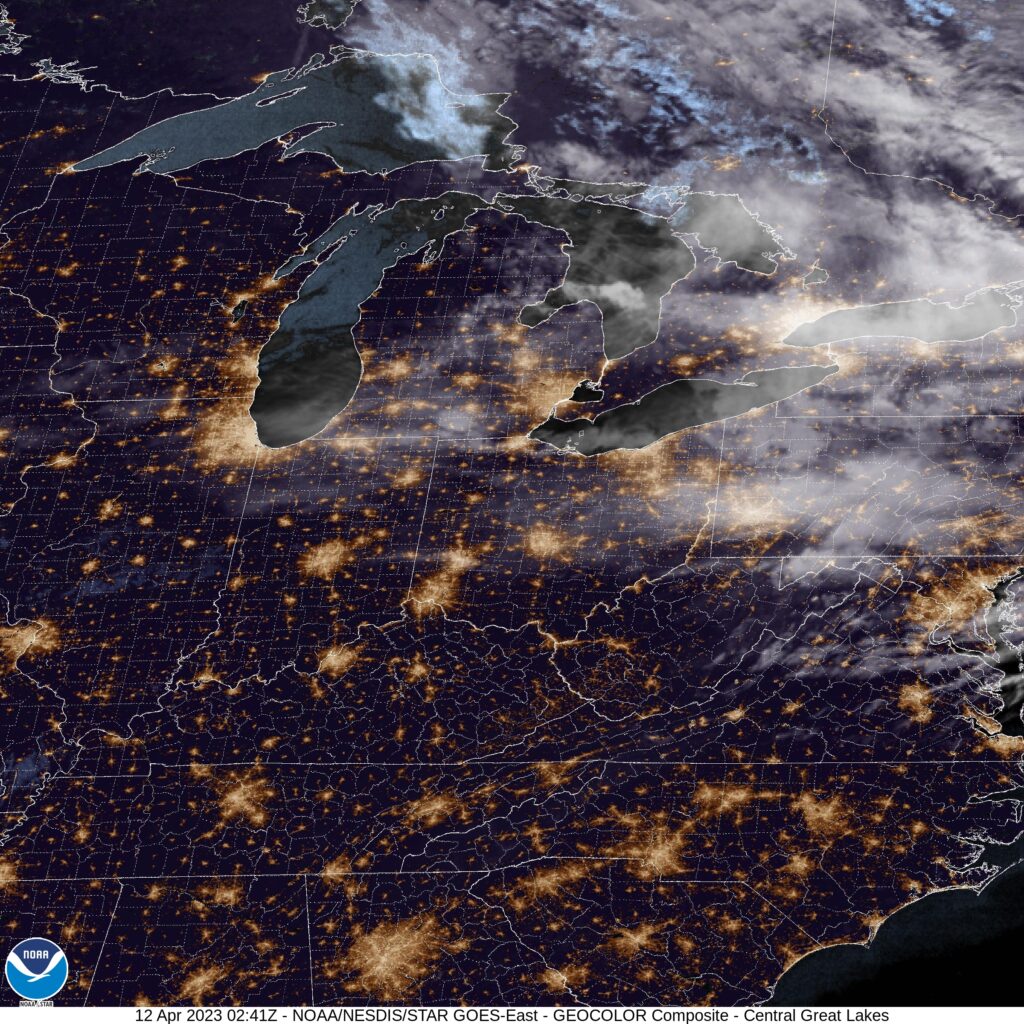
At 1051PM, ET, Canton was reporting a temperature of 60 degrees with fair skies. High pressure is smothering the eastern two thirds of the country, and a nice dry, warm launch to spring has seized Ohio and the Great Lakes at large. Satellite shows the greatest concentration of cloud cover spreading into the Appalachians of Pennsylvania and New York, thanks to the exit region of a jet sliding into New England. There are some streaming clouds over Ohio that may help prevent temperatures from plummeting overnight. Non tropical low pressure rising out of the Gulf will bring another smattering of clouds later in the week. Tomorrow – Mostly sunny, High 76, Low 50 Thursday – Sunny, High 77, Low 52
TWC: Tomorrow – Abundant sunshine. High 77, Low 53 Thursday – Mainly sunny. Mainly sunny, High 79, Low 51
AW: Tomorrow – Partly sunny and very warm; breezy in the afternoon; dry and breezy conditions can lead to an elevated fire risk High 78, Low 53 Thursday – Mostly sunny and very warm High 78, Low 52
NWS: Tomorrow – Sunny High 78, Low 52 Thursday – Sunny High 78, Low 51
WB: Tomorrow – Partly cloudy, High 74, Low 53 Thursday – Sunny, High 76, Low 52
WN: Tomorrow – Mostly sunny, High 75, Low 52 Thursday – Sunny, High 80, Low 51
CLI: Tomorrow – Sunny, High 75, Low 54 Thursday – Sunny, High 79, Low 52
It’s going to be a battle of temperatures in what should be a pretty good forecast. Satellite is fairly quiet.
One day. One long day, and four states, those are the stats on this Midwestern trek. It will take a little over 9 hours, albeit those will be traffic slogged in Chicago, to cover 608 mles. How bad will traffic be? Google suggests an alternate route through Indianapolis that is less than an hour longer, but covers 72 more miles. The pace of our route is 66.4mph, which doesn’t seem daunting, but it does seem optimistic.
Canton, Ohio, via VisitCanton.com
Low pressure in the Great Lakes is bringing some northerly flow to the Northern Plains and cycling in batches of rain and isolated thunderstorms to most of our route. The low is shifting north and a little east, however, and by tomorrow, the Ohio and Indiana portions of our journey will be in the clear. A second volley of wet weather will cycle into the region late in the day tomorrow, and while most of the activity will be heavy clouds in northern Illinois, we should expect some rain in spits and starts between Chicago and the Quad Cities, with thinner clouds bout those same spots of rain between Davenport and Dubuque. Not much, but it will be there, probably when you are bringing luggage to your hotel.
By Dirk – originally posted to Flickr as Dubuque Iowa, CC BY 2.0, https://commons.wikimedia.org/w/index.php?curid=7121481