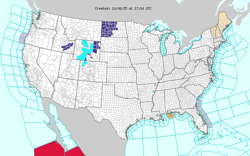
12:19PM: Without showing you the temperature or the radar again, here is another map that proves cold air is bellowing in behind the front in the middle of the country. Yes, those are winter weather alerts and advisories in western North Dakota and the central Rockies.
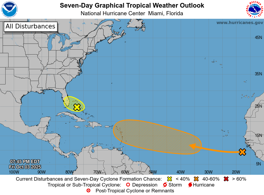
12:38AM: We’ve been talking about the tropics a lot lately, because this is the time of year we usually think about the tropics, had a forecast in Gulfport recently, and frankly, I’m going on vacation soon. Anyways, here is a late night reminder: Don’t put much stock in projections that are more than about 5 days out. There has been a potential tropical feature doing the hokey pokey in the models from the Bahamas to the Gulf late next week. (Right now, it has taken its whole self out)
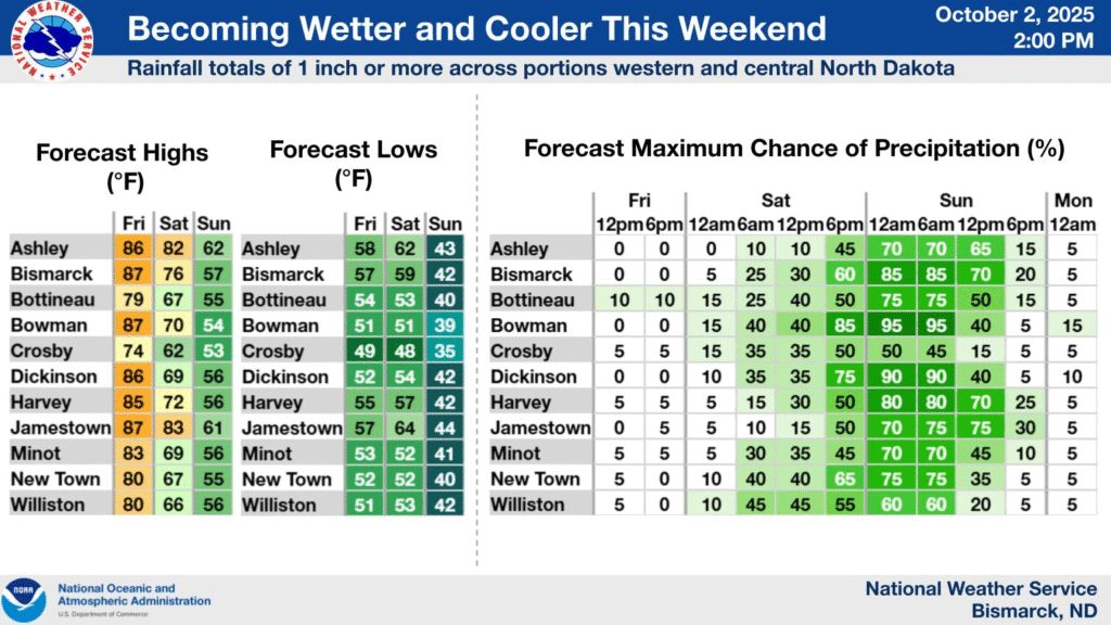
9:12PM: The change from above normal temperatures to something that is a bit closer in line to what we would expect this time of year is from about Houghton, Michigan to Dodge City, Kansas. Demarcated below.
7:05PM: I’m not saying to panic, but I am saying to watch this orange area. The long term track keeps pulling it further eastward (away from the US), but still, keep vigilant.
2:36PM It’s been very quiet nationwide, enough so that we have been focusing a lot of attention on a couple of storms in the Atlantic that have been pretty safely at sea. The first inkling of a changing pattern from the heat that has engulfed much of the middle of the country comes from Bismarck.
This will be a pretty decent little area of low pressure in the Dakotas, and will usher in cool air and a more active pattern for the eastern US, which should take us into the middle of October.
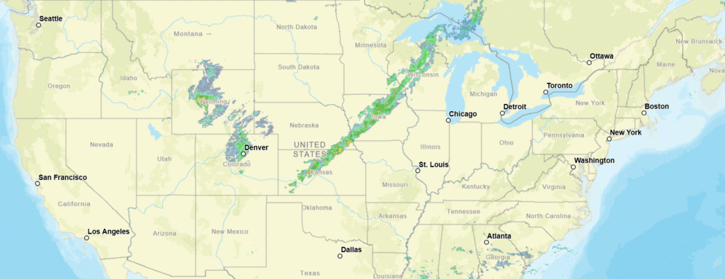
10:08PM: It’s getting cooler out there, absolutely, and even amid hot spells, there is one sure way to know that the atmosphere is chilling out. Cloud bases are getting lower. I had to keep looking at the radar to ensure it wasn’t about to rain today because of the lower deck of cumulus clouds.
Unlike Davenport, Gulfport IS a port, and that is how it got its name.
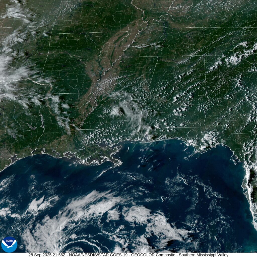
At 453PM, Central Time, Gulfport was reporting clear skies and a temperature of 88 degrees. With multiple tropical features in the western Atlantic, the tropical energy was redirected away from the Gulf, and the Gulf Coast was in the midst of a nice, clear stretch of autumn weather. With nothing driving traffic in the immediate region, eyes turn to Humberto and Imelda, which are going to dance together before merging through the middle of the week. As the pair of storms move off to the Atlantic, a bit of a sea breeze will return, with some afternoon storms coming back on Tuesday. Tomorrow – Mostly sunny, High 91, Low 69 Tuesday – Mostly sunny, isolated storms late, High 90, Low 69
TWC: Tomorrow – A mainly sunny sky. High 90, Low 71 Tuesday- Sunshine and some clouds. High 90, Lo 70
AW: Tomorrow – Warm with plenty of sunshine High 91. Low 70 Tuesday – Mostly sunny and remaining warm High 91, Low 70
NWS: Tomorrow – Sunny, High 88, Low 71 Tuesday – Sunny, High 88, Low 71
WB: Tomorrow – Sunny. High 86, Low 72 Tuesday – Sunny. High 88, Low 71
WN: Tomorrow – Mostly sunny, High 88, Low 71 Tuesday – Mostly sunny, High 88, Low 71
CLI: Tomorrow – Sunny, High 91, Low 71 Tuesday – Sunny, High 89, Low 70
It’s not often that I am on the island with precipitation in the forecast. Also, The Weather Channel got a little bit of a refresh, which is almost as clean as this satellite image.
2:01PM: More good news, especially if you are a fan of the NAM model: It is really showing Imelda taking a hard easterly turn before it reaches the Carolinas. Come on, NAM!
Wow. I’m not sure you could find a longer, flatter stretch of west to east driving in the country. We will see a great deal of prairie over the day and a half drive. We’ll cover 953 miles, which will be traversed over at a pace of 70.1mph, which might be the highest I’ve seen. That means day one will be through after 561 miles, or so.
DAY ONE (Sunday)
Pueblo, Colorado
There isn’t much to say for the day on Sunday. High pressure in the center of the country will keep things dry in the Plains, and unseasonably warm. There is going to be a bit of zonal flow across the Rockies, producing showers and overcast for the first stretch along the Front Range, but clear skies the rest of the way, where we will stop in Odessa, Nebraska, near Kearney, for the layover.
DAY TWO (Monday) It’s going to be a warm day for a late September drive, but otherwise uneventful, aside from maybe traffic and construction in Omaha and Des Moines. The directions should be pretty easy too. I-80 to the destination, and there it is.
6:46PM Imelda is still unnamed in the central Bahamas. In even better news, the storm is even less likely to make a landfall in the US. It will still be impactful, of course, but less rainy and less windy than feared.
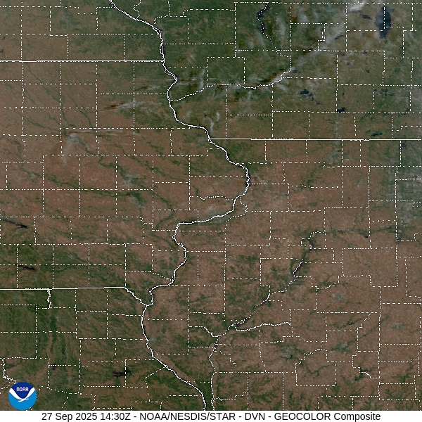
I had assumed that Davenport was named as such because it is on the Mississippi River, and a port. Nope, just named after a guy named Davenport.
At 1052AM, CT, Davenport was reporting a temperature of 83 degrees with clear skies. It was fairly breezy across the area, especially just above the surface. This is because of the leading edge of lee troughing extending all the way into the Dakotas, and brisk southerlies across the Hawkeye State. The jet is zonal and well into Canada, indicating a dry, sunny and warm couple of days ahead. The high pressure centered over the Great Lakes is going to help squash the tropical features in the western Atlantic away from the coast and towards the central Atlantic. Tomorrow – Mostly sunny, High 86, Low 55 Monday – Sunny, High 87, Low 55
TWC – Tomorrow – A mainly sunny sky. High 88, Low 57 Monday – Mainly sunny High 90, Low 57
AW – Tomorrow – Very warm with plenty of sunshine High 87, Low 57 Monday – Very warm with plenty of sunshine High 88, Low 55
NWS – Tomorrow – Sunny, High 87, Low 59 Monday – Sunny, High 88, Low 59
WB – Tomorrow – Sunny, High 88, Low 58 Monday – Sunny, High 88, Low 58
WN: Tomorrow – Sunny, High 87, Low 59 Monday – Sunny, High 88, Low 59
CL: Tomorrow – Sunny, High 87, Low 57 Monday – Sunny, High 88, Low 57
That was a pretty easy forecast. With temperatures potentially reaching the 90s, I would say this qualifies as pretty toasty for late September. Satellite shows a bit of scud, stirred up the brisk winds, but there isn’t much moisture to make for a lot of clouds.