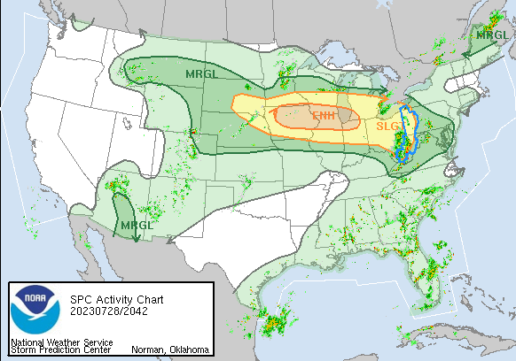
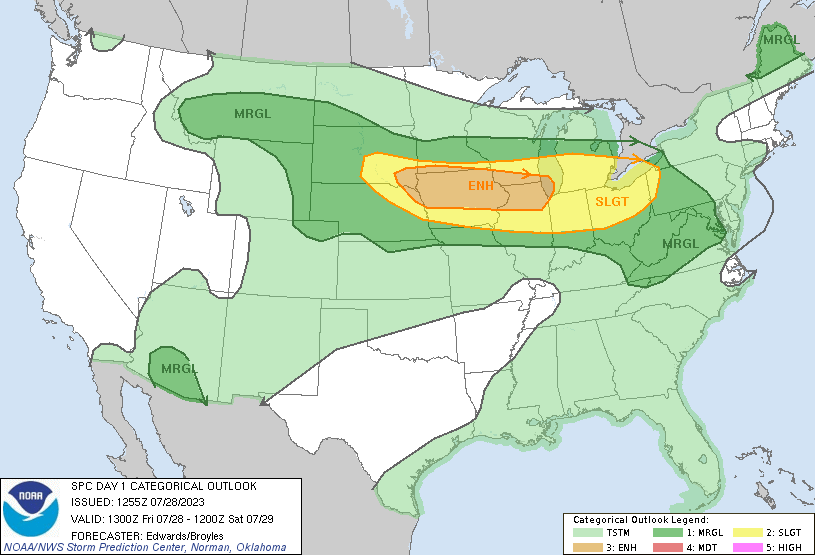
There is a bit of cooler air filtering into the northern US, slowly but surely. Bands of training thunderstorms are expected in the Upper Midwest today. The threat for storms is in the hail and wind variety, particularly when they get going later today. The jet is lingering near the Canadian border, so don’t expect this action to move further south. Sure, it’s hot down there, but at least it isn’t stormy, right?

Strong storms coming for Michigan tomorrow

There is some heavy weather in the northern Plains this evening, including tornado warnings in South Dakota and Nebraska. Fortunately, this activity is in pretty remote terrain, which makes tomorrows threat more dangerous, even if the storms were at the same level as today’s, because Michigan, especially lower Michigan, is well populated.

Tornadoes and strong winds will be the primary concern, though hail is a threat as well.

I’m looking a little bit at the Harrisonburg forecast…

I’m looking a little bit at the Harrisonburg forecast from a few days ago, and I am reminded that, because of the combination of high population and density of vegetation, the region is very sensitive to wind storms. While in the Plains or Midwest, you see long track lines of severe weather with the heaviest storms, you get mottled spasms of wind reports out east like they did over the weekend in the Atlantic Coastal Plains.

The Pueblo office as a map of high temperatures

The Pueblo office as a map of high temperatures that not only gives some good weather information, but also demonstrates Colorado’s topography pretty well. Of course, there is the lower temperature readings found in the mountains in the western 3/5ths of the state, but also, the break between 100s and lower temperatures is close to the Palmer Divide, which usually makes Denver a totally different weather scene than Pueblo or Colorado Springs.