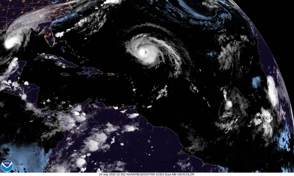
Above is this evening’s satellite picture of the Atlantic. Usually, when we discuss the tropics, we can focus on one storm, or if it’s particularly busy, we can look at the western Atlantic and appreciate the activity bubbling up in September.
We need an entire corner of the Earth to fully capture what’s going on, and even then, we can count our blessings that Tropical Storm Alpha has already expired over the Iberian Peninsula, otherwise we wouldn’t be looking far enough to the east to fully encompass all the activity.
Right now, the biggest and most intense storm, right in the middle of the Atlantic, is Teddy. Teddy will only be what we call a “nautical concern” for the next few days as he drifts through the Sargasso Sea. Still, he is a strong enough storm that a hurricane landfall will be possible in Nova Scotia, of all places.
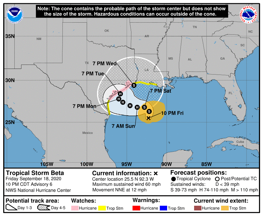
Wilfried is still far enough to the east that she is not a terrible threat, and will continue to be a fish storm, like Teddy but significantly weaker. That leaves Beta.
Tropical Storm Beta stands to become the third Greek Letter hurricane in history, after Beta and Epsilon in 2005. It’s curly path may result in an extended stay off shore. A trip further inland by the middle of next week would surely accelerate deterioration of the storm. Wind and surge don’t look like the primary threats with Beta, but rather rain, like Sally in the Southeast.
There is a lot made out of the prolificity of the 2020 season, but one bit of good news is how infrequently these storms have developed into hurricanes. While there have been a bunch of named storms, and we we will surely surpass 2005 in the number of such storms, we aren’t nearly to the pace of hurricanes as that horrible year. We are on the downslope of the hurricane season now, and hopefully the back side of this peak decelerates much more quickly than it ramped up.