
After several days of severe weather blanketing most of the country, with particular emphasis on the High Plains, the Ozarks and the Carolinas, we are able to focus on just one area in the country, and as luck would have it, it’s the part of the country that I live in.
Low pressure over southern Canada is being undercut by a wave moving north out of Iowa. The nature of this pattern was hard to perceive in the long term by model guidance, and suggests that the nasty weather set up will not be long lived. With all that said, the SPC circled back and posted a slight risk along the Mississippi Valley for today anticipating rough weather.
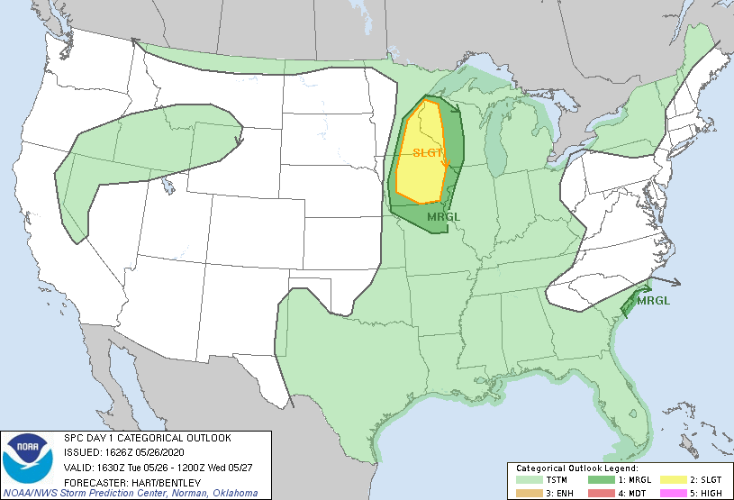
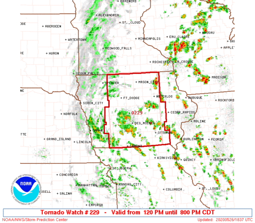
Given the nature of the system, a big of circulation being drawn towards a deeper area of circulation, the primary threat will be tornadoes, though hail and wind will be a concern as well. The threat for tornadoes has already prompted a watch box in Iowa, which has verified with a confirmed tornado west of Des Moines.
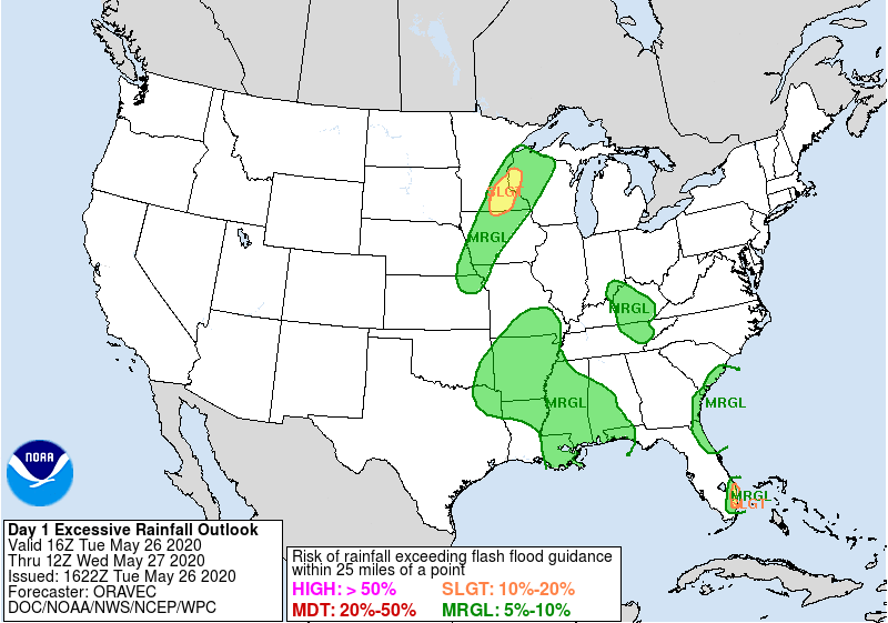
But it’s not just tornadoes that will be a threat. There is a risk that some of the rain fall, particularly in southeastern Minnesota, cold be torrential, and lead to some flash flooding. Below is the WPC heavy rainfall forecast.
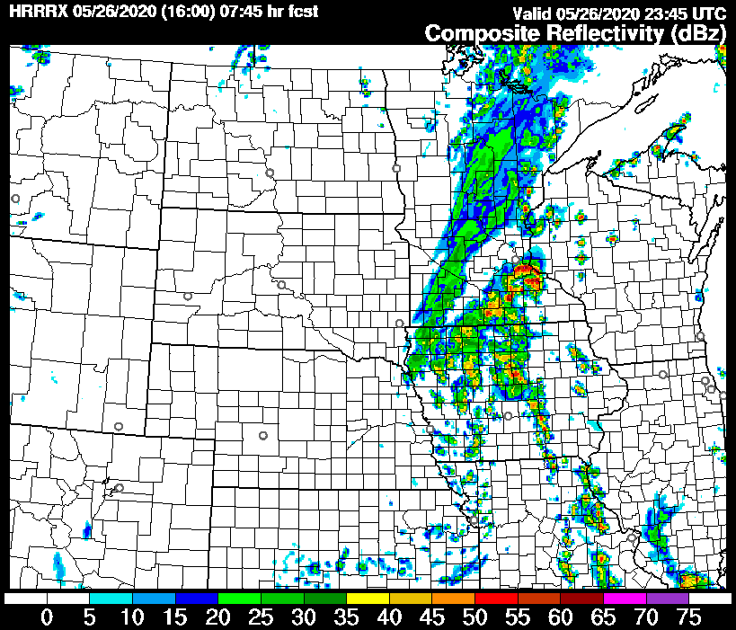
As the storm matures, rain will blanket the region, with some regions of stronger updrafts and heavier rain. Here is the HRRR showing the arrival in St. Paul just before 6pm tonight, and looking somewhat ferocious when it arrives.
The heavier rain will continue even after the initial rounds of strong thunderstorms, making for a long, wet night from Des Moines to the Twin Cities.