
It’s a real spring evening out there. Heavy thunderstorms are popping up in a couple of different areas, from New England, where severe weather has been reported all day from western New York to Massachusetts and New Hampshire. The primary severe component has been gusty winds.
New England storms aren’t usually good for radar imagery, but particularly with this squall, as the Boston radar is down for maintenance. There just isn’t a good way to look at the squall.
On the other hand, look at this iron curtain in west Texas.
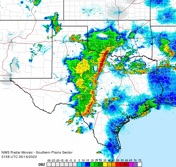
That impressive ling of nearly solid red stretches from east of Wichita Falls to east of Del Rio, bringing strong winds, and a nice batch of cooler drier air behind it. Sharp differences in air mass often show up more impressively on radar, and that’s what we have here.
If this line can hold together as it moves eastward, strong winds loom for cities along I-35 like Dallas, Austin and San Antonio. Hail would only come in small bursts, and the tornado threat that had once been there is now becoming less likely, though there could be a spin up in the scud out ahead of the primary line.
This might be a noisy night for a lot of people in Texas, and the storm system is going to slow down, so east Texas will feel the bumps later in the weekend. By the time the storms wrap up, though, Texans should feel a little bit of refreshing air for a day or so.