As summer has arrived, a lot of people have started thinking about going to the lake and dipping their toes in refreshing waters, though for some reason, I’m not sure Green Bay has often stood out as a desired vacation destination, at least not when it isn’t football season.
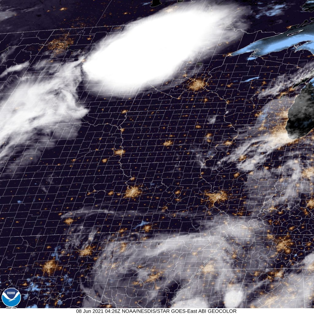
At 1053PM, CT, Green Bay was reporting a temperature of 76 with clear skies. That temperature, warm for the middle of the night, was augmented by a dew point of 70. A clammy fog will likely roll into the near shore areas in the morning, and air conditioners will be stressed over night. Low pressure in the northern Rockies was helping draw more warm humid air north, while a surface trough in the Dakotas was feeding off of the potential energy and triggering thunderstorms across the northern Plains. Though they look impressive, they won’t reach eastern Wisconsin, withering as they get away from actual forcing.
There is a weak trough northeast of the Ozarks, and surface low pressure over the Rockies, the Great Lakes are predominantly under a broad, nearly continent wide ridge. Still, given the soupy conditions across Wisconsin, an area thunderstorm will be possible for the next couple of days, particularly in the afternoon.
Tomorrow – Hot and humid, with isolated evening storms, High 90, Low 70
Wednesday, more of the same, including storms, High 87, Low 68
TWC: Tomorrow – Intervals of clouds and sunshine. A stray shower or thunderstorm is possible.High 89, Low 69
Wednesday – Sunshine along with some cloudy intervals. High 84, Low 63
AW: Tomorrow – Periods of sun with a thunderstorm in a couple of spots; very warm High 92, Low 74
Wednesday – Very warm with intervals of clouds and sun High 87, Low 67
NWS: Tomorrow – A slight chance of showers between 9am and 1pm, then a slight chance of showers and thunderstorms after 1pm. Patchy fog before 9am. Otherwise, partly sunny, High 88, Low 70
Wednesday – Mostly sunny, High 85, Low 67
WB: Tomorrow – Humid, Partly sunny. A slight chance of showers in the morning then a slight chance of showers and thunderstorms in the afternoon, High 91, Low 74
Wednesday – Mostly sunny, High 89, Low 70
WN: Tomorrow – Partly cloudy with isolated storms, High 88, Low 72
Wednesday – Mostly sunny, High 85, Low 67
FIO: Tomorrow – Humid and partly cloudy throughout the day. High 88. Low 70
Wednesday – Partly cloudy throughout the day. High 84, Low 63
Really hit or miss with those thunderstorm chances. The activity east of Fargo sure isn’t missing tonight.