I like this radar image, because it is so unusual for Florida. One isolated storm over Lake Okechobee, and another just out west of the Florida Peninsula.
Usually, you will see bands of showers, or a region wide smattering of showers and storms. The discrete cells aren’t what we usually see.
As was widely reported, yesterday was the hottest temperature in recorded history on the planet. This is a combination of anthropogenic climate change, El Niño and most of the reporting sites around the world lying in the northern hemisphere, where it is summer. That is to say, maybe it was a bit warmer in December, but too many sites were in the depths of winter so we didn’t know.
Before we get to this forecast in the Texas Panhandle, I want to note that with the looming collapse of Twitter, all posts will also be shared on Post.news and Mastadon under my RhinoandCompass handle. Now, it is the beginning of July. What do you think the weather is going to look like?
At 953PM, ET, Amarillo was reporting clear skies and a temperature of 81 degrees with clear skies. Temperatures are on the rise again after a dry line swept through uneventfully earlier in the week. Dew points are back in the low 50s after surging over 60, an unusual event for the Texas Panhandle in the heart of summer. The cold front htat pushed the dry line along is bringing some shower activity to the Oklahoma Panhandle, but will not have the juice to reach Amarillo. The jet is well aloft and fairly weak, but enough to tap into the instability of the northern Plains. The cold front noted earlier is draped through the Prairies of the central States to the Panhandles. Though this is the feature that compelled the dry line eastward, it will also pose a threat for some rain and clouds as the boundary sinks to the south on Wednesday evening. Expect some more humidity and likely some cooler temps also on Thursday. Tomorrow – Mostly sunny, High 95, Low 68 Thursday – Isolated morning storms High 87, Low 65
TWC: Tomorrow – Generally sunny despite a few afternoon clouds. A stray shower or thunderstorm is possible. High 93, Low 69 Thursday – Partly cloudy skies. High 88, Low 65
AW: Tomorrow – Sunshine mixing with some clouds High 92, Low 68 Thursday – A heavy thunderstorm in the afternoon; storms can bring flooding downpours, hail, damaging wind gusts, and an isolated tornado High 84, Low 64
NWS: Tomorrow – Partly sunny, then gradually becoming sunny, Late storms, High 92, Low 70 Thursday – A 30 percent chance of showers and thunderstorms before 8am. Some of the storms could be severe. Partly sunny, High 87, Low 65
WB: Tomorrow – Mostly sunny (late showers/storms) High 89, Low 69 Thursday – Partly cloudy, High 85, Low 65
With the collapse of Twitter, I am trying to experiment with some short form posting (category – Update) since the longer, regular posts are so sporadic these days. Since my posts feed to Twitter (for now) and Facebook, they are still visible for most of the regular audience. Let me know what you think!
Don’t be intimidated by the shower activity presently where you are, because it may not be indicative of where the storms will be for fireworks tonight. I’m specifically thinking of places like Oklahoma/Texas/Arkansas.
That said, storms may reemerge in the upper Midwest later this afternoon. As always, paying attention to the forecast is the way to go!
We are all a bit older, a bit wiser than when we put together our forecast last month for Fort Myers. A lingering boundary lay on the southern end of the Sunshine State, but for the most part, precipitation was staying on the Atlantic side of the Peninsula. Fort Myers is on the Gulf Coast side of Florida. I noticed this and kept rain out of the forecast, and everyone else left it in. Weatherbug had a solid enough forecast that they earned victory based on their temperatures alone, but Victora-Weather was the only one with the proper precip forecast. Actuals: June 10th, High 90, Low 77 June 11th, High 90, Low 76
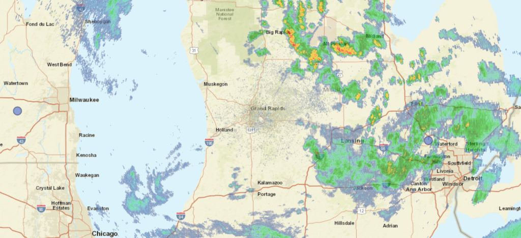
Our trek today takes us to the Lower Peninsula of Michigan, and certainly one of the more enjoyably named cities in the country.
At 453PM, ET, Kalamazoo was reporting a temperature of 65 degrees with overcast skies. A sharp trough directed from the Great Lakes to the Mid Atlantic has brought severe weather to the Ohio Valley yesterday, but is now providing intermittent shower activity across Lower Michigan. At this juncture, most of the rain is east of a line from Big Rapids and Marshall, with lighter activity in the western stretch of the state. The low is continuing eastward, but is occluded similar to a more winter or springlike feature, leading to a lag in the shower activity over Michigan. A chance will linger in Michigan until about lunch time tomorrow, but high pressure and a narrow ridge are building behind the feature. Temperatures will bounce back after this chilly start. The jet will begin to break down, weakening from it’s current state, and as a result, humidity and clouds are going to remain in the forecast. Tomorrow – Cloudy with some light showers in the morning, Clearing late, High 78, Low 57 Wednesday – Partly cloudy and warmer, High 83, Low 54
TWC: Tomorrow – Cloudy skies early, then partly cloudy in the afternoon. A stray shower or thunderstorm is possible. High 77, Low 60 Wednesday – Partly cloudy. High 84, Low 53
AW: Tomorrow – Cloudy and warmer with a passing shower; smoke from distant wildfires can cause poor air quality High 77, Low 60 Wednesday – Mostly sunny, pleasant and warmer High 85, Low 56
NWS: Tomorrow – A 30 percent chance of showers before 8am. Widespread haze before noon, then widespread haze after 2pm. Cloudy, then gradually becoming mostly sunny High 77, low 59 Wednesday – Sunny, High 84, Low 53
WB: Tomorrow – Cloudy with a chance of showers and a slight chance of thunderstorms High 78, Low 60 Wednesday – Mostly cloudy with a 20 percent chance of rain showers until midday, High 83, Low 54
WN: Tomorrow – Hazy, High 77, Low 59 Wednesday – Hazy, High 83, Low 53
CLI: Tomorrow – Overcast (Light rain), High 81, Low 57 Wednesday – Sunny, High 84, Low 54
Radar is deceptively inactive. Don’t be surprised in Western Michigan by random little spritzes of rain this evening.
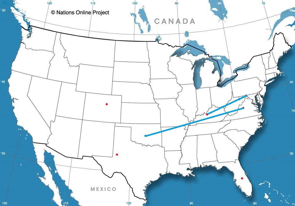
The weeks ahead are going to be hot, and if they are anything like the last few days, fairly active as well. We’re going to dot the country with a variety of forecasts for your viewing enjoyment in the coming weeks.
Odessa, Texas
Denver, Colorado
Harrisonburg, Virginia
Road Trip from Harrisonburg to Oklahoma City, Oklahoma
Louisville, Kentucky
Cumberland, Virginia Road Trip from Louisville – Cumberland
If ever there are months that you want some forecasting consistency, they are the spring time months. Every forecast we had in the month had a combined winner, which suggests that we got that in May. Still, Accuweather was a hair better than the rest, and were able to attain the title of Forecaster of the Month for themselves.
This month has been quite rainy for the southern US, but for a strip from the north central to the mid-Atlantic, it has been quite dry for a couple of weeks. It all started with an omega block, which we identified with our forecast in Allentown. Allentown remained dry, despite some storms in the area on the 6th of June, and it was quickly followed by the apocalyptic smoke that descended on the region. A little rain on any number of tracts of land between northern Canada and Allentown would have been great, but it was not to be. Victoria-Weather’s forecast sparkled, and the victory was ours. Actuals: June 5th, High 77, Low 48 June 6th, High 79, Low 52