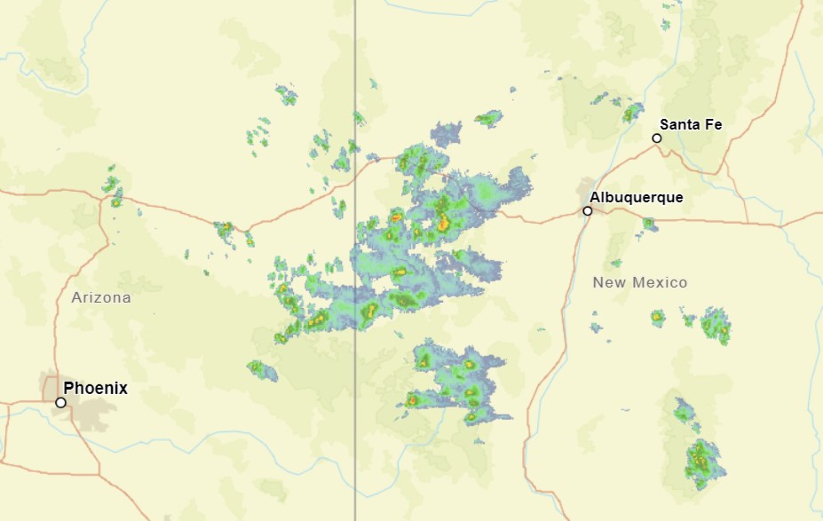
Tired of looking at the Tropics? Me too! Check out these storms in western New Mexico.
This is some monsoonal moisture, but this time of year, things are moving a little bit more from west to east. This moisture is going to get collected into a developing area of low pressure that will bring a little bit of severe weather to Oklahoma and Texas early this week.
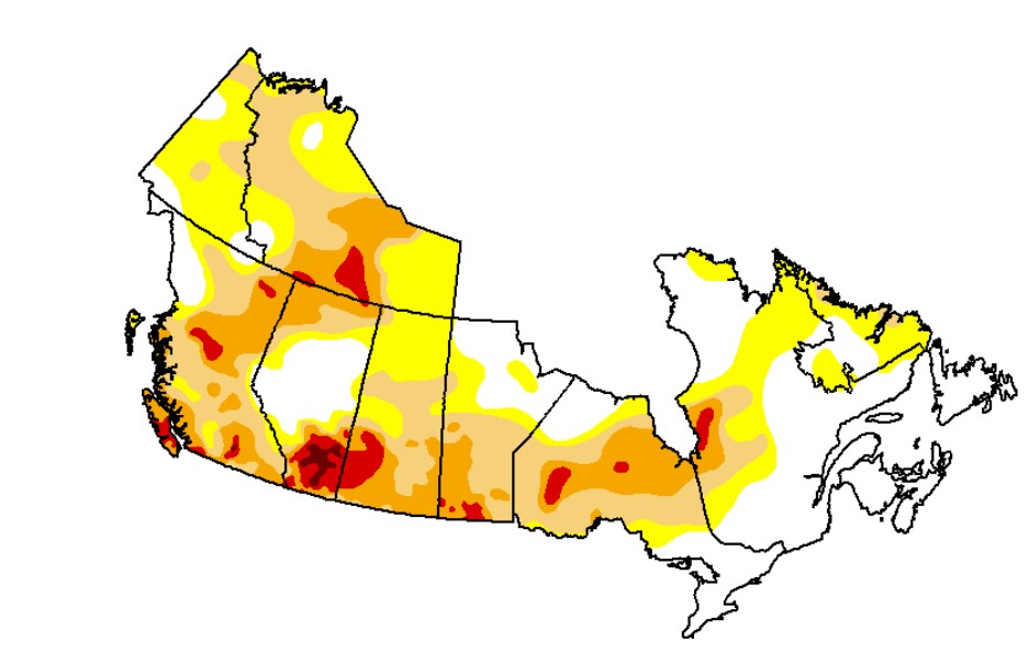
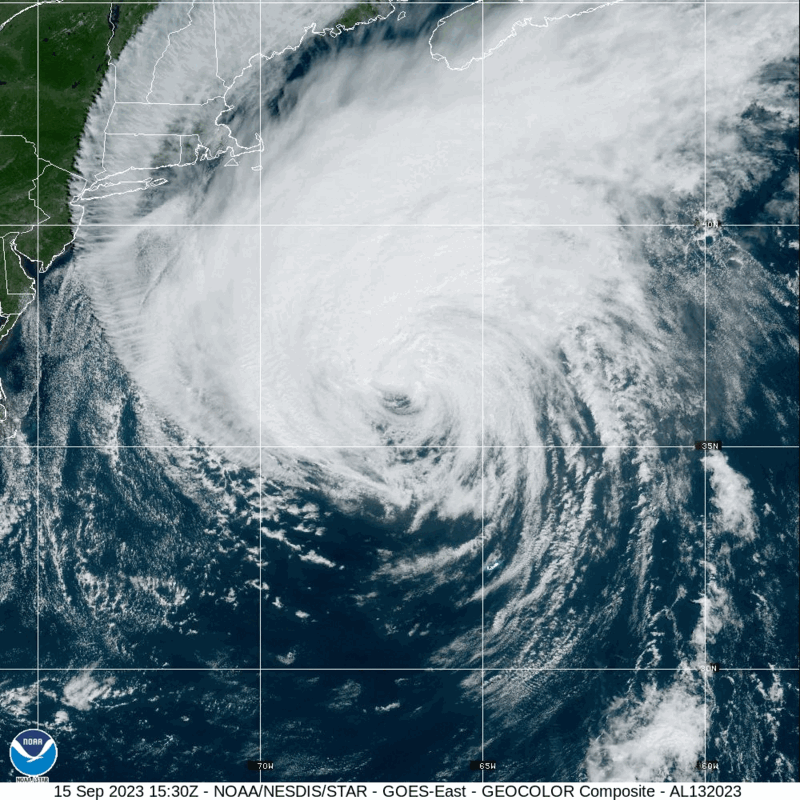
There is a big, sloppy tropical feature blasting through the Canadian Maritimes today. Most of Canada is in the throes of a drought that has brough fires to much of the country and smoke to much of the continent. Most of Canada is in a drought, except for the Canadian Maritimes.
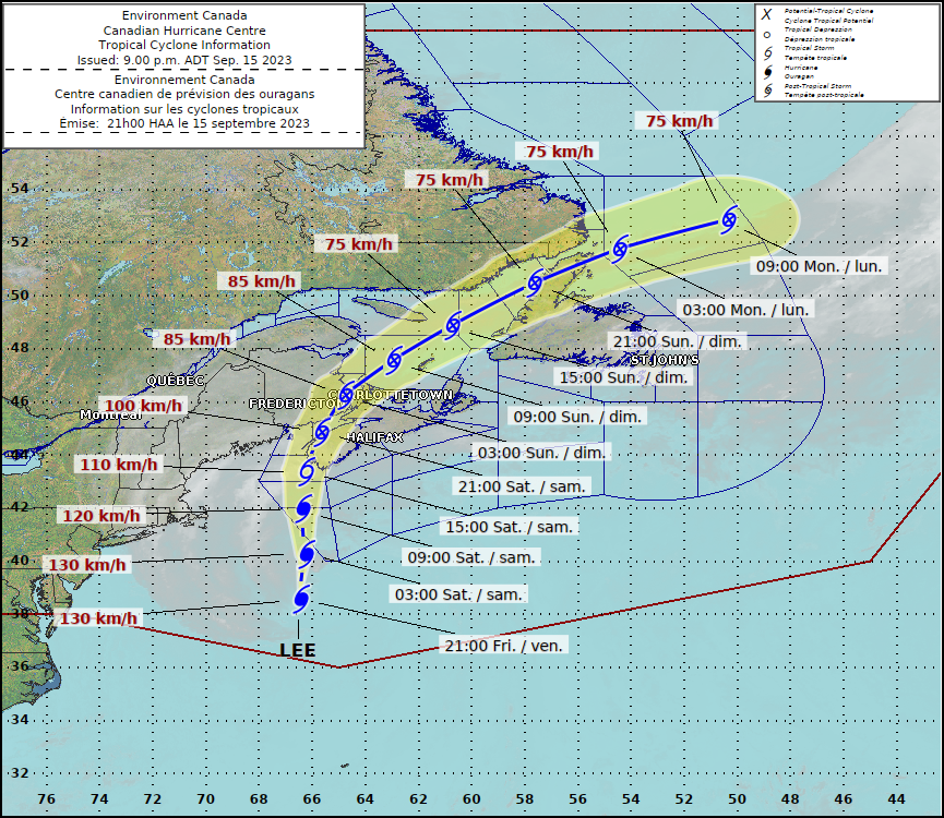
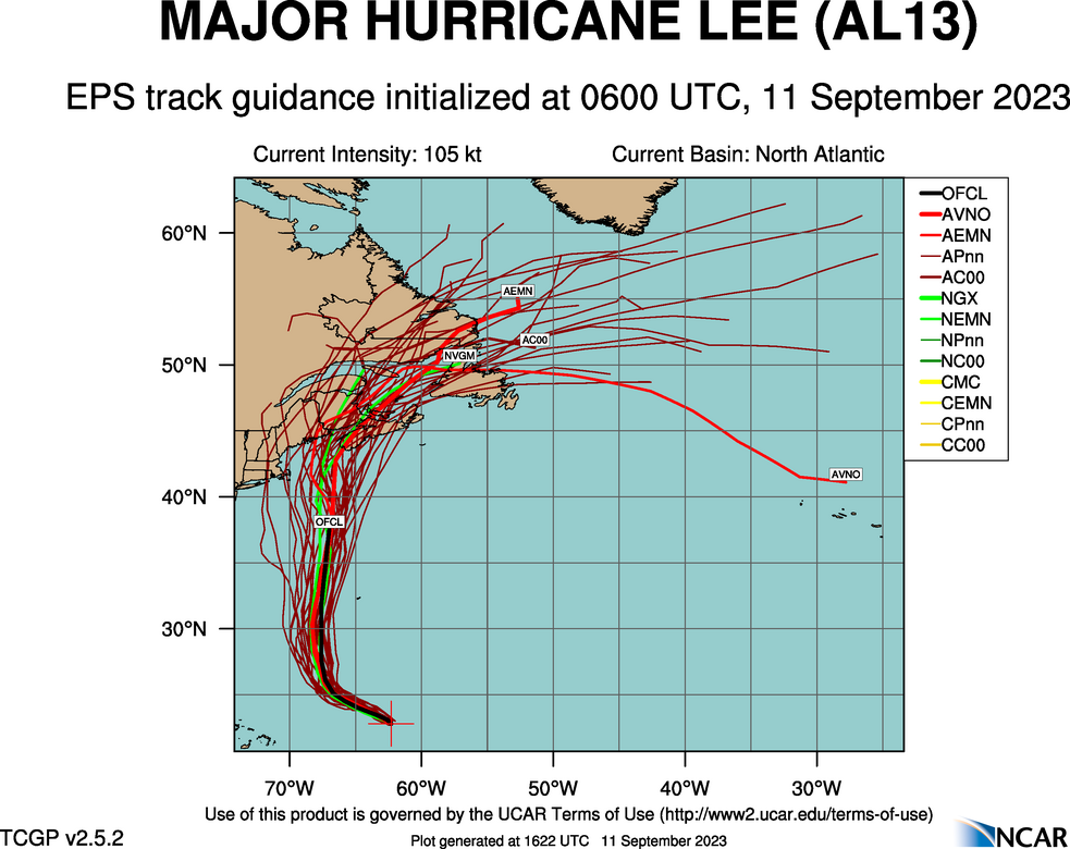
There has been a little bit of positive news from the Atlantic, at least for Stateside interests. The track for Lee has turned a little bit to the right, away from New England and away from the Bay of Fundy, where it could have caused real problems. Instead, the weaker Tropical Storm Lee will land in southwestern Nova Scotia.
Surge and wind threats are lessened for the New England coast, and I’m not nearly as worried about amplified storm surge in New Brunswick, but tropical storm force winds are still going to be an issue for this area, even for parts of down-east Maine, which will get lashed by rain and tropical storm force winds, but the threat, at least in the States, will not be as severe or widespread.
Tropical storm force winds are still anticipated in the southern part of Nova Scotia and parts of coastal New Brunswick, but again, Lee is weakening, and it won’t be a hurricane making landfall in the Canadian Maritimes. The storm will make landfall around Yarmouth, Nova Scotia tomorrow morning, around 8am, CT, or 10 Atlantic time.
It’s been a long wait, and fortunately, Lee is looking like he showed his worst in the open ocean, and a bullet was almost dodged.
Lake Havasu City is probably one of the longest names for a a forecast site that we have. On the other hand, it’s position between Las Vegas and Yuma typically means a particularly brief forecast.
At 815AM, PT, Lake Havasu City was reporting a temperature of 84 degrees with fair skies. Dew points in the area were in the low 50s, though that isn’t terribly absurd for this time of the year, with the monsoon active. Most of the wet weather is at elevation, and will continue to be so in the eastern part of Arizona. An upper level trough is on its way into the northern Rockies, which will reorient the regional flow. Cooler, denser air will be angled off the Pacific towards Lake Havasu City, and will have a difficult time reaching the area. Dew points are expected to drop, and the threat for clouds or spotty rain showers will disappear with the feature’s arrival. Tomorrow – Mostly sunny, High 98, Low 76 Friday – Sunny, High 100, Low 80
TWC: Tomorrow – Sunny skies. High 100, Low 79 Friday – A mainly sunny sky. High 102, Low 78
AW: Tomorrow – Plenty of sun High 99, Low 79 Friday – Plenty of sun High 102, Low 77
NWS: Tomorrow – Sunny High 96, Low 80 Friday – Sunny, High 97, Low 79
WB: Tomorrow – Sunny, High 99, Low 77 Friday – Sunny, High 100, Low 78
WN: Tomorrow – Sunny, High 101, Low 79 Friday – Sunny, High 103, Low 78
CLI: Tomorrow – Sunny, High 100, Low 79 Friday – Sunny, High 102, Low 79
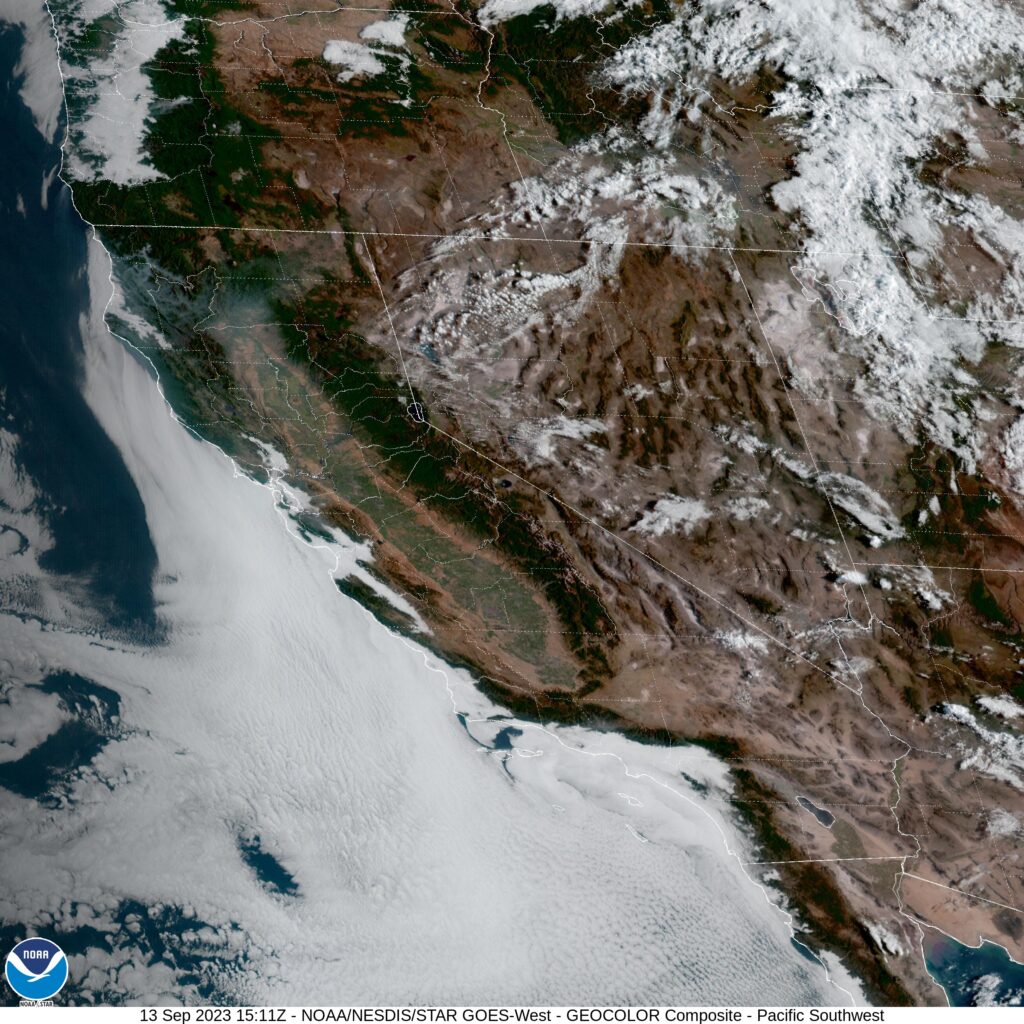
A little variety to the forecast in Lake Havasu City. I’m a little surprised that this is how it shook out. Satellite is clear in California, and getting clearer in Arizona.
It seems as though we have been talking about Hurricane Lee for a while now. It feels like the storm should already have blown past Bermuda. Instead, the storm is still northeast of Puerto Rico, and won’t really kick out of this area until Wednesday. At that point, Lee will relly start to move, and we will get a little more confident on where he will eventually landfall.
Right now, though, even a week out, there is a solid cluster of models that put his landfall near Yarmouth, Nova Scotia next weekend.
Late this week, he will pass to the west of Bermuda, but spiral bands of thunderstorms will certainly swipe at the island, and heavy surf is quite likely. As he passes Bermuda, he will be weakening, and by landfall, may be a Tropical Storm.
If he landfalls as a hurricane, it is because he does so further south and west – one of those stray strands of spaghetti indicating the storm could waiver and strike New England directly. As it is right now, Lee is still a strong storm that developed rapidly. As with every hurricane season, so much depends on luck, and luckily, there is steering flow to drive Lee away from the mainland just enough. Even as storms get stronger, that reliance or hope for good fortune remains the same.
Of course, a strong tropical storm landfalling in Nova Scotia is still noteworthy and not great news. Fortunately, southern Nova Scotia is regularly battered by strong storms, though not of tropical origin, which means the area, infrastructurally, can withstand a pretty decent pummeling. Where I am concern is if the storm orients just right, heading back northeast while driving water into the Bay of Fundy. In that scenario, surge could be a issue in New Brunswick and Truro, Nova Scotia.
More remains to be seen. Where will Lee ultimately decide to go? How swiftly will he start to deteriorate upon finding cooler waters? We still have a week to find out.
I will discuss this in greater detail tomorrow, but I want you to wake up with this knowledge. Hurricane Lee is not going to landfall in the States. I would worry more about that in Nova Scotia. Additionally, this does not mean that US interests on the coast are in the clear. As Lee heads to the north, be wary of rip currents and high surf as the stom heads north.
Labor Day weekend was very hot for the middle of the country, but it took a little bit of ramping up. It wasn’t very warm yet when we forecast for Danville. The temperatures were on the rise, though, finishing at 86 on the 2nd, better than the 55 we observed to start the forecast on the 31st. Victoria-Weather took the W for Danville. Actuals: September 1st, High 82, Low 54 September 2d, High 86, Low 54
To give you an idea of the weather scenario we are in right now, I was just on a conference call with people from many parts of the country. One of the attendees from Texas was lamenting the triple digit heat that continues to boil Texans.
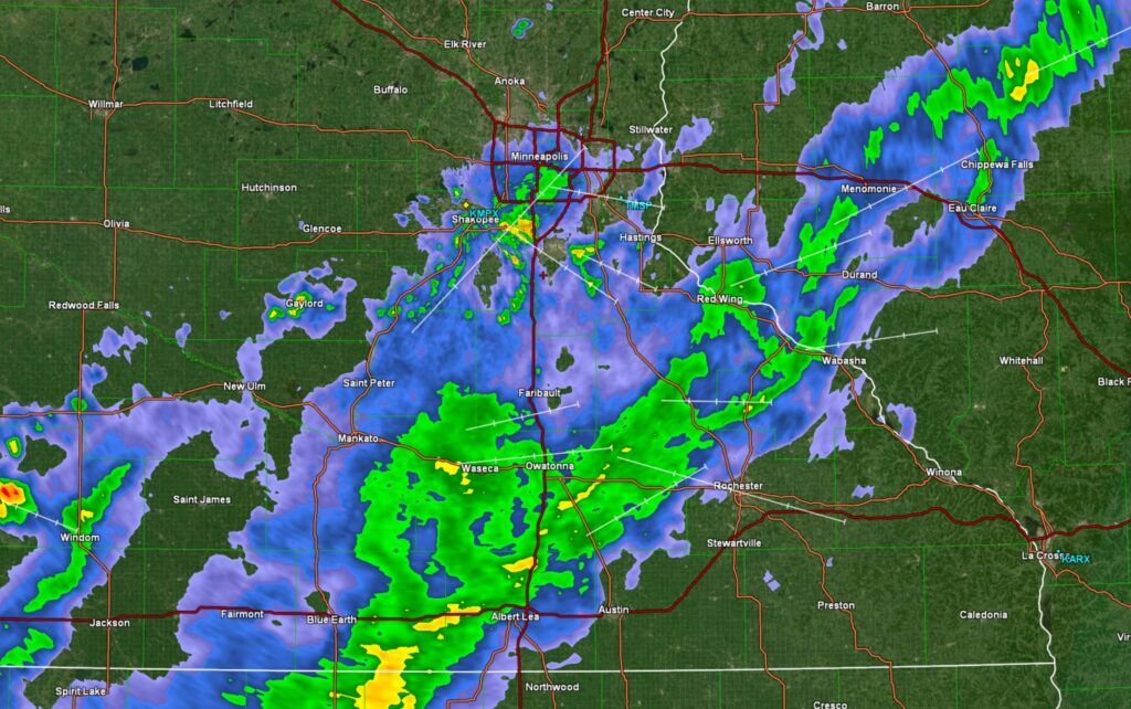
Here in Minnesota, I had to wear a light jacket this morning. Fall is coming, people. Eventually.