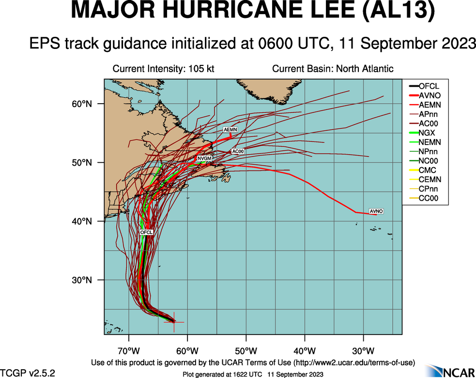
It seems as though we have been talking about Hurricane Lee for a while now. It feels like the storm should already have blown past Bermuda. Instead, the storm is still northeast of Puerto Rico, and won’t really kick out of this area until Wednesday. At that point, Lee will relly start to move, and we will get a little more confident on where he will eventually landfall.
Right now, though, even a week out, there is a solid cluster of models that put his landfall near Yarmouth, Nova Scotia next weekend.

Late this week, he will pass to the west of Bermuda, but spiral bands of thunderstorms will certainly swipe at the island, and heavy surf is quite likely. As he passes Bermuda, he will be weakening, and by landfall, may be a Tropical Storm.
If he landfalls as a hurricane, it is because he does so further south and west – one of those stray strands of spaghetti indicating the storm could waiver and strike New England directly. As it is right now, Lee is still a strong storm that developed rapidly. As with every hurricane season, so much depends on luck, and luckily, there is steering flow to drive Lee away from the mainland just enough. Even as storms get stronger, that reliance or hope for good fortune remains the same.
Of course, a strong tropical storm landfalling in Nova Scotia is still noteworthy and not great news. Fortunately, southern Nova Scotia is regularly battered by strong storms, though not of tropical origin, which means the area, infrastructurally, can withstand a pretty decent pummeling. Where I am concern is if the storm orients just right, heading back northeast while driving water into the Bay of Fundy. In that scenario, surge could be a issue in New Brunswick and Truro, Nova Scotia.
More remains to be seen. Where will Lee ultimately decide to go? How swiftly will he start to deteriorate upon finding cooler waters? We still have a week to find out.
